Every year the Government Records team at the BC Archives processes over 2,000 boxes of records created by the provincial government. Most of these records can now be accessed by anyone, even you! Just remember that all government records are covered by privacy legislation, such as the Freedom of Information and Protection of Privacy Act. This means some records have access restrictions on sensitive or personal information. Here is an overview of just a few of the record series from the last year or so that are now available in our database.

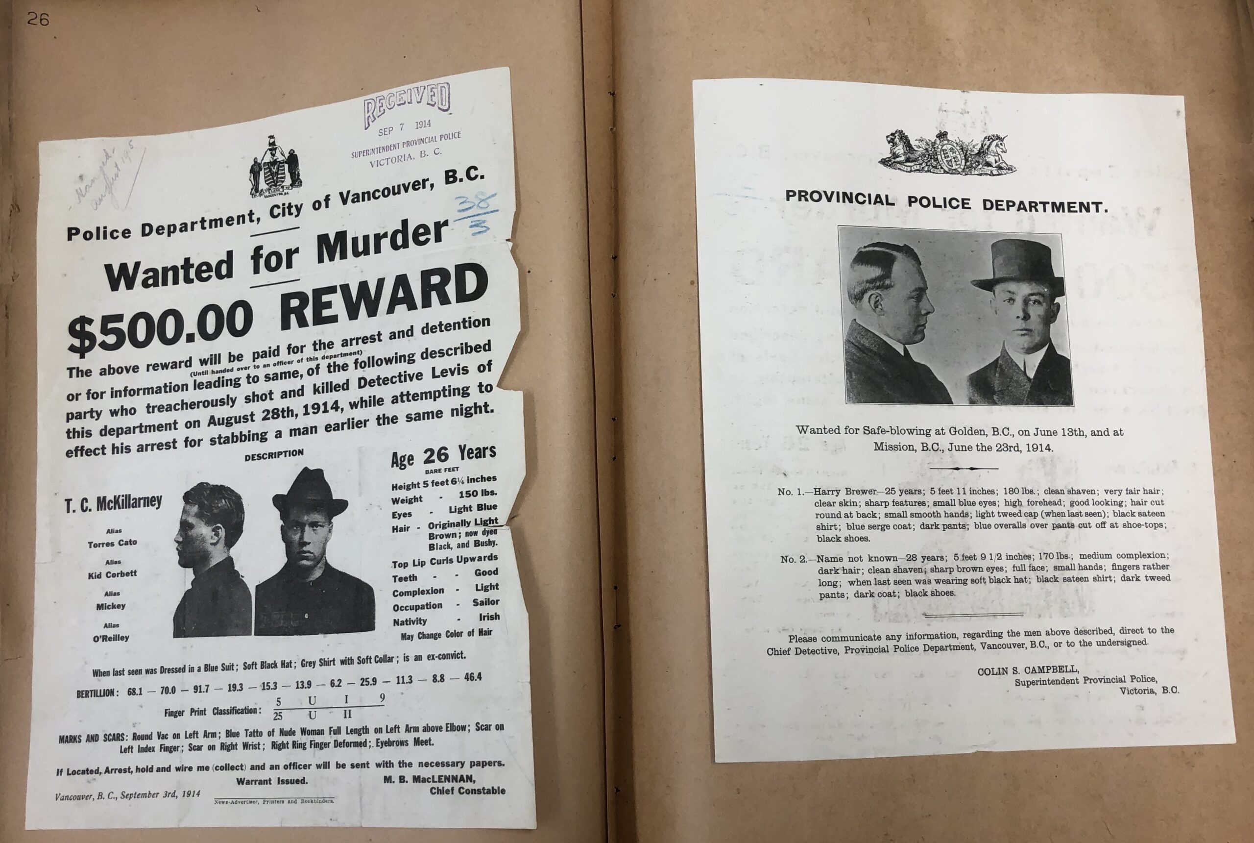
    Wanted posters from GR-4000

    • GR-3346.37 2021 Speech from the Throne
      • The archives’ most recent record, created less than a year ago·
    • GR-3518 Records of the Provincial Health Officer *
      • This accrual covers the records of Dr. Perry Kendall, who served as the Provincial Health Officer from 1999 to 2018. The records address the health of Indigenous populations, water quality and pandemic influenza preparation among other public health topics.
    • GR-3676 and GR-3677 Cabinet committee records and Premiers’ records*
      • Large accruals were added to these series this year, documenting cabinet proceedings and priorities. Most records up to 1991 are publicly accessible.
    • GR-3890 Drafting legislation case files*
      • Comprehensive records covering all aspects of the process for drafting and approving provincial legislation. The records relate primarily to the 1970s and 1980s.
    • GR-3948 Notebook related to the Tsilhqot’in War
      • This delicate and difficult to decipher notebook relates to the events of the 1864 Tsilhqot’in War. It includes a diary of a group of settlers attempting to apprehend the Indigenous men allegedly involved in the deaths of several settlers.
    • GR-3996 Conservation Officer Service major investigation case files*
      • The series consists of the major investigation case files of the Conservation Officer Service between 1992 and 2007. Major cases are serious in nature and address complex issues such as trafficking animal parts, big-game poaching, illegal fishing or guiding, or selling animals for human consumption that are procured illegally.
    • GR-3999 Environmental Appeal Board records*
      • This series includes appeal files submitted to the Environmental Appeal Board and its predecessors: the Pollution Control Board and Pesticide Control Board. The records document the government’s management of the environment.
    • GR-4000 Provincial Police circulars and wanted posters*
      • This series includes a variety of informational posters for alleged criminals wanted across Canada and the United States. Many of the records are pasted into indexed volumes, serving as simple criminal record “databases.”

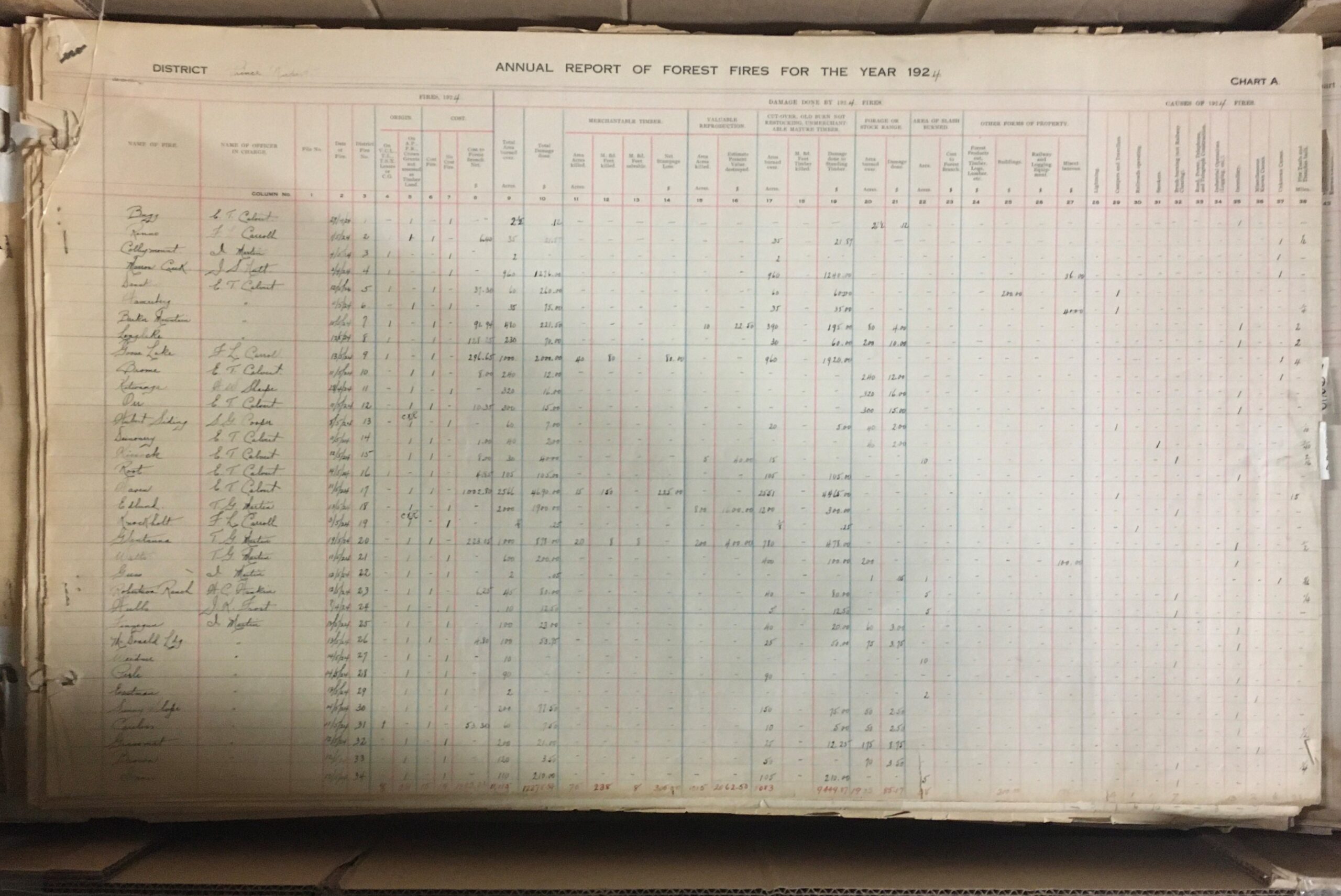
    A page from the GR-4064 fire atlas. Each volume measures over three feet by four feet and weighed over 60 pounds.

    • GR-4002 Forest Practices Board meeting files*
      • This series includes records of the Forest Practices Board which serves as the independent watchdog for sound forest and range practices in the province.
    • GR-4005 Conservation Officer Service wildlife attack final reports*
      • This series consists of final reports summarizing wildlife attacks on humans created by the Conservation Officer Service between 1991 and 2012. They illustrate the evolution of wildlife attack investigative technique, causes of wildlife attacks, and methods used to dispatch wildlife.
    • GR-4008 BC Ambulance Service and air evacuation major accident and investigation files*
      • This series consists of BC Ambulance Service (BCAS) and air evacuation major accident and incident investigation files between 1992 and 2011.
    • GR-4041 Witness statements from CPR train robbery
      • These records purport to be related to a train holdup by the infamous Bill Miner at Ducks. The details match other historical accounts of the incident; however, the year is wrong! These may benefit from some further research.
    • GR-4048 Prince Rupert Forest District wild fire mapping records
      • These huge volumes document wildfires in the Prince Rupert region from 1921 to 1980
    • GR-4051 British Columbia Lottery Corporation’s ombudsperson’s investigations*
      • This series consists of the ombudsperson’s investigation into the British Columbia Lottery Corporation’s prize payout procedures between 1999 and 2010. BCLC retailers and BCLC retailer employees appeared to be winning major prizes at a higher rate than other players in the province. The public and the media expressed concern that some of those winning tickets may actually belong to ordinary players.
    • GR-4063 Cariboo government office records
      • This series contains colonial records from the Cariboo region, including Barkerville. Records cover all aspects of government administration in the area from registering mining claims to court cases to crime statistics.
    • GR-4064 Correspondence regarding immigration
      • This series includes correspondence of the Provincial Immigration Officer from 1903-1905. Many records relate to the deportation of Japanese people under the racist 1904 Immigration Act.
    • 24930E Plan of the No. 2 Extension coal mine
      • This plan was made as part of the investigation into the cause of a 1909 explosion in the Ladysmith mine, resulting in the deaths of 32 men.

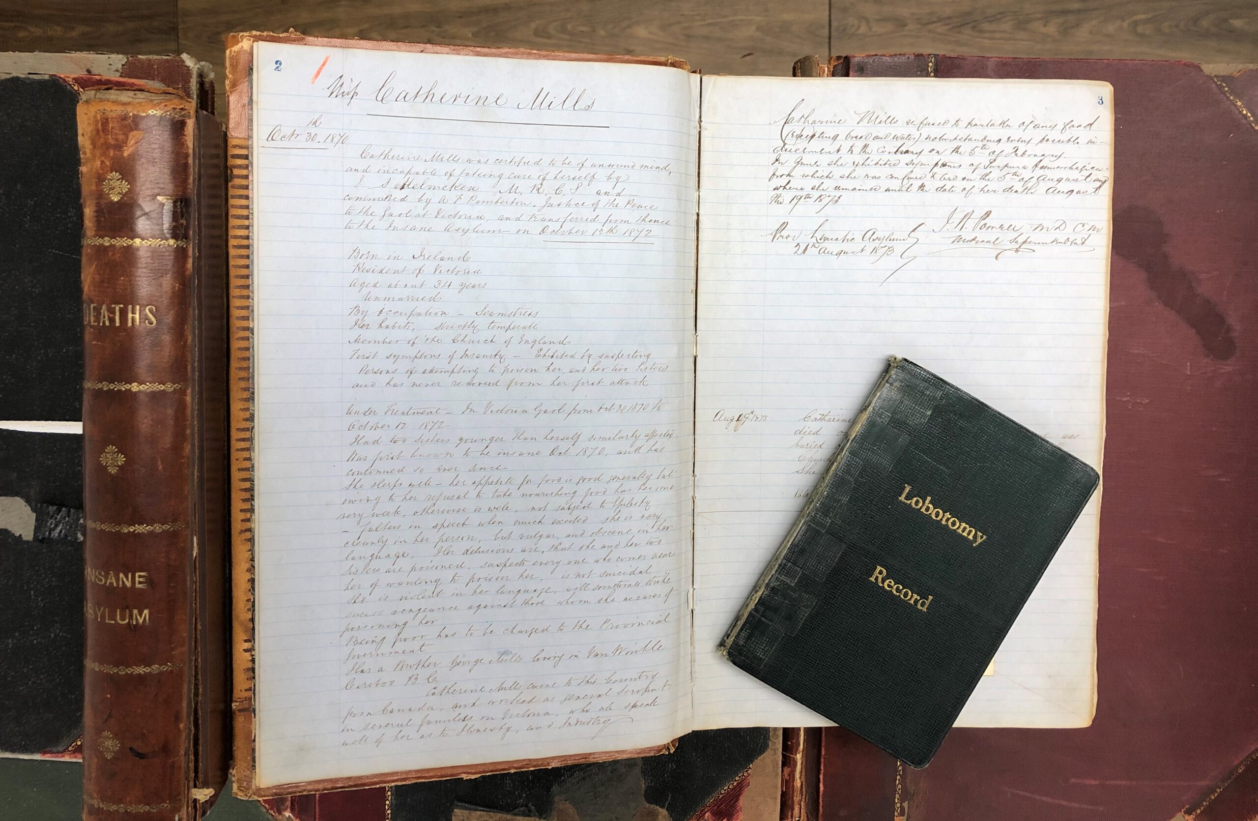
    A selection of volumes from GR-3929, including the first patient file from 1870.

    Bonus records! Here are some other records that were made available a bit before 2021, but are still worthy of a mention:

    • GR-0522 Kamloops Government Agent land records
      • This is a large series of records (160 boxes) that show a comprehensive history of land use in the Kamloops area over 100 years. This includes the time period the land was managed by the Canadian government as part of the Railway Belt.
    • GR-3929 Riverview Hospital Historical Collection*
      • This collection includes a wide variety of records related to the operation of Riverview Mental Hospital (previously known as Essondale). The records were collected and maintained by the Riverview Historical Society. With the closure of the hospital in 2012, government records in the society’s holdings were transferred back to the government and have recently been made available in the archives. The collection includes records of all media and provides an overview of the hospital’s history, grounds, staff, and patient care.

    *These series include sensitive personal information or other restricted records that are not publicly accessible.

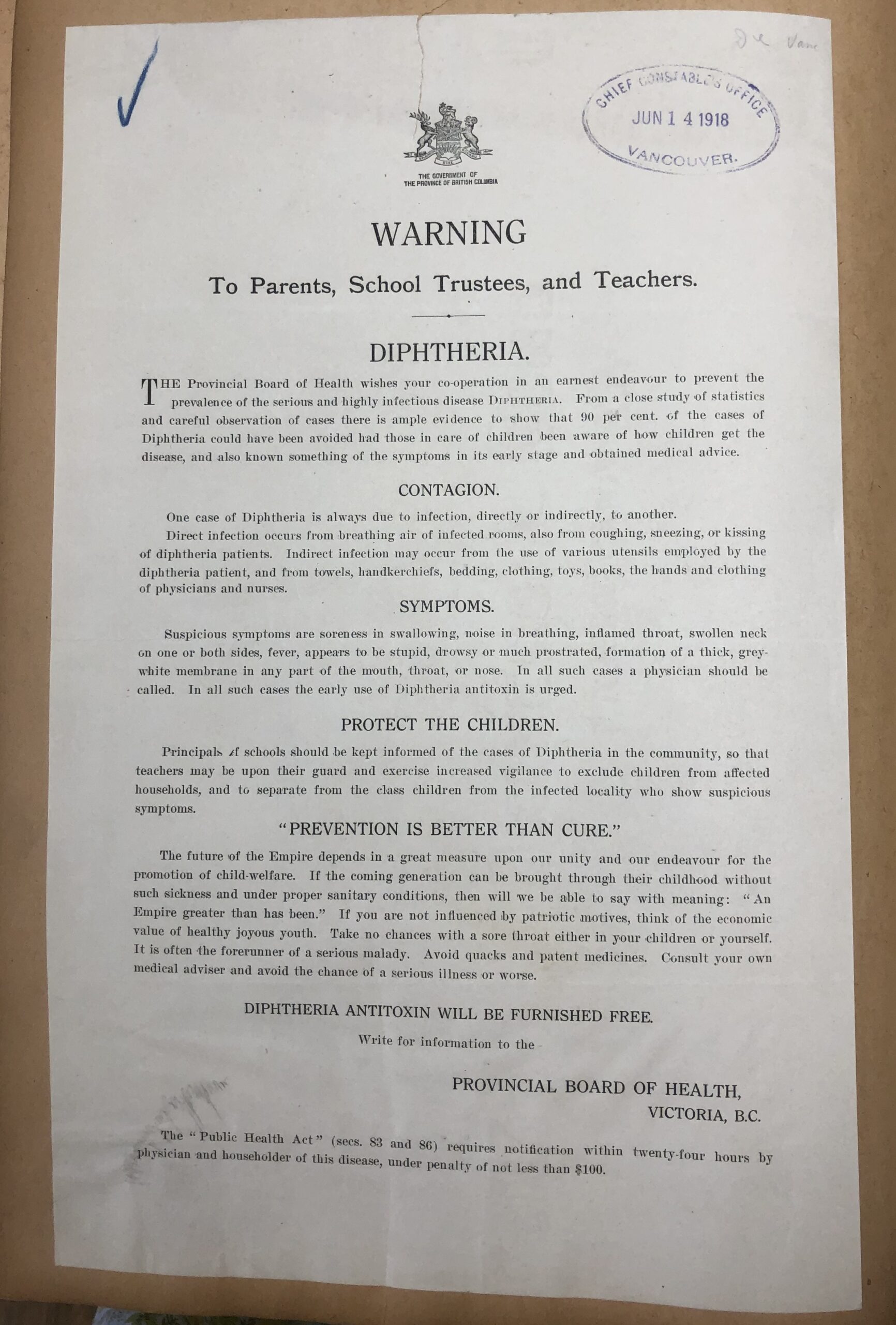
    A public notice to be posted in schools, included with police records in GR-4000

    Government is constantly evolving to meet the needs of the citizens it serves. This often results in the renaming and reorganizing of its various branches and departments. These changes can make it tricky to track which government body was responsible for creating and maintaining particular records through the years. To help myself better understand who created some of the land records I was working with, I set out to create a visual representation of how the land management functions of government moved around over time. This soon expanded to include several other ministries whose records I worked on. It eventually grew to cover all ministries (and their precursor departments) from 1871, when the province was created, to 2021.

    Please see Overview Diagram of Ministries 2022 for the most current version of the diagram.

    I created the chart using information from BC Archives authority records, Orders-in-Council and lists of Cabinet Appointments from the Legislative Library. Ministries are shown in square bubbles and are connected to each other with arrows. The oldest departments are at the top, moving down to the current ministries at the bottom of the page. The ministries are arranged in columns that represent broad categories of government functions, such as health or agriculture.

    Arrows with solid lines show that a ministry was renamed. This usually means it continued to do pretty much the same work and fulfill the same functions of its predecessor.

    Arrows with dotted lines show that some functions moved to another ministry. Dotted lines also show links from ministries that are established (created) and disestablished. I was only able to note large changes; sometimes the various branches that make up a ministry were split between a half dozen other ministries, making it pretty impossible to track all their movements individually.

    The complexity and change over time make this a bit overwhelming to look at all together. But the changing names of a ministry can provide a high-level snapshot of general trends in government’s priorities over time. Each ministry is usually focused on a single function or issue, such as providing health care or managing public forests. The evolution of ministries reflects what government thought was important—and what mattered to voters. To a certain extent, this also reflects what mattered to society at large, though government was dominated by white men for most of the province’s existence, and universal enfranchisement did not occur until 1952.

    Government departments changed very little from the province’s creation in 1871 until the 1970s. Government was small. Initially, the Attorney-General and Provincial Secretary were responsible for functions that would be divided among a dozen different ministers today. The major changes involved the creation of new departments as the role of government began to expand in the twentieth century.

    Members of the Legislative Assembly demonstrating some pretty good social distancing. Photo taken in 1870 in front of
    the Victoria government buildings known as the Birdcages, after the union of the two colonies and just prior to Confederation. C-06178.

    Initially, building infrastructure and promoting the industrial harvest of natural resources (to expand economic opportunities for other white settlers) appears to be more of a priority than providing social supports. For example, two separate departments for railways and public works were established almost 50 years before the Department of Health Services and Department of Social Welfare were finally created in 1959.

    In 1976, all departments were renamed and became ministries. After this point, changes became much more common. By the 1990s it seems to have become fairly standard practice for a newly elected government to reorganize Cabinet, appointing new ministers to differentiate themselves from the previous government and reflect changing priorities throughout their term in office.

    Some ministries have remained remarkably similar over the last hundred years. Others have been regularly broken up, combined and moved around in ways that, at times, can seem confusing and a bit counterintuitive. For example, in 1978, the Ministry of Recreation and Conservation was disestablished and broken into several ministries, including a new Ministry of Deregulation.

    BC Legislative Assembly, Seventh Parliament, Third Session, in 1897 in the Birdcages.
    Construction of the current Legislative Assembly building was completed the following year. A-02563.

    Names have power. Word choice can really impact how people perceive things, and the level of importance or value they place on an issue. The arm of government responsible for social services provides a good example of this. It has fulfilled fairly similar functions over time, but the language around the work has evolved alongside societal beliefs about poverty. It began in 1959 as the Department of Social Welfare. Later names included the Department of Rehabilitation and Social Improvement, the Ministry of Human Resources and the Ministry of Employment and Income Assistance. Currently, it is the Ministry of Social Development and Poverty Reduction.

    Establishing (or disestablishing) a ministry shows that government is assigning its affairs a certain level of importance, with an elected official appointed to focus on the function or issue. The creation of a Ministry of Women’s Equality in 1991, when BC’s first female premier Rita Johnson was in power, shows women’s equality was an important issue for government at the time. In 2001, this ministry was disestablished and lumped into the Ministry of Community, Aboriginal and Women’s Services with four other disestablished ministries, including the also-disestablished Ministry of Aboriginal Affairs.

    Overall, I have found the chart a helpful way to track government’s changing responsibilities at a glance. My hope is that it can be a useful tool for researching archival government records. A record’s creator (often the ministry or department that created it) is one of the main things archivists look at when arranging and determining different series of government records (GR-numbers) in the BC Archives database. If you can think about the ministry that may have created the records you are looking for, it may provide access to some unexpected results. You can search for archival records by creator here.

    Happy researching!

    a black and white image of several people (men, women and children) sitting on a very large felled old growth tree. a ladder is placed against the tree for people to reach the top

    An old growth tree felled near Vancouver c. 1890 (BC Archives item C-06489)

    As a government records archivist, I process a lot of records related to land or resource use, and specifically forestry records. Since the beginning of British Columbia’s colonization, forestry has been a major part of the province’s economy. After over 150 years of industrial logging, the majority of the province has been disturbed by some kind of industrial activity, leaving an estimated 2.7% as productive old growth forest today.

    Most land in the province is Crown land controlled by the provincial government. Crown land and resources—in this case timber—are leased or licensed to forestry companies to use. These agreements are generally referred to as timber tenures and can include a variety of uses, lengths of time they are valid for and other required management practices.

    Managing all these resources has created a huge amount of government records. Many of these are now kept by the BC Archives for government reference and historical knowledge, and so that the public can hold its government accountable. I recently processed a series of records related to forestry in the Clayoquot Sound area, now part of GR-3659.

    GR-3659 documents a type of timber tenure referred to as a Tree Farm Licence (TFL). Most of western Vancouver Island is covered by a handful of TFLs. TFLs provide a forestry company with almost exclusive rights to harvest timber and manage forest in a certain area for 25 years. Every 5 years, companies are required to create detailed plans outlining how they will manage the land and resources within the TFL area.

    Working with the records in GR-3659 got me thinking about a related historical event—the 1993 Clayoquot Sound protests, also known as the War in the Woods, which occurred primarily on TFL 54 and TFL 57. So, I took a look at some of the other records that document it.

    This image shows a view overlooking large evergreen forest with a forest covered mountain in the background. There is a narrow body of water through the image close to the mountain

    Meares Island in 1978, before the War in the Woods (BC Archives item I-02748)

    Protests and blockades began in the 1980s after logging was proposed on Meares Island in Clayoquot Sound. Several attempts were made by the government to reach a consensus between the members of the forest industry, environmentalists, municipalities and Indigenous Peoples. These included the Clayoquot Sound Development Task Force (GR-3535, box 921203-0023) and the Clayoquot Sound Development Steering Committee. Environmentalists left the Steering Committee in 1991 after the government refused to defer logging until an agreement was made. The Steering Committee ultimately dissolved in October 1992, without completing a finalized development strategy.

    A few months later, in April 1993, Cabinet passed the Clayoquot Sound Land Use Plan, but it was widely contested. The government’s lack of consultation with local First Nations and the large area of old growth forest available for clear cutting resulted in protests that spread around the world. Protest camps and blockades were set up to prevent logging, in defiance of court injunctions. Police attempts to enforce the injunction led to over 800 arrests. Thousands of people protested over the summer of 1993, making it possibly the largest event of civil disobedience in Canadian history.

    Ultimately, the government was able to reach a consensus with the Nuu-chah-nulth First Nation, whose traditional territory includes Clayoquot Sound, and new land use plans were developed. This also led to the creation of Iisaak, a new First Nations owned logging company operating in the area (some of their records are in GR-3659), and the designation of Clayoquot Sound as a UNESCO Biosphere Reserve.

    a pile of letters and drawings done by citizens protesting old growth logging

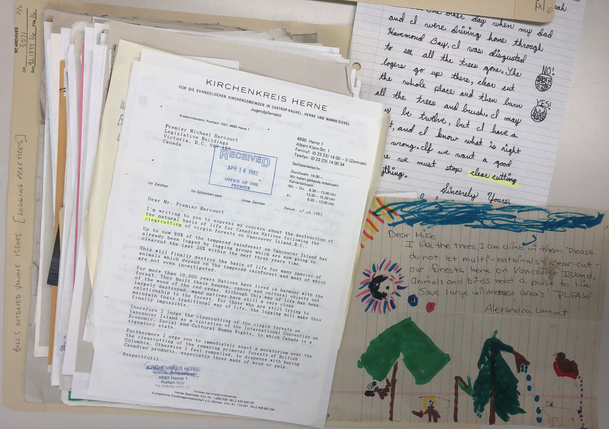
    Letters protesting old growth logging received by the Premier in 1993 from across Canada and the rest of the world (BC Archives, GR-3571, box 921888-0036, file 16)

     A Tale for COVID Time

    I have always believed that culture can transform, art can heal and history holds a mirror to ourselves and our time—thus my deep love for the study of history, arts and culture.

    This current unsettling time of global pandemic crisis easily evokes feelings of insecurity and fear. It is a time of racism and uprisings against racism and other forms of discrimination. When I was given a small public space to share my work, I wondered what would be helpful when facing the challenges of our time.

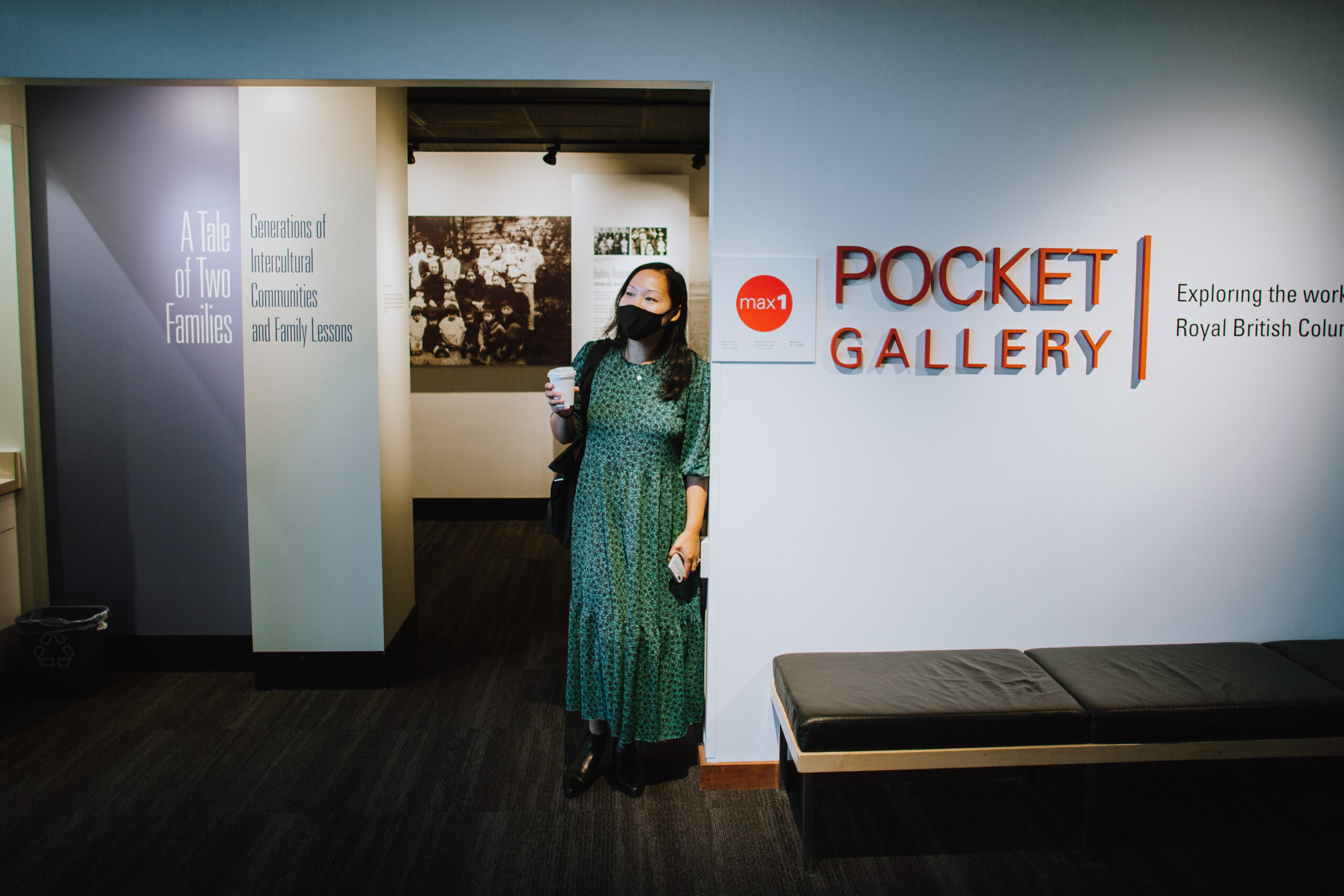
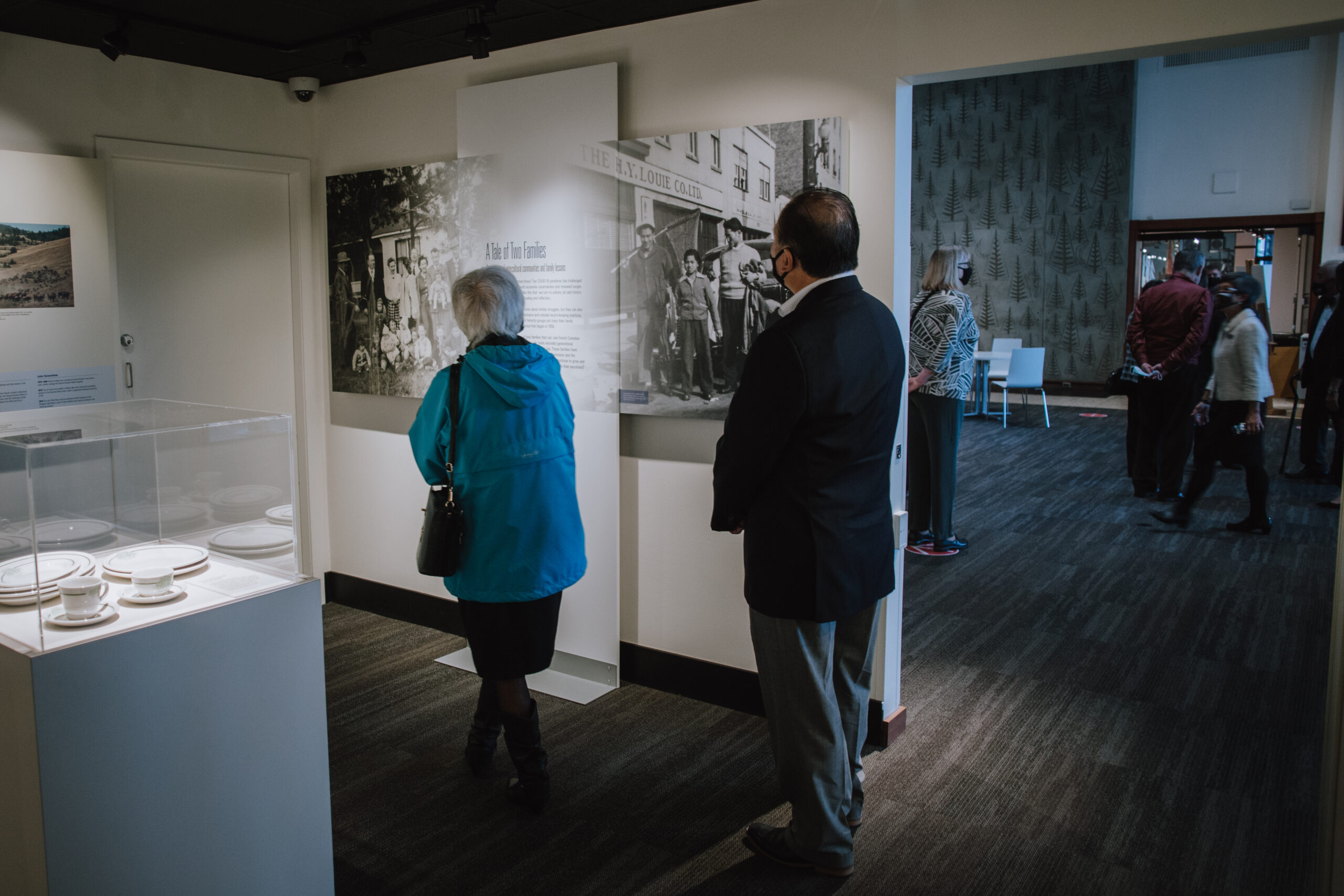
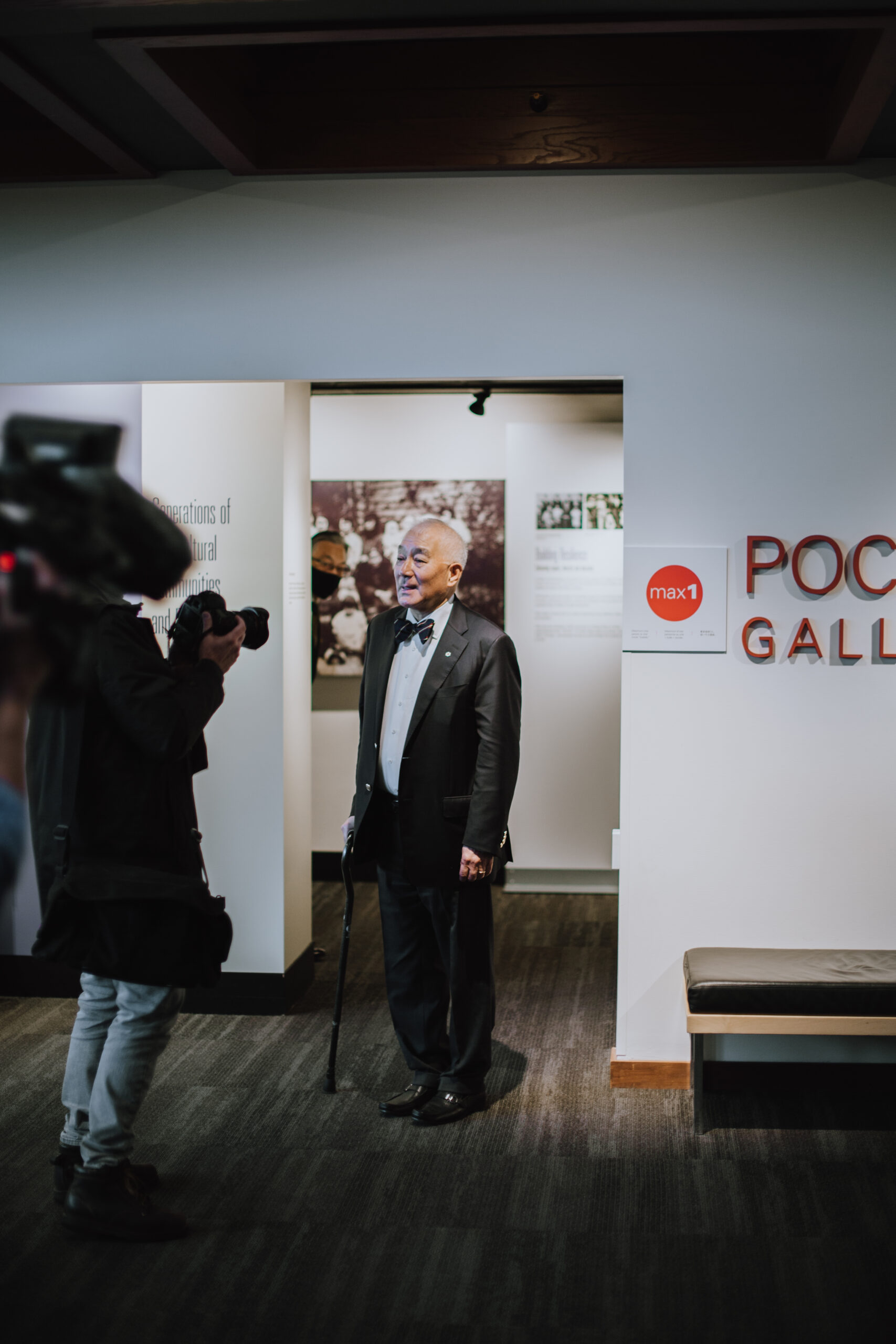
    The Royal BC Museum’s special Pocket Gallery A Tale of Two Families: Generations of Intercultural Communities and Family Lessons conveys a special message for the time of COVID. It assures us other people have not only made it through harsh times but have built legacies of success and community support.

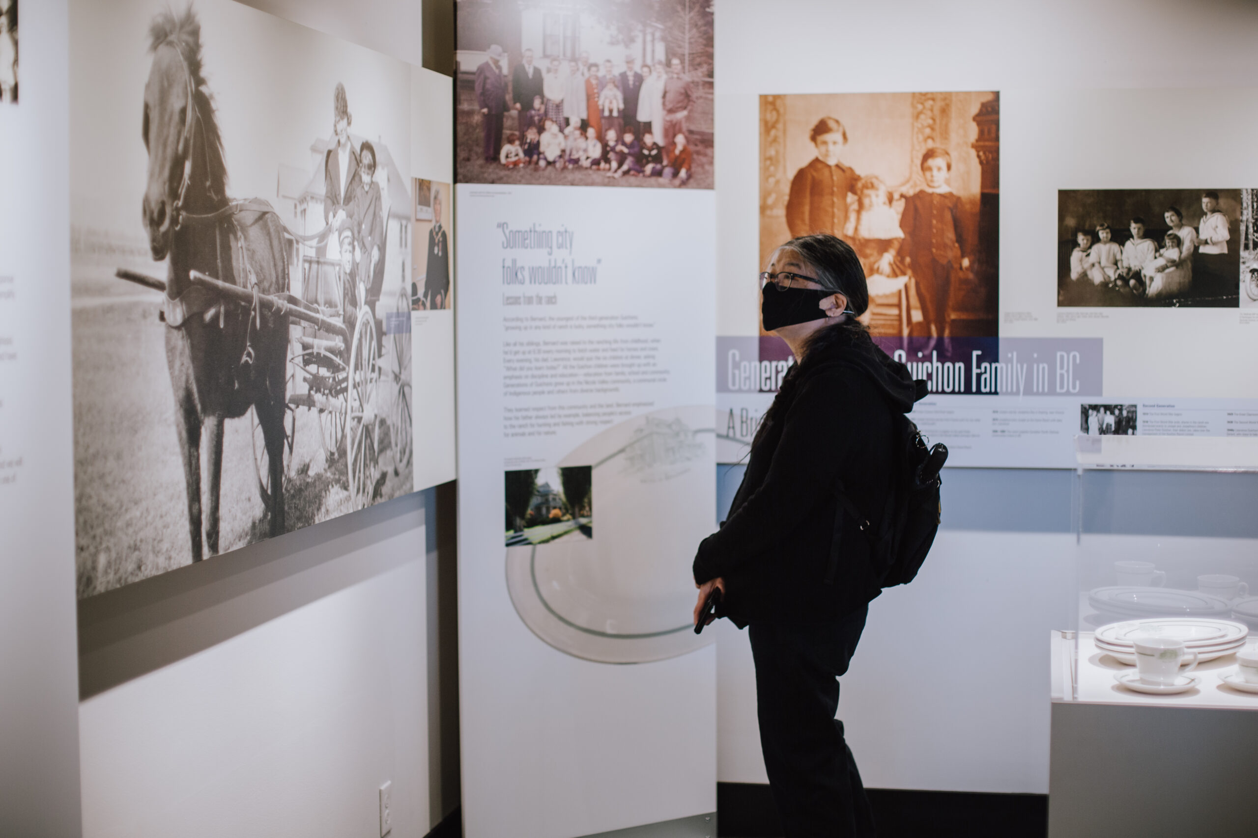
    Due to historical exclusion and colonial record-keeping practices, few families from settler minority groups can trace their histories back to the gold rush period that began in 1858. Since 2016, I have worked with two families that can: one French Canadian and the other Chinese Canadian. Their stories reveal rarely recorded generational continuities from the gold rush era to the present day. These families have survived times of great adversity, including the Great Depression and the Chinese exclusion era, to build lasting legacies in BC. What has kept the two families going for generations and through difficulties? What has allowed them to continue to grow and prosper today?

    A deeper look at the family histories through the family members’ lenses reveals patterns in how the two families persisted through generations. Both families emphasize education, intercultural community building and kindness as family values. Their ideals resonate with our shared experiences and collective values as Canadians. During times of extraordinary challenges, such core values can shape people’s response. The stories of the Guichon and Louie families exemplify resilience through hard times in British Columbia history. Their family lessons are British Columbians’ strength.

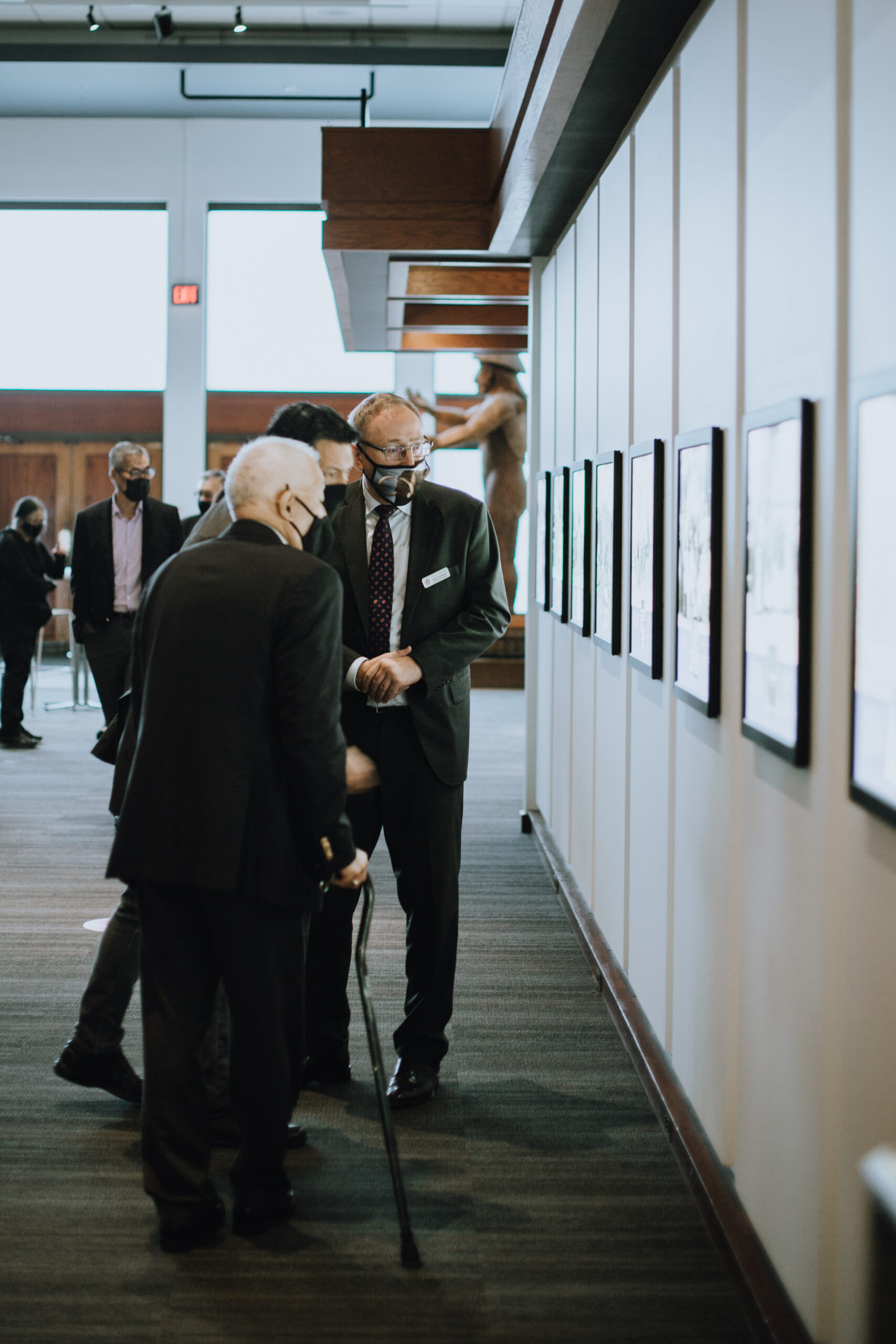
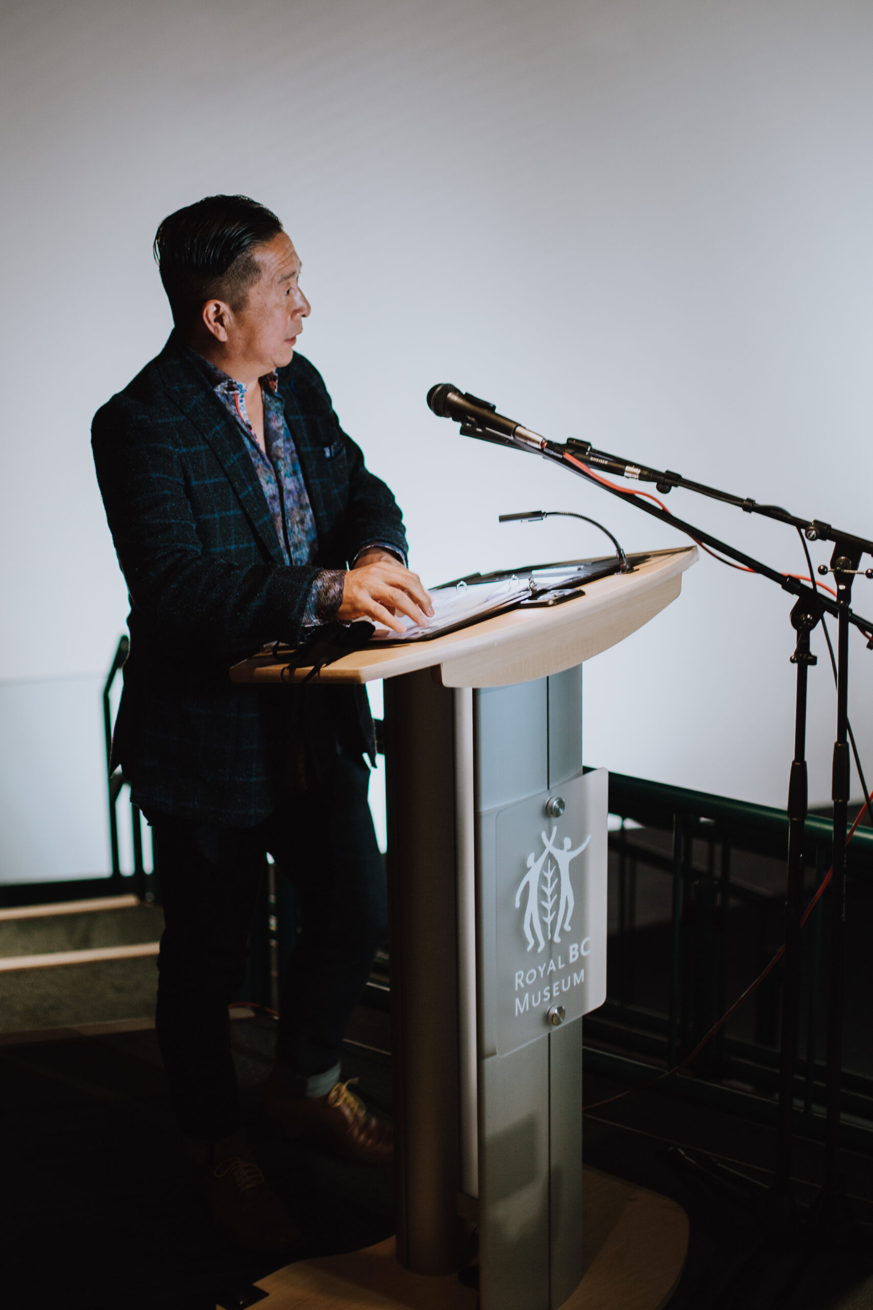
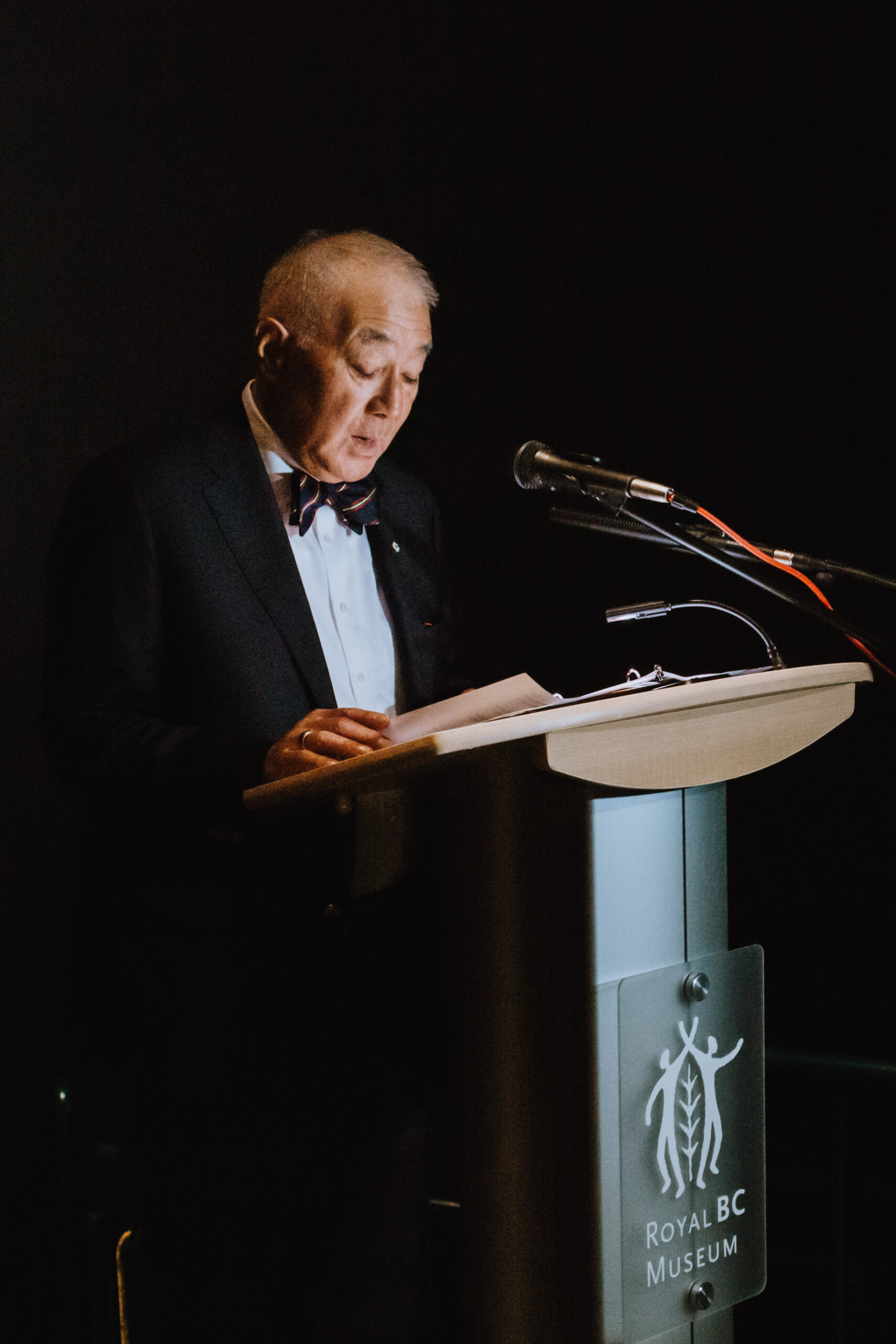
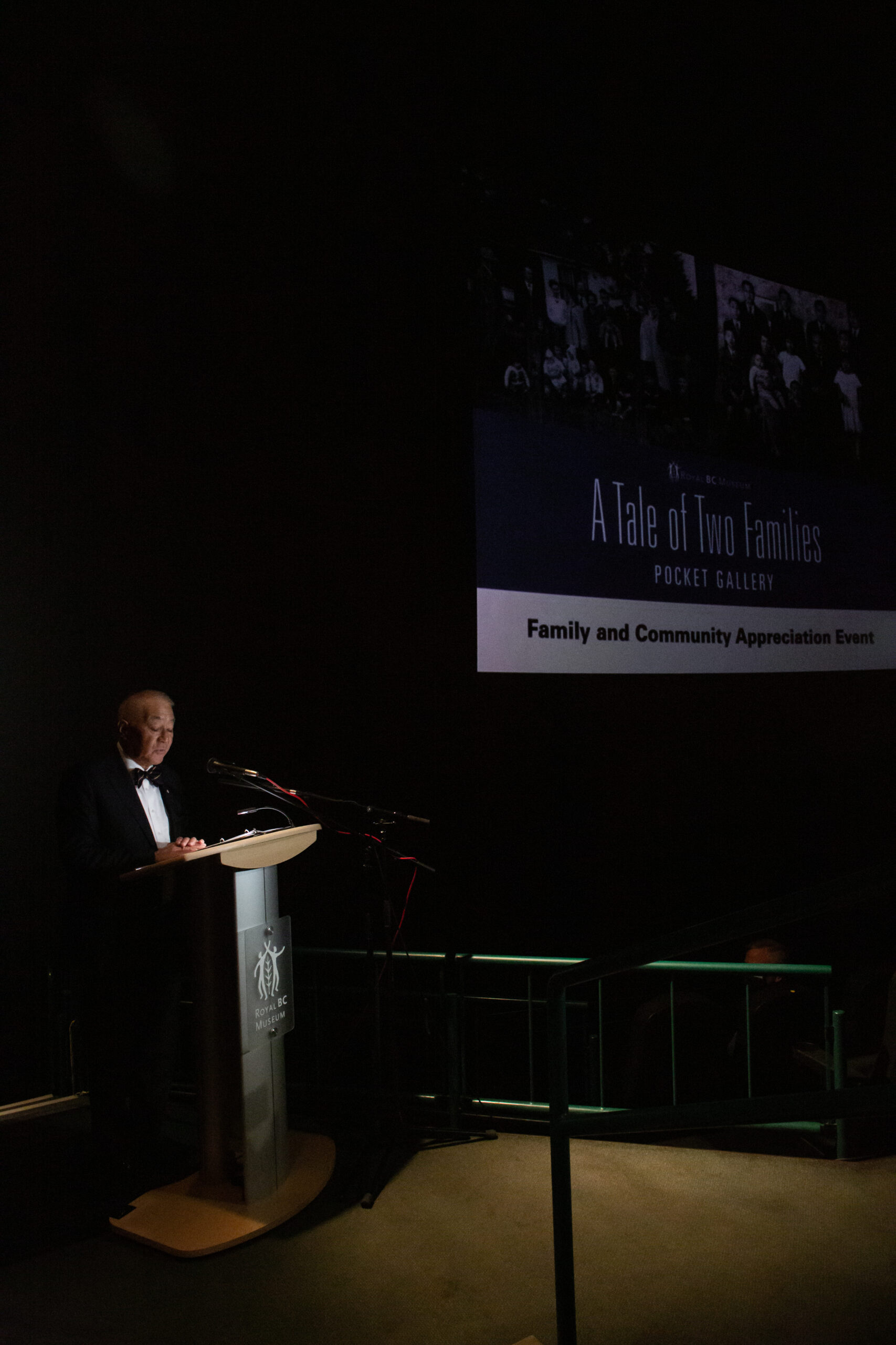
    On September 23, 2020, the museum hosted a special COVID-safe appreciation event for the featured families and communities of this Pocket Gallery. Maurice Guibord, président, Société historique francophone de la Colombie-Britannique, shared on video the significance of the Guichon family history.


    Ms. Hilde Rose, the only living third-generation ranch operator, spoke on behalf of the Guichon family.  With her husband Guy Rose, who was a third-generation Guichon, she operated the Quilchena Cattle Co. and the historic Quilchena Hotel for decades.


    Mr. Alan Lowe, board chair of the Victoria Chinatown Museum Society and long-time beloved leader and former mayor of Victoria, spoke on behalf of the Victoria Chinatown communities to stress the importance of Chinatown history and the need to preserve it with a new museum in Victoria’s Chinatown.

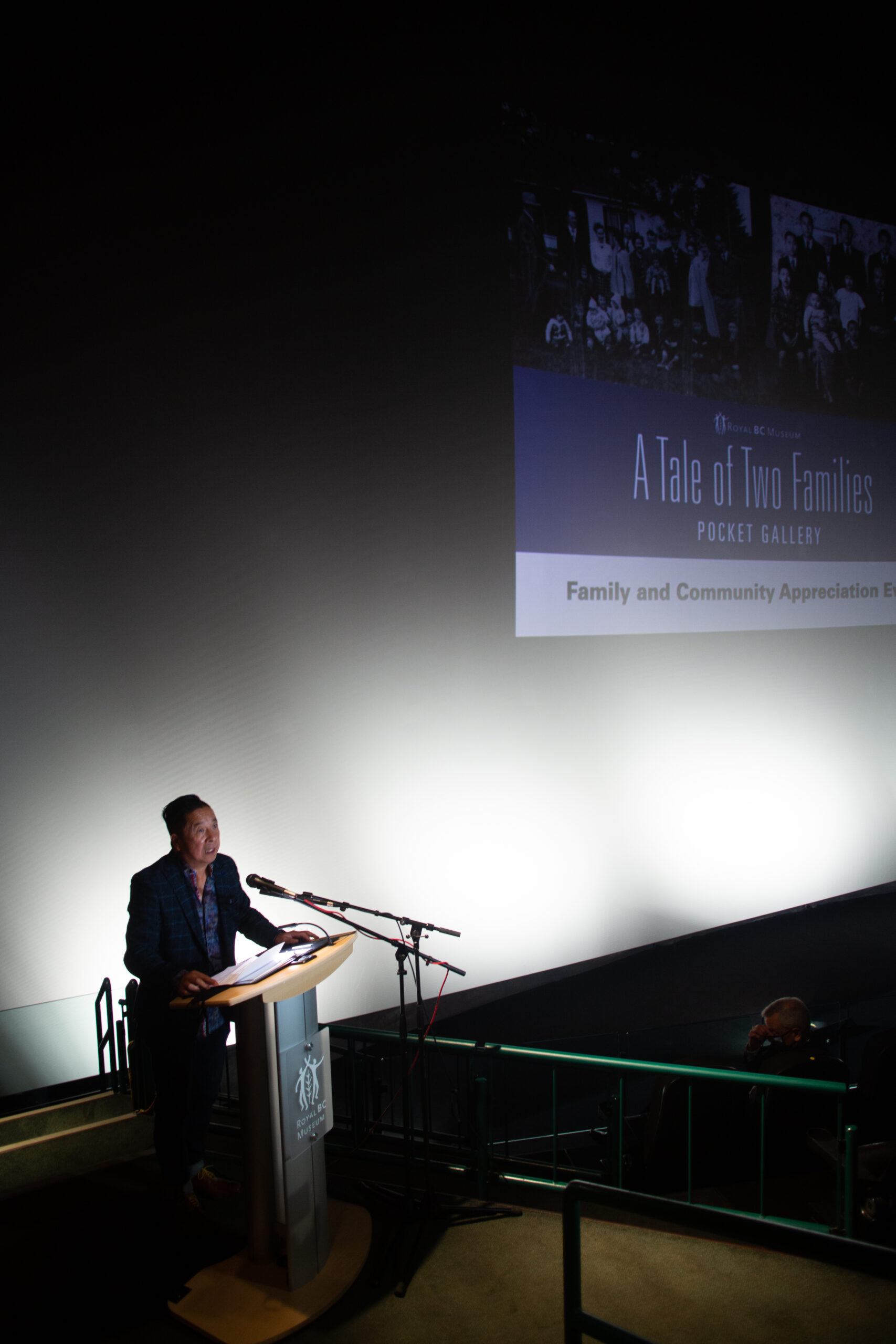
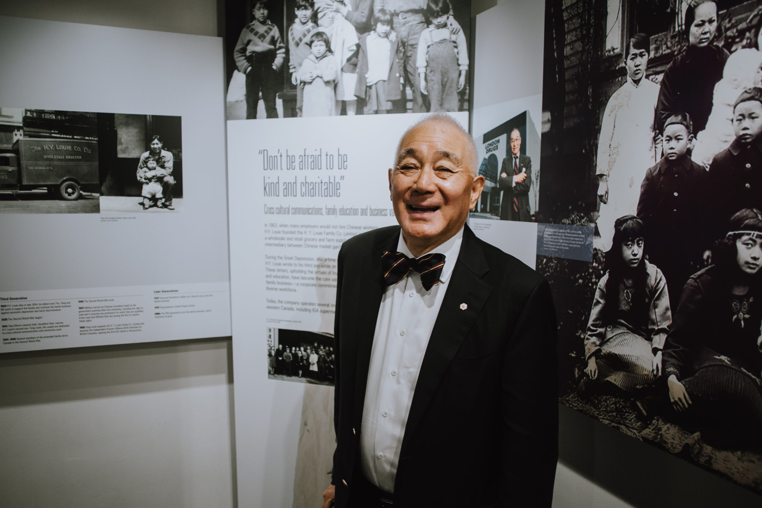
    Mr. Brandt Louie spoke on behalf of the Louie-Seto family as a direct descendant of the pioneer families of the Louies, Setos and Lees in BC, and of the Lews from the United States. He is also the third-generation leader of the H.Y. Louie Family Co. Ltd. His full speech can be found here.

    The families’s joined commitment to education, intercultural community building and kindness resonate with our shared values as Canadians. These core values can help us shape our response during COVID time and the fight against discrimination through intercultural understanding and the pursuit of social justice.

    Royal BC Museum Biodiversity Research During the Pandemic

    Nature is unrelenting. The zoonotic origin of the SARS-CoV-2 novel virus responsible for COVID-19 is a powerful reminder of the connections between human activities, health and biodiversity. As I write this, the COVID-19 pandemic continues to impact all aspects of human society, while the urgency to document, understand and protect biodiversity remains unabated. Museums in particular face the dual challenges of keeping the public engaged and maintaining their research programs. In many institutions, fieldwork, normally a major component of research activities during the summer months, has had to be postponed. Many aspects of learning, public engagement and curation of collections have moved online.

    Researchers at the Royal BC Museum are considering the direct and indirect consequences of the pandemic on biodiversity while continuing to meet the challenges of biodiversity research. Aside from anecdotal reports (indicating, for example, that in many places biodiversity may be benefitting from reduced human activity), it is too early to provide a definitive answer to how the pandemic is affecting biodiversity. Given time, and with ongoing communication among scientists in natural history collections and the wider scientific community, this question can be answered by mobilizing and using biodiversity data found in natural history collections.

    Ongoing communication of natural history collections is important, especially during this challenging time. Many people experience natural history collections only as museum exhibits. In this context, it can be difficult to visualize museum collections as baseline biodiversity data that are fundamental to diverse scientific fields. However, natural history specimens constitute the data for documenting biodiversity and constructing phylogenies, and they address evolutionary, ecological and biogeographic questions. Additionally, possibilities extend beyond the physical specimen, and may include genomic, behavioural and occurrence data. Therefore it is crucial that collections be maintained, that they grow, and that their data be continually enriched and shared. Through collections, we can improve our understanding of evolving species interactions, including those of pathogens and their hosts, which can help to better predict the risks of novel zoonotic diseases.

    What about fieldwork? To cope with the travel restrictions and safety conditions surrounding the pandemic, some researchers have adopted different strategies. For example, in place of large-scale, rapid, people-intensive biodiversity surveys, some locations are studied in great detail over time, with fewer people. One project is the Quadra BioMarathon, conducted by researchers from the Hakai Institute to assess the diversity, abundance and composition of plankton just offshore from Hakai’s Quadra Island facility. The Royal BC Museum provides taxonomic expertise and advises on collection, preservation and identification of specimens.

    Curators, collection managers and other researchers at the Royal BC Museum continue to work on collections, expanding, refining and making accessible the data through online collaborations with colleagues from as close as across town or  as far as halfway across the globe. We are also committed to making biodiversity data and knowledge accessible to our diverse communities online.

    Ongoing projects by Royal BC Museum researchers include taxonomic analysis, linking specimens to nucleotide, genome or protein data, and making data accessible through the Royal BC Museum online database.

    Useful links:

    Royal BC Museum collections

    GBIF Global Biodiversity Information Facility

    iDigBio (Integrated Digitized Biocollections

    Royal BC Museum Natural History Curators and Collection Managers

    Dr. Victoria Arbour, Curator, Palaeontology

    Dr. Henry Choong, Curator, Invertebrate Zoology

    Dr. Joel Gibson, Curator, Entomology

    Dr. Gavin Hanke, Curator, Vertebrate Zoology

    Dr. Ken Marr, Curator, Botany

    Claudia Copley, Collections Manager and Researcher, Entomology

    Heidi Gartner, Collections Manager and Researcher, Invertebrates


    This article examines the Punjabi Canadian Legacy Project (PCLP), a partnership project between the Royal British Columbia Museum and the South Asian Studies Institute at the University of the Fraser Valley, as a case study of heritage from below. The project is based on community action research and practices, joining forces of memory, research, and community institutions, organisations, and groups. Considering ‘heritagisation’ as a process of heritage building, and drawing on their experience as practitioners on this project, the authors argue for the need to consider the vast diversities within and among communities, and the need to work on ‘heritagisation’ through ongoing dialogic engagement.

    Through a myriad of continuous dialogues and inherent challenges, the process and progress of the PCLP is shaped by this dialogic engagement. As an ongoing project, the PCLP demonstrates how a network extended to diverse participants with shared goals can emerge through the organically developed heritagisation process encouraged by the partners’ collaborative efforts in an experimental model for community work by memory and research institutions.

    See full article

    During the first visits of Hudson’s Bay Company officials to Victoria Harbour—William McNeil in 1837 and McNeil with John Work and John McLoughlin in 1839—there was no information recorded about the Indigenous Lekwungen peoples of the area. (Keddie 2003)

    The first information was recorded in 1842 during the visit of the company’s James Douglas to settle on the location of the future Fort Camosun—later Fort Victoria. It was during Douglas’s second visit in 1843 that he brought along the Québécois Jesuit Jean Baptiste Zacharie Bolduc, a missionary who was part of the Quebec Mission to the Pacific Northwest (fig. 1).

    Figure 1. Jean-Baptiste-Zacharie Bolduc. Courtesy of Bibliothèque et Archives nationales du Québec. P560,S2,D1,P109.

    The accounts of the Bolduc provide some of the most important observations of the Indigenous peoples in the Victoria region, more so than those of Douglas at that time. It is important in this regard to be familiar with the different versions of the Bolduc accounts that have been presented in the literature and used by various researchers.

    One difference in the accounts that is significant is Bolduc’s observation of 525 people at Cadboro Bay—the only village observed and visited in 1843. Unfortunately, anthropologist Wilson Duff, in his study of the Victoria Treaties (Duff 1969), used a reference that did not have this account. One wonders what different conclusions Duff may have come to if he was familiar with Bolduc’s original writings.

    To understand the context of what Bolduc documented it is important to know where he was during his visit and more precisely what he said. In examining the information from Bolduc, I referred to and compared published accounts in French and their various English translations when considering statements such as the number of 525 people identified by Bolduc at Cadboro Bay on March 17, 1843. I consider Bolduc’s statements about the number of people he observed to be accurate estimates.  My conclusions were based on the original published documents of Bolduc, his propensity to record accurate information and statements he made of the circumstances of his visit.

    What is crucial here is that there are translations of Bolduc’s work that do not mention the 525 people at Cadboro Bay, as well as other important details. The reference pertaining to Cadboro Bay that I used was Bolduc’s original 1844 account, translated by Landerholm (1956), which is similar to that of a later editor/translator, Kowrach (1979). The latter author used the English translations of Landerholm and others in his French to English translation. Both of the latter translators used the French language documents in the collections of the Oregon Historical Society as well as earlier English translations.

    The incomplete English translation of De Smet that casts doubt on Bolduc’s statement regarding the count of 525 people at Cadboro Bay is an earlier 1847 English translation by Father De Smet: “Oregon Missions and Travels over the Rocky Mountains in 1845-46, Edward Dunigan, New York.”  This does not mention the count of 525 people at the Cadboro Bay village. The missing figure is also absent from De Smet’s earlier, French-language version, “Colombie. Extract d’une letter do M. Bolduc, Missionaire apostolique, a M. Cayene, Cowlitze, le 15 fevrier 1844” (1845).

    However, what is significant is that De Smet’s French-language publication was not a direct copy from French to French, but extracts and paraphrasing of Bolduc’s documents. De Smet simply left out material that he did not think was important or that did not present Bolduc in a favourable manner, such as his complaint about having to shake so many hands at Cadboro Bay. The count of 525 people at Cadboro Bay was included in Bolduc (1845).

    De Smet’s 1847 English translation was from the altered and incomplete French version. The reference was simply left out by De Smet. Wilson Duff, in writing about the Victoria Treaties, used the information from historian Kaye Lamb (1943), who also obtained his information from De Smet’s incomplete writings.

    The Best Published French Language Source

    The best published source in the French language of Bolduc’s trip to Vancouver Island is the 1845 publication of Bolduc’s Journal and letters: “Mission De La Columbie. Deuxieme Lettre et Journal of M. J.-B.-Z. Bolduc, Missionnaire A La Columbie. Quebec: De L’imprimerie De J.-B. Frechette, Pere, Imprimeur-Labraire, No. 13, Rue Lamontagne,” under the subtitle: “A Vant-Propos. Suite Du Journal De M. Bolduc, Missionnaire A La Columbie” is the “Exrait du Canadian du 19 fevrier, 1845”. Within this are two letters, the second on 28 pages being the one of concern here, entitled: “Extrait Du Journal De M. Bolduc” – “Adreese a M. C…… T……. Cawlitz, 15 fevrie 1844”.  Both of the 1843 and 1845 journal documents contained in this larger document and written in French (RBCM Archives N.W. 970.7 B687m; old manuscript MS-0580) were translated into English by Tess Jennings (1937). Jennings’s translation is from the Bolduc 1845 French-language copy in the RBCM Archives (NW970.7 B687m). The 1843  journal of Bolduc does not contain information on southern Vancouver Island.

    Bolduc’s Reliability as an Observer

    In the 1845 publication of Bolduc, the editor/printer Pere Frechette comments in the preface, as translated by Jennings: As in the first Journal, we do not wish to change in any way the form in which it was written.”

    There are five volumes entitled “Missions de Quebec” in the library of the Oregon Historical Society (Landerholm 1956). One of the seven reports translated by Landerholm is entitled “Mission de la Colombie. Notice No. 6,” dated July 1845. The latter includes Bolduc’s travels to Puget Sound and Vancouver Island. These documents provide a view of how careful Bolduc was in documenting numbers of various Indigenous groups and numbers of converts. This was originally published as a report of the Missions of the Quebec Diocese. On page 2, is the translation of a letter of Bolduc’s entitled “Mission of the Cowletz River, March, 1843. On page 4 is the translated statement of Bolduc:

    “I am also going to keep a journal of my northern trip, and try to assemble reliable facts concerning these nations of faraway places.”

    In this report of March 6, 1843, Bolduc regularly provides estimates of the numbers of people in the many groups he visits. He shows interest in leaning the names of individual communities and his keen interest in languages is shown in his writing of a dictionary of the Chinook language.  Bolduc was clearly an experienced observer. His statements about population numbers can be considered accurate. Bolduc’s statement about the numbers of Indigenous people he observed in the Victoria area in 1843 cannot be dismissed as unreliable.

    Figure 2. Portion of the 1842 Adolphus Lee Lewis map showing the village location at Cadboro Bay and the proposed location of Fort Victoria. Courtesy of the Hudson Bay Company Archives. Provincial Archives of Manitoba. Map Collection G.2/25(T11146).

    Cadboro Bay Commentary of Bolduc

    Some additional commentary is necessary regarding the missing pieces of the Landerholm translation of Bolduc, which goes as follows:

    “We headed for the southern point of Vancouver Island. It was about four o’clock in the afternoon when we arrived there. At first we saw only two canoes, but, having discharged two cannon shots, the aborigines left their retreats and surrounded the steamboat. The following day canoes arrived from all sides. Seeing that there was no danger, I landed with the commander of the expedition and the captain. Yet it was only after several days… that I went to their village, situated at six miles from the harbor [from Victoria harbour] at the base of a charming little bay [Cadboro Bay]. Like almost all of the surrounding tribes, this one possesses a stockade fort of about 150 feet square. They fortify themselves thus to provide shelter from the Yougletas [Lekwiltok], a powerful and warlike tribe… These ferocious enemies fall, usually at night, on the villages they wish to destroy, kill and massacre as many of the men as they can, and take the women and children as slaves. On top of posts in the fort one sees many human heads sculptured in red or black, and occasionally both colors together. On my arrival the whole village, men, women and children, arranged themselves in two lines to shake hands with me, a ceremony which they would not omit for a great deal. I counted 525 individuals, apart from absent ones. I assembled them all in the largest lodge, the chiefs’.”

    In his 1845 French publication, Bolduc notes on page 12: “Je comptai 525 individus, et plusieurs etaient absents.” Jennings’s translation of this is the same as that of Kowrach (1979:108): I counted five hundred twenty-five individuals and many were absent.” Landerholm (1956:193) translates the French as: “I counted 525 individuals, apart from absent ones.”. I thought it was more likely that the end of Bolduc’s sentence would be correct as: “and several were absent.”

    I consulted with French teacher Deni St. Clair of Victoria in regard to Jennings’s English interpretation of the statement about the number count in Cadboro Bay. St. Clair pointed out that “plusieurs” is properly spelt as “plusiers” and noted that: “The potential problem I see here is that the dictionary meaning of plusiers is “several” not “many” (St. Clair, personal communication, December 21, 2014).

    The interpretation that “several were absent” makes sense in the context of Bolduc’s observation in “the following days” when he made a journey to where Indigenous people were cutting posts for the fort. Here Bolduc notes: “I baptized three more children who were absent the day of solemn baptism.” The latter “solemn baptism” is referring to the baptism of children on March 17 at Cadboro Bay.

    James Douglas makes reference the day before to the activities of cutting posts mentioned by Bolduc:

    “Spoke to the Samose today and informed them of our intention of building in this place which appeared to please them very much and they immediately offered their services in procuring pickets for the establishment.” Douglas had offered to give them a 2 1/2 point blanket for every 40 pickets of 22ft. by 36in (Douglas 1843).

    Were there people other than Lekwungen at Cadboro Bay?

    One might speculate that Bolduc may have brought outside Indigenous people with him on his first visit to Cadboro Bay on March 17. There is no evidence to support the idea that large numbers of people accompanied Bolduc on his first trip to Cadboro Bay. Bolduc does not mention anyone going with him on his first trip, but he does mention people accompanying him on his second trip to Cadboro Bay from Victoria Harbour.

    As Bolduc is writing about the events of March 17, 1843, after they occurred, the wording he uses suggests that the other groups came after hearing about his visit to Cadboro Bay and began arriving in Victoria Harbour the day before or the morning of the day he set up his outdoor chapel in Victoria Harbour. After telling the Songhees that he would return on Sunday, Bolduc states (1845:13): “Cependant le bruit de mon arrive s’etant repandu dans le voisinage, plusieurs nations arriverent en masse.”

    Jennings’s translation of this is: “But the sound of my coming is being widespread in the neighborhood, many nations arrived en masse.”  Landerholm’s (1956:194) English translation is: “Meanwhile the rumor of my arrival having spread, several neighboring tribes came en masse.” There is no information to suggest that other tribes or Lekwungen from other villages were present during Bolduc’s visit on March 17 to Cadboro Bay. The quotation referred to is related to a time frame after Bolduc’s visit to Cadboro Bay. Based on Bolduc’s information we can conclude that the 525 people at Cadboro Bay were likely all Lekwungen who primarily lived at Cadboro Bay and did not include outside populations.

    Here is Landerholm’s version of the events after Bolduc told the Lekwungen that he would return to Cadboro Bay on the 19th to baptise the children:

    “Meanwhile the rumor of my arrival having spread, several neighbouring tribes came en masse. The 18th being Sunday, I employed it for constructing a temporary alter [near Victoria Harbour] for celebrating on land the Lord’s day. On Sunday early in the morning, more than 1,200 natives from three great tribes, Kawitshins, Klalams, and Tsamishes, [Cowichan, Klallam and Songhees], assembled around the modest temple… That day being the one I had set for the baptism of children, I went to the principal village [Cadboro Bay] accompanied by a Canadian named Gobin and all the crowd that had been present at the divine service. On arrival, I had again to submit to the terrible ceremony of shaking hands with more than 600 persons. The children were placed in two lines at the seaside. I distributed to each one a holy name on a bit of paper, and I began the ceremony. It may have been about ten o’clock, and when I had finished it was almost nightfall; then I counted the new Christens and found 102 of them. On top of that I had to go more than two leagues on foot to return to the steamboat.”

    The Location of the Boats’ Anchorage

    There has been some confusion regarding the specific location where the Beaver was anchored and where some Indigenous people were coming from during the start of Bolduc’s March 15 visit.

    I would interpret the anchorage of the steamship Beaver to be inside Shoal Point at the west end of Victoria’s Inner Harbour, either at what is now the Fishermans’ Wharf location or just east of Laurel Point. The latter we know was the anchorage during the 1839 visit (Keddie 2003).

    There are several details of translation that need to be discussed pertaining to the Landerholm translation regarding the first observations at the expeditions arrival.

    The translation: “At first we saw only two canoes” leaves out the activity of fishing. Bolduc’s “Nous ne vimes d’abord que deux canots occupes a’ pecher” should say: “We at first only saw two canoes occupied in fishing”.

    The translation: “but, having discharged two cannon shots, the aborigines left their retreats and surrounded the steamboat. The following day canoes arrived from all sides”. This could be interpreted to say that Indigenous people came immediately in large numbers shortly after the boat arrived in the harbour, but: “Mais bientot le canon fit sortir les indigenes de leurs retraites” should be translated as: But the canon soon made the natives leave their retreats and “Cependant, comme il se fesait déjà tard, nous n’en vimes que peu ce jour-la.” becomes:  However, as it was already late, we saw but few that day.

    “Mais le lendemain de bon matin, il fallait voir les canots arriver do [de NOT DO] tout cote et entourer le steam boat.”  [But], The next morning it was possible to see canoes arrive from every side and surround the steamboat. From this observation it appears that only one canoe with two people fishing was seen in Victoria’s Inner Harbour. It was not until the next day that more people came in canoes from elsewhere.

    Bolduc writes: “Seeing that there was no danger, I landed with the commander of the expedition and the captain”. This fits with Douglas statement, that after a night on the Beaver he went out the next morning to examine “the wood of the north shore of the harbor.” This clearly indicates that the Beaver was not anchored off Clover Point but was in a harbour with forest on the north shore.

    In 1927 there was a discussion among local historians regarding the locations of the 1842 and 1843 visits of James Douglas. In regard to the 1842 visit C.C. Pemberton mentions in a letter of October 19 to historian Kaye Lamb and to Judge Howay that Walbran (who had a considerable knowledge about the origin of place names but mistakenly referred to the “1841” Douglas survey): “remarks that Sir James’ grandson had informed him that Sir James made his first landing from the Beaver at Clover Point, . . . and . . . party then walked through the area of Beacon Hill Park to the Gorge” but Pemberton knew nothing about it.  “I believe that when Sir James made his survey in 1842, he came in the Cadboro, and in 1843 he landed from the Beaver at Shoal Point…. I think I have a faint remembrance of hearing, when I was a boy, of this landing, and naming of Clover Point.”

    Pemberton, in a another letter to Judge Howay, on November 2, pertaining to the 1842 visit, noted that: “D. H. McNeill. . . says that he knows that his grandfather, Capt. Wm. McNeill, landed Sir James and party at Clover Point, and then went around to Victoria Harbour and anchored, waiting for them to return to the Beaver.”(Pemberton 1927).

    Conclusion

    Bolduc’s writings have suffered from problems of translation, but his work is significant in providing a glimpse of Lekwungen peoples as they were in the spring of 1843.


    References

    Bolduc, Jean Baptiste. 1844. Letter of M. Bolduc to M.C. of February 15. In: Notices & Voyages of the Famed Quebec Mission to the Pacific Northwest, pp. 189-198. Oregon Historical Society. 1956.
    Bolduc, Jean-Baptisite Zacharie. 1845. “Extrait Du Journal De M. Bolduc” “Adreese a M. C…… T……. Cawlitz, 15 fevrie 1844]. (RBCM Archives N.W. 970.7 B687m – old manuscript MS-0580).
    De Smet, Pierre-Jean. 1844. Voyages aux Montagnes Rogcheuses et Une Annee de Sejour. Chez Les Tribes Indiennes Du Vaste Territoire De L-Oregon, Dependant, Des Etats-Unis D’Amerique, Par le R. P. Pierre De Smet, Missionarie De La Compagne De Jesus. Malines. P.J. Hanicq, Imprinmeur De Saint Siege, De La Sacree Congregation De La Propagande et De L’archevech De Malines.
    De Smet, Piere-Jean. 1845. Annals De La Propagation De La F01 Recueil Periodique. Tome Dix-Septieme, A Lyon. Copy in the Royal B.C. Museum Archives (NW 282 A614, Vol. 17).
    Douglas, James. 1851. In: Private Papers of Sir James Douglas, RBCM Archives B20/1853.
    Douglas, James. 1843. Diary of a Trip to Victoria, March 1–21, 1843. RBCM Archives, Ms A/B/40/D75.4.
    Douglas, James. 1850.  Letter of September 1, in Fort Victoria Letters 1846-1851. The Hudson’s Bay Record Society, Vol. XXXII, p. 115–118.
    Douglas, James. Diary of a Trip to Victoria. March 1-21, 1843. RBCM Archives A/B/40/D75.4a.
    Duff, Wilson. 1969. The Fort Victoria Treaties, BC Studies 3:3-57.
    Jennings, Tess.  1937. (Translator). “Mission of the Columbia. Second Letter and Journal of Father J. –B. Z. Bolduc. Missionary of the Columbia”. Works Progress Administration, Project 4185, Frederick E. Bolton, Sponsor and Project 5606, J.S. Richards, Sponsor. Seattle, Washington, (RBCM N.W. 970.7 B687d).
    Keddie, Grant. 2003. Songhees Pictorial. A History of the Songhees People as seen by Outsiders, 1790-1912. Royal B.C. Museum, Victoria.
    Kowrach, Edward J. 1979. (Editor and translator) Mission of the Columbia. Jean Baptisite Zacharie Bolduc. Ye Galleon Press, Fairfield, Washington.
    Lamb, W. Kaye. 1943. The Founding of Fort Victoria. British Columbia Historical Quarterly, Vol. VII, no. 2, April.
    Lamb, Kaye. 1943. The Founding of Victoria. The Beaver, Outfit 273, March, 1943:3-8.
    Landerholm, Carl (Translator. 1956. Letter of M. Bolduc to M.C. of February 15. In: Notices & Voyages of the Famed Quebec Mission to the Pacific Northwest, pp.189-198. Oregon Historical Society.
    Pemberton, C.C. 1927. Add. Mss.0522; letter to Kaye Lamb E D P361.9; letter to Judge Howay, Oct. 19, 1927.

    The properties on which our legislative buildings are now located in Victoria Harbour are within the traditional territory of the Lekwungen First Nations, today represented by the Esquimalt and Songhees Nations. There is clear evidence in the form of written documents and maps that James Douglas intended this property to become an Indigenous Reserve as part of the treaty settlements of 1850. (See Appendix 1: The Paper Reserve.)

    The legislative property is shown on this 1862 map to the left of lot VI belonging to James Douglas. It is located at the southern foot of the James Bay Bridge. (BC Archives 11520A. Part of Beckley Farm No.4.)

    The Lekwungen people were rightfully compensated, in November of 2006, with an out of court settlement for the failure of this property to become a modern First Nations reserve. There is no evidence of any agreement being made in the nineteenth century to dispose of this proposed reserve with any Lekwungen peoples.

    This is a case where, in my opinion, compensation would not need to be predicated on the Lekwungen ever having a village on the property. There is, in fact, no archaeological evidence that there was a pre-contact village on this property. (See Appendix 2: Archaeological Observations in the Legislative Building Precinct and Along the Adjacent Waterfront 1972–2019. )

    Courtesy of the American Library of Congress. #2005680426, No.2.

    Homestead of Montreuil on what became the legislative Grounds, 1858. Buildings owned by non-Indigenous peoples seen to the right of this image on the larger panorama are west of the legislative property. Courtesy of the American Library of Congress. #2005680426, No.2. 

    A Historic Overview of the Legislative Property

    Here I will examine the nature of some of the early historic documentation regarding the legislative property. 

    There are no Hudson Bay company records or accounts of military, religious or other visitors to Victoria Harbour in the 1840s to early 1850s that pertain to Lekwungen people living in a village at the location intended to be a future “Indian Reserve” shown on the 1854 map The historic Inner Harbour village was located a few blocks further west, near Laurel Point. This village was one that was co-occupied by local Xwsepsum treaty people and their Clallam relatives from the American side of the Straits of Juan de Fuca for a short period of time about 1847–1855.  

    I would propose that the historic village sometimes being referred to as being “near”, “in front of” or “on” the legislative property was in fact at the latter location, near Laurel Point. (See Appendix 3: The Location of the Historic Village of the Xwsepsum and Klallum.)

    Here I will present some observations in regard to the earlier use of the property around the legislative buildings. There is no archaeological evidence of a shellmidden that would represent the remains of a village site at this location. Direct accounts that observe local First Nations occupying this site area are lacking.  

    Dorothy Kennedy has provided a detailed analysis of the ethnographic literature pertaining to the locations in Victoria Harbour and the Gorge Waterway of  the Kosampson and other Lekwungen peoples (Kennedy 2006:57-64 & 70-86). I refer to this and add my own opinions in Appendix 4: Lekwungen Winter Villages and Seasonal Movements. 

    Historic Observations: Who Occupied Buildings on the Legislative Property?

    An 1851 map (HBCA G.1/131 [N8362]) of surveyor Joseph Pemberton includes the area that was to become the legislative precinct. On this map are five small buildings marked in red. One small square dwelling in red is  located near the northwest corner of James Douglas’s property, and four more small square dwellings marked in red are in a line continuing on the property to the west along the waterfront—which later became the location of the Parliament buildings.

    Portion of Pemberton Map showing the legislative precinct area (G.1/131 [N8362]). All houses are coloured in red.

    These buildings only appear together on this one map. The map was most likely created from information collected by surveys undertaken in the late spring to early summer of 1851. The one building on Douglas’s property is also located on a map dating 1852 from information collected in the late fall of 1851. These small buildings were most likely occupied by Indigenous and/or non-Indigenous persons working for James Douglas during a period of intense building on his property between late 1850 and the summer of 1851.  

    In regard to the James Bay “Indian Reserve”, William Tolmie’s letter to Thomas Fraser of June 24, 1865 states: “That the piece of Land in question was ever in any sense an Indian reserve has from the first – been disputed by the company’s Officers, resident here, since the foundation of the Colony. – Indians of various Tribes sometimes employed by the Governor, and on other occasions by the Company, were allowed to reside on it at times under the surveillance of a half-breed (Montreuil) who lived on the spot in a small cottage said by Tiedmann to have been claimed by the Governor and to have been, with another small house on this Reserve, by him transferred to the Colony in 1859 for the sum of $200.” (Tolmie, William J. Letter of June 24th, 1865; HBCA A.11/80 f.148-169d)

    The James Douglas Property

    On January 13, 1849, a Charter of Grant awarded Vancouver Island to the Hudson’s Bay Company for “the advancement of colonization and encouragement of trade and commerce”. The main condition was to establish “a settlement or settlements of resident colonists” by 1854. Revenues from land sales were to go mostly for the construction of public schools, buildings, roads and bridges.

    Douglas and other Hudson’s Bay company employees now had the opportunity to acquire land that had previously been denied to them, as the purchase was seen as being in conflict with company business. 

    On December 10, 1849, James Douglas applied to Archibald Barclay to acquire land for himself. He showed the letter of application that month to Eden Colvile.  He wrote to Hargrave on January 17, 1850: “I am thinking of making a purchase of land on Vancouver’s Island…more as a speculation than with any serious intentions of settling. Yet there is no saying what in the chapter of accidents may come to pass.” (Letter to Archibald Barclay, Secretary to the H.B. Co. Governor and Committee. Eden Colville’s Letters. 1849-52. The Publications of the Hudson’s Bay Record Society XIX. Edited by E.E. Rich, 1956).  Douglas was unhappy with the small dividend from the HBC and seemed to consider quitting his job. He said to A.C. Anderson on October 28, 1850: “I hope the next [dividend] will be more respectable – or the sooner we cut and run the better.” (Fort Victoria, Correspondence Outward, 1850-1858, PABC)

    According to Roderick Finlayson, it was Douglas who convinced the governor and committee of the HBC to open the fur trade reserve for public sale, with the exception of 1212 acres containing part of downtown Victoria and Beckley Farm. (Finlayson, Autobiography of Roderick Finlayson, ms, PABC; Rich, The Hudson’s Bay Company, vol. 3:763)

    Douglas acquired his property indenture on Dec. 15, 1851. (Map – Victoria District, Lot No. 1, Section VI, James Bay by Joseph Despard Pemberton, 1851, HBC Archives H.1/1 fo.4)  In late 1850 Douglas also applied to acquire what became the 300 acre estate called Fairfield. (Victoria District. Section 1, Lot no.2, HBCA H.1/1 folio 6)


    James Douglas’s property to the east of the later legislative property, 1859. Courtesy of the American Library of Congress. #2005680426 – No 1.

    Building Activity

    On September 1 of 1850, James Douglas was—on his own property—in the process of “putting up a dwelling House with the aid of three of the Company’s servants, whose board and wages will be charged to my private account, for the time I employ them, and a party of native labourers, who promise to become useful as rough carpenters.” Douglas also acquired his 10 acres at Rosebank in Esquimalt harbour at this time. (Douglas to Barclay, Fort Victoria Letters, p. 115)

    Douglas had the foundation of his house finished in January of 1851. On January 23, he wrote Hargrave: “I have lately purchased a bit of land in this neighbourhood…and have laid the foundation of the first private house in the town of Victoria. This will of course cost me a good deal of money, but then it will be a refuge in time of need, and eventually repay the original outlay with interest.” (Hargrave papers, NAC). On July 1, 1851 Rear Admiral and Commander-in-Chief Fairfax Moresby reported to the Secretary of the Admiralty that “Douglas has a commodious dwelling, nearly completed, on his farm, near the Fort, and a farm house on the inland limit.” (BC Archives GR332, Vol. 1:335-41)

    By April of the same year, while his own 10 acres were “under improvement” (Douglas to Barkley, Victoria Letters, p. 176), Douglas started a vigorous building program on the HBC company property. He employed “100 Indians” in clearing brush and trees and began “putting up buildings about the Fort, having a dwelling House, and a Flour Mill in progress,”  erecting a hospital and having plans to erect buildings “for religious and educational purposes.” (Letter of April 16, Douglas to Barkley, Fort Victoria Letters, pp. 170-172). 

    The five houses on Pemberton’s 1851 (G.1/131; N8362) map (one on and four west of the Douglas property) would have been placed on the map by Pemberton during the spring to early summer of 1851 by which time he had finished most of the Victoria harbour area work. On August 5, 1851, Douglas reported to Archibald Barclay that “Mr. Pemberton is actively employed, in the survey of the Fur trade Reserve, and the Victoria District generally. The day after tomorrow he will proceed toward Esquimalt.…He expects to complete the Victoria District in about 3 weeks hence, when he will forward a pretty complete sketch.” (Fort Victoria Letters 1846-1851. Publications of Hudson’s Bay Record Society XXXII, Editor Hartwell Bowsfield, Hudson’s Bay record Society, 1979, p.206) Pemberton’s report, dated September 11, was sent by Douglas with an accompanying map on October 6, 1851 (Bowsfield 1979:218).

    The original map could not be located in the HBC archives (see Bowsfield 1979, footnote 2, p. 218). Ruggles, in his detailed study of all the Hudson’s bay Company maps, concludes that a map in the Land Title & Survey Authority of British Columbia “is likely the original manuscript topographic map.” This map, titled “Victoria District & Part of Esquimalt,” is located in Maps and Plans Vault L, Locker 5, given numbers 108577 and 108578. The map does not show houses on the property west of the Douglas Property. 

    Ruggles considers the Pemberton 1851 map—“Victoria & Puget Sound Districts Sheet No.1, HBC map G.1/131, N8362 (that shows the above mentioned buildings marked in red)—and two others (G.1/132 & G.1/133) to be “tracings or copies” of this original. (Ruggles, Richard I. A Country so Interesting: The Hudson’s Bay Company and Two Centuries of Mapping, 1670-1870. Montreal and Kingston: McGill-Queen’s University Press, 1991, pp. 100; footnote 12, p. 284)

    If G.1/131 is a tracing of the original, it would appear that the one square building structure on the Douglas property and the four structures on the adjacent property were added from information collected in the spring or early summer of 1851. Four of the houses are gone by the end of 1851. Pemberton’s 1852 map (HBCA G1/258a) shows only one red square on Douglas’s property and none on the adjacent property to the west.

    By the end of 1851 when Douglas’s house was nearly complete these five houses appear to have been gone – and therefore not marked by Pemberton’s detailed 1852 map of the local area. (A Plan of the town of Victoria Shewing Proposed Improvements, HBCA Map Collection, G.2/38 [T13107] Hudson’s Bay Company Archives Provincial Archives of Manitoba)

    The ground survey for the 1852 town of Victoria map would have been started in the late fall of 1851. Douglas reports to Barclay on December 9 of 1851 that Pemberton is “now completing the survey and preparing a plan of the town site of Victoria.” (Bowsfield p. 239)

    The row of five buildings marked in red are not shown on any maps predating 1851. They are not marked on the 1850 “Map of the Victoria District, Vancouver’s Island” by Walter Colquhoun Grant (HBC Archives Map Collection, G.1/256) or on any of the earlier Admiralty Surveys of the Victoria Harbour area.

    It was noted on September 11,1855,  that “Mr. Douglas has built a house and taken 20 acres of land in the most desirable spot and has reserved for purchase 200 acres more adjoining it.” (H.W. Bruce [at sea on HMS Monarch] to Ralph Osborne, GR332, Vol. 2: 248.)

    Much later, Edgar Fawcett, in his reminiscences (1912:86-87), observed:

    “Before the road opposite the Government grounds, which is now Belleville Street, was reclaimed from the sea, [*this was only the area of the slight bay near the N.E. corner of the legislature grounds] there was an Indian trail which ran through the woods, From Laing’s Ways, [*today known as Fisherman’s Wharf area] in the direction of town along the water-front, around the head of the bay to Humboldt Street. I might say that the plat [*plot] of ground on which the Government buildings were built in 1859 was bought from a French-Canadian who came overland form Montreal, and although in the service of the Hudson’s Bay company for years either could not or would not speak a word of English other than ‘yes’ and ‘no’. He built his house here and lived here until he sold out to the Government, the house being afterwards used as a Government tool house.

    Mr. Harry Glide, from whom I got these particulars, is a pioneer of 1856, and lived near the outer wharf. He married a daughter of Mr. Laing. He says all James Bay from the bridge to the mouth of the harbour was covered with pine trees, [this would be true of the southern half of what is now the community of James Bay, where the dominant species was Douglas fir. Garry Oak communities and open parklands and swampy areas existed to the north] and all this land, together with that facing Dallas Road up to Beacon Hill, was called Beckly Farm. The greater part of all these trees were cut down for Kavaunah [*died in Victoria on November 21, 1891 at age 60. Registration number 1891-09-007565], a man whom many will remember as having a woodyard about where the James Bay Athletic Association now stands.” (*See B.C. Archives G-02827 and C-09028)  


    Appendix 1

    On August 26, 1854, James Douglas sent a letter to Archibald Barclay of the Hudson’s Bay Company: 

    “I herewith transmit a letter from Mr. Pemberton, with a tracing of an Indian Reserve, which has been accidentally omitted in Lot No. 24, Section XVIII, though reserved to them, on the general sale of their lands; they have since offered it to me for sale, but as the cost may be considerable, and I do not want the land for my own use, I declined their offer though I should have no objections to purchase it in part, if the company will take the remainder of the lot. I will probably make some arrangement with the Indians if they dispose of it, on reasonable terms, particularly if any other party should be tampering for the purchase of their rights.”

    Although the treaty of 1850 for this area was made with the Swengwhung family of the Lekwungen people, there is no mention by Douglas of which Indigenous peoples he talked to regarding the land. But we can conclude that it was obviously “reserved” for some or all Lekwungen people “on the general sale of their lands.” (Douglas to Barclay A/C/20/Vi2A, P. 222)

    Appendix 2

    Archaeological Observations in the Legislative Building Precinct and Along the Adjacent Waterfront 1972–2019

    For 48 years, my office windows at the Royal BC Museum overlooked the legislative precinct. In examining the question of whether there was once a village or season camp site on the location of the present legislative buildings, I have, over this period of 48 years, observed and examined numerous trenches and holes being dug on and all around the Legislative property.

    This has included such activities as water, sewer and gas pipe installation and repair along Belleville, Government and Menzies Streets; the excavations in the repair and rebuilding of the sidewalk and walls along the waterfront on the north side of Belleville in front of the legislative grounds; the installing of the underground sprinkler system in the legislative lawns; and underground repairs related to the driveway, sidewalks, fountain and War Memorial on the legislative property. I also observed many smaller hole excavations involving tree removal and planting and the installation of the totem pole.  

    I have looked carefully for any evidence that the location was once the site of a village or seasonal camp site, as I have done in many other parts of the city. Archaeological shellmiddens are common on bays and inlets in greater Victoria. These locations always have some evidence of discarded shellfish remains, fire-altered rocks, bones, charcoal rich soil and other materials. Even where serious damage has occurred to many shellmiddens around Victoria there is always evidence of fragmentary scattered remains. None of this material evidence has ever been observed around the Legislative precinct. I can only conclude that this location was never occupied as a village or seasonal camp site.

    The fact that the area near the old shoreline along Belleville Street was built up with soil rather than having soil removed would make it more likely than shellmidden material from any old village site should be easier to find in modern excavations in the area. When the original legislative buildings were constructed and Belleville Street was being constructed, a wooden wall (see photograph) was built at the edge of the bank and large amounts of fill brought for the road construction.

    The location of the legislative buildings would not be a favourable location for a village site, as it lies on what was once (and still is in some locations) a very rocky shoreline, not conducive to the easy in-and-out movement of canoes. Exceptions are locations that could serve as defensive locations, these being best placed on a high peninsula that can be fortified from enemy attack and from which one can see enemies approaching. 

    The three known ancient sites in Victoria’s Inner Harbour, which starts at Shoal Point, are all on steeper rock bluffs. One of these, DcRu-123, located at Lime Point on the north side of the harbour, is a known defensive site that once had a trench embankment across its back end. The others, DcRu-33 and DcRu-116 are located on Raymurs Point near Fisherman’s Wharf and on the bedrock bluffs around the Capital Iron building near the intersection of Store and Chatham Streets.

    Further, there are no water sources on the legislative property. Villages are usually adjacent to a freshwater stream.

    Excavations around the Steamship building From March 14, 2017, to February 18, 2018.
    Keddie photographs.


    Excavations  along the south side of the Blackball Ferry terminal, February 2016.
    Keddie photographs.

    Excavations along shoreline, February 2016 to June 2018.
    Keddie photographs.

    Excavations along Government Street and near Belleville Street.
    Keddie photographs.

    Excavation of legislative grounds driveway.
    Keddie photographs.


    Appendix 3

    The Location of the Historic Village of the Xwsepsum and Klallam

    James Teit, working with Klallam Nation consultants of Washington State in 1907-10, was told there was “a village of them formerly in Victoria” and that “they were closely related to the Songhish” (Teit 1910).  Henry Charles, the Beecher Bay Klallam consultant of anthropologist Wayne Suttles, told him in the 1950s that “Scaqe’nam, a chief from Port Angeles, moved over to Victoria when the whites came, in order to make shingles and plant potatoes for them.” (Suttles 1974:11) This community would be the “Clallam Village” referred to by the editor of the Weekly Victoria Gazette on August 28, 1858. It was located in the community of James Bay, west of the legislative buildings and just to the east of Laurel Point. It was occupied about 1847 to 1855.

    Figure 1. Modern location of mid nineteenth century Klallam/Xwsepsum village along the shore near the centre of this photograph.

    Figure 2. Looking across the narrowing in Victoria’s Inner Harbour to the enlarged Laurel Point at the centre.

    Laurel Point was half its current width in the nineteenth century. The location of the historic Xwsepsum/Klallam village is on the far upper left to the east of Laurel Point. Songhees Point is at the centre in the foreground and was once part of the Old Songhees Reserve.  Grant Keddie photograph.

    This village included Klallam people from the Olympic Peninsula, and some of the Sapsom or Kosampson (Xwesepsum) people of the 1850 Douglas Treaties. The Klallam may have lived here by right of intermarriage with the Xwesepsum, or, after the Klallam moved here from the Port Angeles area, the Xwesepsum may have joined them at the locality from a village in Esquimalt harbour.  This was a short-term historic village. There is no evidence of a village site being here before the late 1840s. There were no occupied village sites observed in Victoria’s Inner Harbour until after the building of Fort Victoria in 1843. For further information on the context of this article see Keddie (2003).

    Figure 3. Rectangular outlines of what are most likely abandoned plank houses or long houses can be seen on this portion of an 1855 map (AGBC640445). The insides of the outlines are blackened for visibility. This location is east of Laurel Point and west of Oswego Street in the community of James Bay.

    In 1905, anthropologist Charles Hill-Tout collected information from Lekwungen people (the Songhees and Esquimalt of the Victoria region) who lived on or had close family ties to the Esquimalt Reserve located in Esquimalt Harbour. Hill-Tout’s interpretation of the information indicated that James Douglas had “also transplanted the village of the Qsapsem [Kosampson], who dwelt near the spot where the Parliament Buildings now stand.”

    One of the people that Hill-Tout received his information from was “the wife of Tom James.” She was called Sitlamitza, or Mary Anne James. She was a part of at least one family of Xwesepsum people that lived in the “Clallam” village on the shore to the west of the legislative buildings. Sitlamitza was born in this village around 1847 to 1850. But as she left when only one or two years old, she would not have any personal memory of this location. She would have had the place of her birth explained to her by others, years later. 

    In 1912, William Roberts, a Songhees Band councillor, stated that Mary Anne James “belongs to Saanich Arm [Upper Gorge] and is of the Sapsam [Xwesepsum] tribe, which is not Songhees” [i.e., not among the people that made up the Songhees Reserve]. A response came from Reverend C. M. Tate, who had worked among the Lekwungen since 1873, and was an advocate for the James family who went to his church:

    “The home of the Sapsams was Victoria harbor, and their village stood in front of where the parliament buildings now stand. The home of the Songhees was at Albert Head, from which place they moved to Victoria harbor when the Hudson’s Bay Company built their fort.”  This is a very oversimplified version of Lekwungen history (see Duff 1969). 

    A notarized statement by Mary Anne James was dated January 10, 1912. It is not know who assisted her in writing this, but it was likely Reverend Tate. It stated in part:

    “That my Indian name is Sitlamitza. That I was born in my father’s house in front of where the present parliament buildings now stand. That my mother died in giving birth to me, and my father was killed when I was a baby. That my uncle, Chief Seesinak [“Say-sinaka” was the 5th person on the Kosampson treaty list of 1850; his grandson Joe Sinopen, born 1863, and his son Edward Joe, born 1885, were both former chiefs of the Esquimalt band], adopted me.  That when Sir James Douglas moved the Indians to the reserve across the bay, my uncle asked for a place at Esquimalt. That my younger days were spent between Victoria, with my aunt, Seesinak’s sister, and Esquimalt.”

    It is uncertain if this comment about the movement “to the reserve across the bay” refers to the 1844 movement of peoples camped in the Johnson Street Ravine area or that some of the people living in the historic village near Laurel Point moved across to the Old Songhees Reserve. If it does refer to the former, James Douglas did not move the Songhees to the Old Songhees Reserve, as he did not take charge of the Fort until he moved here in 1849.  Roderick Finlayson was the person who arranged for some of the Songhees to move to the west side of Victoria Harbour from their temporary camps.  

    Mary Anne James indicates that she later lived on both the Old Songhees Reserve in Victoria harbour and the Esquimalt Reserve in Esquimalt Harbour. It is likely that Mary Anne’s mother’s family, father’s family, or both, originally came from Esquimalt harbour to join the Klallam village after the founding of Fort Victoria. This may have been a result of previous marriage relations with the Klallam: Mary Anne’s nephew Chief Edward Joe of the Esquimalt Reserve had a grandfather named Skekanim who was from Port Angeles. Later, when treaty negotiations began in 1850, Mary Anne’s uncle “Say-sinaka” may have asked at that time for a reserve in one of their old Xwesepsum village sites back in Esquimalt harbour. It is likely that the family had maintained a seasonal occupation of the upper Esquimalt Harbour area during their stay at the “Klallam” village or stayed with relatives who continued to live there. 

    Hill-Tout himself says that before the fort was built, the Xwesepsum lived “on the Gorge.” James Deans, who came to the Craigflower area in 1852, was told that their village was on the Gorge at what is now Kosampson Park.

    Outlines of the location of four houses at the site of the Klallam/Xwesepsum village can be seen in Figure 3. The map shows new surveyed lots several blocks west of the 10 acre “Indian Reserve” land that was to become the site of the Legislative buildings. The map shows four elongated houses with lot boundaries cutting through two of them, suggesting they were abandoned by this time. Three houses span Lots 513-15, and one house spans lots 516-17. This location today is along the waterfront in the area of Oswego and Pendray Streets at the S.E. corner of Laurel Point. 

    Figure 4. I placed stars on this later map opposite the lots with the house outlines in the 1855 map. This shows the location of the lots in figure 3, in relation to existing streets and the Legislative buildings at right.

    The Klallam village was located “near” the parliament buildings, according to Charles Hill-Tout. It appears that Reverend Tate changed the story to “in front of” the legislative buildings. 

    The subject of which Lekwungen families occupied the area around Victoria Harbour and whether there was a village at the site of the legislative buildings is a subject of debate (see Kennedy and Bouchard  2006:57-64). 

    Figure 5. Modern location of the old shoreline where the historic Klallam/Xwesepsum village was located off Belleville Street on the south side of Victoria Harbour. Grant Keddie photograph.

    Figure 6. The historic Xwesepsum/Klallam village location from across the harbor. It is to the left of Laurel Point which is located on the right of the photograph. Grant Keddie photograph.

    Figure 7. The historic village was located along the shore on the left half of this image. July 13, 2017. Grant Keddie photograph.

    Appendix 4

    Lekwungen Winter Villages and Seasonal Movements

    Songhees band members Jimmy Fraser, Sophie Misheal and Ned Williams identified Swengwhung as the people who formerly lived along the Gorge above the Tillicum Road Bridge (Duff 1969:35). This group had houses at the bay inside Gorge-Kinsmen Park. This is the known location of a shellmidden, archaeological site DcRu-5. Jimmy Fraser noted that one woman remained alive whose mother had lived in this village. If the living women was about 80 years old in 1950, we can speculate that there was at least one house that her mother lived in at this location before about 1870. Fraser indicated that most houses were located just west of the bridge at locations recorded as archaeological shellmidden sites DcRu-112 and DcRu-7. The former contains only a light scatter or shellmidden and was likely only occupied for a short time. The latter is a large shellmidden dating back at least 1,500 years based on the artifacts found there and radiocarbon dating (around 1,000 years).

    Edward Joe of Esquimalt, and his father Chief Joe Sinopen before him, considered the Swengwhung peoples to be part of the general migration of Songhees into the Inner Harbour after the founding of Fort Victoria (Duff 1996:35; Hill-Tout 1907:307). Edward Joe said that the Xwesepsum owned the entire Gorge and Inner Harbour (Duff 1969:35).

    Hill-Tout recorded that the Xwesepsum village before the time of the fort was on the Gorge. This was located at Kosampson Park at the location of the old Criagflower school house. This is a large shellmidden recorded as archaeological site DcRu-4. James Deans also noted that the Esquimalt came from this location in the not-too-distant past (Macfie, 1865). 

    Anthropologist Dorothy Kennedy pointed out that Suttles discussions with Cecelia Joe at the Esquimalt Indian Reserve in 1952 had raised the idea that some of Hill-Tout’s villages might not be winter villages, but rather sites that were occupied at other seasons, a practice common among the Coast Salish. (Kennedy 2006:31). Kennedy indicates that

    “The ethnographic literature presents several scenarios of how Lekwungen local groups may have occupied southern Vancouver Island. According to Cecelia Joe, …the Lekwungen winter villages were all situated around Victoria Harbour. This included the sc̉áηcs people, otherwise found near Albert Head, and certainly the village of Mrs. Joe’s husband’s people, the Kosapsum (the “Kosampsom” of the 1850 treaty), who reportedly spent the winter where the Parliament Buildings now stands, and according to Mrs. Joe, owned the Gorge and Esquimalt Harbour. Mrs. Joe also reported that the Lekwungen people of Cadboro Bay had a winter location at Parson’s Bridge, in Esquimalt Harbour, and that the Discovery Island people had a winter site at Rose Bank (inside Dunns Nook on Esquimalt Harbour’s west shore). …Still, in the winter, according to Cecelia Joe, the Lekwungen could be found in Victoria Harbour where, out of the wind, they built dance houses for their winter ceremonials and, in nice weather, fished the winter runs of spring salmon found offshore.” (Kennedy 2006:32)

    Not all Lekwungen consultants agreed with Cecelia Joe’s designation of Victoria Harbour as the Lekwungen’s winter quarters. David Latess (also spelled Latesse, who was of Lekwungen ancestry) told anthropologist Diamond Jenness that the old summer home of the main body of the Songhees was at Xthapsin [xwsέpscm, anglicised as “Kosapsum” or “Kosampsom”], just above the Gorge, and that their winter home was at Cadboro Bay. While it is unclear what is meant by the main body of the tribe, Latesse’s account clearly recognizes that the same people (the Songhees) used both a site on the Gorge and in Cadboro Bay, areas sometimes named in association with specific Lekwungen local groups, …Moreover, Sophie Misheal and Ned Williams divided the Gorge, not Victoria’s inner harbour, into sites occupied by distinct local groups, noting with respect to the “lck’wcŋcn”  they come in here during winter, with reference to the area from Gorge Bridge to Songhees Point, while the Swengwhung and Kosapsum people, according to them, wintered at sites farther up the Gorge. Though the notes are cryptic, they do indicate more movement within the Lekwungen territory than reflected by the rigid divisions of land ownership set out in the treaties. These above-noted aboriginal elders offered different perspectives on the season of occupation and the precise local group’s association with sites located on the protected waters – Victoria and Esquimalt harbours and the Gorge—yet there was a recognition that named groups of people used a variety of sites associated with the general Lekwungen territory”. (Kennedy 2006:33)

    Wilson Duff, based on his interviews with these Songhees Band members, along with accounts he received from Edward and Cecelia Joe of Esquimalt, suggested that both the Xwesepsum and Swengwhung groups formerly wintered up the Gorge, and that both groups were living in the Inner Harbour area at the time of the treaties in 1850, the Xwesepsum likely on the James Bay Reserve site and the Swengwhung at the new Songhees Point village across from the fort. (Kennedy 2006:35)

    My opinion would be that Cecelia Joe, who had no personal experience on the Old Songhees, could have been making reference to the early historic activities on the Old Songhees first occupied in 1844 and these activities did not pertain to pre-contact practices.  An alternate explanation could be confusion regarding the perception of the term “Victoria Harbour,” which may have included what today we call the Gorge Waterway. The winter villages referred to by Cecelia Joe were likely further up the Gorge waterway, which was included in the term “Victoria Harbour”.


    References:

    Bowsfield,  Hartwell (ed).  1979. Fort Victoria Letters 1846-1851. Publications of Hudson’s Bay Record Society XXXII, Hudson’s Bay record Society, 1979, p.206).
    Douglas to Barclay. Royal B.C. Museum Archives A/C/20/Vi2A, P. 222
    Fawcett, Edgar.  1912. Some Reminiscences of Old Victoria. Toronto. William Brigs.
    Finlayson,  Roderick. (c.1891). Autobiography of Roderick Finlayson, ms, PABC.
    Hill-Tout, Charles.  1907. Report on the ethnology of the southeastern tribes of Vancouver Island, British Columbia. Journal of the Anthropological Institute of Great Britain and Ireland. vol. 37: 306-374.
    Keddie, Grant. 2003. Songhees Pictorial. A History of the Songhees People as seen by Outsiders, 1790-1912. Royal B.C. Museum, Victoria.
    Kennedy, Dorothy.  2006. ABORIGINAL AFFILIATION OF THE JAMES BAY RESERVE. Final Report. Prepared for: Greg McDade, Q.C., Ratcliff & Co. North Vancouver, BC. Counsel for the Esquimalt and Songhees First Nations. Prepared by: Dorothy Kennedy, M.A., D.Phil. Bouchard & Kennedy Research Consultants. Victoria, BC, April 17th, 2006.
    Kennedy, Dorothy and Randy Bouchard. 1995. An Examination of Esquimalt History and Territory: A Discussion Paper. Prepared for: the Esquimalt Nation. B.C. Indian Language Project, Victoria, B.C., July 29th, 1995.
    Rich, E.E. (ed)  1956. Letter to Archibald Barclay, Secretary to the H.B. Co. Governor and Committee. Eden Colville’s Letters. 1849-52. The Publications of the Hudson’s Bay Record Society XIX.
    Rich, E.E.  1960. The Hudson’s Bay Company 1670-1870. McCllelland and Stewart, Toronto, Vol. 3:763.
    Ruggles, Richard I.  1991. A Country So Interesting: The Hudson’s Bay Company and Two Centuries of Mapping, 1670-1870. Montreal and Kingston: McGill-Queen’s University Press.
    Suttles, Wayne.  1974. Coast Salish and Western Washington Indians 1. The Economic Life of the Coast Salish of Haro and Rosario Straits. Garland Publishing Inc. New York.
    Teit, James A. 1910. Salish Tribal Names and Distribution. June 10, 1910. Unpublished Manuscript in the Files of Franz Boas. American Philisophical Library. (Film 372, Roll 15) [RBCM Archives Additional Manuscript 1425, Reel A 246].
    Tolmie, William J.  Letter of June 24, 1865; HBCA A.11/80 f.148-169d.

    Tom Bown, Volunteer Archaeology Research Associate.

    The first artifacts to arrive at the Royal British Columbia Museum from the Esquimalt Harbour Remediations dredging project (Esquimalt Harbour Remediation 2019) were a pair of pop or mineral water bottles from Charles Mumby, Portsmouth and Gosport.

    This establishes a direct link between the Royal Navy Base in Portsmouth and Esquimalt.

    As many of the Royal Navy ships would have been resupplied at Esquimalt, bottles and other artifacts from British Columbia companies will likely be found in Portsmouth.


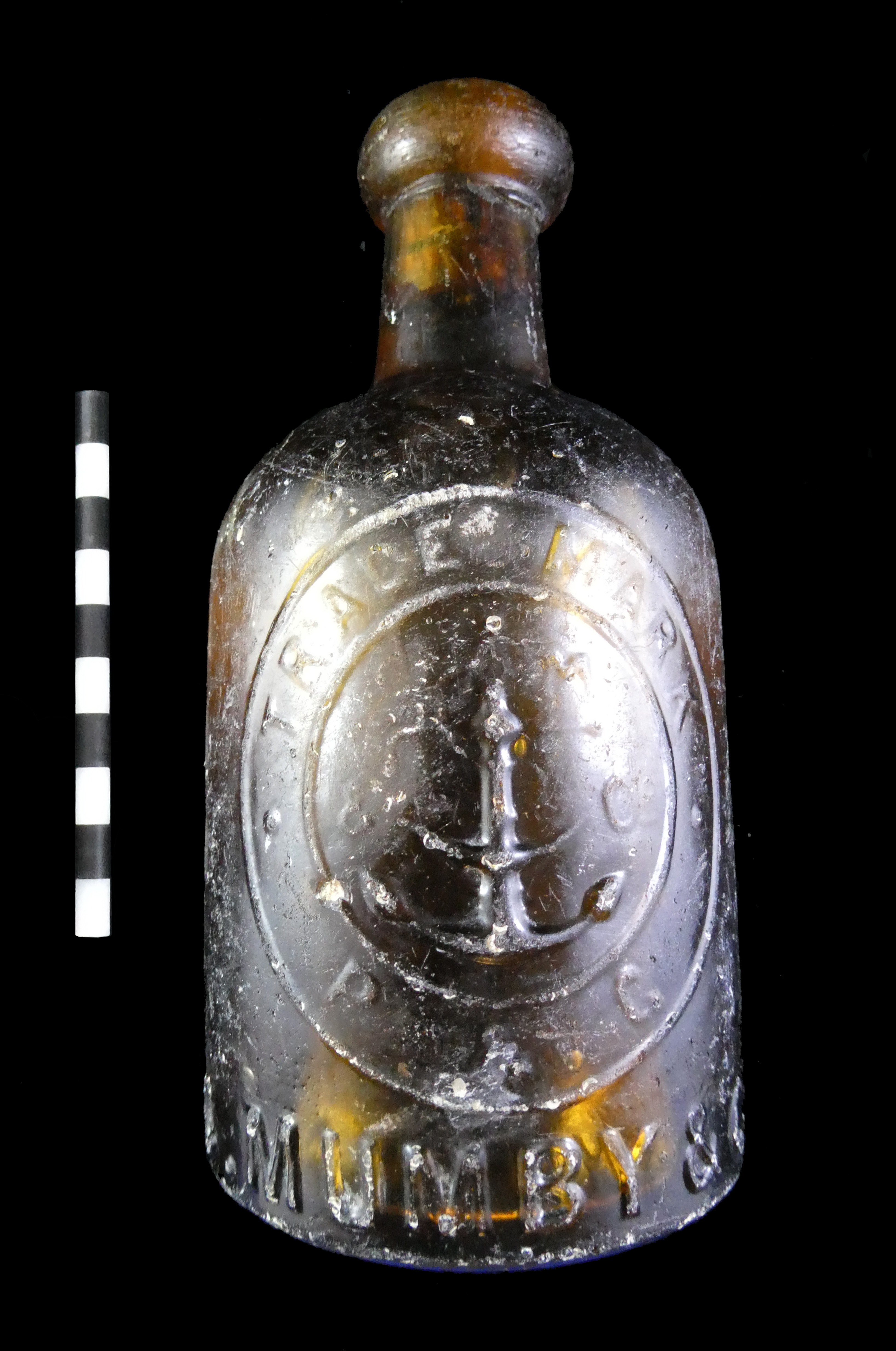
    Fig. 1 C. Mumby glass bottle from Esquimalt Harbour, DcRu-1278:125

     (photo by author)

    The first of these two bottles, is a short squat, amber coloured, cylindrical, bottle with a hand finished blob top.  It is 15.5 cm. in height and 7.7 cm in diameter.  Remarkably the cork is still in the neck and the bottle might still have the original contents.  The front is embossed C. MUMBY & Co with a double circle embossed TRADE MARK P & G and a fouled anchor in the center.  A bottle such as this would likely date between 1884 and 1910.  Hannon and Hannon (1976) state the term trade mark on Mumby’s bottles post dates 1884.


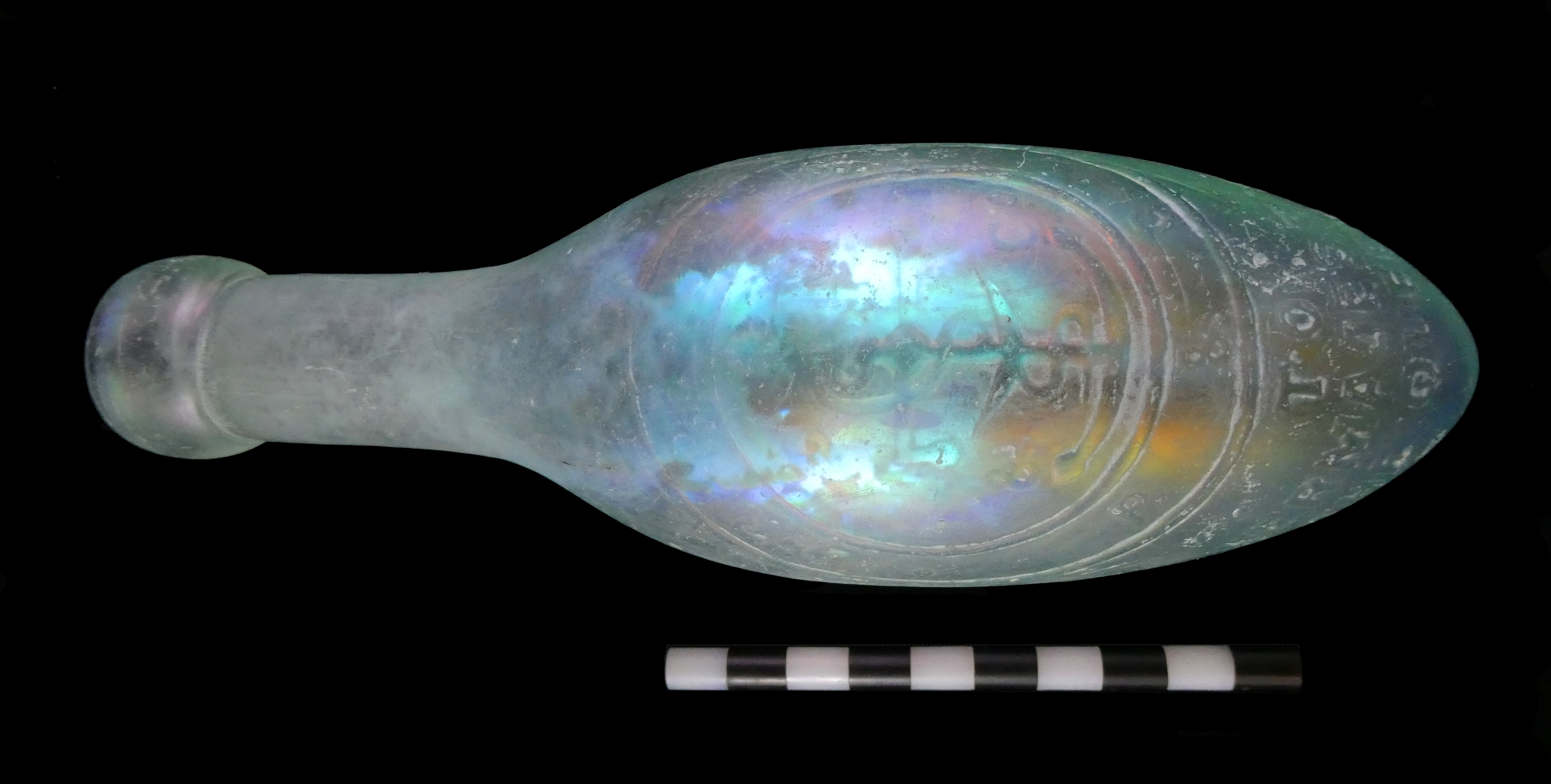
    Fig 2a C. Mumby “torpedo” bottle from Esquimalt Harbour DcRu-1278:36 (front). Photo by author

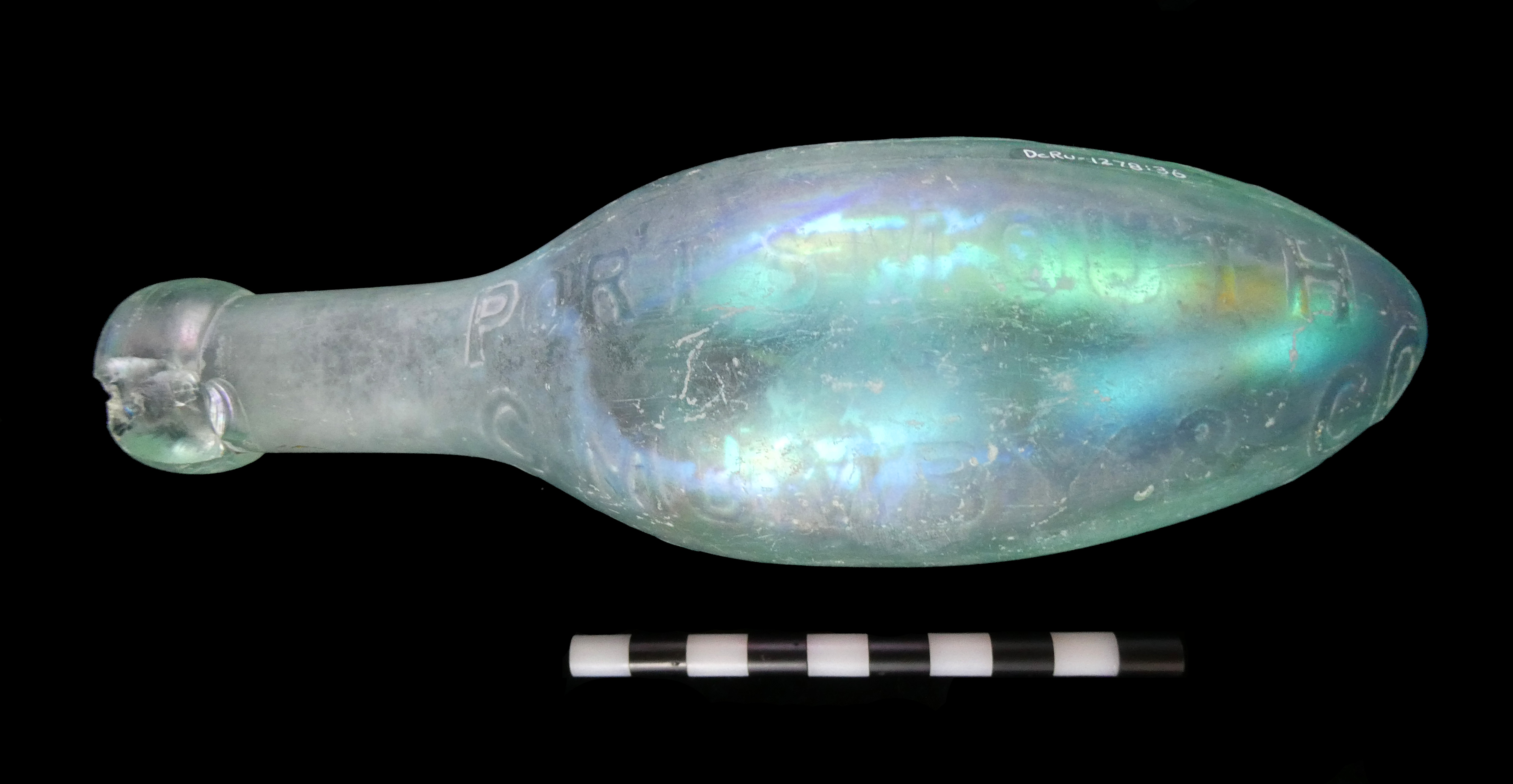
    Fig 2b C. Mumby bottle from Esquimalt Harbour (reverse side). Photo by author

    The second, is a “torpedo” shaped bottle also known as a Hamilt on style named after the inventor.  In aqua coloured glass, it has a hand finished blob top. It is 19.0 cm in length and 6.1 cm at its widest diameter.  On the front it has a double circle with TRADE MARK at the top and P&G at the bottom with the fouled anchor in the center the same as the one in figure 1.  Above the circle only the last two letters are legible as ER the phrase was likely SODA WATER MAKERS and below the circle TO HER MAGESTY THE QUEEN.  On one side it’s embossed C MUMBY & Co PORTSMOUTH AND GOSPORT on the opposite side.  This bottle likely dates between 1884 and passing of Queen Victoria in 1901.

    The torpedo style bottle was initially designed to withhold the pressure of the carbonation as well as keeping it from standing up right allowing the cork to dry and the carbonation to escape. They were used extensively in the mid 19th century and a few companies kept the design until the start of the 20th century.  In British Columbia, there are no known bottlers that ordered torpedo style bottles embossed with company names.

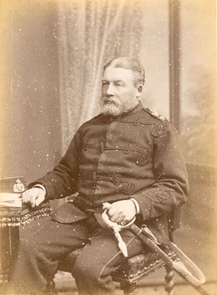
    Fig. 3 Colonel Charles Mumby. Photo with permission of David Moore, Historic Gosport

    Starting on the mid-19th century, both the Royal Navy and British Army were recognizing alcohol as a serious problem.   Lloyd and Coulter (1963:96) state: “Heavy drinking especially on shore, diminished towards the end of the century when tea and coffee were fast supplanting grog…”   Increased levels of technology required higher levels of training that had little tolerance for drunkenness.   In addition, the temperance moment was having an influence.  As a result, many of the Royal Navy Clubs and regimental canteens were supplying their own soft drink bottles with club names and regimental crests (Bown 2015).  A second advantage of these products was the carbonation which acted as a preservative keeping the contents for long sea voyages.

    It would appear Charles Mumby saw an opportunity and was close at hand to supply the Royal Navy with a good supply of non-alcoholic beverages.   Even his choice of logo with the fouled anchor was likely designed to appeal to the Navy.

    Like many prominent businessmen in the Victoria era, Mumby was an officer in the local militia.  This may have given him the necessary status and connections to supply the Royal Navy.  The following was provided by David Moore at Historic Gosport (2019):

    “Charles Mumby set up business in Gosport in 1849 as a chemist and manufacturer of mineral waters.  His shop was at 47/48 High Street.  His supply of water was a large bore hole in the yard at the back of the shop, which had rear access from North Street.  At 345 feet he hit natural water in the chalk subsoil.  He installed machinery to increase the production of natural ice.  He produced famous soda water, ginger beer and lemonade, selling across the south of England.  He supplied the Army and the Navy, receiving a Royal Warrant from Queen Victoria.  The manufacture of mineral waters continued at his original premises in the High Street, and an office was opened up at Portsmouth, first at 71 St George’s Square, then, from the late 1870s, at 34 The Hard.  Charles Mumby was a Poor Law Guardian, a magistrate, a County Councillor for Hampshire, and sat on innumerable public and social committees.  Charles retired in 1885 leaving the business to his son Everitt.” It was floated as a company in 1898.”

    WikiTree (2019) also states Mumby and Company was awarded a Royal Warrant to supply King Edward VII and the company continued to supply the Royal Navy until about 1970.


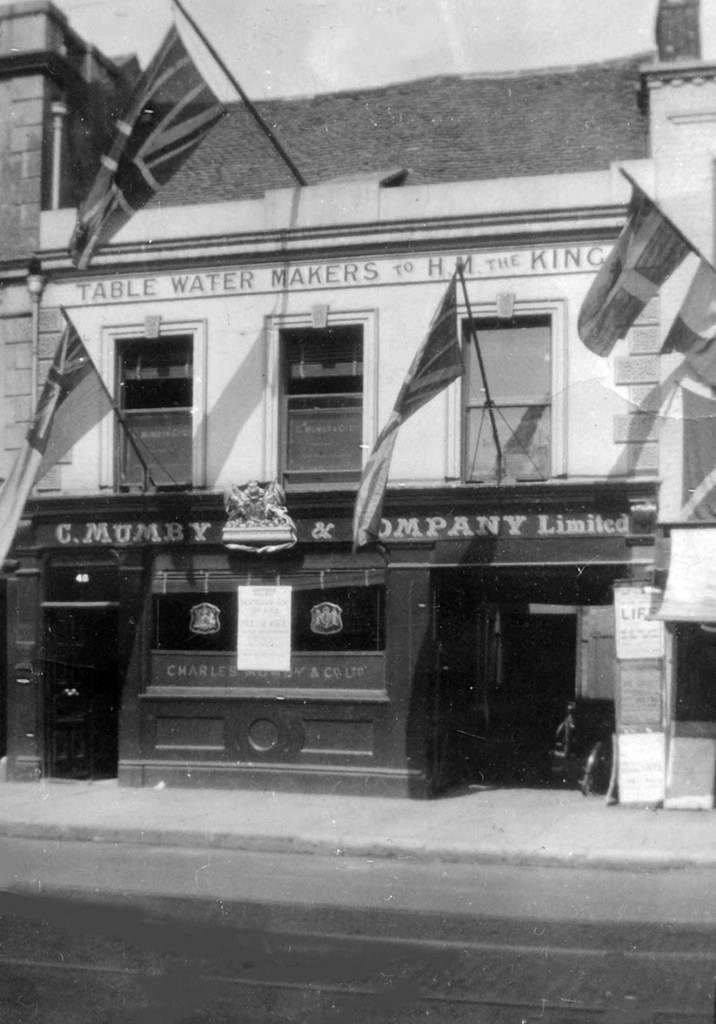
    Fig. 4  A Photo of Mumby’s Shop, Photo with permission of David Moore, Historic Gosport


    Located at 47/48 High Street sometime after the reign of Queen Victoria as the banner states TABLE WATER MAKERS TO HM THE KING. His business in Gosport was conveniently located within a kilometer of the Royal Navy base at Portsmouth across the harbour.


    References
    Bown, T. and C. Addams, 2015. Glass and Pottery of the Royal Navy and British Military: Historic and Archaeological Finds form the 18th, 19th and 20th Century. First Choice Books Victoria B.C.
    Esquimalt Harbour Remediation 2019.
    https://www.canada.ca/en/department-national-defence/news/2016/09/esquimalt-harbour-recapitalization-remediation-projects.html  Accessed July, 2019.
    Hannon T., and Hannon A., 1976.  Bottles Found in St Thomas, Virgin Island Waters. Journal of the Virgin Islands Archaeology Society, Volume. 3, 1976, pp. 29-46.
    Historic Gosport, 2019. David Moore Webmaster.
    https://historicgosport.uk/bottles/ Accessed July, 2019.
    Lloyd C., and Coulter J. L. S., 1963. Medicine and the Navy 1200-1900, Vol IV 1815-1900. E. & S. Livingstone Ltd. Edinburgh and London.
    WikiTree 2019.
    https://www.wikitree.com/wiki/Category:Charles_Mumby_and_Company. Accessed July, 2019.


    Historic Objects from the Esquimalt Remediation Dredging Project

    by Tom Bown, Volunteer Associate in Archaeology
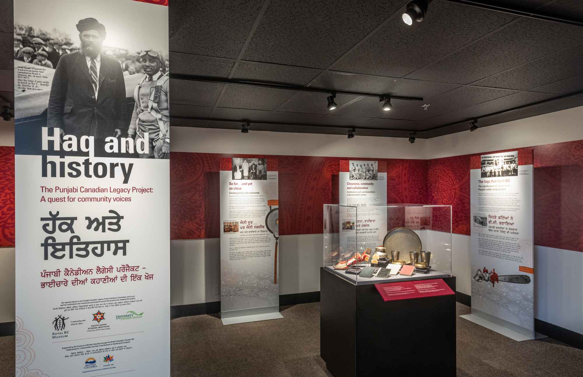
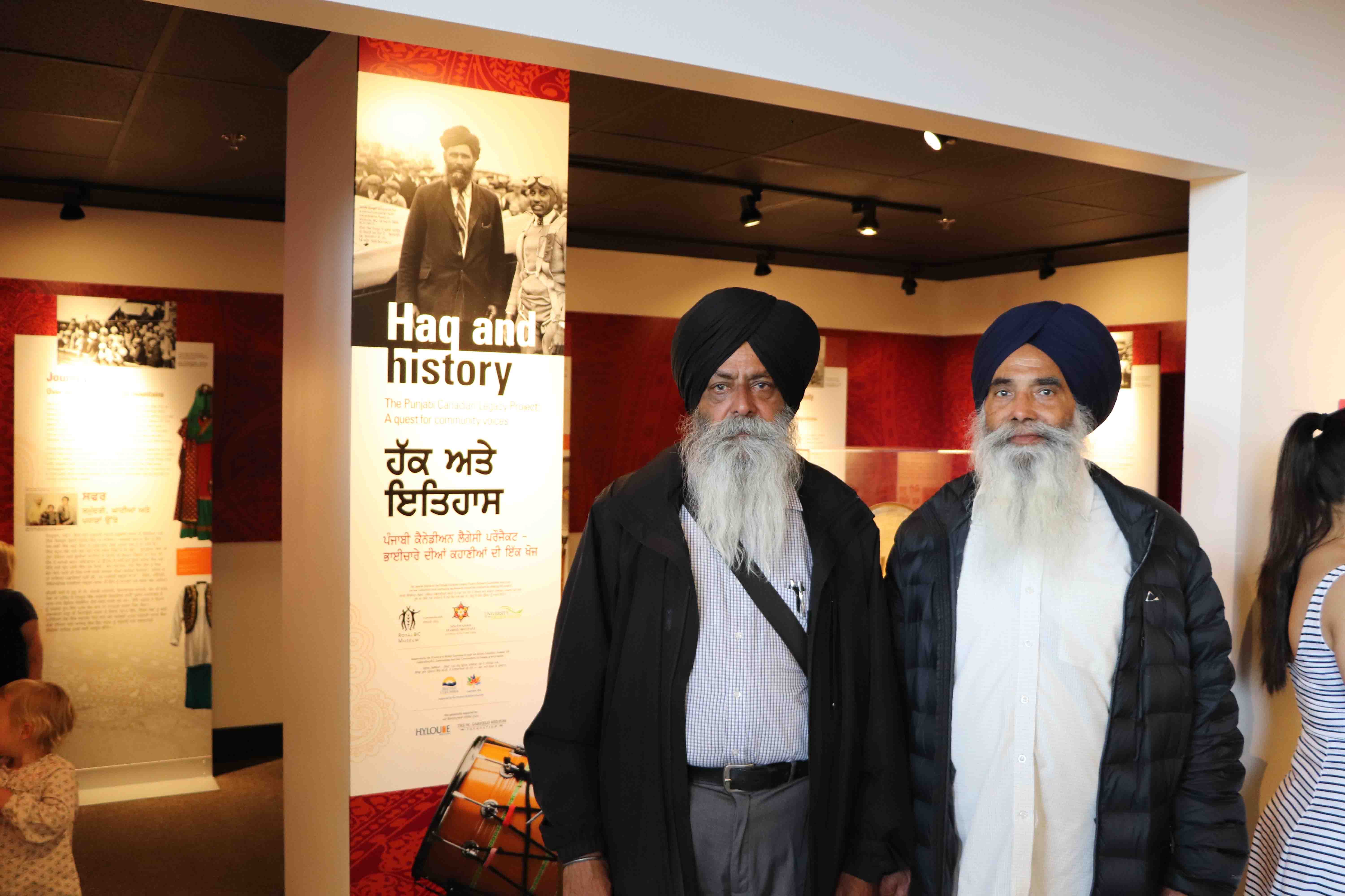
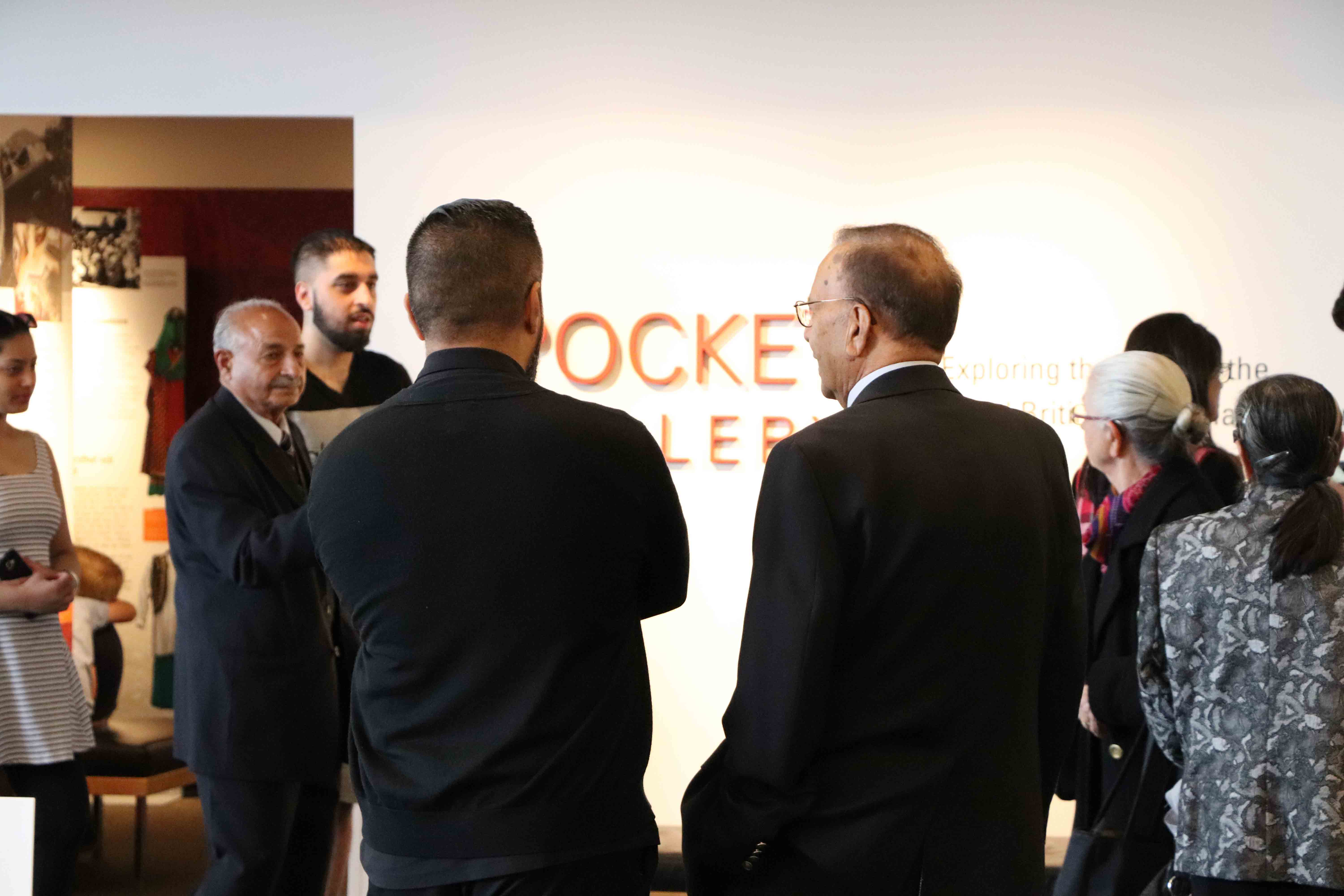
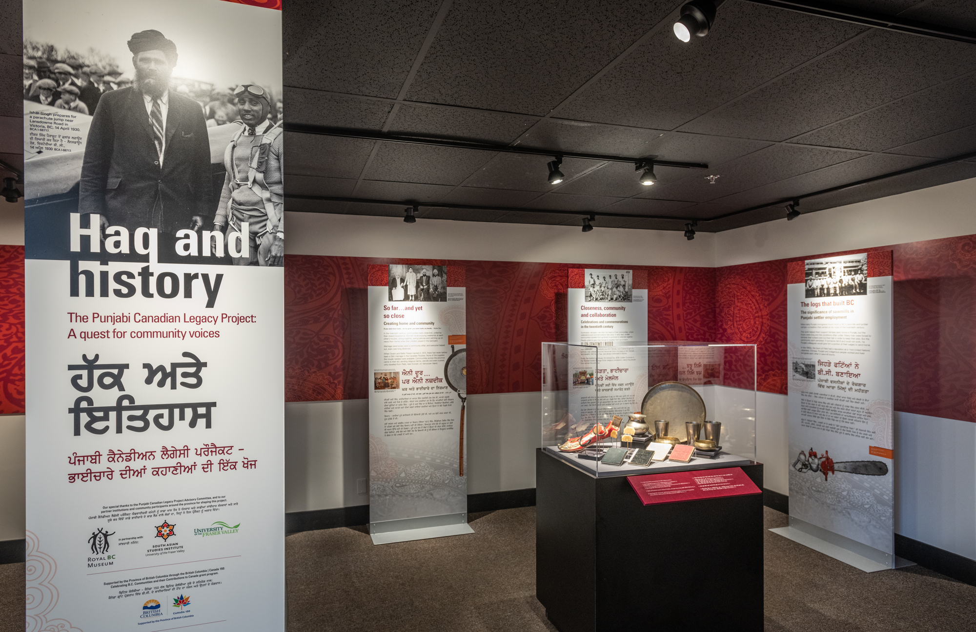
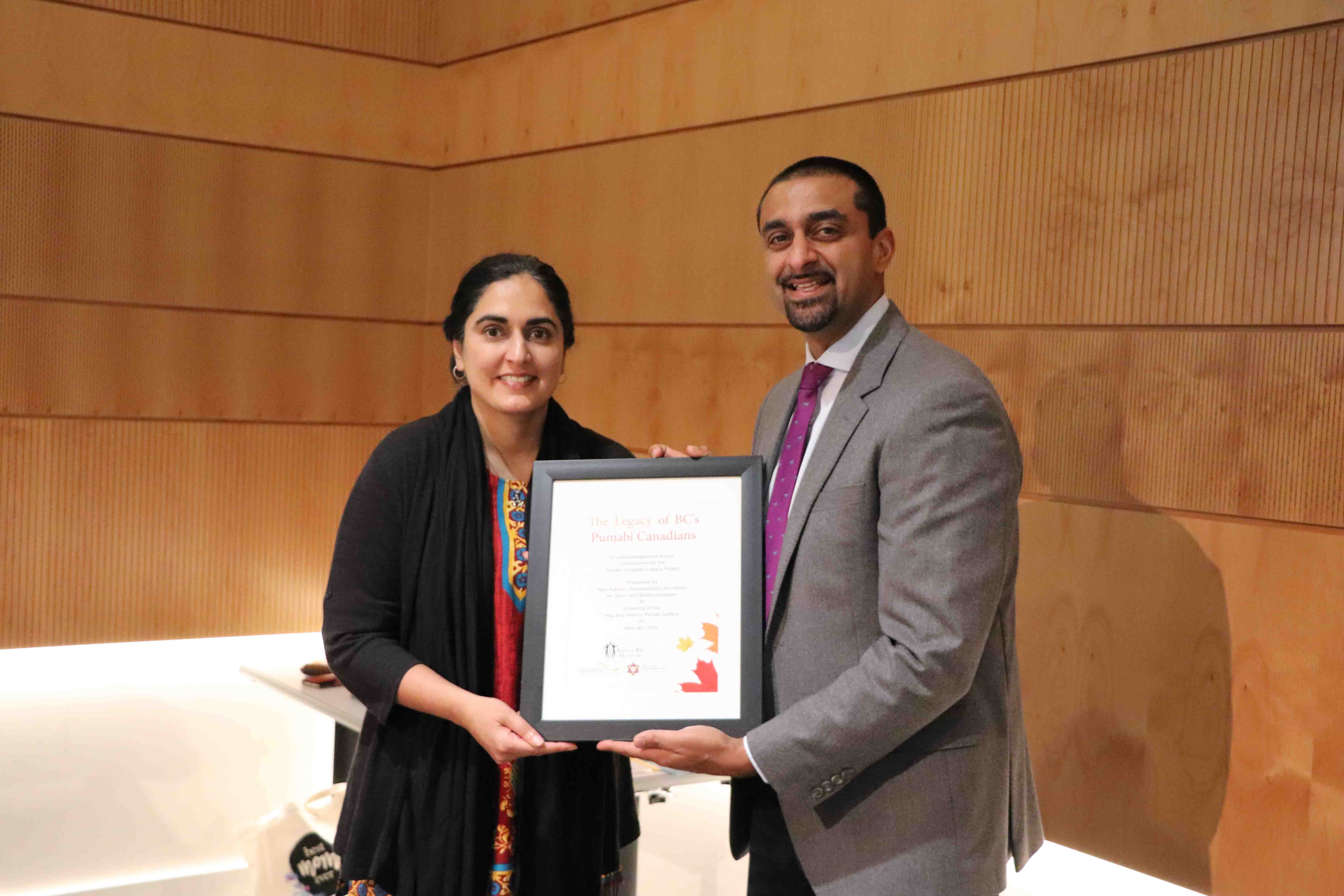
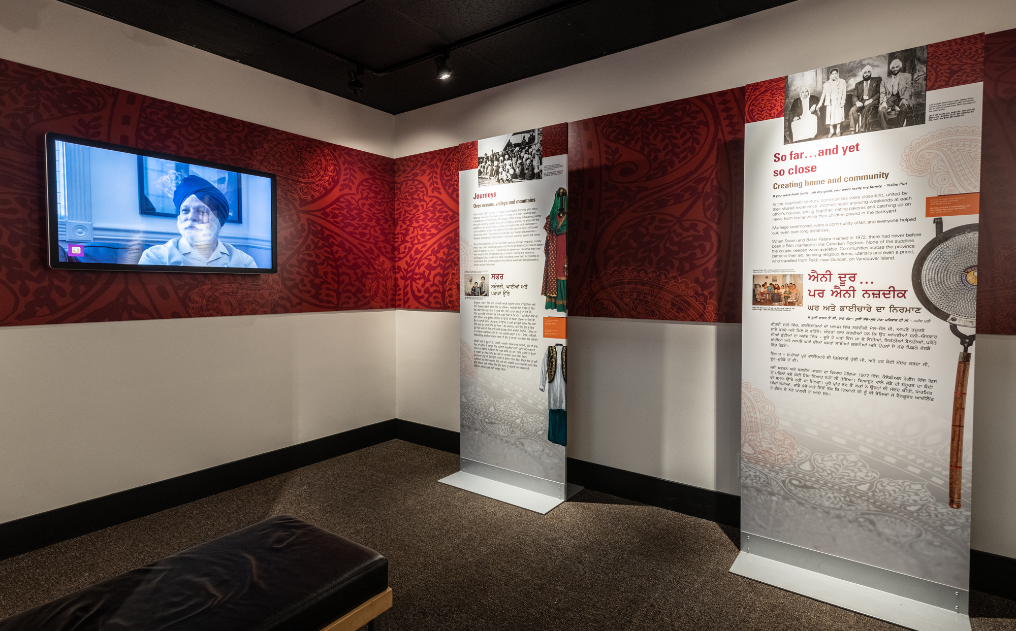
    Punjabi Canadian Legacy Project Community Event

    Museums across the world are going through paradigm shifts – a shift that calls for a transition of power and authority, and a transition from exclusions to more holistic models of inclusion. The Royal BC Museum has been working towards such shift through community history projects based on community engagement.

    In this type of community-based heritage work, the goal is to work closely with previously marginalized groups for exploring, preserving and sharing self-identified communities’ heritage defined in their terms. Our hope is to facilitate the sharing of the self-identified communities’ diverse stories and heritage in our galleries and beyond from community perspectives and in community voices.

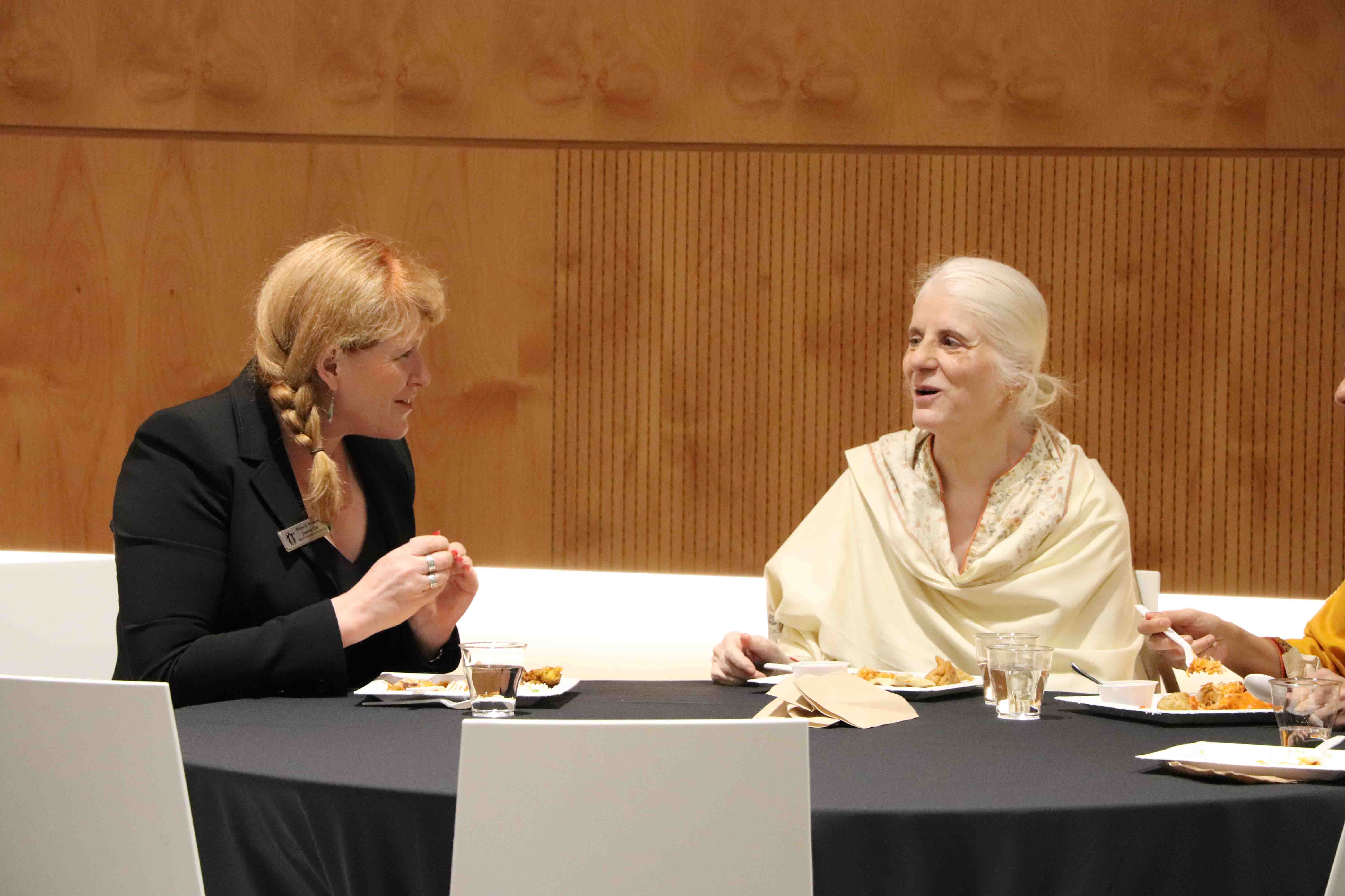
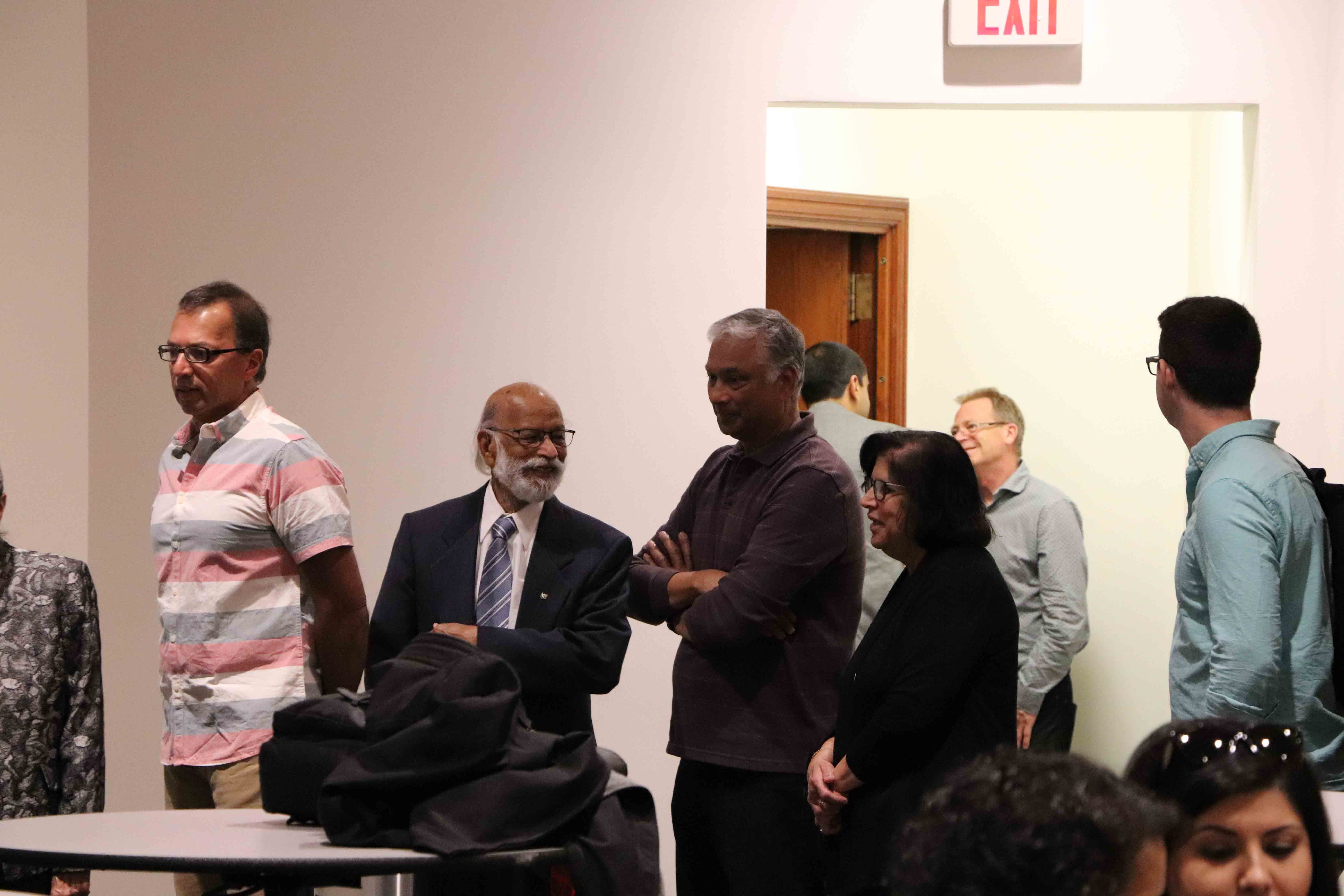
    The Punjabi Canadian Legacy Project (PCLP), a partnership project between the Royal BC Museum and the South Asian Studies Institute at the University of the Fraser Valley, is one of the museum’s attempts toward this goal. Six years ago in the summer of 2013, the initial discussion that eventually led to the creation of the PCLP took place in the Fraser Valley. Almost four years ago in 2015, the PCLP Advisory Committee met for the first time, where Mo Dhaliwal initiated a call for a revolution to break traditional institutional boundaries. It led to the community gallery intervention event. At this time, Punjabi Canadian communities took over the museum space and inserted their stories and presence.

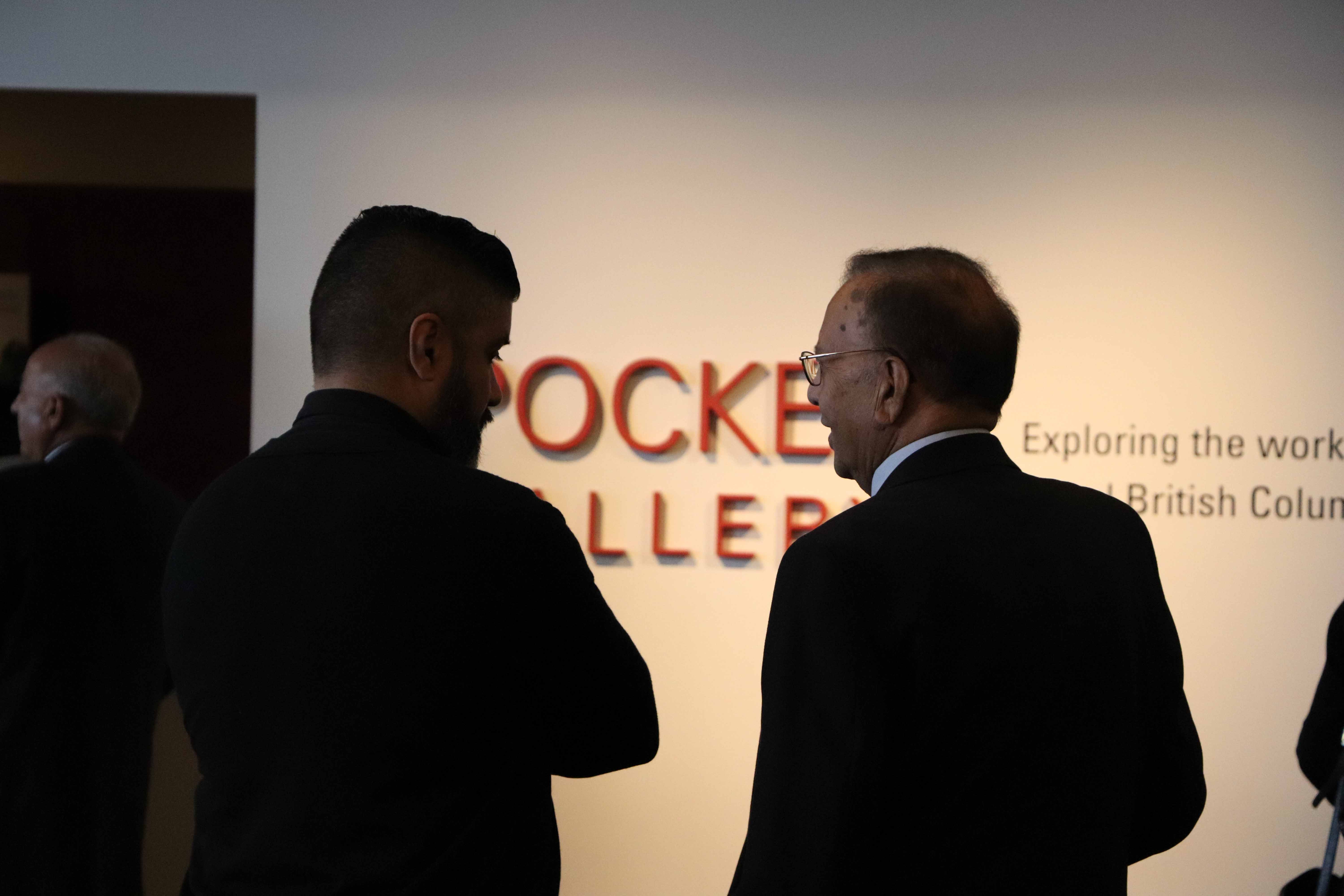
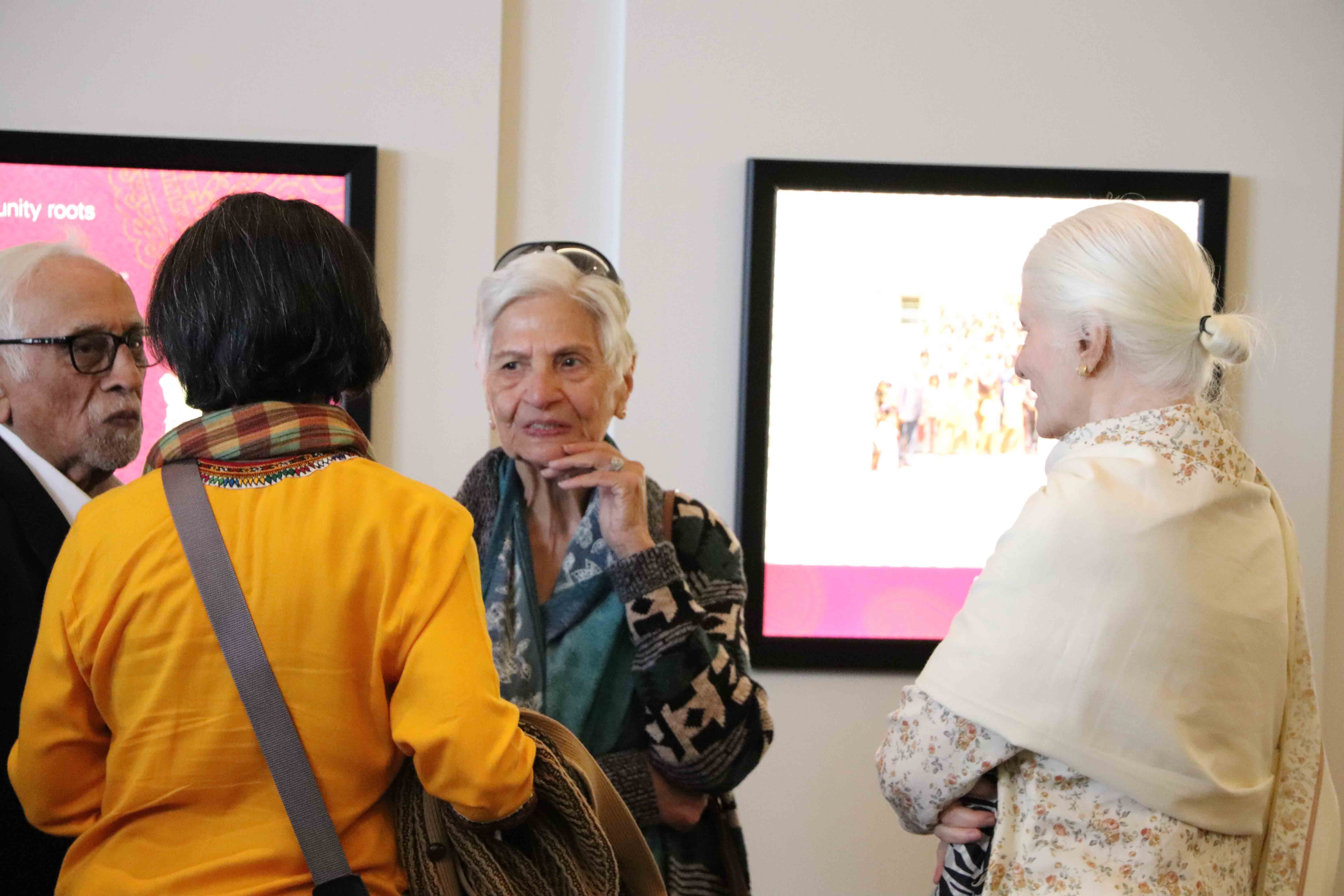
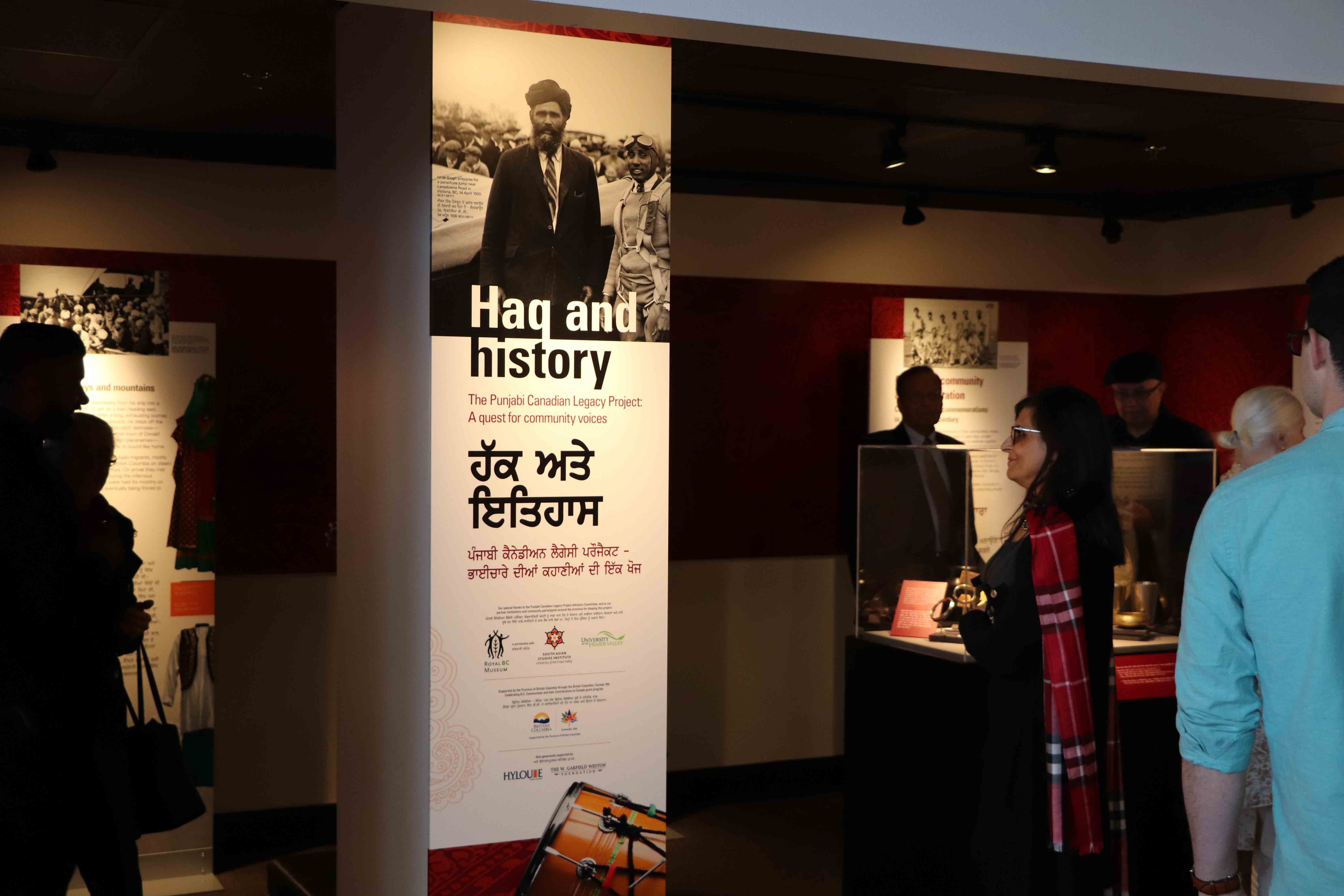
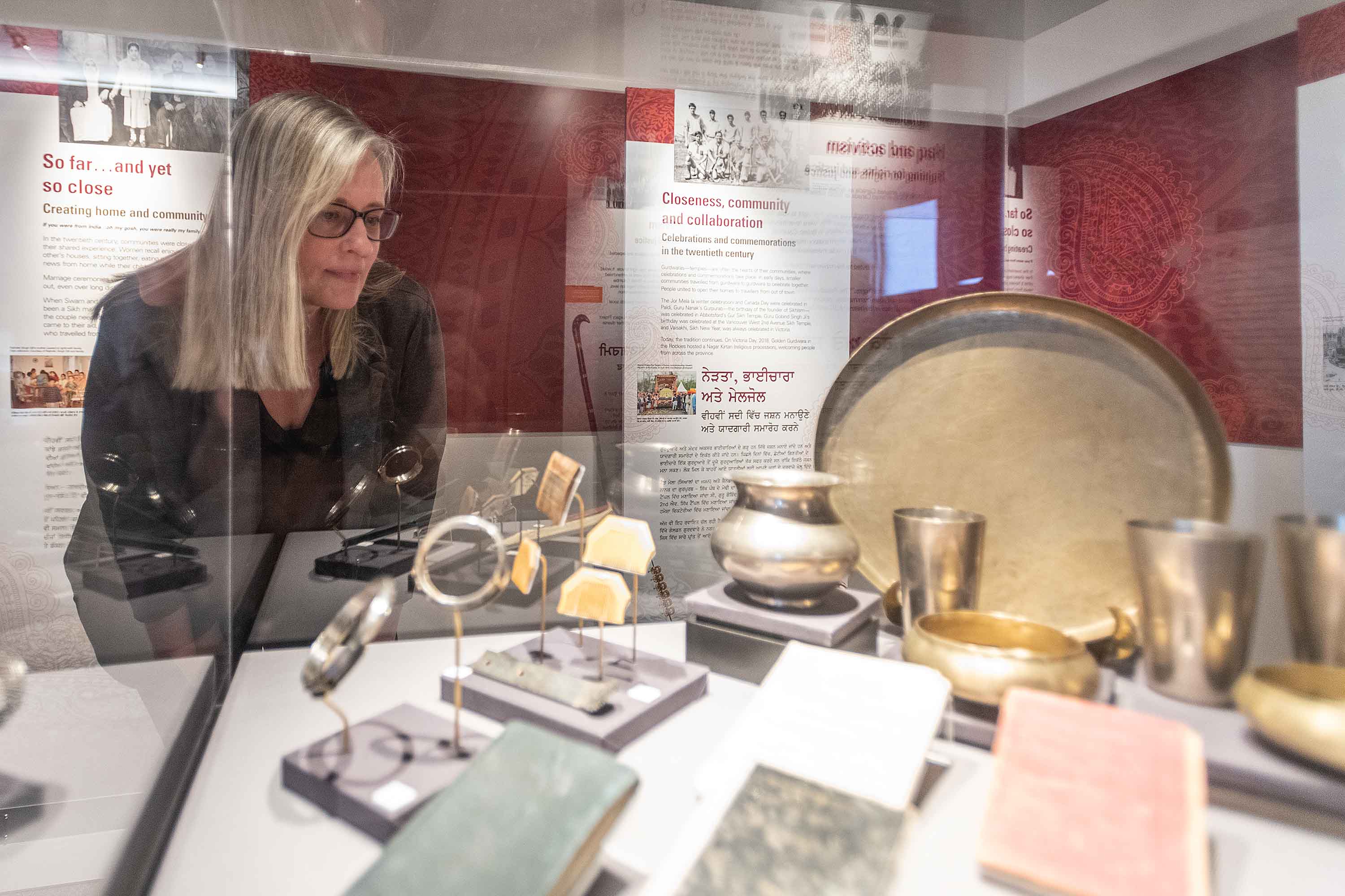
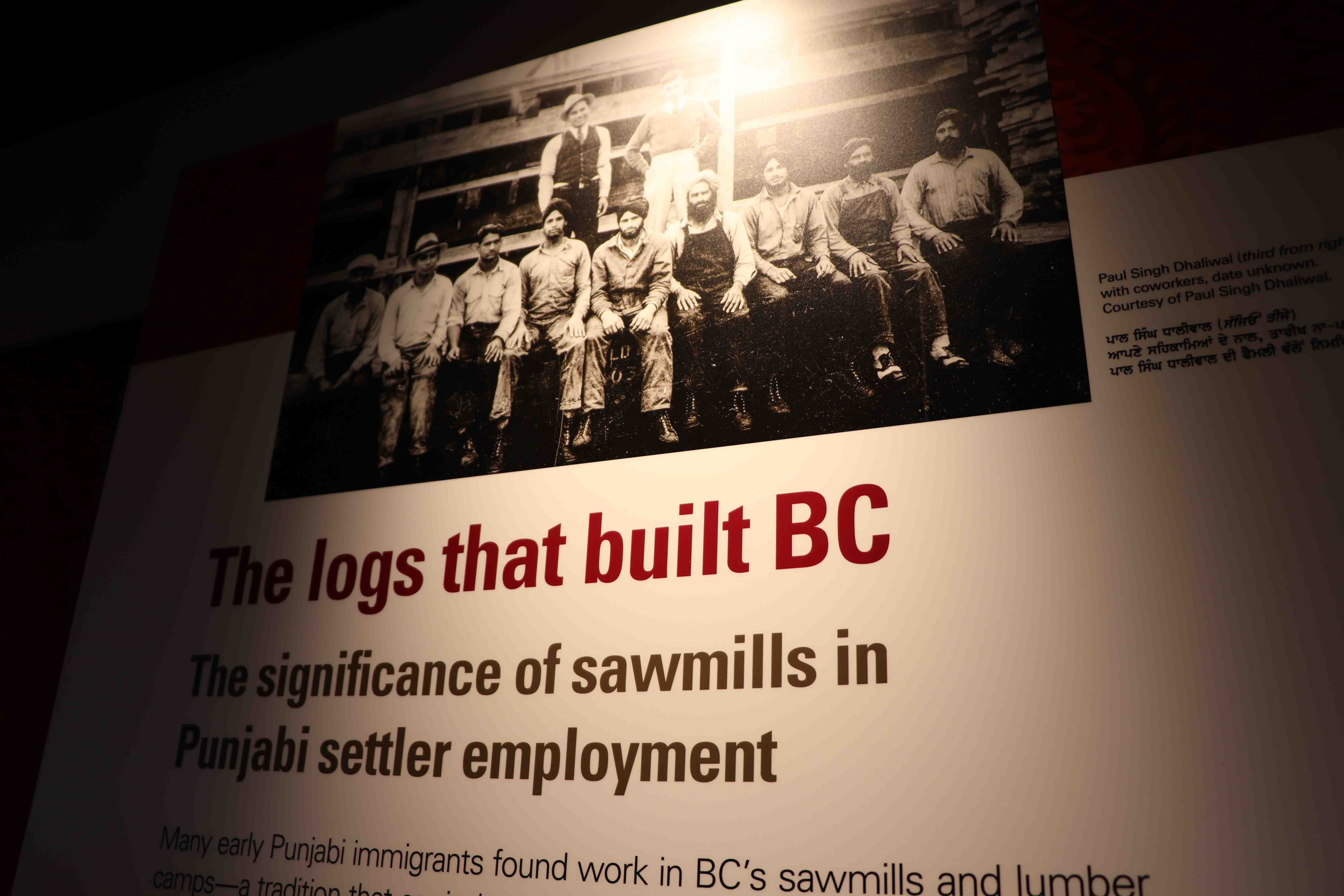
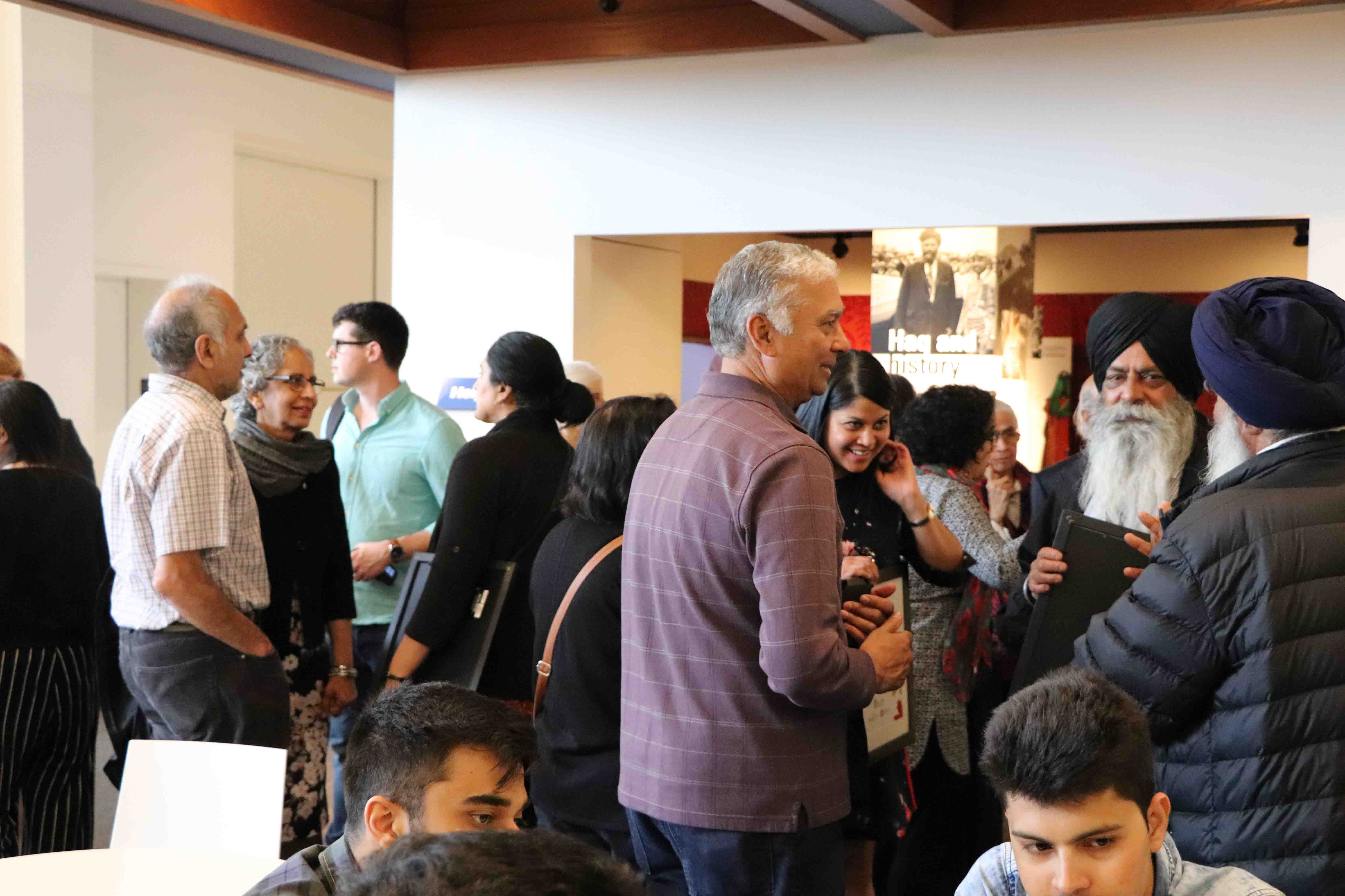
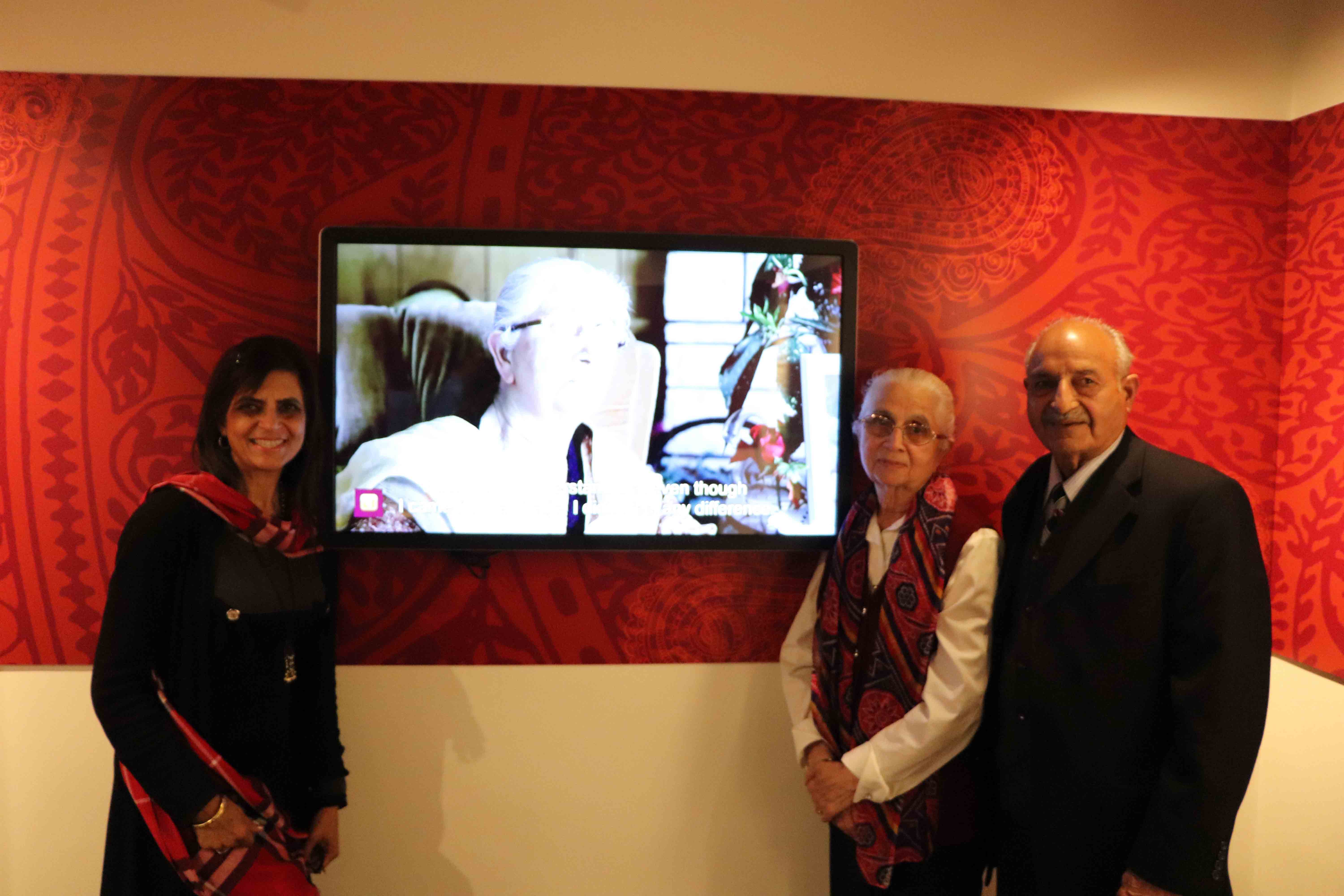
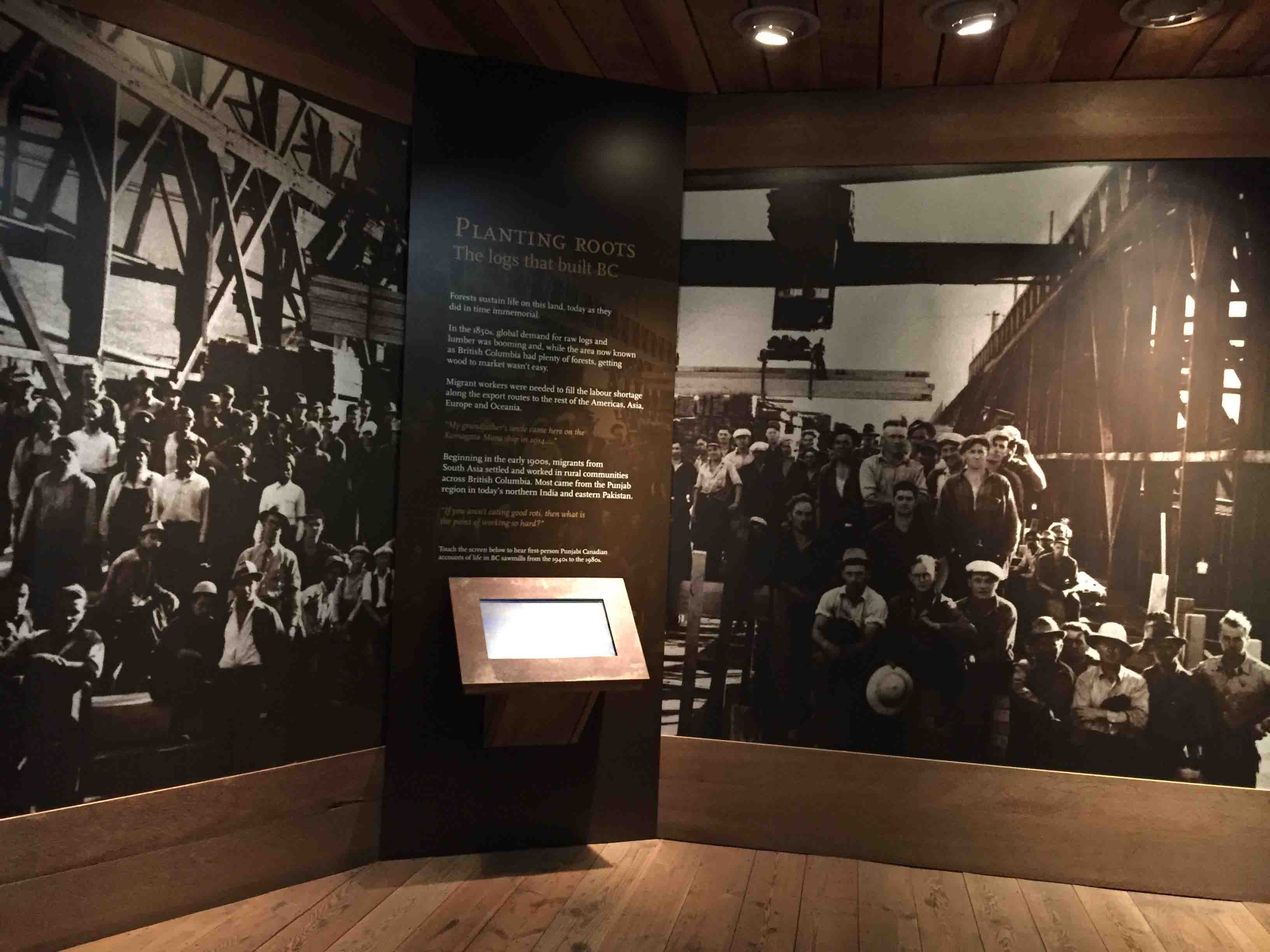
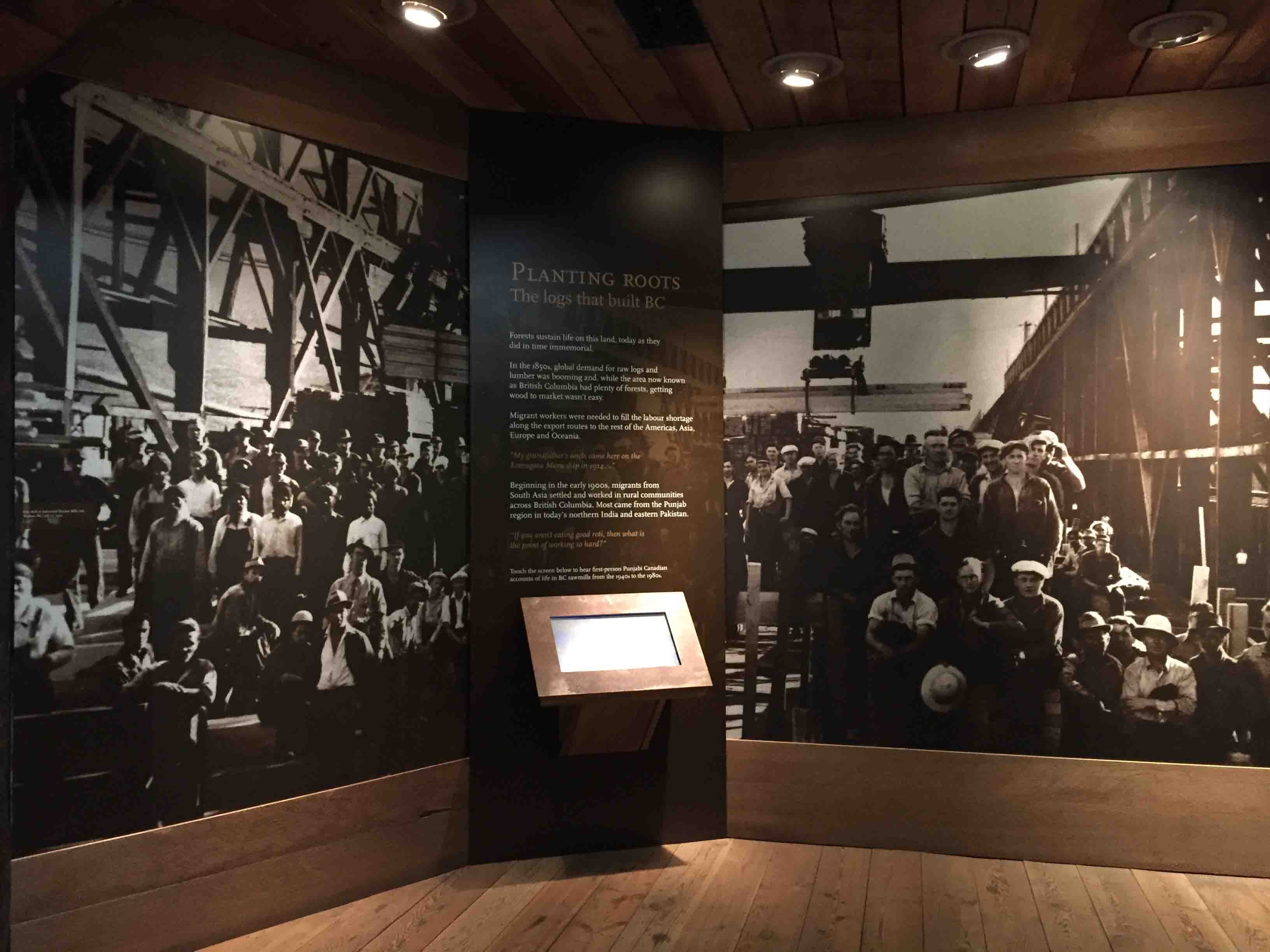
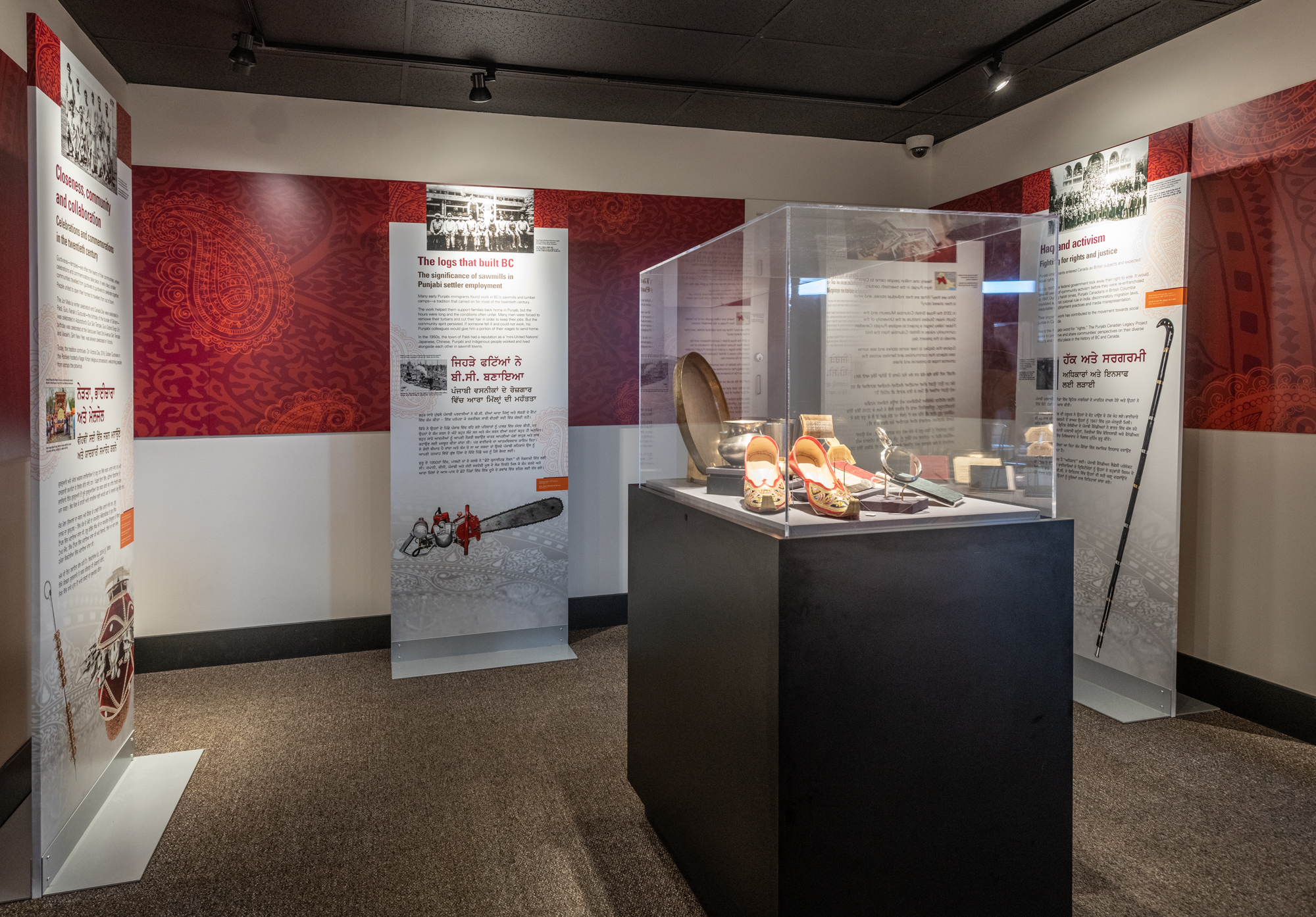
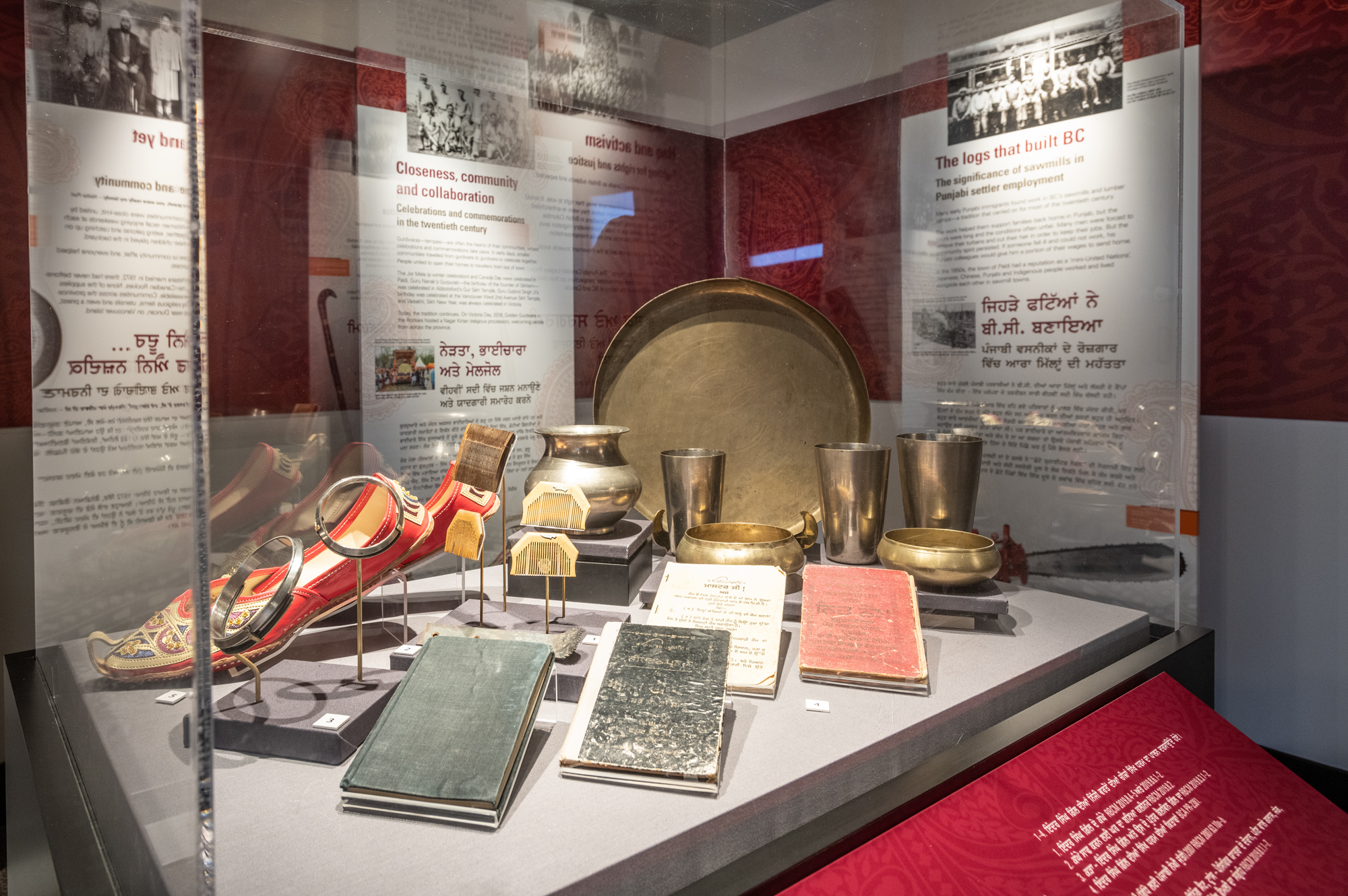
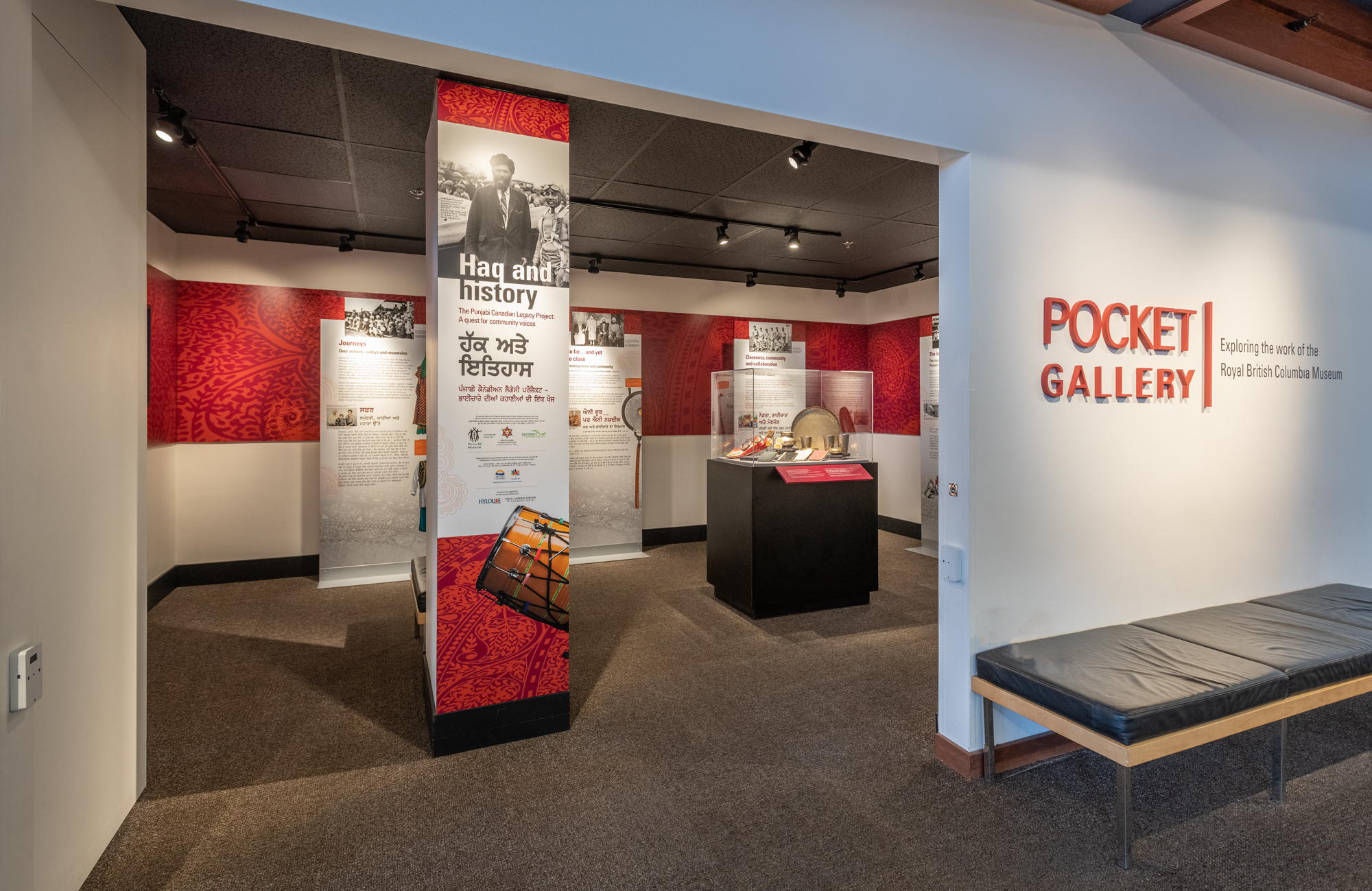
    Years later, community members gathered at the Royal BC Museum again on May 4, 2019, to view the cumulative result of the long-term work – the bilingual Pocket Gallery exhibit Haq & History: Punjabi Canadian Legacy Project a Quest for Community Voices, and the kiosk featuring community voices in the Logging area in the Modern History gallery. The kiosk was installed based on community feedback from the intervention event, sharing family, union and industry stories in the sawmill industry, an industry that have woven the Punjabi Canadian stories in BC together.

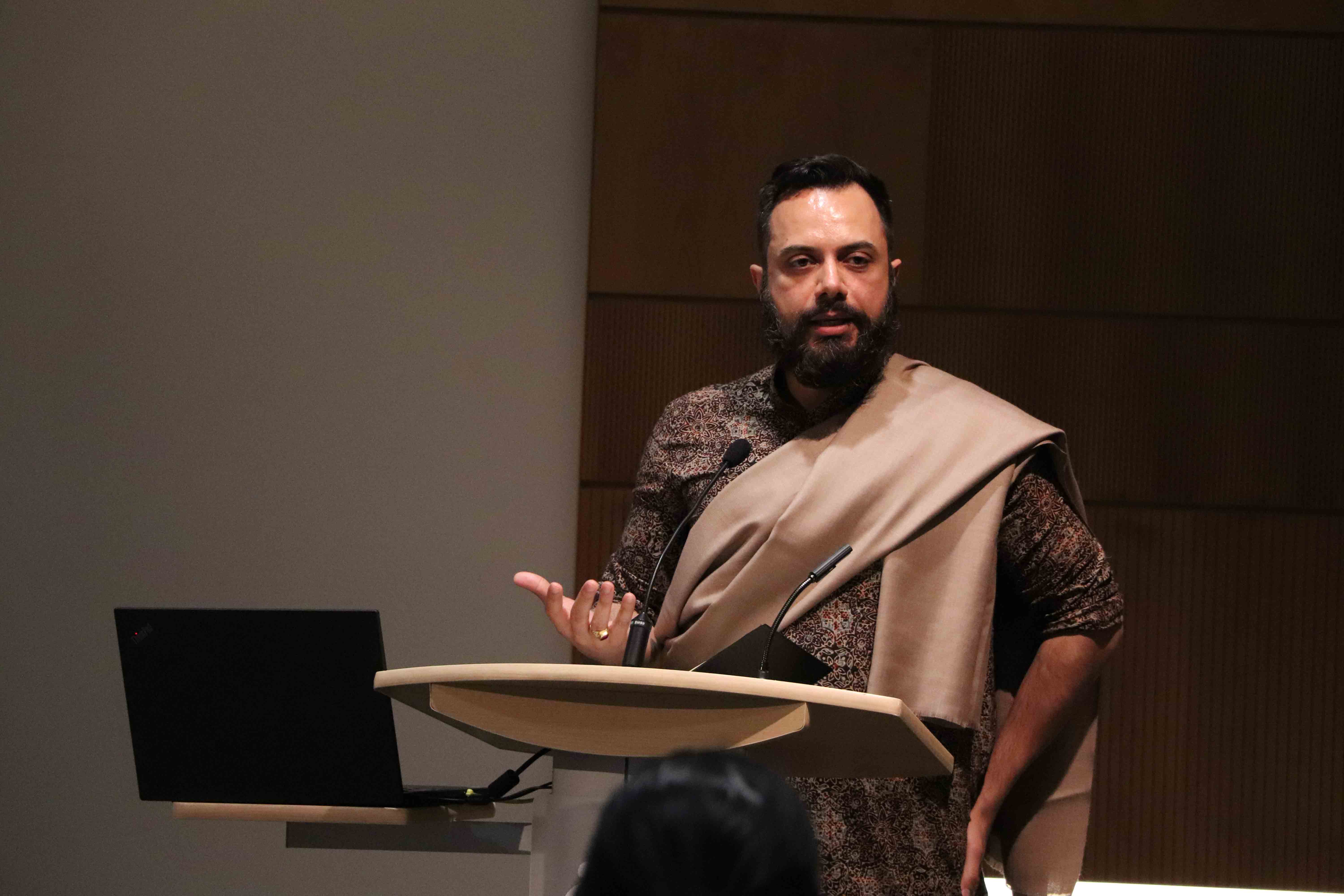
    Leading this community gathering in the museum, Mo Dhaliwal, on behalf of the PCLP Advisory Committee, started with the land acknowledgement, and thanked all ancestors, matriarchs, and all living things for getting us to where we were. Ravi Kahlon, then Parliamentary Secretary for Sport and Multiculturalism, acknowledged all the PCLP advisors and community participants. The most moving part of the event was when people saw their stories and images, interwoven into the community stories under the five themes. The five themes were identified by the communities around the province as the most significant to Punjabi Canadian history in BC – trans-Pacific journeys, families and homes, community celebrations and commemorations, sawmill experiences and community activism for rights and justice.

    This exhibit marked a historic moment for the underrepresented Punjabi Canadian stories in BC to be collectively preserved and shared. ‘Haq’ means rights, and the PCLP is about putting community voices and history in their rightful places. Next to the kiosk in the gallery, Mo ended the event by leading three calls of ‘Inquilab Zindabad!’ – ‘Long live the revolution!’ (in Punjabi) – calling for continuous work to move beyond traditional boundaries and create new paradigms for heritage work.

    The Haq & History exhibit, pending funding, will later travel to the communities who helped shape this work.
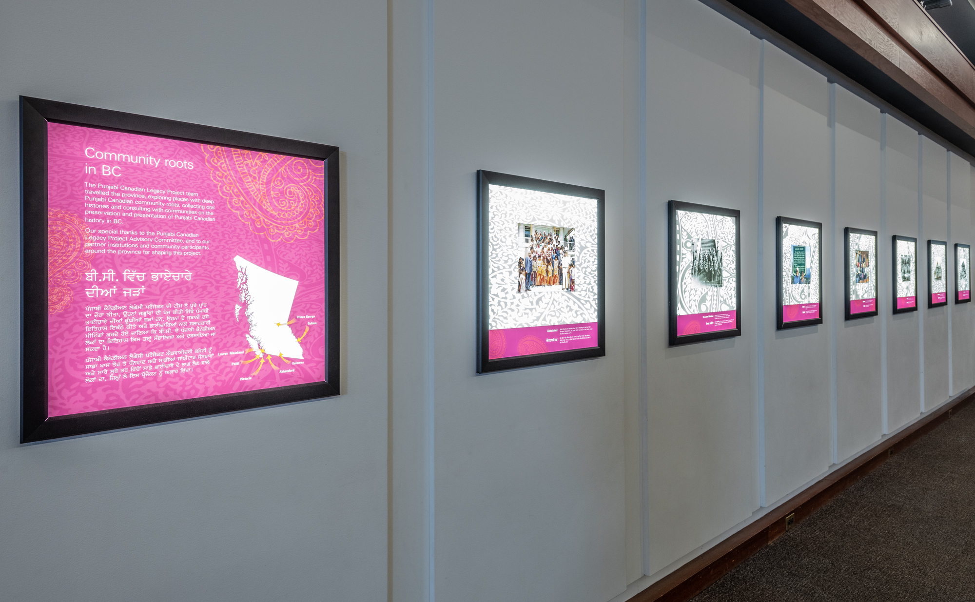
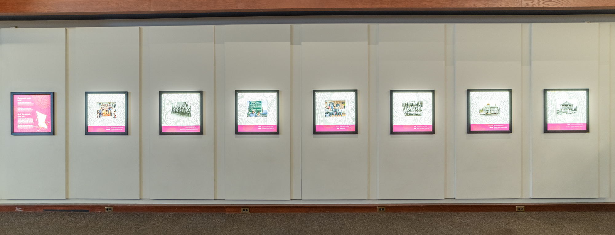
    Event Images:

    The kiosk in the Logging area in the museum permanent gallery.

    The Haq & History Pocket Gallery display

    The Haida were among the many Indigenous northern visitors to Victoria after 1853. Many came to work to get trade goods or wages to purchase European commodities. The Haida visitors brought carvings they made on Haida Gwaii. Many of these were made of argillite, a stone unique to Haida Gwaii (see appendix 1, What is Argillite). Argillite was used primarily after 1810, there are only a few examples of argillite being used for labrets in ancient times (Keddie 1981).

    Argillite plates, platters, mugs, goblets, knives and forks became popular as the Haida copied the European-style tableware used by the settlers. The citizens of Fort Victoria enthusiastically purchased these.

    On July 21, 1859 the Victoria Gazette reports that the Haida “brought with them a large number of curiosities in the shape of carvings on wood and slate {argillite], and ingenious plaited works in straw, etc. A carving on wood of a steamship, displays great ingenuity, …It is supposed to be designed from a Russian steamer, which occasionally visits the island to trade, and of which the Indians have before brought reports. The carving is about nine inches long and four thick, and is out of a piece of solid oak, with pieces of bone for the masts, bowsprit, guards and fancy work on the sides. On the bow is carved in the wood the double-headed Russian eagle, with Crowns of bone; the carving is very good.”

    The paper goes on to describe the moving parts on this artifact which “is intended as an ornament pipe, the smoke stack being the bowl”. The paper describes an argillite plate with an image of the San Francisco Herald carved on the inside.


    Figure 1 and 1a. Argillite carving of what is probably Dr. John Sebastian Helmcken.

    Figure 2 and 2a. Two photographs show Helmcken about 1859 and in later years.

    Although the Haida brought carvings with them to Victoria, they also made them while staying in Victoria and left behind the waste material from their manufacture. Some Haida argillite carvers were known to take consignments to carve figures to resemble known people, such as that in figure 1. There is no document saying who this figure represents.

    I would suggest that this figure is intended to be a characterization of Dr. John Sebastion Helmcken. Helmcken had a distinct flop of hair on one side of the top of his head and always wore a ribbon-like bow tie and a buttoned vest under a formal jacket – like that of the carving. The early photographs of Helmcken resemble the carved figure. In his later years his flop of hair was on his right side, but in early photographs it was, like that on the argillite figure, on the left side. Figure 2 shows the young Helmcken about 1859 and figure 2a shows him in later years.

    The Haida often stayed in the Victoria region for long periods of time, acquiring goods and money by working on the local farms clearing land and assisting in building roads (Keddie 2003). A number of Haida worked on the Craigflower farm after 1853. This may be the source of the broken pieces of argillite found in the refuse from the farm. The Haida visitors to Victoria initially camped in the Rock Bay area but were assigned a temporary place on the south end of the Old Songhees reserve for which they were to pay rent for its use. The waste material from argillite carving has been found at the latter location.

    Figure 3. At top is the broken argillite pipe from Haida Gwaai (after Fladmark 1973). Figure 3a shows a similar style broken pipe (RBCM14810).

    The Archaeological Finds

    When excavating an early 19th Century Haida House at the Richardson Ranch site on Haida Gwaii, Knut Fladmark uncovered an early style broken argillite pipe (fig.3). This is similar to an example in the Royal B.C. Museum collection, RBCM14810 (fig. 3a). No provenience was recorded for this figure, but it matches the description of a pipe in the old Tolmie collection that is recorded as being found on the Old Songhees reserve.

    The Haida did not take up smoking tobacco in pipes until it was introduced by Europeans. They did grow tobacco but mixed it with burnt abalone shell and sucked on a ball of it placed under their lip (Keddie 2016).

    Other archaeological work in the 1970s resulted in the detailed examination of argillite fragments from the historic Village of Kiusta on Haida Gwaai (Gessler and Gessler 1976). These are similar to some of the plate fragments found in Victoria and to the complete plates found in the Royal B.C. Museum Indigenous collections.

    Argillite Finds in Victoria Region

    Fragments of worked argillite and unfinished artifacts, broken during manufacture, were found on the southern end of the Old Songhees Reserve (Archaeological site DcRu-25) on the west side of the inner most portion of Victoria harbour.

    During the massive alterations to the landscape in this area in the 1980s, Museum associate Tom Bown and the author found several pieces of argillite in the old area of the Haida camp and Tom Bown reported that another person (private collection) had found a cluster of argillite manufacturing waste on the south slope of the Hill behind the latter area.

    Recent excavations by I. R. Wilson and Golder consultants recovered argillite pieces in the same general area west of Songhees Point. All of this material was recovered from deposits highly disturbed by previous industrial developments and all were mixed with European manufactured goods.

    Figure 4. Both sides of an unfinished and broken human figure similar to those on large argillite pipes

    Figure 4a. Waste argillite material from the Old Songhees reserve archaeological site DcRu-25.

    Figure 4, shows two views of an unfinished broken human figure resembling finished ones seen on large decorated pipes in the Royal B.C. Museum collection. Figure 4a, shows in addition, a corner of an argillite picture frame (DcRu-25:1546) and tiny (DcRu-25:1591) and large (DcRu-25:1539) sawn discarded pieces. Figure 5, shows three views of a discarded sawn piece of argillite (DcRu-25:5763) and Figure 6, shows three more discarded pieces from the Old Songhees reserve.

    Figure 5. Three views of a discarded piece of sawn argillite.

    Figure 6. Two views of discarded argillite pieces (DcRu-25:445 & 251) and another piece (DcRu-245:5733).

    Round plates decorated with floral, circular and sunburst designs, often on both sides, were the most popular. Figure 7, shows a piece of argillite plate from the surface of site DcRu-123, which has a historic surface area component that is part of the historic Old Songhees Reserve site DcRu-25. The pattern on the fragment (DcRu-123:57) matches the design on the bottom of the same plate (fig. 7a)whose top designs match the pieces from the Craigflower Farm site.

    Five pieces of a plate were found by Tom Bown in a systematic beach survey of old washed out garbage deposits at Craigflower farm (figure 8). The figure shows five pieces (two fit together) of the same argillite plate.

    Figure 7 and 7a. Piece of argillite plate, RBCM DcRu-123:57, from the Old Songhees Reserve area that matches the bottom design of plate RBCM15709 in the Royal B.C. Museum collection. The top of the same plate matches pieces from the old Craigflower Farm.

    Figure 8.  Pieces of the same argillite plate from the old Craigflower Farm in View Royal.

    Figure 8a. Close-up of design patterns on argillite plate in the RBCM collection that has similar patterns as the pieces found at the Craigflower farm (RBCM15709).


    Appendix 1. What is Argillite?

    Argillite is variable in content. The particular dense black carbonaceous material used by the Haida from their Tllgaduu Creek reserve site is different than other argillites found on the Islands. The Tllgaduu argillite is basically composed of silt-sized fragments of kaolite (a fine clay) present in a fine carbonaceous clay matrix. Because of folding and heating of these deposites caused by an ancient nearby volcanic eruption, these argillite deposits have unique properties that enable it to be easily carved. It ranges from, gray to black and has a hardness of 2.5. Argillite contains some moisture when quarried and needs to be dried out to prevent cracking – but the moisture content does not have any effect on the hardness of the material.


    References

    Macnair, Peter L. and Alan L. Hoover. 2002. The Magic Leaves. A History of Haida Argillite Carving. Photgraphs by Andrew Nieman and Burt Storey. Royal British Columbia Museum, Victoria, B.C.

    Barbeau, M.C. 1953. Haida Myths Illustrated in Argillite Carvings. Bulletin 127, Anmthropology Series 32. Ottawa. National museum of Canada.

    Barbeau, M.C. 1957. Haida Carvings in Argillite. Bulletin 139, Anthropology Series 38. Ottawa National Museum of Canada.

    Fladmark, Knut R. 1973. The Richardson Ranch Site: A 19th Century Haida House. In: Historical Archaeology in Northwest North America, edited by R.M. Getty and K.R. Fladmark. University of Calgary Publication,Calgary.

    Gessler Nicholas and Trisha Gessler. 1976. A Comparative analysis of argillite from Kiusta. Syesis 9:13-18.

    Keddie, Grant R. 2016. Aboriginal Use and Context of Pipes, Tobacco, and Smoking in Northwestern North America. In: Elizabeth A. Bollwerk and Shannon Tushingham (Editors). Perspectives on the Archaeology of Pipes, Tobacco and other Smoke Plants in the Ancient Americas. 157-181. Interdisciplinary Contributions to Archaeology. Springer International Publications Switzerland.

    Keddie, Grant R. 1981, The use and distribution of labrets on the North Pacific Rim. Syesis 14:59-80.

    After the building of Fort Victoria some of the Lekwungen peoples from outside winter villages moved into the inner harbor. In 1844, they became established at a new location on the west side of Victoria’s inner harbor. This village became what is now known as the Old Songhees Reserve (Keddie 2003).

    By the mid-1840s a surface burial ground was established by the Lekwungen on the northern tip of Laurel Point across from the new village.

    The burial ground was composed of several burial sheds covered with tuli reed mats and associated with prominent carved wooden burial figures that represented the dead who were buried there. The first Image of this location (fig. 1) was drawn by William McMurtrie a draughtsman in the hydrographic party surveying the American coast. He made a brief visit Victoria in July of 1850 (Monroe 1960).

    Figure 1. Drawing of Laurel Point burials by William McMurtrie, July 1850. Museum of Fine Arts Boston. C18868, Acc #59.153.

    In the 19th century, Laurel Point, earlier called Deadman’s Point, was a long thin rocky peninsula (Fig. 2). The burial ground was a feature seen by everyone coming into the narrow portion of the inner harbour. Drawings of the location with human figures in front of the wooden shed-like structures, and one figure wearing a European style top-hat, were the subject of several other artists and at least one photographer over the next nine years until they disappeared.  Only a lithograph of the photograph has been located to date. Drawings and water colours were done on two occasions by marine surveyor James Alden during visits of the American steam frigate Active.  A day after the ship arrival on September 16, 1854, Alden drew a close-up version of the wooden figures (Fig. 3). Alden did other drawings in the area and returned in 1857 to do another water colour of Laurel Point and burial sites at the Coffin and Deadman (Halkett) Islands. He drew his ship USS Active in Esquimalt Harbour on June 29, 1857.

    James Anderson (the son of Alexander C. Anderson of the Hudson’s Bay Company) saw the burial sites in 1850, and commented: “the wooden effigies marking the place where some notable was laid to rest in his canoe or wooden sepulchre surrounded by many of the personal belongings.”

    Figure 2. Long thin Laurel Point about 1868. Burials were once on the end of the point. RBCM Archives A-02660.

    Figure 3. “Indian graves Laurel Pt Victoria Harbor” James Alden September 17, 1854. Washington State Historical Society (1932.93.7(1)-2).


    The Gazette Story

    A drawing of the burial ground by Charles Chistian Nahl was being made into a lithograph engraving in 1858, but did not get published in the Gazette until October 16, 1859. The location was described on October 15, 1858, in the Victoria Gazette:

    “The Burying Ground of the Songhish Chieftains, at Dead Man’s Point. The burying ground …of the chiefs of the Songhish tribe is located on Deadman’s Point, nearly west of Victoria …Subsequent to the migrations of whites hither in 1848-9, this burying ground has not been used … Since that period none of the deceased have been considered worthy of interment there. The four figures placed on the spot are rude carvings of wood, as large as life, each one representing the chief against whose grave it is placed. They are arranged in line, and are about two feet apart, facing the entrance of the harbour, and formerly struck the eye of the stranger …as a body of military sentinels on duty, guarding the inner harbour.

    At one time they were very conspicuous, being painted in bright colors and with much taste, vermilion, black, &c, being the predominant hues. The old Laurel [arbutus] trees were well chosen by the Indians to shade their great dead.

    One of the figures holds between his hands the skull of a dead enemy and rival chief, whom he killed in deadly fight, …He in his life was a warrior of renown, and the tradition with his deeds …in the memories of his descendants of the present generation, would make him a Songish Caractus.

    The next to him was …a celebrated warrior; but more particularly famed as a spokesman, sagacious advisor, seer and statesman. He is represented as addressing the tribe, in an attitude of imperative command. The two others were renowned hunters revered in the oral annals of the tribe for daring feats in slaying the black bear, panther and wolf, …One is represented as holding in each hand a live wolf, rampant, the other is also grasping in either hand a wolf inverted”.

    Figure 4. A lithograph engraved from a drawing by Charles Chistian Nahl. Published October 16, 1859, in the Victoria Gazette. RBCM PDP03722.

    Water colours were drawn in three views by Tyrwhitt Drake in August of 1859’ Drake painted and described these figures as “sentinels over a large grave, of the family vault” – in one he saw an “old gentleman …doubled up into a sitting position, a bit of reed matting put over him & then he is built in with post logs of wood & a few stones to keep all snug” (King, 1999:153).

    Figure 5. Three Paintings of the grave figures by Montague Tyrwhitt-Drake. August 1859.

    Lithographs in Richard Mayne and John Keast Lord Publications

    Richard Mayne, a Naval officer on board the Plumper (1857-60) and Hecate (1861), first visited Vancouver Island in 1849. He had a lithograph (illustration 18, opposite page 271) done from a photograph for his 1862 publication, Four Years in British Columbia, showing the burial ground on Laurel Point (Mayne 1962).  The present location of the photograph is unknown.  We can only speculate that the original photograph was taken by one of the two Royal Engineers trained in photography brought over in 1859. We can give a suggested date of late 1859 or early 1860 for the photograph from which the lithograph was made (Fig. 6).

    In this lithograph the animal figures and arms have been broken off the wooden grave figures. This same lithograph, but in reverse, is found in John Keast Lord’s vol. II of his The Naturalist in Vancouver Island and British Columbia  published in 1866 (Fig. 7).

    Lord added drawings of artifacts not at the site and of three skulls, also not related to the burial site. These skulls have nothing to do with this burial – they have been drawn in this lithograph to represent the two dominant types of artificial head shaping – The northern Vancouver Island style on the left and the southern Island type on the right, compared to the unshaped skull in the middle.

    Figure 6. Lithograph of Laurel Point burial ground. The arms and animals have been broken off from the human figures. From Mayne 1862.

    Figure 7. Lithograph with addition of skulls shown in J.K. Lord’s publication. The reverse of the Mayne lithograph. From Lord 1866.

    Lord describes the burials and the objects that were added to the drawing that were not in the original photograph:

    “ The Indian burial ground was drawn from a photograph. The huge figures, carved from solid trees, are placed round the boxes in order to keep away evil spirits; small tin vessels, pieces of coloured cloth, the skins of small animals, and all kinds of odds and ends, are hung by the relatives of the dead on the boxes containing the body. One thing they never fail to do – that is, to bore the bottom of the tin cups or vessels full of holes: thus rendering useless no one will steal them.

    Scattered on the ground are flint implements, once used by the Indians, and  the three skulls spoken of. The one to the left is that of the chief, brought from Fort Rupert (vide trip to Fort Rupert, Vol. I), showing the effect of circular pressure; the middle one is an unaltered head from the middle Columbia; whilst that on the left shows the effect of flattening of the forehead” (Lord 1866 (2):260-261).

    Lord mentions the location of the middle skull dug out of a gravel bank: “The place from whence I obtained these singular relics was a gravel-bank, near Fort Colville, whilst digging out the nests of land-martins” Lord 1866 (2):103).

    The Laurel Point peninsula has undergone a great deal of development and has been greatly expanded by land fill over the last 60 years (Fig. 8 & 9).  It was only short lived, starting after 1844 and no longer being used by 1858. What happen to the ancestral remains is unknown. They may have been transferred over to the burial ground on Halkett Island.

    Figure 8. Looking south to Laurel Point across Songhees Point at the centre. Grant Keddie Photograph 2008.

    Figure 9. Laurel Point on left showing the extent of landfilling. Grant Keddie photo 2007.


    References

    Anderson, James Robert. RBCM Archives Additional Manuscript 1912.

    Ayers, Jr. Darien. Drawing of Laurel Point in “1857”. Collection of the Washington State Historical Society, Plate 23, p.70 [mislabelled as “Departure Bay”]. Tacoma Washington; (NW 759.13 A358)

    Drake, Tyrwhitt. 1859. Paintings and commentary of Tyrwhitt Drake. British Museum. Department of Ethnology.  Document 1310. Letter: Am.BR56-TWR

    Keddie, Grant. 2003. Songhees Pictorial. A History of the Songhees People as Seen by Outsiders, 1790-1911. Royal B.C. Museum, Victoria, British Columbia.

    King, Jonathon 1999. First Peoples, First Contacts. Native Peoples of North America. London: British Museum Press.

    Lord, John Keast Lord. 1866. The Naturalist in Vancouver Island and British Columbia. Vol. 1&2. Richard Bently, New Burlington Street, Published in Ordinary to the Majesty, London.

    Mayne, Richard Charles. 1862. Four Years in British Columbia and Vancouver Island. An account of Their Forests, Rivers, Coasts, Gold Fields, and Resources for Colonization. John Murray, Albermarle Street, London.

    Monroe, Robert D. Two Early Views of Vancouver Island. Beaver. Summer 1960:12-14. The image used is in the Museum of Fine Arts, Boston, C18868, Acc.# 59.153, Titled: Graves at Laurel Point.

    Stenzel, Franz. James M. Alden. “Indian Graves Laurel Point, Sept 17, 1854” (Plate 9, p.33). Collection of Mr. & Mrs. Albert W. Ayers, Jr.

    Victoria Gazette. 1858.  The Burying Ground of the Songhish Chieftains, at Dead Man’s Point. Oct. 15, Vol. 1, No.67.

    Victoria Gazette. 1858. The Weekly Gazette, Oct. 16 “Contains a View of the Songhish Indian Burial Ground, At Deadman’s Point [Laurel Point], opposite Victoria”, Notice in Victoria Gazette of Oct. 22, p. 3.

    Victoria Gazette. 1859. A lithograph engraved from a drawing by Charles Chistian Nahl. October 16. 1859. (Archives, PDP03722).

    Lord, John Keast.  1866.  The Naturalist in Vancouver Island and British Columbia, Vol. II, p. 103, Richard Bentley, London.

    Gilmore, Berenice.  1980.  Artists Overland. A Visual Record of British Columbia 1793-1886, Burnaby Art Gallery, Century Park, September 10 to October 18, 1980. Provincial Archives of British Columbia, Victoria. November 3, 1980 to January 9, 1981. p. 44 [Mistakenly shows drawing as “Departure bay”].

    Introduction

    There are many different sizes of bird bone artifacts found in archaeological sites in British Columbia. The function of many of these remains unknown.  There is often no comparable artifact type in the ethnographic record. They are sometimes ascribed functions by archaeologists for which there is no evidence. Some of the long bird bone tubes referred to  as “drinking tubes” are in fact, what I am calling bird bone snare guards – devices on snares which prevent marmots and ground squirrels from biting through the noose cord and escaping.

    Figure 1. Modern bird bone noose tube. Made by Grant Keddie.

    Figure 1. Modern bird bone noose tube. Made by Grant Keddie.

    Figure 2. Complete and broken bone noose guards. Bottom to top: DhRx-16:963, 966, 961, 965, 964, 959, 960. DgRr-2:2535.


    Here I present the evidence of how I determined, from my own observations and technology experiments, that some of the unidentified bird bone tub artifacts are snare guards. I also examine why split quills are superior material for making nooses.

    When I was seven years old I assisted my 12 year old brother in snaring rabbits with copper wire. This was his spending money, as he received a dollar and twenty five cents for the skin and five cents for each foot. At the time the feet, with small attached chains, were sold in the stores as key chains and called “lucky rabbit feet”.  This was not so lucky for the rabbits. Fortunately, I have partly absolved myself of this wasteful practice by being involved in the creation of new parkland habitats.

    One of the things I leaned in setting snares is that rabbits and other small animals can easily turn their heads and free themselves by biting through snare nooses made of rawhide or plant fibres, especially when they still have their four legs on the ground.

    Experimentation and Observations

    I have undertaken many experiments in making bone tools, which has included cutting off the ends of bird bones to make hollow tube shaped artifacts. The tube artifacts are usually made from the leg and wing bones of larger birds such as great blue herons and eagles. The easiest way to cut through the bone is with a series of small serrated edged stone flakes (figure 3). I practiced to produce cut marks similar to those seen on the cut ends of ancient bird bones.  If I am working quickly in removing the ends of a bird bone, I produce unintentional cut marks but these are usually alongside and parallel to the main intentional cut (figure 4).

    Figure 3. Sectioning of bird bone with stone flake used in sawing motion.

    Figure 4. Modern unintentional stone flake cut marks next to deeper sectioning cut.

    Figure 5. Sawn off ends of bird bones used in making snare tubes.


    When I observed sharp cut marks across old bird bone tube artifacts in the museum collection, especially those at an angle across the bone, the origin of many did not make sense as being a product of either butchering the bird or of cutting the bone in sections. Rodent chew or scrap marks seemed a better explanation for some of the marks. Examining the sectioned ends of the bird bones showed a minimum of cut marks next to the cut hole, if at all (figure 5). Cut marks seemed to occur mostly on bone tubes that had an elongate hole cut near one end that was distinct from the cuts made in sectioning the bone.  These slots cut above one end of the bone would be for attaching a string cord. These slot holes are often heavily worn from having a string rubbing the hole.

    Figure 6. The marmot whale bone trap stake on the left still has the bird bone guard as a component of the noose. Chilkat Tlingit (AMNHCatalogue No. 19/568).

    I have observed thousands of bones of all sizes that show cut marks from human butchering, as well as bones that have been chewed by rodents as a source of calcium. Human induced cut marks and rodent marks can usually be distinguished from each other.  By measuring the width of two parallel cuts representing the front incisors of a rodent we can sometimes identify which species of animal did the chewing. There is a difference between deep controlled chew marks and what on trap noose guards one might call quick panic scrap marks. In desperation to escape the rodent chews quickly at the bone tube covering the noose.

    There is no mention of these noose guards in the ethnographic literature but I did find one of these bird bone tubes still attached to a snare in the collection of the American Museum of Natural History (figure 6). The marmot stake on the left of figure 6 shows the bird bone tube attached to the snare which is still attached to the whalebone stake. It was collected between 1869 and 1890. It is from the Chilkat of Haines Borough Alaska (AMNHCatalogue No. 19/568. Length 27cm; Maximum width 4cm).  The stake on the right, without a bone tube, was collected in same time period by Lt. George T. Emmons from the Tlingit Aak’w clan (AMNH Catalogue No. 19/562; Length 28.2cm; carved end 3.3×2.3cm).

    It became clear that one end of the snare string was tied into the cut hole near the end of the bone and the string was then passed through the tube.  When the animal was caught the noose was pulled tight around its neck with the bird bone tube protecting the snare cord from being chewed.

    How the bird bone tube slider works.

    Figure 7. Bird bone noose guard pulled to neck of model animal.

    (1) The string noose extends through the bird bone tube.

    (2) The end of this noose is tied through a hole or around a groove at the lower end of the tube.

    (3) The string is looped out of the bottom of the tube to form a noose.

    (4) When the animal is caught and pulls on the noose the bone tube is pulled down to the animal’s neck.

    (5) The animal cannot bit the string because it is covered by the bone tube.

    (6) The bottom of the tube, where it is tied, gets tucked into the neck of the animal in a position that is difficult to reach.

    (7) The animal tries to bite at the bone tube creating evidence of teeth marks that are mostly near the bottom end above the cut hole and at a slight angle to the hole. Biting further up the tube creates more angular teeth marks.

    (8) The roundness and flopping around of the bone tube makes it difficult to bit through and break

    The cut marks

    One would predict that the gouge marks made from a marmot biting on a bird bone tube would include a series of close cuts across the surface of the turning tube or scrape marks randomly at angles across mid portions of the tube as the desperate animal dried to escape in a hurry.

    A Bird Quill Noose

    In reading that split bird quills were sometimes used as trap cords, I experimented to see how well quills lasted compared to other kinds of strings. I knew from previously splitting of bird quills to put feathers on arrows that they split longitudinally without breaking across the string.  If rodents bit into a quill from the side they might cause it to split over and over without breaking across the string. A quill string split many times lengthwise maintained much of it strength.  I surmised that if animals tended to bite a cord from the side rather than cut across the quill cord the noose would keep splitting into more strands and not break without a lot of persistent chewing.

    In order to test this I caught six invasive grey squirrels and four rats in two old Mink cages set in my back yard.  I tied the trap doors tightly closed with a long strip of 3mm wide quill string from peafowl feathers (birds I had previously raised). If the animal bit the cord through, they could push the door open. Two of the squirrels and two of the rats bit the cord through and escaped. The other six animals had chewed the cords splitting them into long partial strips but the cord held in place, even when some of the longer stands had been severed.  This demonstrated the probable preference for Indigenous peoples using quills as snare string. The other advantage was the slipperiness of the quills which will not catch on things like a plant fibre or rawhide cord. Some snares had special slip triggers made by setting a quill trigger in a quill noose.

    There is a type of artifact found in British Columbia that I suspect archaeologists have been missing during the process of excavation. Some have a minimum of grinding on the ends and are difficult to identify if they are not carefully examined. These are artifacts made from the tubular shaped shell or tunnel cast of the Teredo mullosc, the common shipworm.

    These Toredo tube shells have been used in historic times as hat ornaments (figures 1-3) and as smaller beads (figure 4-5) in ancient times.

    Figure 1. Bella Coola woven hat with Toredo shell ornaments. RBCM 18655.

    Figure 1. Bella Coola woven hat with Toredo shell ornaments. RBCM 18655.

    Figure 2. Close up of three pieces of Toredo cast tubes from hat. RBCM 18655.

    Figure 2. Close up of three pieces of Toredo cast tubes from hat. RBCM 18655.

    Figure 3. Close up of ground end of Mullosc tube on hat. RBCM 18655.

    Figure 3. Close up of ground end of Mullosc tube on hat. RBCM 18655.


    The Teredos are intertidal species of salt water clams famous for eating holes in ships and other wooden objects.  It is the wood tunnel lined with calcareous material extruded by the mollusc that creates a round sectioned tube. This tube was used by Indigenous people for making body adornment artifacts such as the beads and hat ornaments shown here. The tubes can be up to 600mm long and often range from 4-12mm in thickness (figure 4).


    Figure 4. Natural Teredo shell tubes on left. Right: Tube beads - DeRv-107:56 on the bottom and DeRt-9:230 on top.

    Figure 4. Natural Teredo shell tubes on left. Right: Tube beads – DeRv-107:56 on the bottom and DeRt-9:230 on top.


    There are six shell tubes strung on leather cords that can be seen as ornamental design on the Bella Coola hat (figure 1). Their length ranges from 40 to 62mm. Only a few of the tubes show evidence of grinding on the ends.  This hat was collected in Bella Coola in 1893.

    The larger of the two tube beads (figure 4-5) is from archaeological site DeRv-107 in the Maple Bay area of Vancouver Island. It is 21mm long by 13mm wide and has been ground on the ends. The small bead from site DeRt-9 at Lyall Harbour on Saturna Island is 8mm long by 7mm wide. It has been ground on the ends as well as the sides. The ground ends of the two beads can be seen in figure 5.


    Figure 5. Tube beads showing ground ends. Left: DeRv-107:56. Right: DeRt-9:230.

    Figure 5. Tube beads showing ground ends. Left: DeRv-107:56. Right: DeRt-9:230.

    In 2006, the “Spirit bear” was adopted as the provincial mammal of British Columbia.

    The term “Spirit Bear” has to a large extent been overused as a media hype word. It has often been misinterpreted as a direct aboriginal name of a unique type or species of bear. The circular movement of information between indigenous peoples and popular writers, have created some modern myths such as comments that white bears, also referred to as “ghost bears” were not traditionally hunted. Today they are referred to as a subspecies of black bear called Ursus americanus kermodei.

    The environmental movement of the western world has over-simplified the portrayal of all white coloured black bears by using them as a symbol of political opposition to the destruction of our valuable ecosystems. In a positive way this has produced an expanded awareness of the role of bears in the forest eco-systems of British Columbia and resulted in the protection of some of our valuable habitats. However, we must see the protection of habitats and the genetic diversity of all plants and animals as important.  Discussions need to expand beyond what we call “endangered species” to what we think of as “common animals” that have, and continue to be, extirpated from many parts of our Province.  Caribou (which are reindeer) once expanded over large areas of the Interior of the Province. It should not be necessary to find ones with red noses to justify saving their habitat.

    Figure 1a. Black bear (Ursus Americanus). Grant Keddie photograph 2010.

    Figure 1a. Black bear (Ursus Americanus). Grant Keddie photograph 2010.

    The Strategic Plan for our planets biodiversity developed by participants to the 2010 Convention on Biological diversity adopted 20 targets. Target 11 involves making 17% of land and inland waters and 10% of coastal and marine areas into conservation areas (Piero et al 2019). By world standards British Columbia is a leader in developing conservation areas like the Great Bear Rain Forest. However, as Piero and colleges emphasize, we cannot use square kilometers as a measure of success but need to document the biodiversity impacts of conservation areas. By placing a focus on protecting white coloured black bears we need to understand what effect are we having on the bigger long term picture of the genetic diversity of black bears.

    What makes a White Coloured Bear

    The white fur coloration in bears is caused by a single recessive gene called Mc1r, a melanocortin 1 receptor which is involved in melanin production. Melanin is primarily responsible for the pigmentation of the skin, hair and eyes of humans and other animals. The chemistry involved here is called melanogenesis. The Mc1r gene produces enzymes such as tyrosinase which play an important role in melanin synthesis. The same chemical process is used today in making tooth whiteners, where chemicals are used to suppress the tyrosinase enzyme and stop the production of colouration (see Reimchen and Klinka 2017; Hedrick and Ritland 2011; Klinka and Reimchen 2009; Marshall and Ritland 2002; Ritland et. al. 2001).

    The chemistry produced by this gene causes some bears fur to be white or black. If both a female and male have the recessive Mc1r gene, one of their four offspring will have white hair and two of them will have recessive genes for white hair. A white furred bear mating with a bear with the recessive gene will have two white bears and two with the recessive gene. There are other genes related to thyroid hormone production that create combinations of white and black fur colours in bears (see Crockford 2006; 2003).


    Figure 2a. Two white furred black bear cubs in pre-1906 Provincial Museum exhibit (RBCM 020317 and RBCM 120318).

    Figure 2b. “Kermode’s bear exhibit” in 1909, at the Provincial Museum. A new exhibit case with the addition of two adults and a juvenile (RBCM F-07368).


    There is currently discussion as to how one uses genetics (with or without obviously physical morphology) to define an animal subspecies. It is likely there are genes with currently unrecognized functions that are far more important for the survival of black bears than genes that affect hair colour. Today we could target and edit out the single gene that produces the tyrosinase enzyme that affects pigmentation, and make all black bears white albinos if we choose to. Responsible people, of course, would not do this, but it emphasizes how such minute genetic differences can affect cultural attitudes and land use policies that affect species diversity and the future of animal and human survival.

    The flogging of the name “spirit bear” stems out of activities of the early 1900s when there was an over-abundance of new species and sub-species of bears named on the bases of sometimes flimsy physical evidence (see Merriman 1918; Holzworth 1930). In 1905, we saw the naming and promotion of black bears with the recessive genes for white fur being mistakenly given status as a separate species, Ursus kermodei – after the Provincial Museum director Francis (Frank) Kermode.

    White Coloured Bears and the Collection of Specimens

    White coloured bears were documented in Northwestern North America as early as 1805, during the Louis and Clark expedition.  In the 19th century British Columbia Indigenous people were known to bring in white bear skins to fur traders. Mayor Findlay of Vancouver wrote about his observations of white bear skins: “I have in my possession a skin which I secured in 1896. In Bella Bella in the store of John Clay, five skins at one time, brought there by the Bella Bella Indians of Princes Royal Island. I have at other times seen skins of this bear in Robert Cunningham’s store at Port Essington, as well as one or two in cannery stores in Rivers Inlet” (Daily Colonist Nov. 23, 1912, p. 6).

    It was Robert Cunningham, of Port Essington, who previous to 1904, provided Francis Kermode of the Provincial Museum with the first white furred bear specimens which included a mother and two cubs. These were mounted at different times in two museum display cases seen in figure 2a&b. It was reported that Kermode was “at a loss to classify it” and sent the skin of a female bear to Dr. W.T. Hornady, the director of the New York Zoo. Hornaday was in Victoria in 1900, where he “was led to believe that such a white bear existed by the discovery of a skin at the premises of J. Boscowitz” (Daily Colonist 1905; 1925). The mother bear and cubs were mounted specimens that were not catalogued into the Museum collection at the time they were received. The Provincial Museum’s 1909 Natural History & Ethnology Catalogue, in referring to the Ursus Kermodei (Hornaday) notes that: “now the species is represented by a group of five specimens” (1909:18). This reference seems to refer only to those five mounted bears shown in the display case in the same publication. At this time only four specimens had received catalogue numbers, which did not seem to include one or two of these mounted bears. The two cubs shown in the exhibit case were later given catalogue numbers RBCM 020317 and RBCM 020318.

    The Museum received a male partial skull and white skin of a bear from Gribbell Island in May of 1904 (RBCM 001369). This became the type specimen for what was later seen as a species and then a sub-species. Other specimens of white coloured black bears in the Royal B.C. Museum collection include another two from Gribbell Island. One was the skull of an immature bear (RBCM 001371) collected May 22, 1906 and the other a mandible of a young bear (001638) collected May 28, 1907. Two specimens were later collected from Princess Royal Island, an adult skull (001367) collected on June 1, 1908 and an adult male skull and skin (001370) collected May 22, 1910. Future DNA analysis will be needed to match a few of the skins with the other catalogued remains.

    In 1911, “One whole specimen Kermode’s white bear” was shipped to Vienna Austria for an exhibit at the international Sportman’s Show which was reported on by B.C. hunter Warburton Pike (Daily Colonist 1911). This resulted in an international interest in acquiring specimens of the white bear. In 1912, the Victoria Daily Colonist reported that Dr. French of Washington was willing to pay $250 for a live white bear (Daily Colonist 1912b).

    The First Live Bear Captured

    Figure 3. Black bear with recessive white fur gene in Beacon Hill Park. The bear lived in the Park from 1924 until it died in 1948 (RBCM Archives (j-00051_142).

    A live six month old white colored black bear was captured on Prince Royal Island in 1924, by Indigenous people and brought to Ocean Falls where it was sold to a Virginian, O.W. Flowers for $60. Flowers brought the bear to Powel River and then to Vancouver. It was seized by the Game Commission in Vancouver and sent to Kermode in Victoria. It was put into a cage in Beacon Hill Park on July 31, 1924 (figure 3). It remained in the Park until it died in December 1948. The skull and skin where put in the Provincial Museum collection on December 5, 1924 (RBCM 005526).

    Much later two specimens came to the RBCM from the Terrace area, an immature male skin and skeleton collected in September 1, 1974 (RBCM 009047) and a skin, skull and hyoid bones collected in May 1985 (RBCM 016007). A specimen from the Penticton Game Farm that died at the age of 19 years was acquired on January 26 1990 (018558).

    Current Subspecies Designations

    More recent summaries based on morphological studies have defined five subspecies of black bears in British Columbia: ursus americanus altifrontalis, ursus americanus carlottae, ursus americanus cinnamonum, ursus americanus kermodei and ursus americanus vancourveri (Hatler et. al. 2008). Ongoing DNA studies have, so far, identified three subcontinental clusters (lineages or haplogroups), which are further divided into nine geographic regions. The Western genetic population cluster included the region from western Alaska along the Pacific Coast to the American Southwest (Puckett et. al. 2015). More extensive whole genome research will be needed to gain a better understanding of the range of genetic diversity and the extent of the various recessive genes found in black bears in British Columbia.

    Traditional Indigenous Beliefs

    In traditional societies, indigenous people were very aware of the complex physical and behavioral diversity of animals. The term “Spirit bear” is a little more complex in its meaning than what is generally presented in the media. Indigenous peoples knew that this was a variation of the black bear. If we were to go back in time and observe Indigenous bear hunters we would probably label them all – to use the modern jargon – as “bear whisperers”. Before the introduction of the rifle, bears were hunted in their winter dens and caught in dead fall traps (see appendix 2. Bear Traps and Indigenous Laws Pertaining to Bear Hunting). Detailed knowledge of bear behavior was crucial for survival.  First or second hand observations about bears by Indigenous peoples are scattered through the ethnographic and historic literature. A selection will be presented here that make reference to the complexity of bear fur colours and the in depth relationship of Indigenous peoples with all bears.

    The term Moksgm’ol (different ways of writing it) which can be interpreted as “spirit bear” is used in a Tsimshian Raven creation story. Various Tsimshian and Niska families have held family crests with names translated as  “white bear”; “white grizzly”; “robe of white bear”; “hat of white bear”; “grizzly of winter”; “robe of white breast [of bear]”. There are both grizzly and black bears with various degrees of white as well as albino bears (Sapir 1915). Figure 4, shows a person dressed in a bear costume in a theatrical ceremony that demonstrates the alliance of the Fort Wrangell Tlingit chief Shakes with the bear family from whom he traces his descent (Niblack 1888).

    Figure 4. Bear ceremonial for Chief Shakes. (After Niblack 1888).

    Tlingit and Tsimshian stories mention bears with unusual white markings. The “Story of the White-faced Bear”, is about a bear that was once a human who had killed too many bears. As a bear he had killed many humans. He was considered invincible: “Each time that he kills a man he tears him, and examines him carefully, as if he is searching for some marks on his body. He is unlike other bears, in that his head and feet are white” (Golder 1907).

    Some of these stories are told as more recent historic events and others in the context of a man marrying a bear-woman or a woman marrying a bear-man in the distant past. A Tsimshian story relates how their clan is descended from the survivors of a great flood – a woman and a bear with white fur. A Tlingit hunter killed a bear with a “white furred belly”, which after he skinned it, turned into a woman who helped him (Swanton 1908:228-229). Stories of bears transforming themselves into humans and marring humans are common – such as the story told by Tsimshian, Henry Tate (Maud 1993) or the story told by indigenous peoples of Hartley Bay of a marriage to a female bear with a “very white belly’ (Cove and McDonald 1987).

    Figure 5. Leo Taku Jack of Atlin on the Nakina River. Bear skin with light coloured markings. About 1935. (RBCM PN009693).

    Figure 5. Leo Taku Jack of Atlin on the Nakina River. Bear skin with light coloured markings. About 1935. (RBCM PN009693).

    In 1972, I had discussions with the late Leo Taku Jack (1909-1979) of Atlin, who told me about the variations in white markings on the belly, sides and necks of black bears that he hunted along the Nakina and Taku rivers in the 1930s to 1950s period (see figure 5).

    Indigenous bear hunters were good observers and aware that black bears came in variations of browns and various degrees of creamy white, as well as the white of albinos. When I talked to the Bella Coola bear hunter, Clayton Mack in 1969, he would specify white markings on grizzly bears when telling stories of hunting episodes.  This seemed to be a way of remembering events surrounding individual bears.

    Individual bears might be noted in stories because of their distinct colour patterns – but they were all recognized as being black bears (Ursus americanus) or grizzly bears (Ursus horribilis) and noted as such in the various indigenous languages. Because of genetic variation there is a greater propensity for certain colour variations to be located in specific regions. Pale blue-grey, coloured individuals of a black bear litter were more common near glaciers in the area from Mount Saint Elias to the Skeena River. Hunters often called these “glacial bears”. George Emmons recorded observations of Tlingit hunters in the 1890s. The Tlingit called all black bears “tseek” but recognized colour phases. They called glacier bears “klate-utardy-seek or klate-ukth-tseek” meaning “snow like black bear” or “tseek noon” meaning “grey black bear” (Emmons 1991:133).

    Figure 6. Kitsumkalem bear hunters. Grant Keddie collection. Early 20th century.

    Based on hunter’s accounts and fur trade records, the all white black bears were once more widely distributed along the mountains of the mainland coast from the Skeena River to the Bella Coola regions but have since been extirpated from much of the area. White bear skins were rarer and therefore more highly valued. Cultural selection in the past may have played a role in reducing the gene pool that allowed for the recessive genes to take affect and produce more white furred bears in some areas.

    It appears from early written accounts that there were a greater occurrence of regional colour and or size variants of both black and grizzly bears (see appendix I). Over hunting in the last one hundred and fifty years may have exterminated some of these regional genetic variants. In 1909, Richard Pocock presents the state of knowledge of non-indigenous peoples about bears of the northern coast forests:

    “The White bear (Ursus Kermodei), a few specimens of which have been shot at points along the extreme northern coast, are confined to a very limited area; but a similar variety, ranging in colour from almost pure white to a dirty grey, are seem or shot occasionally in the Western Cascades from Bella Coola north to Taku River, including the lower reaches of the Skeena, Nass and Stikine rivers. These bears are small in size, and called by the various names of white bear, rock bear, white rock bear, blue bear, glacier bear and ice bear” (Pocock 1909).

    Pike notes in referring to “Ursus Kermoda” in 1910, that: “this little white bear has so far been found only in that part of the coast range of mountains which lies immediately South of the Skeena River and on the adjacent islands known as Gribbell and Princess Royal Islands, and perhaps a dozen specimens in all are to be seen in the museums of North America. It has lately been classified by American naturalists as an entirely distinct species of bear; but there is still no record of any white man having seen this animal in the flesh, although now and then an Indian brings in a skin to one of the small trading posts of the mouth of the Skeena.” (Pike 1910)..

    Holzworth, while on Admiralty Island in 1928, noted that an elderly Indigenous person told him of “a very peculiar type of bear, a dark brown with a yellow stripe which runs all the way down its sides from the shoulders to the rump, about four inches either side of the back bone. He saw two or three hides himself, all from the same locality on Admiralty Island. They were killed by Anderson a white man about fifteen years ago, who found them in the interior of the northern section of the island. An Indian had killed two or three similar ones on Chichagof Isle” (Holzworth 1930:73-74).

    It was generally believed by indigenous peoples that the spirit of a bear (as with other animals) could be acquired as a guardian spirit. Bear spirits were considered one of the more powerful spirits. Clan crests, with social and economic rights, are linked to these early encounters between humans and bears.

    Figure 7. Bear Hunters from Kincolith. Walter Haldane (c.1855-1932) on left Barber Brothers postcard photo. c. 1912-16. Grant Keddie Collection.

    The bear hunter had to purify himself by bathing and fasting. It was important for the hunter to refrain from announcing that he was going bear hunting for it was believed that a bear could hear and understand everything that humans said and be forewarned of its approaching death. When a man killed a bear he and those with him painted their faces and sang a bear song or prayed to the bear as a way of appeasing or thanking it for allowing itself to be killed. When being butchered it was believed that the bear could sing through the body of the hunter. Sometimes certain parts of the black bear would be ritually burned during a prayer ceremony (see Swanton 1908:228-229; Swanton 1905:94-95).

    In 1970, I was told by the late Jack Koster of Canoe Creek a story of an experience of his father in the 1920s when he went hunting with an Indigenous uncle who was an old bear hunter from the Canoe Creek Reserve. After the bear was killed, the old hunter chanted a prayer and “cut off the tip of the nose and tongue and took out the bear’s eyes and eardrums to bury together. They believed that a bear’s spirit would return in the form of a bad man to seek revenge. This was necessary to eliminate the senses so the bear – as the Indians said – ‘will not find me again’.”

    Summary

    The importance of bears in the cultures of Siberia and their similarity to those of cultures of the New World was brought to the forefront of academic discourse by the publication of A.I. Hallowell on Bear Ceremonialism in the Northern Hemisphere (Hallowell 1926).

    On the Eastern Pacific Coast bear imagery can be seen on everything from monumental poles and house screens, to boxes, rattles and combs. These physical objects are a manifestation of a complex way of life that involves Indigenous beliefs and practices. Bears have played a role in the ceremonialism and magico-religous practices of human cultures across the northern forests of the world for thousands of years.

    Indigenous traditions suggest that bears are the shamans of the animal world.  Skinned bears resemble humans. On the northern coast bears are considered ancestors due to the earlier encounters, and sometimes resulting marriages, between transforming bears and humans.  Clan crests, with social and economic rights, are linked to these early encounters between humans and bears (for example see: Swanton 1908:228-229; Swanton 1905:94-95) .

    On the west coast of Vancouver Island, the butchered remains of bears are commonly found in cave and rock shelter sites. One recorded site, that was briefly visited, is reported to have contained 22 bear skulls in four piles. Bears appear to have been, at least, partially butchered in these more remote locations away from village sites (Keddie 1994). There are still stories to be told about human-bear relationships waiting to be revealed by archaeology.

    Black bears with the genetic variants that produce white or partly white furred bears are believed by indigenous peoples to have special spirit powers – but so do all bears. Bears that have unusual markings and more extensive white in their fur may be seen as being of special significance because they occur more rarely. Indigenous peoples, however, did not see all white bears as a separate and distinct species and give them distinct names meaning “spirit bear”. Older traditions show that white markings allowed individual bears to be identified, and that indigenous understanding was much more complex than that presented in the media.

    Non-indigenous people from the cities related to bears in the 1950s in a way that we would find appalling by current standards (see appendix 3). The spotting of white coloured “Spirit bears” or “Ghost bears” is increasingly become a focus of the Tourist industry and sometimes the cause of a romanticized view of the natural world. We need to step back and think about how this behavior will be looked upon 50 years into the future

    Appendix I.  Some Accounts of Bear Diversity on the Northwest Coast

    David Thompson, while travelling in western Canada in the 1798-1807 time period noted that: “The only bears of this country are the small black Bear, with a chance yellow Bear, this latter has a fine fur and trades for three Beavers in barter, when full grown” (Thompson 2009:122). He notes that the black furred bears trade for one or two Beaver skins depending on their size.  As Thompson discusses the grizzly bear elsewhere, it appears he is referring here to the “yellow Bear” as a variation of the black bear.

    Figure 8. A cinnamon coloured black bear with black cubs. Keddie collection.

    Daniel Harmon was an early observer of bears in the Interior of B.C. In 1810, around Ft. St. James, he observes: “The brown and black bear differ little, excepting in their colour. The hair of the former is much finer than that of the latter. They usually flee from a human being. …The brown and the black bear, climb trees, which the grey, never does. Their flesh is not considered so pleasant food as the of the moose, buffalo or deer; but their oil is highly valued by the Natives, as it constitutes an article of their feasts, and serves, also, to oil their bodies, and other things. Occasionally, a bear is found, the colour of which is like that of a white sheep, and the hair is much longer than that of the other kinds which have been mentioned; though in other respects, it differs not at all from the black bears.” (Lamb 1957:260).

    Black, travelling on a branch of the upper Stikine River on August 3, 1824, with an Indigenous  Slave notes bears of a pale white colour.  Black explains “there are Bears, Black, blue or Grizzly & brown of different shades & they all appear large, the Old Slave is by no means inclined to attach them, the other day Mr. Manson & the old Slave in Company saw two Bears of a pale white colour, but the old Gentleman would not consent to attach them, such is the Idea of these Indians regarding Bears” (Rich 1955:153).

    Crompton, who travelled extensively in B.C. in the mid 19th century stated: “The black bear is subject occasionally to albinism like most for the other animals on this coast thus I have seen white (black) bears, white otters, white racoons, white martins and white minks.  The Indians set a great value on the white bear skin & I was shown one  which was supposed to be the paternal originator of the Tsimpsean race after the flood for their tradition of the deluge is that only a woman & a bear were saved on a mountain & that from this peculiar miscegenation the Tshimsean race arose.”  (Crompton 1879:51).

    Frederica De Laguna acquired information from both Indigenous and non-indigenous peoples in the territories of Tlingit peoples in the 1930s to 1950s, which shows the confusion of bear descriptions at the time: “The Yakutat people; face a variety of large brown bears and grizzlies. These have never been classified to the satisfaction of biologists, but for the native all these large species are “the bear” (xuts; Boas, 1917, p. 158, xuts), the prize of the intrepid hunter and an important sib crest. The very large, dark grizzed Dall brown bear, Ursus dalli, lives northeast of Yakutat Bay, especially along the Malaspin Glacier. The forester, Jay Williams (1952:138),

    reports this huge bear at Lituya Bay, it may be another variety, or there may be a break in its distribution between Yaktat and Lituya Bays. Apparently confined to the south-eastern side of Yakutat Bay is the Yakutat grizzly, U.nortoni, a large true grizzly with yellowish or golden brown had and dark brown rump and legs, the whole looking whitish from a distance. It seems to range as far south as Lituay Bay (Williams, 1952:138). Also known at Yakutat is the giant brown bear of Kodiak, the Alaska Peninsula and Prince William sound, U. Middendorffi. The Alsek, U. Orgiloides, a cream coloured medium sized bear with long narrow skull, ranges the foreland east of Yakutat, especially along the Ahrnklin, Italia, and Alsek Rivers.  It is not known whether this bear, or the closely related Glacier Bay grizzly, U. Orgilos, is the form found at Lituya Bay. Between Cross Sound and the Alsek delta is the large Townsend grizzly, U. Townsendi, the exact range of which is undefined.

    The black bear (sik), found along the coastal glaciers form Lituya Bay (or Cross Sound) northward to the eastern edge of Prince William Sound or Cape Saint Elias, is very much smaller than the ordinary American black bear. Furthermore, in addition to the usual black and brownish colors, many from the same litter are blue-gray or maltese. These are called glacier bears, U. Americanus emmonsii, formerly Euarctos emmonsee or Ursus glacialis. The Indians make no distinctions, as far as I know, between the color variants, unless what Boas (1891:174) recorded as the “polar bear” (caq, i.e., cax) is really the blueish glacier bear.  A few bones of the black bear were found in the site of Knight Island.” (Laguna 1972:36-37).

    Appendix 2. Bear Traps and Indigenous Laws

    Swanton (1905:58-69) was told the story of a bear hunter and his traps by a Haida, Jimmy Sterling. In telling the story he gets a detailed description of how the traps are constructed. Haida names were provided for each part of the deadfall trap.

    Figure 9a. Grizzly bear in log fall trap. North coast of British Columbia. (RBCM PN15226).

    In the Haida bear path deadfall trap shown in figure 9b, the letters indicate: A- Four posts, two on each side of the bear trail. B-Short cross posts tying each set of vertical posts together. C- Between the posts lays a post on the ground. D- The deadfall log that drops on the bear. E- The suspended end of the deadfall post is held by a loop which passes over a short stick E. Stick E is supported by post B. A rope is fastened to the inner end of stick E and carried down to a notched in stick F which is tied to a stake pounded into the ground on one side of the bear trail. Other cords G are fastened across the two front posts and down to the same loop. The bear steps over the log and comes against these latter cords causing the rope to slip out of the notch and the deadfall log to fall (Swanton 1905:6).

    Figure 9b. Haida bear path deadfall trap. (After Swanton, 1905).

    Koppert gives one of the better explanations of the use, design and traditional laws around the subject of bear traps or “Chim mis yek ”. Koppert was informed that, if one eats “bear meat or venison, one must abstain for two months from eating fish, especially salmon and halibut”.

    In regard to the hunting grounds of bears:  “There are no special districts set aside for hunting. Traps are set in places frequented by the animals. An Indian has full right to an animal trail as long as his traps are there. Once he removes his trap, any other Indian may put his trap there and claim all the animals on the trail. An exception to this law is made with regard to the bear trails. The bears are a very valuable animal to the Indians, and the trail is, therefore, owned by the individual whether he has his trap set or not. No one may hunt on such ‘roads’, even though no trap is set. Such bear trails, as well as creeks in which certain Indians have the sole right to fish with trap-boxes, are called ha-how- thle, meaning: belonging to so and so”.  These (ha- how- thle) are inherited in the same manner as “house grounds”.  They may, however, be ‘leased’, or given away and be lost forever to the family and descendants.  A traveller may not take or capture an animal if traps are set in the vicinity.

    Koppert describes how bears are trapped in the following manner: “poles driven closely together into the ground near a stream where the bears follow the creek. These poles are about four feet high and arranged in a semi-circle with a diameter of about three feet [See Fig. 10]. The top and sides are covered with branches and sod to make the trap and ‘cave’ appear natural and to make the interior dark.  The entrance, at the center of the semi-circle, is just large enough to admit the head and shoulders of the bear. Over the entrance are erected two uprights and a cross-piece. Resting on this cross-piece and projecting about six inches, is a pole reaching back to the farther end of the ‘cave’. A strong string is tied to the inner end of the pole and let down into the ‘cave’; three stakes are driven into the ground at the back of the ‘cave’; to the tops of these stakes and lashed to cross-pieces forming a V …the V is closed by a stick held in place by the pull on the cord which in turn is tied on the ‘tripper’; the ‘tripper’ suspends the weighted log at the entrance of the ‘cave’.  To the same stick, a stout string is tied at the end of which is the bait of salmon. Above the entrance, a log is suspended by a thong from the end of the pole resting on the cross-piece. The log at the other end has a dozen or more other logs resting on the top of it as well as heavy stones. When the bear snatches the fish he releases the string that suspends the weighted log over the entrance, and is crushed under the weight of the fallen log. This effective dead-fall is still commonly used. It either kills the bear outright or so cripples him that he cannot run away.” (Koppert 1910:78-80).

    Figure 10. Nuu-chan-nulth style enclosed baited bear trap. (After Koppert 1910, fig.53).

    In the type of trap shown in figure 10, the bear sticks its head into the cave-like structure and pulls the bait on the rope. The rope pulls a short post out from the edge of a rectangular structure that is holding down, by a rope, one end of a long pole that extends across the cave and over a post across the entrance to the cave. The other end of this post is tied to the large heavy deadfall log. The release of distant end of the long post causes it to flip up over the entrance post causing the deadfall log to come crashing down on the bear.

    Figure 11. Bear Deadfall trap. Dene type. (After Morice 1893, fig. 86).

    Father Morice wrote how the Carrier of the Interior began to ritually prepare “a full month previous to the settling of his snares. During all that time he could not drink from the same vessel as his wife, but had to use a special birch bark drinking cup. The second half of the penitential month was employed in preparing his snares. The omission of these observances was believed to cause the escape of the game after it had been snared. To further allure it into the snares he was making, the hunter used to eat the root of a species of heracleum (tse’le’p in Carrier) of which the black bear is said to be especially fond. Sometimes he would chew and squirt it up with water exclaiming at the same time: Nyustluh! May I snare you!  Once a bear, or indeed any animal, had been secured, it was never allowed to pass a night in its entirety, but must have some limb, hind or fore paws, cut off, as a means of pacifying its fellows irritated by its killing. …The skulls of bears whose flesh had been eaten up are even to-day invariably stuck on a stick or broken branch of a tree. But the aboriginals fail to give any reason for this practice (Morice 1893:107-108).

    In the type of deadfall trap in figure 12, the bear crawls part way into the wooden structure to get the bait on the inner end of a bait stick. The outer end of this bait stick has resting on it a short post holding up the deadfall log. This upright support post is in a notch on the bait post.  When the bear swings the bait post around the short upright support post slips out of its notch and causes the deadfall log to crash down.

    Figure 12. Tahltan Deadfall Trap.


    Appendix 3. Humans and Bears of the 1950s

    In the 1950s bears were often seen as entertainment animals with little understanding of their relationship to their natural habitat. As bears lost their fear of humans they mingled together (see figure 13). When I camped in Banff and Jasper as a child it was common to see large line-ups of cars on the highway feeding bears. Ice cream cones were their favorite treat. My father would drive us to the local open garbage dumps where large number of bears came at dusk (figure 14a&b). In one incident a large bear climbed up onto the front of our car and looked at us through the windshield. My father (not a “bear whisperer”) blasted his car horn causing him to be required to explain later how his company car received some very large scrape marks down its entire front. We know today that feeding of wild bears usually ends in them having to be shot. We need to continually educate people not to do this.

    Figure 13. Black bear with four cubs at Jasper Train station c. 1935. Keddie Post Card Collection.

    Figure 14a&b. Bears at the Banff (above) and Jasper (below) Garbage Dumps in the 1950s


    References

    Cove, John J. and George F. McDonad (eds). 1987. Tricksters, Shamans and Heroes. Tsimshian Narratives I. Canadian Museum of Civilization. Mercury Series. Directorate. Paper No. 3.

    Crockford, Susan J. 2006. Ryths of Life: Thyroid Hormone and the Origin of Species. Trafford Publishing.

    Crockford, Susan J. 2003. Thyroid hormone phenotypes and hominid evolution: a new paradigm implicates pulsatile thyroid hormone secretion in speciation and adaptation changes. International Journal of Comparative Biochemistry and Physiology Part A 135(1):105-129.

    Crompton, Pym Nevins. 1879.  RBCM Archives Additional Manuscript 2778. Natural History, pages 50-52.

    Daily Colonist. 1911. Reports on Game Exhibit at Vienna. March 9:15.

    Daily Colonist. 1912a. Ursus Kermodei. November 23:6.

    Daily Colonist. 1912b. Will Pay $250 For A Kermode Cream Bear. Nov. 17.

    Daily Colonist. 1905. Museum Curator Gets High Honors. February 1:9.

    Daily Colonist. 1925. White Bears Capture Ends Savants Dispute. January 14:5.

    De Laguna, Frederica 1972. Yakutat. Land and It Peoples. Smithsonian Contributions to Anthropology. Vol. 7 part 1.

    Emmons, George Thornton. 1991. The Tlingit Indians. Edited with additions by Frederica de Laguna and a biography by Jean Low. Douglas & MacIntrye, Vancovuer/Toronto. American Museum of Natural History, New York.

    Emmons, George Thornton. 1911. The Tahltan Indians. University of Pennsylvania. The Museum Anthropological Publications, Vol. IV, No.1. Philadelphia.

    Golder, F. A. 1907. A Kadiak Island Story: The White-Faced Bear. Journal of American Folk-Lore. Vol. XX. No. LXXIX, Oct. to Dec. pp. 296-299.

    Hatler, David F. David W. Nagorson and Alison M. Beal. 2008. Carnivores of British Columbia. Royal B.C. Museum Handbook. Vol. 5. The Mammals of British Columiba. Royal B.C. Museum Victoria, Canada.

    Hallowell. A. Irving.  1926. Bear Ceremonialism in the Northern Hemisphere. American  Anthropologist. New Series 28:1-175.

    Hedrick, Philip W and Kermit Ritland. 2011. “Population Genetics of the White-Phased ‘Spirit’ Black Bear of British Columbia,” Evolution vol. 66, no. 2.

    Holzworth, John M. 1930. The Wild Grizzlies of Alaska. G.P. Putnam’s Sons, The Knickerbocker Press, New York.

    Klinka, Dan R. and Thomas E. Reimchen. 2009.  “Adaptive Coat Colour Polymorphism in the Kermode Bear of Coastal British Columbia,” Biological Journal of the Linnean Society vol. 98, no. 3.

    Koppert, Vincent. 1910. Contributions to Clayoquot Ethnology. The Catholic University of America. Anthropological Series. No. 1. Washington, D.C.

    Lamb, W. Kaye ed.  1957.  Sixteen Years in the Indian Country. The Journal of Daniel Williams Harmon. 1800-1816. Edited with Introduction by W. Kaye Lamb. The MacMillan Company of Canada Limited.

    Marshall, H.D. and Kermit Ritland. 2002. “Genetic Diversity and Differentiation of Kermode Bear Populations,” Molecular Ecology vol. 11, no. 4.

    Maud, Ralph. 1993. The Girl Who Married the Bear and The history of Kbi’shount, pages 30-41. In: The Porcupine Hunter and other Stories: The Original Tsimshian Text of Henry W. Tate. Newly translated from the original manuscripts and annotated by Ralf Maud. Talon Books.

    Merriam, C. Hart.  1918.  Review of the Grizzly and Big Brown Bears of North America (Genus ursus) with Description of a New Genus, Vetlarctos. North American Fauna: February 1918, Number 41: pp. 1 – 137. U.S. Department of Agriculture. Bureau of Biological Survey. Government Printing Press, Washington.

    Morice, A.G. 1893. Notes archaeological, industrial and sociological on the Western Dénés: with an ethnographical sketch of the same. Transactions of the Canadian Institute, Vol. IV, part 1, no.7, 1892-93.

    Niblack, A. P. 1889. “Ethnology of the Coast Indian tribes of Alaska.” Proceedings of the United States National Museum. 11 (718):328.

    Pocock, Richard J. 1909.  Hunting and Fishing, Here and Elsewhere. Victoria Daily Colonist December 12, 1909.

    Piero, Viscounti, Stewart H. M. Butchart, Thomas M. Brookes, Penny F. Langhammer, Daniel Marnewick, Sheila Vergara, Allberto Yanosky and James E.M. Watson. 2019. Science Vol. 364. Issue 6437:239-241.

    Pike, Warburton Pike. 1910. The Big Game of British Columbia. The Victoria Colonist, Nov 13, 1910, p.6.

    Puckett, Emily E., Paul D. Etter, Eric A. Johnson, Lori S. Eggert. 2015. Phylogeographic Analyses of American Black Bears (Ursus americanus) Suggest Four Glacial Refugia and Complex Patterns of Postglacial Admixture. Molecular Biology and Evolution, Vol. 32, Issue 9, 1 September 2015:2338-2350.

    Rich, E.E. (ed), 1955. Black’s Rocky Mountain Journal. 1824. The Publication of the Hudson’s Bay Company Record Society, XVIII, London.

    Reimchen, Thomas E. and Dan R. Klinka. 2017. “Niche Differentiation between Coat Colour Morphs in the Kermode Bear (Ursidae) of Coastal British Columbia,” Biological Journal of the Linnean Society.

    Ritland, K, C. Newton and H.D. Marshall. 2001. “Inheritance and Population Structure of the White-phased ‘Kermode’ black Bear,” Current Biology vol. 11, no. 18.

    Provincial Museum. 1909. Provincial Museum of Natural History and Ethnology. Victoria, British Columbia. Printed by Authority of the Legislative Assembly. Printed by Richard Wolfenden, L.S.O., V.D, Printer to the King’s Most Excellent Majesty, Victoria.

    Sapir, Edward 1915. A Sketch of the Social Organization of the Nass River Indians. Canada Department of Mines. Geological Survey. Museum Bulletin No.19. Anthropological Series, No.7. October 15, 1915. Ottawa. Government Printing Bureau.

    Swanton, John R.   1908. The Story of the Grizzly- Bear Crest of the Te’qoedi. Tlingit Myths and Text. Smithsonian Institution. Bureau of American Ethnology. Bulletin 39. Washington D.C.

    Swanton, John R. 1905.  A Story Told to Accompany Bear Songs.   Haida Myths and Text. Skidegate Dialect. Smithsonian Institution. Bureau of American Ethnology. Bulletin 29, Washington D.C.


    Figure 1. Charles Newcombe 1851 – 1924

    Dr. Charles Newcombe played a major role in the development of the Royal B.C. Museum ethnology and palaeontology collections (figure 1). He left behind four of his own interesting photographs that were missing the details of their context. Here, I present the story behind these images.

    Newcombe was fascinated by the Northwest Coast paintings of the famous Canadian painter Paul Kane.  In 1904, Newcombe traveled to the University of Toronto where he photographed some of the Kane paintings from the Sir Edmund Osler private collection that were on loan to the University.  Newcombe was keenly interested in Kane’s composite oil painting – then labelled as No. 84 (now ROM912.1.84). This painting was made from several images that Kane sketched in 1847 (see Lister 2010: 292-293). Newcombe had a lantern slide made from some of Kane’s images that he used in public talks (figure 2).

    On July 4, 1907, sixty years after Paul Kane’s visit to Fort Victoria, Newcombe went in search of the location of Kane’s painting of I-eh-nus.  The site was located near the mouth of Ennis Creek east of Port Angeles on the Olympic Peninsula of Washington State (figure 3). Newcombe took four photographs (RBCM PN352; PN352B; PN353; PN353B) of the location during his visit but these have remained in the ethnology photo collection without information describing their context (figures 4-6).

    Newcombe also left a typed draft manuscript of his trip to Ennis Creek which did not appear among his family papers.  In the 1970s, I identified this important draft in an old box piled amongst miscellaneous natural history items in what was then the Museum’s Birds and Mammals Division.   Newcombe had a special interest in Indigenous fortified defensive sites (Keddie 2013). Images of these forts that still existed in the mid-19th century are rare. Kane’s visuals of the Ennis Creek fortified village are the best preserved of all. His interest in archaeology, ethnology, geology and natural history is expressed in his draft article, included here, where he refers to the village as “Inas”. I have corrected some of the spelling or typos from the draft, added annotations in brackets, a few notes (*) for the Appendix 1 and interspersed some images relevant to Newcombe’s commentary.  Following this I have added the commentary that appeared in Paul Kane’s 1859 publication regarding his visit to the Ennis Creek village.

    Newcombe’s Manuscript

    Battle. Between Cllam [Clallam] & Macaw Indians, at I-eh-nus, a Clallam Fort in the Strats [Straits] of Fuca.

    Directed by the nephew of the late “King George” (*1) of New Dungeness, who unlike his relative, bound to abstinence from alcohol & tobacco by his affiliation with the sect of Shaker [the Shaker Church (*2)], the writer found the site of the old village of Inas, on a point of land about a mile & a quarter to the east of the steamboat wharves at Port Angeles.

    It is a wide sandy flat full of rounded pebbles of all sizes which have been washed down from the bluff of boulder clay & glacial material which forms part of the coast line along the southern shore of the Strait of Fuca.

    Figure 4. The hill on the left is the location of the fortified site that was the subject of the Paul Kane sketches and painting. Ennis Creek is located in front of the hill. Looking West toward Port Angeles. Charles Newcombe 1907 photograph (RBCM PN352)

    To the west of this village site is bounded by a small pebbly creek which cuts through the bluff at this point & afforded an unfailing supply of water to the village and, no doubt both salmon & trout at certain seasons. The Bluff itself, covered with cedar, & all the common trees of this region, protected the back of the fort which fronted on the sea, & the 4th side had no natural cover.

    Figure 5. Looking east across Ennis Creek from just north of the fortified hill. Newcombe 1907 Photograph RBCM PN352B

    The site is full of signs of Indian occupation, consisting of shell mound material, burnt stones, fragments of whetstones & hammers and the lines of the house places are still marked by long rounded mounds formed by the rubbish thrown out from time to time.

    This is especially noticeable in the case of a carved board, the face of which is rounded & show traces of red paint on the carved surface. The west face is flat & roughly hewn. The fragment is of cedar & covered with a bright yellow lichen. [It is surprising that Newcombe does not mention the pole that he photographed (figure 6). His photo catalogue only says “Inez pole and stream”. It is likely that the large pole remnant was a major support for the corner of the old Fort].

    Figure 6. Looking south up Ennis Creek and the shingle beach refered to by Newcombe. The fort site is on the upper right. Newcombe 1907 photograph RBCM PN353

    The parallelogram occupies the portion of the sandy flat shown by Kane as fortified. Some very old Indians seen at Port Angeles will remember the incident of the burning of the fort by the Macas [Macaws] & confirm many of the details related by Kane.

    Figure 7. Remnant of large post that formed part of the old Fortified village. Charles Newcombe 1907 photograph RBCM PN353B

    Sheltered by Ediz Hook, a spit of sandy shingle which runs in a curve for nearly three miles from shore, this village occupied an ideal situation.

    Useful trees, shrubs & plants noted. Cedar, Douglas fir, balsam fir, hemlock, spiraea, dogwood, willows, crab apple, thorn, goose b., current, thimble b., straw b., claytonia, onion, cherry, salal, rushes. Woods abounded in bear, elk, deer, birds of many kinds as ducks, geese (?), grouse, eagles, woodpeckers, &c.

    Lighthouse at end of hook in line with cedar hill gives location of bluff above flat on west side of creek. Spanish map of Eliza, 1791, shows houses a little to east of Inas (*3). [Newcombe includes on his draft a simple sketch of the top of the hill that notes on each sloping east-west sides a “bank of shell” and at the N.W. corner a “carved board with no paint”].

    Paul Kane’s Visit to Ennis Creek

    Paul Kane’s description of this Fortified site and the battle between the Makah and Klallam (see figure 8) was presented in his 1859 publication. He visited the village site of I-eh-nis from May 9 to 11, 1847. His description is as follows:

    “Made a portage across the spit, and by the evening reached I-eh-nus, a Clallam village or fort. It was composed of a double row of strong pickets, the outer ones about twenty feet high, and the inner row about five feet, enclosing a space of 150 feet square. The whole of this inner space is roofed in, and divided into small compartments, or pens, for the use of each separate family. There were about 200 of the tribe in the fort at the time of my arrival. Their chief, Yates-sut-soot, received me with great cordiality. … A few months before my arrival a great battle had been fought with the Macaws, in which the Clallums had suffered very severely. It originated in the Clallums having taken possession of the body of a whale which had been killed by the Macaws, but had got away, and was drifted by the current to the village. The Macaws demanded a share of the spoils, and also the return of their spears, some fifteen or twenty in number; which were sticking in the carcase; both demands were refused, and a feeling of animosity sprang up between the tribes.” … A few months after the quarrel about the whale, the brother of Yellow-cum, the head chief of the Macaws, went to Fort Victoria to trade for ammunition and other necessities, and on his return was attached by the Clallums. He and one of his men were killed, but three others escaped, and succeeded in getting to Cape Flattery, where Yellow-cum resided. Immediately upon hearing of the death of his brother, Yellow-cum fitted out twelve of his largest canoes, with twenty warriors in each, and made a sudden descent upon I-eh-nus;  – after fire was set to the grass and wood – the Clallam were forced to run out and fight – Yellow-cum took prisoners, mostly females, who were made slaves, and he had eight heads stuck on poles in the bows of the canoes on his return. These heads were carried to the village, and placed in front of the lodge of the warriors who had killed them as trophies” (Lister 2016).

    Figure 8. George Gibbs 1855 map showing Klallam and Chimacum territory (Gibbs 1855)

    Figure 9. Captain Henry Kellet’s 1847 information reproduced on this portion of Captain George Richards 1859 map showing “Indian Village” at Ennis Creek below the tip of False Ness spit

    During the same year as Paul Kane’s visit, the region around the Ennis Creek village was surveyed between July 22-28, by Captain Henry Kellet (Kellet 1847).  He showed three “Indian village” places west of Ediz Hook. The furthest village east below the tip of Ediz Hook is the Ennis Creek village.  This survey information formed a portion of the George Richards map of 1859 (Figure 9).

    Charles Newcombe’s notes and his photographs in the Royal B.C. Museum collection, taken on his 1907 journey, have contributed to providing a better understanding of the physical landscape and context of Paul Kane’s unique imagery.

    Appendix 1. Notes on Charles Newcombe’s Draft article

    (1) It is likely that the person who guided Newcombe was Lah-ka-nim called “Prince of Wales”, who was still living in the 1930s. It was common for high ranking Klallam peoples to take on names of high-ranking Europeans. The “King George” mentioned was S’Hai-ak, the brother of Chits-a-mah-han or Chetzemoka [c.1808 -1888], who was also called the “Duke of York” and recognized by Europeans as a “chief”.  Chetzemoka was the leader of a mixed group of about 200 Chemakum and Clallam peoples living at Port Townsend, Washington.  He had two wives Chil-lil or Jenny Lind and See-hem-itza or “Queen Victoria”.  The latter was the mother of Newcombe’s guide Lah-ka-nim. His uncle S’Hai-ak or King George was the older brother of Chetzemoka and was recognized as the “chief” of the Port Townsend peoples before him. Lahka-nim or the Prince of Wales, was named after his grandfather who was present at the time of Captain Vancouver’s visit in 1792 (McDonald 1972; Castile 1985). S’Hai-ak is seen in a drawing done during his 1848 visit to Victoria one year after Kane’s visit (see Keddie 2003).

    (2) The Indian Shaker Church is a blend of Christian and indigenous religion that originated in lower Puget Sound in the 1820s. It was founded by John Slocum, a Puget Sound Squaxin man in his 40s who, it is claimed, died and came back to life.

    (3) I agree with Newcombe here that the Elisa 1791 map,  Carta que comprehende, that shows two houses to the east of Port Angeles are likely too far east to be at the location of Ennis. Erna Gunther (1927:174), mistakenly shows I’e’ nis  west of Tciwi’tsen near the base of Ediz Hook. This location is too far west. Gibbs (1855:22) description is not specific and is only given as “Yennis, at Port Angeles or False Dungeness”. A map that clearly shows a village at Ennis Creek is the 1853 map of Lieutenant James Alden (Alan 1853). Henry Kellet’s information shown in figure 9 is also shown on a second 1859 map (America N.W. Coast. Strait of JUAN De FUCA. Surveyed by Captain Kellett, R.N. 1847. Haro & Rosario Straits. By Captain G.H. Richards, R.N. 1858. Admiralty Inlet and Puget Sound. By the United States Exploring Expedition, 1841. Coast South of C. Flattery by the same in 1853).

    References
    Alden, James. 1853. (KNo.5) U.S. Coast Survey. Reconnaissance of False Dungeness Harbour, Washington.  Lieutenant  James Alden. U.S.N. Assistant.
    Castile, George (editor). 1985. The Indians of Puget Sound. The Notebooks of Myron Eells. University of Washington Press.
    Eells, Myron. 1886.  Indian Shakers. Ten Years of Missionary Work among the Indians at Skokomish, Washington Territory 1874-1884. The Post Treaty Years.
    Gibbs, George. 1855. Pacific Railway Reports. Vol. 434. Report of Mr. George Gibbs to Captain Mc’Clellan, on the Indian Tribes of the Territory of Washington. Olympia, Washington Territory, March 4, 1854. Washington.
    Gibbs, George. 1877. Tribes of Western Washington and Northwestern Oregon. Part II. In: Department of the Interior. U.S. Geographical and Geological Survey of the Rocky Mountain Region. J.W. Powell.  Contributions to North American Ethnology, Vol. I. Washington: Government Printing Office.
    Gunther, Erna.  1927. Kallam Ethnography.  University Publications in Anthropology, 1(5)171-314. University of Washington Press. Seattle, Washington.
    Keddie , Grant.  2013. http://staff.royalbcmuseum.bc.ca/wp-content/uploads/2013/08/AboriginalDefensiveSitesarticleOct2006.pdf
    Keddie, Grant. 2003. Songhees Pictorial. A History of the Songhees People as seen by Outsiders, 1790-1912. Royal B.C. Museum, Victoria, Canada.
    Kellett, Captain Henry. 1847.  Victoria Harbour. Hydrographic Office. America N. W. Coast.  Vancouver Island.  RBCM Archives CM A215/149.
    Lister, Kenneth R. 2016. (Editor) Wonderings of an Artist Among the Indians of North America by Paul Kane. Royal Ontario Museum.
    Lister, Kenneth R. 2010. Paul Kane. The Artist. Wilderness to Studio. Royal Ontario Museum Press, Toronto. Pages 292-293.
    McDonald, Lucile. 1972. Swan among the Indians. Life of James G. Swan, 1818-1900. Binfords & Mort, Portland, Oregon.
    Richards, George. 1859. Haro & Rosario Straits. Surveyed by Captain G.H. Richards and Officers of the H.M.S. Plumper. 1858-9. (see Kellet 1847 for relevant portions of this map).

    Introduction

    Wooden and antler wedges are a common tool found in the Northwest Coast cultural area of North America. The purpose of this article is to drive a wedge into our current thinking about wedges and to stimulate further research by making some observations based on Royal B.C. Museum archaeological and ethnological artifacts. I combine this view of collections with my own background experience in working with wedges.

    Wedges are commonly known to have been used for splitting fire wood, for the manufacture of posts and planks used in house construction, household items such as boxes and bowls, and for the whole process of canoe making from cutting down trees to splitting the tree trunks and carving out the canoes.

    When archaeologists find antler wedges in old shellmidden sites their presence is usually interpreted as evidence of wood working activities. Wedge shaped antler artifacts, however, do have a number of other uses, the most significant is their use in the repairing of canoes and in hide working, as well as the general use of their proximal end as a hammer.  This article is intended to bring about the awareness of the need for more experimentation, fine scaled observation and analysis of what we normally call antler wedges.

    Figure 1. Elk antler wedges being used to close the split sides of a cedar canoe. Charles Newcombe photograph RBCM PN629

    Canoe Repair Wedges

    This inside of a canoe (Figure 1&2) was photographed by Charles Newcombe in 1913, at Alert Bay on northern Vancouver Island. Although no commentary was preserved with it, Newcombe obviously took the photograph to show the ten antler wedges being used to repair a major split in the side of the canoe. There are likely, at least several more wedges that cannot be seen in the image.

    If this canoe was pulled up from the beach long ago and left to rot on land, a concentration of antler wedges would likely became buried in an archaeological shellmidden site. The presence of all these wedges in close proximity to each other would likely be mistakenly interpreted by archaeologists as the location of extensive woodworking activity.

    The use of wooden wedges for canoe repair has been minimally known about, but photograph RBCM PN629 is important in clearly showing small antler wedges in canoe repair as late as the early 20th century.

    Figure 2. The shape, texture and fracture patterns indicate these are antler and not wooden wedges. Close-up of RBCM PN629

    Why Use Antler Wedges for Canoe Repair?

    When the canoe sides begin to split, holes are drilled into each side of the crack and twisted bark rope is strung across the crack. In order to firmly tighten or pull the boards together a small antler wedge is pounded between the ropes and the side of the canoe to pull the boards tighter together than can be done by simply pulling and tying the rope by hand.

    A significant statement was provided by First Nations consultants of Waterman about wedges used in Puget Sound (Waterman 1973). He noted that: “They were made of yew, or of hemlock knots, or of elk antler, the last named being the best”.

    Waterman worked with Indigenous advisors in the 1919-1921 period – their experiences would go back to the 1850s.  Although he does not mention why antler is best, I would surmise that one of the benefits of antler is the fact that it does not shrink and expand as much as wood – making it better for long term canoe repair jobs.  From my own experience in using antler wedges for splitting wood, antler can keep a tougher distal end than wood and not split as easily as some types of medium to hard woods.

    Figure 3. Example of common antler wedge assemblage from the McNeil Bay site DcRt-16

    The Reworking of Antler wedges

    Both antler and wooden wedges vary enormously in size. It appears that most of the antler wedge-like artifacts we find in Archaeological sites are the broken fragments and re-purposed portions of previously larger examples (figure 3). When longer antler wedges are broken or weathered down by use they usually break near the tip and become too small to use as wood splitting wedges. They then can be more appropriately used as canoe repair wedges (figure 4). Many short broken wedge tips show post breakage pounding or compression on their proximal end – which demonstrate that they were reused. Archaeological collections contain many broken wedge tips that also show evidence of being graved into smaller pieces to be used for making other objects such as antler projectile points (figure 5).

    Observations of Wedge Use

    During his travels along the lower Columbia River in 1824, George Simpson of the Hudson’s Bay Company observed: “Our Iron Works are not as yet come in to general use among them; they have no occasion for Hatchets to fell timber as their shores are covered with Driftwood which they split with wedges” (Merk 1931:103).

    Figure 6. Wedges being used to split planks off cut log

    When reading the ethnographic literature on the use of wedges, it helps to have a bit of personal experience with the subject matter in order to judge or interpret what is being reported.

    Starting when I was six years old I often used an axe to cut down trees and split wood for the stove in our cabin at Skeleton Lake Alberta.  This wood splitting experience was helpful when I later had to root out 300 year old tree stumps. When I was 13, I was given a specific job of splitting 120 ten foot poles of hemlock and cedar to make 240 fence posts to enclose our new property in Surrey, British Columbia.

    I started off with two steel wedges which I soon lost inside partially split logs. I was forced by necessity to make an increasing number of wooden wedges. I soon remembered the importance of the width and thickness of the wedge in relation to the splitting edge and how multiple wedges were needed to be used in concert with each other. A series of wedges that are flat in relation to the cutting edge could be used on cedar with near perfect grain structure, but thicker wedges on both the top and sides were usually required for controlling the split.

    Figure 7. Three common types of wedges after by Boas (1909). Figure on the left is 24cm in length

    Anthropologist Franz Boas reports that seven sizes of wedges were being used to split boards among the Indigenous peoples on the north end of Vancouver Island (1909:253&324). See figure 7 for the distal end shapes shown by Boas. Anthropologist Phillip Drucker (1951:80) notes the practice of using eight to a dozen small wedges across the top of a split tree trunk to remove a large board.  These are used to get the split started and then they are replaced with larger wedges

    First Nations Canoe Wedges

    We are fortunate in having a detailed description by Boas (1909:323-324) in the making of wooden canoe wedges (figure 7). Indigenous advisors told him that one should cut four pieces of yew wood to different lengths. What is significant is that even the smallest wooden wedges described are much bigger than what appear to be complete antler wedges found in Archaeological sites. I have only seen (in a private collection) two elk antler wedges of an archaeological nature that are over the 30cm size mentioned below. These were found together just below the surface in a rocky bush area above the N.W. corner of Bay and Cook Streets in Victoria. There was no evidence of a habitation site at this location.

    Boas gives the measurements in spans-distance from the tip of the thumb to the tip of the middle finger. I will use 9 inches or 0.2286m for the usually accepted English standard for a spam. For fingers, I will use 19mm or ¾ inch. I will record these to the nearest cm. Given these standards, Boas’s seven canoe wedges of six different sizes(the last two being the same size)would be: (1) 76cm (2) 69cm (3) 53cm (4) 46cm (5) 30cm (6) 23cm (7) 23cm. Unfortunately, a description of how the various sizes of wedges are used in the production of a canoe is not explained. Wooden wedges generally had twisted plant fibre grommets on the end to prevent splitting (See figure 8a&8b).


    Alter wedges used as an axe head

    Sproat, from observations made in the 1860s, indicates that, in canoe making among the Nuu-chan-nulth of the West Coast of Vancouver Island, the tree trunk was split in half with wedges and the best half used for making a canoe. An “axe used formerly in falling the largest tree …was made of elkhorn [antler], and was shaped like a chisel. …This chisel-shaped axe, as well as large wooden wedges, was also used in hollowing the canoe” (Sproat 1868:86). It is uncertain here if Sproat is referring to a wedge hafted in the mid section like a modern axe head or an antler chisel-like wedge pounded with a stone hammer.

    When Drucker visited the same area in the 1940s, he pointed out that none of his indigenous consultants knew of the elk antler chisels described by Sproat (Drucker 1951:78).

    Antler wedge shaped hide processing tools

    The most common land mammal remains found in archaeological sites in British Columbia are those of deer, with elk and other ungulates being prevalent in some areas.  The preparation and wearing of animal hides by coastal peoples is downplayed in reports in favour of the wearing of woven clothing. This, in part, is due to a lack of knowledge as to what artifacts were used in the processing of hides on the coast – in some areas this information is lacking in the ethnographic literature – especially on the southern coast.

    Boas reports on the use of yew wood wedges in the processing of the hides of large animals such as elk and bear. It is likely that antler wedge-like artifacts would serve the same purpose (figure 9). After elk hides have been soaked and hung up in preparation for further work:  “the woman takes a scraper, consisting of a wedge of yew-wood, and scrapes it downward on the hair side. Thus all the water is squeezed out. Then the flesh side is scraped with the back of a cockle-shell which is fastened to a long handle. When all the fat and tissue have been scraped off and all the water has been pressed out, it is scraped down once more with the shell scraper (figure 10). Next the whole hair side is rubbed thoroughly with a little oil of the silver perch, and is scraped once more with the yew-wood wedge until the oil has been pressed out again. The skin is put in the sun; after this, it is scraped once more until it is quite dry” (Boas 1909:400-401).

    Examples from the RBCM Archaeology Collection

    Some antler artifacts described as “wedges” have sharply turned angles which would make it unlikely that they were used for splitting wood.  Others with slight curing distal ends (figure 11) would

    Figure 11. Curved antler wedges ground from one side. DcRu-7:168&507: DcRu-15:1006

    be suitable for the removal of wood in shaping the sides on the inside of a canoe. Some of the longer “wedges” with long tapering and flatter distal ends would function effectively as hide stretchers (figure 9).

    Some shellmiddens on the south-eastern coast of B.C. contain large numbers of whole or portions of antler wedge-like artifacts. Figure 3 is an example of antler wedges from archaeological site DcRt-16 in McNeil Bay dating between about 500 and 200 years ago.

    Figure 12,shows a common example of a short stubby elk antler artifact (DcRt-Y:102; Length 152mm; wide at mid-section 30mm;18mm wide at a distance of 10mm from the distal end and 37X40mm at the proximal end)that has been broken off a large wedge and re-used – judging by the evidence of pounding on the proximal end. This is a likely example of a wedge re-used as a canoe repair wedge. Figure 16 shows very different distal ends on two small antler wedges. The wedge with a pointed end (DcRt-15:4202) would have had a specialized purpose. Figure 17 shows three wooden wedges from water-logged sites. The two on the left are shaped from both sides to form the triangular point. Both are over 2000 years old. DcRu-74:88, has been burnt on the tip to harden it – as was known in historic times.


    Figure 12. Broken, re-used elk antler wedge tip. Possible canoe repair wedge. RBCM DfRu-13:851

    There is one example of a large wedge made of a whale rib bone (14250) in the ethnology collection like those found at the Ozette Village site (Figure 18). Based on the condition of this artifact, I suspect it is actually from an archaeological site and has recent twisted root material tied around the neck.

    Additional Uses of Antler Wedges

    Boas recorded several other uses of antler wedges.  The proximal or flat ends were used as hammers for breaking open Sea Urchins – often referred to as sea eggs (figure 13).  Boas notes this activity among the people of northern Vancouver Island: “His wife often carries a yew-wedge to break the sea eggs” with a grommet of cedar twigs at the upper end to prevent splitting (Boas, 1921:491). He also indicates that the wedge was used as a beater in fish preparation (Boas 1921:387-394), and as a hammer in the preparation of octopi tentacles to use as bait on fishing hooks. After the pieces of octopi tentacles are dried they are placed on a board and pounded flat with a short wedge.  A man in: “His left hand holds the piece of devil-fish, and with his right hand he holds the flat point of the wedge; and he pounds the devil-fish with the other end of the short wedge” Boas (1909:483).

    Figure 13. Sea urchin. These were broken open with the proximal end of a wedge. Grant Keddie photograph 1985

    Wedges found in museum ethnographic collections rarely have associated information on their use. Two small thin hemlock wedges, RBCM Ethnology 2063a&b (18.3cm and 16cm), were collected by Charles Newcombe in 1912 at Alert Bay. They are described as having been “used by women with a small stone hammer for splitting wood for household purposes”. The small size of these would suggest they were only used for making kindling wood.

    An Ethnographic Example of a Wedge Set

    A bark bag of an open twilled weave for holding wedges was collected with 6 yew wood wedges – four large and two small examples (RBCM2237A-g). It was collected by Charles Newcombe in 1912, from the northern Moachaht on the west coast of Vancouver Island (figure 14&15). Drucker later makes reference to a special woven bag to carry wedges (Drucker 1951:78).

    Boas records that after chopping a small yew tree in pieces, the points or distal ends of these are “burned off to harden them, and are rubbed down with water on a large slab of sandstone. The burning of the wood prevents it from warping. When the point is ground down, the lower side of the wedge is given a steeper slant than the upper one; so that when driven into a horizontal log, the wedge is ground down on one side only (Fig. 51,b,c) [Examples are 47cm and 57cm long], and the sides are flattened down by chopping with an adze or by grinding. The tip of the wedge also generally tapers down from the sides. The butt-end is tapered down slightly, and is then provided with a ring made of cedar-withes.  After the ring has been fastened on to the wedge, the butt-end is sometimes rubbed against a wetted grindstone until it is quite flat. Generally, however, it is battered down on a stone slab. Wedges for splitting boards are always made in sets of seven pieces, the longest of which is four spans long, while the others decrease in length to about two spans and a half or less” (Boas 1909:323).

    Boas specifically mentions wedges made for hollowing out canoes: “These are made of crooked pieces of yew-wood, which are bent so as to conform to the inner curvature of the canoe. They are ground down to a point on the concave side.

    Drucker (1950) lists wooden wedges as element #420 and includes element #421 as a “symmetrically tapered” wedge and element #422 as a “curved” wedge. He notes: “There are apparently two forms of curved wedges, used particularly in canoe making, but it was not possible to differentiate between them consistently” (Drucker 1950:255).

    Boas indicates that small wedges are “used for work in the house, particularly for splitting fire-wood. These are only about 20cm long, and are generally ground down evenly from both sides, the point of the wedge being rounded.” The example he shows in his Figure 51a is 24cm long (Boas 1909:323).

    Figure 14. Ethnology Collection Wedge Set

    Figure 15. Large woven cedar bag made for carrying a set of wedges


                                              Wedges from the Ozette Site

    The excavation of the famous Ozette site on the Olympic Peninsula, buried in a mud slide about 400 years ago, resulted in the recovery of 1100 wooden wedges. This site provides us with the largest comparative sample of wedges. Wedges at this site were grouped into seven sub-types on the basis of morphology, cross section size, and length. There were 42 preforms (unfinished examples) at the site. Gleeson notes that “both wedge fragments and complete wedges with evidence of repair indicate steps used to maintain the wedges” (Gleeson 1980:67).

    The Ozette wedges were made primarily from compressed spruce wood (Friedman 1975:121). Compression wood is cut from the underside of a leaning branch. Because of the stress on the moving branches, this wood has very thick cell walls and round cells in cross section.  It is important to have the compression parallel to the grain to take heavy pounding.

    The Ozette collection has a much wider range of wedge types than is reported in the ethnographic literature.  Gleeson indicates: “it is supposed that the majority of the large cross section oval wedges were used for heavy duty splitting such as removing large blocks from standing trees or fallen trees, the rectangular wedges represent somewhat different approach. Because the oval wedges have their bit in the same plane as the thickness dimension, their lifting height is therefore equal to their width and not their thickness”. He refers to thickness as “lift” (Gleeson 1980:67).

    Gleeson observes that oval wedges are symmetrical; the rectangular wedges are asymmetrical on the width axis, one side being straight and the other convex. This characteristic could work to advantage when splitting wide thin pieces of cedar that would be likely to develop secondary splits or fractures.

    The “rod” wood wedges do not fit into the above descriptions: “The rod wedge is a long slender wedge almost circular in cross section. The proximal ends of these wedges are not grommeted and the distal end has more of a point than the convex margin of the other wedges” (Gleeson 1980:67).

    The Ozette whole wedges and fragments were subdivided into large, medium, small, and marking (extra small) wedges. The four most numerous categories were large rectangular wedges, large oval wedges, rod wedges and preforms (Gleeson 1980:68).

    Drucker indicates that the short wedges “are seen to be those that may have been cycled out of use, while the medium to long wedges are probably still usable. The groups of wedges are assumed to reflect the splitting of both different shapes and sizes of wood”. Length ranges three feet to several inches (Drucker 1951:78).

    The Ozette sizes are as follows: Short large Oval: L. 10.0–25.8cm. Mean 17.4 SD 3.34.  Width: 2.2–5.8cm Mean 4.0 SD.52. Thickness “lift”: 1.9-5.5. mean 3.1.SD .58cm

    Medium to long. Large oval wedges; L. 26.1–64.5 Mean 37.2. SD 9.68. Width 3.5-5.5. Mean 4.6. SD.52. Lift 1.9-4.6 Mean 3.5 SD.77.

    Gleeson indicated that 114 of the Ozette wedges still had grommets and the other 304 have battered ends Gleeson 1980). Although wooden wedges have a variety of shapes the antler wedges of Ozette have only one morphological variety. They are low angled dense short wedges that Gleeson believes were mostly likely used for starting splits. Whale bone rib wedges include one variety of broad flat wedges possibly used to split and support wide thin boards such as would be used for boxes (Gleeson 1980:62).

    Gleeson inventoried 54 antler and two bone wedges: Elk base (1) whole beam (19) split beam (17) joint as proximal end (1) tine (1); and indeterminate tip fragment (16). Antler and bone L: 6.9-26.6 Mean 16.0 W: 2.1-7.2; Th: 1.3–5.6; bit angle 12-31 mean 20 degrees (Gleeson 1980:65).

    Stern describes the use of wedges in processing a cedar tree. It is felled: “by cutting all around it with a sledge and an elk horn blade. … the tree is then trimmed and when the boughs are removed, it is split into halves by means of large stone hammers: both halves are used as material for canoes. Small bone wedges start the split at one end and after the crack is begun, wooden spruce knots are inserted as gluts. As the wedges open, short timbers catch all the slack and the working wedge is placed at the smallest part of the spit until the other end is reached.” After fires have burned holes at intervals inside the canoe, the section between the holes are hewn out with an antler wedge and hammer (Stern 1934:95).

    Conclusions

    An examination of Museum collections and descriptions in the ethno-historic literature indicate there is a wide variety of artifacts often labeled as wedges that have specialized uses as wedges as well as uses for purposes other than wood working. A question for the future is to ask what are the differences in the use of wooden wedges and wedge-like antler artifacts? A more precise description of those objects we find in archaeological sites and controlled experimentation with replicas in their use is needed to gain a better understanding of the more complex behavior behind these important processing tools.

    References
    Boas, Franz. 1909. The Kwakuitl of Vancouver Island. Jessup North Pacific Expedition. 5(2) 301-522. Memoirs of the American Museum of Natural History, 8(2).
    Boas, Franz.   1921. Ethnology of the Kwakiutl Indians.  Thirty-Fifth Annual Report of the Bureau of American Ethnology to the Secretary of the Smithsonian Institution 1913-1914. Government Printing Office, Washington, DC.
    Drucker, Philip.  1950. Anthropological Records. 9:3. Culture Element Distribution: XXVI. Northwest Coast. University of California Press, Berkley and Los Angeles.
    Drucker, Philip.  1951. The Northern and Central Nootkan Tribes. Smithsonian Institution. Bureau of American Ethnology.  Bulletin 144. United States Printing Office, Washington.
    Friedman, Janet Patterson. 1976. Wood Identification – An Introduction. In:  Gerald H. Grosso (ed), Pacific Northwest Wet Site Wood Conservation Conference. September 19-22, 1976. Volume 2, Neah Bay, Washington, pp. 41-46.
    Gleeson, Paul F.  1980.  Ozette Woodworking Technology.  Project Reports No. 3. Laboratory of Archaeology and History. Washington State University, Pullman.
    Newcombe, Charles. 1904.  Newcombe Family File. RBCM Archives manuscript 1077, Vol. 59, F14-1.
    Sproat, Gilbert Malcolm. 1868. Scenes and Studies of Savage Life. London: Smith, Elder and Co.
    Stern, Bernhard J.  1934. The Lummi Indians of Northwest Washington. Columbia University Press, New York: Morningside Heights.
    Waterman. T. T. 1973. Indian Notes and Monographs No. 59. Notes on the Ethnology of the Indians of Puget Sound.  Museum of the American Indian. Heye Foundation. Printed in Germany by J.J. Augustin, Gluckstadt.

    The Haultain Valley 14 meter Ocean Standstill.

    At the end of the ice age the land, in relation to the sea level, was undergoing enormous changes around Greater Victoria. Where the land surface was covered by ice or had ice sheets nearby, it was pushed down making local sea level high in relation to the land. This was occurring even when world-wide sea levels were much lower.

    As ice melted the local earth’s crust quickly rebounded and relative sea level fell at least 45 meters below where it is today. The sea then slowly came back up to near its present level around 4500 years ago – creating Victoria harbour, Esquimalt harbour and the large Bays as we know them today. It is of scientific interest to determine when and what part of the landscape was available at this time for the occupation of plants and animals – including humans.

    During the period of rapid local emergence of the land from the sea there were short periods of stability. At these short times of more stable environments ancient beaches with clam beds developed in the bays and inlets found at various levels over time. These periods of stability are called ocean standstills. At these now buried locations one can often pull out whole intact marine clam shells. These locations are usually exposed during digging for the installation or replacing of sewer or water mains and by modern housing developments.

    Indigenous History

    There is evidence of humans spearing mastodon and butchering bison around 13,800 years ago to the south of Vancouver Island on the Olympic peninsula (Waters et. al.2011) and Orcas island (Kenady et al. 2010). We should expect to find similar evidence on southern Vancouver Island.

    Much of the evidence for the history of Indigenous people in Greater Victoria is missing between about 13,000 and 4,500 years ago because the sea level was far below what it is today. The bays we are familiar with were not here. There was no Victoria or Esquimalt Harbour, they were dry land. Evidence of indigenous activity is still to be found at inland localities, but these are much more difficult to identify than the large shell middens found at the back of most current bays and inlets. Any coastal villages occupied during that time are now under water and mostly destroyed. There will, however, still be some interesting intact waterlogged evidence in silted in bays.  Most stone artifacts washed out of old, now underwater, village locations and stone tools or weapons lost from canoes will still be found on the ocean floor.

    A few examples of the ancient raised beaches or sea stands exist around greater Victoria. These are locations where there are buried marine beaches in now extinct inlets or bays that existed for short time intervals in the past. If these bays were stable for even a few hundred years, there may be evidence of human use or habitation at these bays that we need to be looking for.

    Figure 1, shows an example of an undated marine shell layer at 34 meters above the current sea level. This old marine beach was exposed during excavations in the 4500 block of Lockside Drive on March 12, 1989. Jim Phillips, who lived nearby on Lockside Drive, took this photograph and collected Shell samples at the location. He turned these over to the author in 1993. Areas along Lockside Drive were once an ancient sea ridge.


    Problems with Radiocarbon dating Ancient Beaches

    Although some ancient beach levels have been dated for the greater Victoria area, the dates do not always fit with the expected lowering of sea level or the dates overlap considerably – making it difficult to provide specific times for each ancient beach level. When ocean inlets disappear their basins are generally filled in with small lakes or marshes. Some radio carbon dates pertain to the testing of peat or marl (composed of fresh water snails) at the base of these wet areas that often lay above the extinct ocean basin. These dates can only tell us when the sea level was no longer at that location. The dates may be several hundred years after the ocean has retreated from the area. It is therefore import to compare the actual shells from each of the beaches as well as later material.

    Dating Marine Shells

    Radio carbon dates need to be re-calibrated based on known changes in atmospheric carbon found at various times in the past. Scientists refer to this as the re-calibrated date. Although the atmospheric carbon re-calibration has been refined over the years, a second calibration is needed when dating marine shells.

    This second calibration is needed because of the different amounts of carbon in different marine environments at different time periods. Marine shells can produce older dates than contemporaneous terrestrial non-marine materials. This is because marine shells can contain older carbon. To re-calculate a standard radio-carbon date on marine shells for the Victoria area, at least minus 400 years would be added to the calculation of dates more than 800 years old (Deo et al.(2004). This is called the marine reservoir correction number.

    It is believed that the need for a decreasing reservoir correction number during the early Holocene is due to lower amounts of oceanic mixing of carbon when sea level fell. In recent years there have been different calculations on what marine reservoir number should be added to dates of different ages. Hutchinson and associates favoured adding 950+or-50 years to dates over 10,000 years ago (Hutchinson et al. 2004). James and associates summarized most of the previous radio carbon dates related to sea level change in the Victoria region using the above calibration figures (James et al.2009). Although they did suggest that the reservoir number was possibly too large for the Victoria area and a reduction to 850 years “would reduce the slight discrepancy between some of the transitional samples and the inferred sea-level pattern” (See Robinson and Thompson 1981; Mackie et al. 2011 and other reference sited for many of the previous publications relevant to this discussion).

    In light of more recent information by Miskelly (2012)pertaining to the existence of a previously unrecognized glacial advance at around 21,000 years ago of what is now called the Saanich Glaciation, and new information on the early period of the glacial advance and retreat, there is a need for a re-examination of earlier documentation.

    Clague had demonstrated that the Quadra Sands (proglacial outwash and beach sands) began being deposited in the Victoria area after 22,600+-300 years ago (Clague 1976, 1977). Miskelly (2012)showed that this glacier had reached Saanich Inlet by around 21,000 years ago, which correlates well with Anderson’s demonstration of the underwater glacial terminus deposits in the eastern Strait of Juan de Fuca at the same time (Anderson 1968). Our knowledge of what happened between the time of the retreat of the Saanich glacier and the advance of the Fraser glaciation is in need of much more research. In addition, the possibility that some of the ancient beach standstills may be the result of a short re-inundation of the landscape needs to be considered.

    The new Radio-Carbon Date

    I am presenting here a new radiocarbon date, the first date on an ancient marine beach located at 14 meters above the current shore line. The actual location above sea is about 12.8 to 13.8 meters, but I am using 14 meters for discussion purposes. As there seems to be some problem with dates in the region being out of alignment with their stratigraphic position on the landscape, I will present this date from the Haultain Basin of Victoria with two different marine reservoir calibrations to demonstrate the problems involved. More dates of ancient shorelines will be needed to better clarify what reservoir correction numbers need to be used in future calculation of marine samples from various time periods.

     The Haultain Valley 14 Meter Marine Standstill

    Over the years I have made sporadic visits to examine various excavation holes being dug throughout greater Victoria. My recognition of the importance of this area resulted from finds of marine shells and bison remains by Charles Newcombe in the 1914-15 period under Haultain Street to the west of Empire Street and a later donation of bison remains found a few blocks away on Oregon Street during a water main excavation in 1946. Figure 3 shows Haultain Street, where two blocks down the road to the west Charles Newcombe found evidence of shells from a 14 meter marine standstill and bison remains from the bottom of swamp that developed later at this location. On the left of the image is the location of the recent finds discussed here.

    Figure 3. Looking west down Haultain Street at area of old marine inlet and later swamps along a creek. Grant Keddie Photograph May 4, 2009.

    Charles Newcombe was the first person to take a keen interest in this subject matter. In 1914, he wrote a publication entitled: Pleistocene Raised Beaches at Victoria, B.C. (Newcombe 1914). Newcombe had found marine shells and a bison cranial and horn core fragment (RBCM EH.2002.004.0001) in 1914, and a posterior portion of a bison 12th or 13th rib (EH.2007.004.0007) near the same location in 1915 (figure 4A and 4B).

    Newcombe’s 1914 map, not as accurate as those of today, shows what he calls the Saanich formation marking the area up to 100 feet (30.48 meters). It was below this level where he had observed marine shells in several locations. The highest  location that Newcombe did observe sea shells was at 27 meters above current sea level at Blenkinsop Lake (see figure 5).

    Figure 5. Charles Newcombe’ s 1914 map

    In July of 1946, Herbert Raines, a City of Victoria pipefitter found a nearly complete bison maxilla with articulated premaxilla (EH.2007.004.0001) when sewer pipes were laid along Oregon Avenue further up the Haultain Basin between Walnut and Bay Street (see figure 6).

    Figure 6. Bison maxillae from above marine deposits under Oregon Street  (EH.2007.004.0001).Grant Keddie photograph.

    In 2009, I monitored the city of Victoria water main insert project in the Haultain Valley and surrounding areas. One evening, while looking in an excavation hole on Haultain Street near Wesley Place (48.4361595 N. latitude – 123.3498 longitude) I discovered an ancient beach where whole clams could be pulled out of the cut bank. The location was clearly a 14 meter high sea stand and one that was not dated. Above this marine beach layer is a layer of lacustrine marl from decomposed fresh water snails and above this a peat layer (see figures 7 and 8).

    I had earlier talked to the project foreman and a number of workers, gave them my card, and told them what I was looking for in terms of stratigraphy and bison remains, and asked them to call me if they find anything. Several days later I received a phone call from Tina Anderson, who worked at the adjacent Haultain Fish and Chips shop where some of the workers came for lunch. She indicated that a larger amount of shells were turning up. Tina has been enthusiastically supportive of helping information recovery and encouraged the workers from the contractor to bring her any bones they might find.

    On April 29, I collected Marine shells (Saxidomus & Mya species) from the excavation area. These included specimens that I collected myself from the back dirt piles and insitu in the wall as well as some of those turned over by workers to Tina Anderson (see figure 9 and 10).

    I later photographed and collected matrix samples from both the peat layer for future seed and pollen analysis and the marl layer below. Most of the marl layer is composed of delicate and highly crushed snail shells (figure 11).

    I collected a larger sample of the marl to go through and extract any complete or nearly complete identifiable fresh water snails (figure 12).

    At another location at the intersection of Walnut Street and Oregon Avenue I had also photographed (figure 13-14) the stratigraphy showing the same sequence of peat overlaying a marl layer that was overlying marine deposits with marine shells. The Haultain Street and Oregon Street excavation locations were both, respectively, within 100 meters of where separate bison remains were previously recovered.

    I was able to observe that the marine shell and fresh water shell sequences did not extend east up Haultain Street to Garden Street (c.150cm deep hole) and did not extend east up Walnut Street to Belmont Avenue (figure 15). The excavation extended to a depth of 250cm at the latter location. This helped determine the boundaries of the ancient shore line and that its limit was at 14 meters above sea level – as found on Haultain Street. The marl layer at both locations was around 137cm below the present surface.

    Figure 15. Deep excavations at Walnut and Belmont Street demonstrate that the ocean beach stand did not extend this far east. Grant Keddie photograph September 26, 2009

    Bison Tooth

    Figure 16. Bison molar tooth from bottom of ancient swamp above marine beach under Haultain Street. Grant Keddie photograph

    A re-excavation of the same hole on Haultain Street, that I had earlier visited, had exposed new stratigraphy at the east end of the excavations. On August 7, 2009 a worker turned in a tooth to Tina Anderson who immediately phoned me. The unwashed tooth clearly showed peat embedded on one side and marl embedded on the other side. This showed that the tooth was found at the junction of these two stratigraphic layers that I had observed and sampled previously and was able to re-examine again. I identified the tooth as the 3rd upper molar of a bison (Figure 16). These remains were from the eastern portions of the same swamp where Charles Newcombe collected bison remains 95 years earlier. The tooth, marine shells and freshwater snails are now part of the Royal B.C. Museum’s Earth Sciences Collection (RBCM.EH2009.016) and await further studies.

    Dating the ancient beach.

     A portion of a valve of Saxidomus gigantea or butter clam (Accessioned as RBCM.EH2009.016.0020) was sent for radio-carbon dating thanks to the generosity of long time museum volunteer and patron Sharon Smith.

    The conventional radio carbon age date was 12,910+-40 BP (Beta-488449). Adjusted for the local marine reservoir correction of minus 400+-20 the date is 12,510+-45. The corrected date range to a 95.4% probability is 14,131-13,848 cal BP. or to a 68.2% probability is 14,069-13,920 cal BP. If the marine reservoir correction was minus 950+-50, the calibrated age on a date of 11,960+-40 BP would be 13,886 +- 166 BP or a range of 13,720-14,050 BP. Using either of the marine calibrations the results are not much different for the probable date range of the sample. If we combined the maximum and minimum extent of the two ranges we can provide a probable conservative date for the Haultain 14 meter standstill between 13,720 and 14,131 years before present.

    Comparison with other Ancient Beach Stands.

    James et al. (2009) indicated that in the Victoria region: “Sea level fell rapidly from its high stand of about +75 m elevation just before 14,000 cal BP (12,000 radiocarbon years BP) to below the present shoreline by 13,200 cal BP. (11,400 radiocarbon years BP).”

    I will only refer here to three locations with dated marine standstills in close proximity to the Haultain valley that I see as most pertinent in the discussion. The calibrated ages given for the other raised beaches are reported after James et al. (2009).

    There are difficulties with coordinating radio carbon dating with elevation in this region. As mentioned there has been changing opinion as to how much time needs to be taken off to account for the varying amounts of carbon found in shellfish remains at different time periods. As James et al. suggest “It is possible that the marine reservoir correction of 950+-50 years is too large for the Victoria area”, but they chose to retain the 950+-50 years marine reservoir correction proposed by Hutchinson et a. (2004)for samples older than 10,000 BP.

    The Blenkinsop Lake 27 Meter Ocean Standstill

    Only a few kilometers to the south of the undated 34 meter ocean standstill on Lockside Drive is a 27 meter ocean standstill located at Blenkinsop Lake. A standard radio-carbon date of 12,110 B.P. (GSC-246a) was received on the shell (Mya truncata) from these deposits (Dyck et. al. 1965). The standard calibrated date for Blenkinsop Lake was 13,060+or-80 years. This result was then given a date range of 13,844-14052 years before present (James et. al 2009).

    Because the standard correction was not applied to this early Geological Survey of Canada date, a correction factor of plus 400 was added by James et al (2009) giving a date of 13,060-+80. The latter resulting conventional date was adjusted for a local reservoir correction of minus 950+-50 years resulting in a date of 12,110+-94, and from this, a calibrated age range of 13,844-14,052 BP(original sampling Dyck et al 1965). [If the marine correction for 13,060+-80 was only minus 400 the resulting date would be 12,660+-80, giving a calibration range of 14713-15347 BP].

    The McKenzie Avenue 26 Meter Ocean Standstill

    Shells (Hiatella arctica) located at 26m above current sea level received a radiocarbon age of 13,120-+80 (GSC-763) (Lowden and Blade, 1970). Adjusted for the local reservoir correction of 950+-50 it is 12,170-+94 and a calibrated age range of 13,904-14,133 BP (James 2009).

    If the reservoir correction was calculated at only minus 400 years, the resulting date would be 15,131-+289 BP with a 68% calibration range of 14842 – 15420 BP, and therefore substantially different. Sea shells were exposed in a day-lighted creek running through the Saanich Municipal yard (See figure 17).

    Figure 17. Marine shells from Mckenzie Street Ocean standstill. Collected by Grant Keddie, February 20, 1987

    Rithets Bog 15 Meter Non-Marine date

     At about the same level as the Haultain site, there is a 15 meter marine shell layer at Rithets Bog. However, this shell layer was not dated. A date on a basal Gyttja layer which lay above the marine shell deposits was given a conventional date of 11,400+-95 (GSC-945; Lowden and Blade, 1970). A correction of 625+-60 years to the Gyttja provided a date of 10775+-112 BP and a calibrated date of 12708-12876 BP. (James et al. 2009). This date indicates when the ocean had gone below this level and does not date the ancient beach.

    Cook Street 1 Meter Ocean Standstill

    A marine shell (Saxidomus giganteus)in deposits c. 1 meter above current sea level was dated to 12,100+-160 (GSC-1114; Fulton 1971). Adjusted for the local reservoir correction of 950+-50 it is 11,550+-94 BP with a Calibrated age of 13440-+ 130 BP and a 68% range of 13,309-13,570 BP.(James 2009). If the marine correction for 12,100+-80 was only minus 400 years the resulting date would be 11,700+-80, giving a calibration range of 13,435-13,731 BP. These marine shell deposits include the Cook Street village area and extended east into Fairfield (See figures 18-19).

    There are three other radio carbon dates from the Cook Street area that are from above the marine shell layer and are therefore later than the shell date. These include:

    (1) Fresh water shells had a radiocarbon age of 11,200 +_170 (GSC1130;Fulton 1971). A corrected and radiocarbon age is given in Table 1 of James et. al (2009) as 11,620+-85 yr BP with range of 13366-13580 BP.

    (2) Plant material (peat) was given a conventional date of 11,500+-160 (GSC1131; Fulton 1971). It is recorded as 11500+-80 in Gowen (2005) and as 11500+-85 with a corrected date of 13269-13413 BP in James (2009).

    (3)Gyttja material provided a date of 11200+-190 BP (GSC1142; Fulton 1971). It is given a radiocarbon and corrected age in James as 11200+-95 and a corrected range of 13020-13193 BP).

    Discussion

     If we accept the marine reservoir correction of minus 950+-50, the Haultain Street high sea stand was in existence about 13,886 years ago. The possible time range of the ancient beach is between 13,720-14,052 BP. Even if the marine reservoir correction was taken at minus 400, the date range would be similar.

    The Blenkinsop Lake ocean standstill at 27 meters above current sea level and the McKenzie Street standstill at 26 meters both have similar time ranges using a marine correction of minus 950+-50(13,844-14,052 B.P.) and (13,904-14,133 BP). However, in this case, and unlike the Haultain date, using a marine correction of minus 400(14,713-15,347) and (14,842-15,420 BP) would involve a potentially large difference of 1287 years at the older part of the time range and 869 at the younger end of the range. The expected closeness of dating on these two sites does fit better with the marine reservoir correction of minus 950+-50 years.

    The calibrated dates before present for the McKenzie Street, Rithet’s Bog and Haultain Basin are in reverse order of what we would expect – the oldest dates being above the younger dates. The Haultain Street date range is 13,720 BP to 14,052 BP with a marine reservoir of minis 950+-50 and a range of 13,848 BP-14,131 BP. When we compare the blended Blenkinsop and McKenzie Street ranges of 13,844-14,133 years ago, they overlap considerably with the Haultain Basin time range. The difference of the date ranges being only 81 years at the older end and 124 years at the younger end of the time range.

    Conclusions

    It is difficult with current dating to determine the specific age of ocean standstills or how fast the sea level in the Victoria region was falling to each of these locations. It appears that the sea level fell from around 27 meters to near the present shore in a period of only about 400 to 600 years. This might suggest the land was rising in relation to the sea about a meter every 20 years, but the ocean standstills indicate there were intervals of reduced movement which allowed for the development of shellfish beaches. Until further detailed radio-carbon dating is undertaken we can assume that the ocean standstill at the 14 meter mark in the Haultain Basin is about 13,886 years old and the likely time range is between 13,720-14,052 years ago.

    References

    Alley, N. F. and Hicock, S. R., 1986. The stratigraphy, palynology, and climatic significance of pre-middle Wisconsin Pleistocene sediments, southern Vancouver Island. British Columbia. Canadian Journal of Earth Sciences 23(3): 369-382.
    Anderson, Franz E. 1968. Seaward terminus of the Vashon continental glacier in the Strait of Juan de Fuca. Marine Geology 6(6):419-438.
    Armstrong J.E., Crandel D.R., Easterbrook D.J., and Noble J.B. 1965. Late-Pleistocene stratigraphy and chronology in southwestern British Columbia and northwestern Washington. Geological Society of America, Bulletin 76(3):321-330.
    Barnosky C.W. 1981. A record of late Quaternary vegetation from Davis Lake, Southern Puget Lowland, Washington. Quaternary Research 16(2):221-239.
    Barnosky, C.W. 1985a. Late Quaternary Vegetation near Battle Ground Lake, Southern Puget Trough, Washington. Geological Society of America, Bulletin 96(2):263- 271.
    Barnosky, C.W. 1985b. Late Quaternary vegetation in southwestern Columbia Basin, Washington. Quaternary Research 23(1):109-122.
    Barnosky, C.W., Anderson, P.M., and Bartlein, P.J. 1987. The northwestern U.S. during deglaciation; vegetation history and paleoclimatic implications. In North America and Adjacent Oceans During the Last Deglaciation. Edited by W.F. Ruggiman and H.E.Wright, Geological Society of America, Boulder, CO, pp. 289-321.
    Barrie, J.V., and Conway K.W. 2002. Rapid sea level changes and coastal evolution on the Pacific margin of Canada. Sedimentary Geology 150(1-2): 171-183.
    Blais-Stevens, A., Bornhold B.D., Kemp A.E.S., Dean J.M., and Vaan A.A. 2001. Overview of Late Quaternary Stratigraphy in Saanich Inlet, British Columbia: results of Ocean Drilling Program Leg 169S; Marine Geology 174(1-4): 3-20.
    Blake, W. Jr. 1982. Geological Survey of Canada radiocarbon dates XXII. Geological Survey of Canada, Paper 82-7.
    Bretz, J.H. 1920. The Juan de Fuca lobe of the Cordilleran ice sheet. Journal of Geology 28(4):333-339.
    Clague, J.J. 1976. Quadra Sand and its relation to the late Wisconsin glaciation of southwest British Columbia. Canadian Journal of Earth Sciences 13(6):803–815.
    Clague, J.J. 1977. Quadra Sand: A study of the late Pleistocene geology and geomorphic history of coastal southwest British Columbia: Geological Survey of Canada, Paper 77-17, 24 p.
    Clague, J.J. 1978. Mid-Wisconsinan climates of the Pacific Northwest. In Current Research, part B. Geological Survey of Canada, Paper 78-1B, pp.95-100.
    Clague, J.J. 1980. Late Quaternary geology and geochronology of British Columbia, Part 1 – radiocarbon dates. Geological Survey of Canada, Paper 80–13, pp. 28.
    Clague, J.J. 1981. Late Quaternary geology and geochronology of British Columbia, Part 2: Summary and discussion of radiocarbon-dated Quaternary history. Geological Survey of Canada, Paper 80-35, 41 p.
    Clague, J.J. 1983. Glacio-isostatic effects of the Cordilleran ice sheet, British Columbia, Canada. In Shorelines and Isostasy. Edited by D.E. Smith and A.G. Dawson. Academic Press, London, UK, pp. 321–343.
    Clague J.J. 1986. The Quaternary stratigraphic record in British Columbia — evidence for episodic sedimentation and erosion controlled by glaciation. Canadian Journal of Earth Sciences 23(6): 885-894.
    Clague, J.J. 1989. Cordilleran Ice Sheet. In Quaternary geology of Canada and Greenland. Geological Survey of Canada, Geology of Canada No. 1. Edited by R.J. Fulton, R.J. pp. 17-95.
    Clague J.J., Armstrong J.E., and Mathewes W.H. 1980. Advance of the late Wisconsin Cordilleran ice sheet in southern British Columbia since 22,000 yr BP. Quaternary Research 13(3): 322-326.
    Clague, J.J., Harper, J.R., Hebda, R.J., and Howes, D.E. 1982. Late Quaternary sea levels and crustal movements, coastal British Columbia. Canadian Journal of Earth Sciences 19(3):597–618.
    Clague, J.J., Mathewes, R.W., Guilbault, J.P., Hutchinson, I. and Ricketts, B.D. 1997. Pre-Younger Dryas resurgence of the southwestern margin of the Cordilleran ice sheet, British Columbia, Canada. Boreas 26(3):261-278.
    Clague, J.J., and James, T.S. 2002. History and isostatic effects of the last ice sheet in southern British Columbia: Quaternary Science Reviews 21(1-3):71–87.
    Clague J.J., Ager T.A., and Mathewes R.W. 2004. Environments of northwestern North America before the last glacial maximum. In Entering America: Northeast Asia and Beringia before the last glacial maximum. Edited by D.B. Madsen. University of Utah Press, Salt Lake City, UT. pp. 63–94.
    Cosma, T.N., Hendy, I.L., and Chang, A.S. 2008. Chronological constraints on Cordilleran Ice Sheet glaciomarine sedimentation from core MD02-2496 off Vancouver Island (western Canada). Quaternary Science Reviews 27(9-10):941– 955.
    Deo, Jennie N., John O. Stone and Julie K. Stein. 2004. Building Confidence in Shell: Variations in the Marine Radiocarbon Reservoir Correction for the Northwest Coast over the past 3,000 Years. American Antiquity, 68(4)771-786.
    Dethier, D.P., Pessl Jr. F., Keuler, R.F., Balzarini, M.A., and Pevear, D.R. 1995 Late Wisconsinan glaciomarine deposition and isostatic rebound, northern Puget Lowland, Washington. Geological Society of America, Bulletin 107(11):1288–1303.
    Dyck, W. and Fyles, J.G. 1962. Geological Survey of Canada radiocarbon dates I. Radiocarbon 4:13-26.
    Dyck, W. and Fyles, J.G. 1963. Geological Survey of Canada Radiocarbon Dates I and II: Geological Survey of Canada, Paper 63-21.
    Dyck, W., Fyles, J.G., and Blake, W. 1965. Geological Survey of Canada Radiocarbon Dates IV; Geological Survey of Canada, Paper 65-4.
    Dyck, W., Lowdon, J.A. Fyles, J.Q. Blake, W. Jr. 1966. Geological Survey of Canada Radiocarbon Dates V. Geological Survey of Canada, Paper 66-48.
    Fulton. R. J. 1971. Radiocarbon geochronology of southern British Columbia. Geological Survey of Canada, Paper 7 l-37. Fyles, J. G. 1958. Stratigraphy of the Cordova Bay Pleistocene deposits. Geological Survey of Canada, unpublished diagram.
    Halstead, E.C. 1968. The Cowichan Ice tongue, Vancouver Island. Canadian Journal of Earth Sciences 5(6): 1409-1415.
    Hansen, B., and Easterbrook, D. J. 1974. Stratigraphy and palynology of late Quaternary sediments in the Puget Lowland, Washington: Geological Society of America, Bulletin 85(4):587-602.
    Heusser, C.J. 1973b. Environmental sequence following the Fraser advance of the Juan de Fuca lobe, Washington. Quaternary Research 3(2):284-306.
    Hicock, S.R., and Armstrong, J.E. 1985. Vashon Drift: definition of the formation in the Georgia Depression, southwest British Columbia. Canadian Journal of Earth Sciences 22(5):748-757.
    Hutchinson, I., James, T.S., Reimer, P.J., Bornhold, B.D. and Clague, J.J.  2004. Marine and limnic radiocarbon reservoir corrections for studies of late-and postglacial environments in Georgia Basin and Puget Lowland British Columbia, Canada and Washington, USA. Quaternary Research, 61:193-203.
    Huntley, D.H., Bobrowsky P.T., and Clague J.J. 2001. Ocean Drilling Program Leg 169S: surficial geology, stratigraphy and geomorphology of the Saanich Inlet area, southeastern Vancouver Island, British Columbia. Marine Geology 174(1-4): 27- 41.
    James, Thomas S., John J. Clague, Kelin Wang, Ian Hutchinson. 2000. Postglacial rebound at the Northern Cascadia subduction zone. Quaternary Science Reviews 19:1527-1541.
    James, Thomas S. Evan J. Gowan, Ikuko Wada and Kelin Wang. Viscosity of the asthenosphere from glacial isostatic adjustment and subduction dynamics at the northern Cascadia subduction zone, British Columbia, Canada. 2009. Journal of Geophysical Research, 114, B04405.
    Keddie, G. 1979. The Late Ice Age of Southern Vancouver Island. The Midden (newsletter of the Archaeological Society of British Columbia) 11(4)16-22.
    Linden, R.H. and P.J.Schurer. 1988. Sediment characteristics and sea-level history of Royal Roads Anchorage, Victoria, British Columbia. Canadian Journal of Earth Sciences 25:1800-1810.
    Lowdon, J.A., Fyles, J.G., and Blake, W., Jr. 1967. Geological Survey of Canada radiocarbon dates VI. Radiocarbon 9:156-197.
    Lowdon, J.A., Robertson, I.M. and Blake, W. Jr. 1977. Geological Survey of Canada radiocarbon dates XVII. Geological Survey of Canada, Paper 77-7, 25 p.
    Lowdon, J. A., and Blake, W., Jr. 1978. Geological Survey of Canada radiocarbon dates XVIII. Geological Survey of Canada, Paper. 78-7.
    Mackie, Q., D. Fedje, D. McLaren, N. Smith, and I. McKechnie.  2011.  Early environments and archaeology of coastal British Columbia.  Chapter 3 in N.F. Bicho, J.A. Haws, and L.G. Davis (eds.) Trekking the Shore: Changing Coastlines and the Antiquity of Coastal Settlements, pp. 51-103.  Springer-Verlag, New York.
    Mathews, W.H. 1979. Late Quaternary environmental history affecting human habitation of the Pacific Northwest. Canadian Journal of Archaeology 3:145-156.
    Mathews, W.H., Fyles, J.G., and Nasmith, H.W. 1970. Postglacial crustal movements in southwestern British Columbia and adjacent Washington State. Canadian Journal of Earth Sciences 7(2)690–702.
    Miskelly, Kristen Rhea. 2012. Vegetation and climate history of the Fraser Glaciation on southeastern Vancouver Island, British Columbia, Canada. Master of Science Thesis, Department of Biology. University of Victoria.
    Mosher, D.C., and Hewitt, A.T. 2004. Late Quaternary deglaciation and sea-level history of eastern Juan de Fuca Strait: Cascadia: Quaternary International 121(1)23–39.
    Mosher, D.C. and Johnson, S.Y. 2001. Neotectonic mapping in the eastern Strait of Juan de Fuca: Report of field activities. Geological Survey of Canada Open File No. 3868. 27 p.
    Mullineaux, D.R., Waldron, H.H., and Rubin, M. 1965. Stratigraphy and chronology of late interglacial and early Vashon glacial time in the Seattle area, Washington. United States Geological Survey, Bulletin 1194-0. 10p.
    Porter, S.C., and Swanson, T.W. 1998. Radiocarbon age constraints on rates of advance and retreat of the Puget lobe of the Cordilleran Ice Sheet during the last glaciation. Quaternary Research 50(3): 205-213.
    Robinson, S.W. and G. Thompson.  1981. Radiocarbon corrections for marine shell dates with application to southern Pacific Northwest Coast prehistory. Syesis 14:45-57.
    Shugar, Dan H., Ian J. Walker, Olav B. Lian, Jordon B.R. Eamer, Christina Neudorf, Duncan McLaren, Daryl Fedje. 2014. Quaterary Science Reviews 97.
    Stuiver, M., and Reimer, P.J. 1993. Extended 14C database and revised CALIB radiocarbon calibration program. Radiocarbon 35:215–230.
    Stuiver, M., Reimer, P.J., and Reimer, R.W. 2011. CALIB 6.0. Available online at: http://calib.qub.ac.uk/calib
    Thorson, R.M. 1980. Ice-sheet glaciation of the Puget lowland, Washington, during the Vashon Stade (Late Pleistocene). Quaternary Research 13(3): 303–321.
    Thorson, R.M. 1980. Ice-sheet glaciation of the Puget lowland, Washington,during the Vashon Stade (Late Pleistocene). Quaternary Research 13(3):303–321.
    Thorson, R.M. 1989. Glacio-isostatic response of the Puget Sound area, Washington. Geological Society of America, Bulletin 101(9):1163–1174.
    Waitt Jr., R.B., and Thorson, R.M. 1983. The Cordilleran ice sheet in Washington, Idaho, and Montana. In Late-Quaternary Environments of the United States, Vol. 1: The Late Pleistocene. Edited by S.C. Porter. University of Minnesota Press, Minneapolis, MN, pp. 53–70.
    Ward, B.G., Wilson, M.C., Nagorsen, D.W., Nelson D.E., Driver, J.C., and Wigen, B. 2003. Port Eliza cave: North American West Coast interstadial environment and implications for human migrations. Quaternary Science Reviews 22(14):1383–1388.
    Willis, B. 1898. Drift phenomena of Puget Sound: Geological Society of America, Bulletin 9: 111-162

    Small Spindle Whorls in the Ethnology Collection of the Royal BC Museum

    Figure 1. Small Spindle Whorls in the Ethnology Collection.

    Much of the attention in the literature has focused on the large spindle whorls used by speakers of languages in the Salish linguistic family on the south-eastern coast of British Columbia. In the 19th and early 20th centuries, small spindle whorls were found among peoples belonging to several of the larger linguistic families. The lack of iconography on most of these smaller spindles likely contributed to their being of less concern to researchers than the study of the larger whorls – many of which have geometric, anthropomorphic or zoomorphic design patterns.

    The resurgence of indigenous weaving with the use of large spindle whorls in recent times has focused primarily on the use of animal wool. It earlier times the small whorls were primarily used for producing finer and longer threat made from stinging nettle. Stinging nettle thread would have been mass produced for the making of fish and bird nets as well as for a general tying string. Given that small whorls were introduced before the larger whorls, suggests that the earliest introduction of whorls into this region of North America was primarily related to the procurement of fish and birds. Although other plant fibres, such as fireweed, were likely used in earlier times, the use of animal hair and sinew along with plant fibres and bird down for clothing was probably a feature that developed later in time among some populations.

    Morphology and Function

    Most spindle whorls fall into two distinct sizes with a limited size range that we can refer to simply as large and small. The 20 smaller whorls in the RBCM ethnology collection range in diameter from 48mm–94.4mm. However, the upper range is biased by the three wooden whorls that range from 67-94mm. The diameter of the 17 sea mammal bone whorls ranged from 48mm-79mm. Wooden whorls are lighter than bone whorls and need to be larger to be of equivalent weight. The size of the hole in the whorl is related to the size of the whorl. Although the diameter of the central hole of the whorls ranges from 8mm-13mm, the smaller 48-65mm whorls have holes with a smaller range of 8-9mm.

    The weight of the whorls in the RBCM collection can only be measured on ten whorls that are removed from their spindles or do not have associated spindles. The weight range of the 10 whorls is 16.6 – 45.9 grams. Where whorls were attached to the spindle, weights were taken of the combined elements of whorl and spindle. The range of the latter was 43.9-64 grams. The length and weights of the spindles used with small whorls was much less than those used with the larger whorls.

    Regional samples are not large enough for any definitive comparisons, but comparing the more common sea mammal bone whorls, the three from the northern coastal regions are the larger in diameter range from 69.5-89mm. The five Heiltsuk examples range from 59-77mm, the three Nuxalk examples from 49-68mm, and the Kwakwala speakers six examples have a range of 48-69mm.

    As a comparison, the seven bone whorls from Kwakwala speakers in the American Museum of Natural History have a similar diameter range as those in the RBCM of 40mm–80mm in diameter. Of the eight examples of Nuxalk small whorls in the Canadian Museum of History, three bone ones range from 50-64mm and five cedar ones range from 71-90mm. The five cedar Gitksan examples range from 59-95mm and two Tsimshian ones from 62-67mm. The one bone Nisga’a example conforms to the smaller size at 53mm. Two “central coast Salish” bone whorls in the Burke Museum range from 63-72mm, with a single stone Cowichan example being 50mm.

    Sometimes the ethnographic literature is unclear about whether the smaller or large whorls are being referred to. Museum records may also have incorrect information added long after the whorls were collected – confusing the uses of small and larger whorls. Some small whorls were occasionally placed in ethnographic collections when, in fact, they were found in shell middens. In museum settings one needs to be aware that wool may have been added to museum spindle whorls for display purposes that were not part of the original purchase.

    The size of spindle whorls differs according to the size and weight of the required thread. Most spindle whorls cluster into a standard small size and another grouping of larger varieties. The use of a small spindle whorl imparts a higher degree of twist and produces a finer and stronger thread than can be made with the larger spindle. It is for the latter reason that small whorls were primarily use for producing the finer threat made from stinging nettle. Stinging nettle thread was mass produced for the making of fish and bird nets.

    The important considerations in the functioning of a spindle whorl are its weight or mass and its radius. The shape of the whorl and how its mass is distributed is also important. A spindle whorl with a lenticular cross section is thinner at the edges and will therefore have less inertia in its spin. A whorl must move at a constant speed in order to produce the best uniformity in the material being spun. The radius of the whorl and size of the spindle shaft will determine the size and weight of the fibre ball that accumulates on the whorl. For a technical functional analysis of spindle whorls see Barber (1991) and Loughran-Delahunt (1996).

    In using the small spindle whorl, the yarn was fastened to the longer end of the spindle. A person sitting on the ground drew out the yarn with one hand as it was twisted and with their other hand rolled the spindle shaft below the whorl rapidly down the thigh or shin.

    Ethnographic collections of small spindle whorls are found among the Nisga’a, Haida, Haisla, Heiltsuk (Bella Bella), some Tsimshian speakers, Nuxalk (Bella Coola), Kwakwala speaking peoples and Nuu-chan-nulth peoples. There are no examples of small whorls in the RBCM ethnology collection from First Nations

    that belong to the Coast Salish linguistic family.  Larger spindles from the latter region will be dealt with in Part 3 of this series. The RBCM collection does have archaeological examples of small spindle whorls from the latter area (see Part 1).

    Practices & Materials Used

    The ethnologist Franz Boas documented information on spinning and spindle whorls in the 1886 to 1897 period. He focused his attention on the Kwakwala speaking peoples of North-Eastern Vancouver Island and the Nuu-chan-nulth peoples of the West Coast of Vancouver Island, who he saw as being less affected by European culture at the time.

    Boas’s First Nation consultants described four different sizes of spun thread that were used for different purposes. The method of free-dangling of the whorl was not practiced in British Columbia in the historic period.

    Small spindle whorls are mostly made of sea mammal bone. Boas describes most spindle whorls from the west coast of Vancouver Island as being made of whale bone, with a few of wood and stone. Small spindle whorls in the Berlin Museum from the west coast of Vancouver Island have geometric and realistic designs. Among the “Kwakuitl”, Boas did not observe any with designs (Boas 1909:373-374).

    Boas (1909:372-373), describes in detail the making of twisted stinging nettle string which is coiled up in a basket and then spun. His figure 67 shows a 34cm long, quarter section maple wood spindle shank with a small whorl attached near the thicker middle. He notes:

    “The spindle-whorl is made of bone of whale, the anterior part of the skull-bone being preferred. It is ground down on a gritstone. Then it is polished, and finally rubbed with deer-tallow. The size of the spindle-whorl differs somewhat, according to the size of the thread to be made. The sizes of those in the Museum [Berlin] collection range from 7cm to 8cm. in diameter. They are not decorated. Many of the spindle-whorls from the west coast of Vancouver Island (Fig. 68) are decorated with geometrical and realistic designs. Most of these are also made of bone of whale, while a few are made of wood and of stone.”

    Boas notes that his figure 68a “corresponds in style to other decorated tools of the Nootka”. He states that: “it is remarkable that the spindle-whorls from this whole region are all small, while spindles used by the tribes of the Fraser River region are very large”.

    Carved figures of humans and animals are rare on small spindle whorls. Boas’s figure 68, is reproduced here as Figure 2. His figure 68a shows a squatting human with the central hole for the spindle through the centre of the figures chest. The figure is cut out within a solid ring forming the outer portion of the whorl. This figure is reminiscent of some of the later larger whorls from south-eastern Vancouver Island with human figures around a central hole. Three of the top row images and one of the bottom images show the designs that Boas refers to, while the plain ones on the bottom row are typical of the Kwakwala speakers of North-eastern Vancouver Island. These same whorls are incorrectly referred to as being from the “Lower Fraser River” in a later Boas publication (1955:371; fig. 296, p.283).

    Figure 2. Small Spindle whorls from the west coast of Vancouver Island collected by Franz Boas for the Berlin Museum in the late 19th century (After Boas 1909, fig.68).

    Washington State. Uses of the Spindle Whorl.

    In reference to the southern coast, James Swan notes that the women “spin the thread and twine for making nets. This operation is performed in a very simple and primitive manner by twisting the strands between the palm of the hand and the bare leg …these cords, when spun, are tied up in hanks of thirty or forty fathoms each, and carefully stowed away for future use. The men make the nets” (Swan 1969:163-164).

    The nets “are made of a twine spun by themselves from the fibres of spruce roots prepared for the purpose, or from a species of grass brought from the north by the Indians. It is very strong, and answers the purpose admirably. …The nets vary in size from a hundred feet long to a hundred fathoms, or six hundred feet, and from seven to sixteen feet deep” (Swan 1969:104).

    Newcombe notes: “String is made by joining strands of nettle fibre by rubbing them on the thigh and then twinning them together by means of a small spindle-whorl. Sometimes these are carved with a crest of the owner” (Newcombe 1909:37). Unfortunately, Newcombe does not give any specific examples of whorls with iconography that represents an owner’s crest.

    Ethnologist Wayne Suttles noted, from information collected in the 1950s, that among the Central Coast Salish speakers:

    “Weavers also made a fabric of yarn produced by mixing waterfowl down with nettle fibers, and they made pack straps by twinning on suspended warps, incorporating some of the design elements seen in the blankets” (Suttles 1990:462). There is no mention here of the size of the spindle.

    Suttle’s First Nations consultant Julius Charles (born about 1865. Father Semiahmoo and mother Lummi) noted that during winter hunting men wore a buckskin jacket over a bird down and nettle fibre undershirt (Suttles 1974:262-265).

    During his field research in Washington State in 1925-27, Olson interviewed five Quinault First Nation consultants that were all over 60 years old, with one, Bob Pope, being over 90. Olson was informed that there were four sizes of nettle thread. Netting was made from two of these threads spun together. The same method was used for the Mt. goat and yellow cedar (Olson 1936).

    “The familiar rabbit skin blanket of western North America was also made. The skins were cut into strips and these twisted hair side out, a spindle being sometimes employed. The strips were either woven as a simple cross weave or, probably more usually, used only as the warp, the weft consisting of elk sinew threads twined in at intervals. The skins of ducks were sometimes cut into strips, which were twisted and woven in the same fashion as the strips of rabbit fur” (Olson 1936:82). No mention is made if different sizes of whorls were used for the production of different materials.

    Olson refers to the sheared dog hair being placed into “a cleft stick to keep the hairs aligned”. Here he clearly describes the use of the larger whorls:

    “Twisting of this hair into yarn was done simply with the fingers (Pope) or by means of a spindle which was rolled down the thigh. The spindle was eight inches or so in diameter (210-220mm). A third informant stated that a spindle (without whorl) which had a hook at its tip was used to pick up the tufts of hair out of the split stick, the spindle being merely twisted by the fingers of the right hand. The yarn was then rolled into balls. Few (or none?) blankets were woven with both the warp and weft of this yarn, twisted elk sinew being woven or twined in as the other element” (Olson 1936:82).

    Nuu-Chan-nulth of the West Coast of Vancouver Island

    It is unclear whether small spindles were being used among some Nuu-Chan-nuth peoples in 1792. Don Francisco Mosino observed the women at Yuquot “are mainly engaged in the sedentary occupations of spinning and weaving”. But he then suggests that they do not have spindles in his reference to “distaffs”.  He points out that: “They have no distaffs except their teeth and fingers, with which they bind together cypress [cedar] fibre and otter hair in order to form a thick plait.  This they then make thinner and longer, until they have a skein about a foot long. They use the most simple looms, making a warp out of a cane set horizontally at a height of four and a half feet from the ground; they move their fingers along it rapidly in different directions and with extraordinary skill, making up in this way for the lack of tools which would in any other case be necessary and indispensable for this work.” (Jane 1971:107).

    Drucker, working among the Nuu-Chan-nulth (1951:94), notes that after beating cedar: “A part of the strands were woven into thin cord to be used in weaving the robes, rain capes, and women’s aprons. Spinning of this, and all other cordage, was done by hand, on the bare thigh. Spindles have not been used within the reach of modern folk-memory. Several informants recalled having seen Nitinat women spinning with large wooden spindle whorls, apparently like those of the Coast Salish. Presumably the practice of spinning with small bone and stone spindle whorls went out of use very early.”

     The observations of Nitinat women using large spindle whorls is interesting in light of the suggestion that the Nitinat, or at least some of them, once spoke a Salish language (Drucker 1951:94). In 1861, a settlement of “Cowichan” were recorded as living “near San Juan harbor”. The British Colonist reported that: “Some years ago this tribe was a very numerous one, but through wars and disease it has been reduced to only twenty men and women” (The British Colonist, March 9, 1861:3). Chief Charlie Jones told the story of how people from Cape Flattery “took over Nitinat Lake for a period” before the coming of Europeans (Arima 1983:105).

     The Iconography on Small Spindle Whorls

    Figure 3. Small carved bone whorl (after Miles 1969:186 fig. 7.146).

    There are few small spindle whorls in ethnographic collections with designs of any kind. Unique examples include one collected in 1893, by Adrian Jacobsen at Bella Bella (old RBCM #454). It has a frog on one side and what is described as a “mountain spirit” on other side.  The “mountain spirit” has a human-like face with round eyes, heavy eye brows and raised cheeks.  A Nuu-chan-nulth example (figure 2) collected by Boas in 1886-1897 shows a squatting whole human figure, but no interpretation of the image is given. Like some later images on large whorls of speakers of Salish languages of Vancouver Island, the hole for the insertion of the latter spindle is centered in the body of the human figure.  A unique design can be found on a whale bone specimen (on a short spindle) from a private collection pictured in Miles (1963:102 & 186).  It is a more stylized modernistic image (figure 3) that may represent a bird head with the hole representing an eye, or it is a combination of symbols. Miles describes this “Northwest Coast nettle fibre spindle” as having a “design Haida in character”.

    It is interesting that geometric designs exist on small pre-contact stone and bone whorls from locations on the south coast and into the southern Interior but are not found as ethnographic examples.

    The Ethnology Collection

     Nisga’a

    RBCM 1692 A,B – (with spindle A); (old #480). Nisga’a. Gitkateen. Lakalsap. Whorl: Wood. Flat. Diameter: 79-81mm; th. 9-9.3mm; hole dia, 12mm. Weight: 16.6 grams.  Flat edge irregularly cut.  There are two small nails in the edge on opposite sides of the whorl used for the purpose of strengthening the crack across the centre of the whorl.  Purchased by Charles Newcombe in 1912. Newcombe notes: “Spinning wheel Lagiauks, spindle turned by right hand on right leg. Rest stick Watuqs”. Spindle: L: 377mm; Thickness: 10mm near center; Weight: 14.5 grams. Whorl is removed from spindle but originally near center.

    RBCM 1693. Nisga’a. Stone. Large hole. Four carved oval eyes on one side. Weight: (not available).  On artifact “1088”; “26 (?) 13”. Lakal? “Mark Tait, Skimmer for (BD?) GR Equals Hadaq 2.00, whirl of stone equals Hagia KS 2.00 NTBK 29A. Purchased by Charles Newcombe in 1913 from Mark Tait. Lakalzap. Greenville, Naas River”. Transfer to Nisga’a First Nation (No image).

    RBCM 15908 B – (with spindle A), Nisga’a. Lakalsap. Gitkateen. Sea Mammal bone. Flat edge. Whorl: dia. 69.5-71mm; th. 9.5-13.5mm (thicker toward middle); hole dia. 11mm; Whorl Weight: 32.3 grams. Whorl positioned 21cm from one end. Spindle L: 478mm; Weight: 29.5 grams.  Purchased in 1977 from Queensway Trading in Terrace, B.C., who purchased it earlier from Mr. Sam Green of Greenville.

    Haida

    RBCM 9963a&b. (with spindle) (old #963). Bone.  Near flat disc. Slightly concave on both sides. Weight: 45.9 grams. Diameter: 83 by 84mm; hole diameter 13mm. Thickness: 4mm on outer rim to 7mm near inner hole.   Spindle, wood. Length: 430mm. Thickness: maximum 13mm. Collected by Charles Newcombe in Masset, Oct. 1, 1913. (Newcombe Family papers. Add. Mss. 1077. Vol. 40, Folder 7. Subject Files, Series B: Collections. Photo by Newcombe, Nov. 1917, EC575 glass plate). Collected in 1913. From estate of William Newcombe 1961.

    Haisla

    RBCM 2066a,b. (with spindle);  “Kitimat”. Wooden whorl.  Maple?  Diameter: 88.2X94.4mm; pencil line circle inside 73X77mm; th. 11.8X16.5mm (thicker near middle), whorl centered toward one end on spindle; hole dia. 11mm (slight burned area in hole). Edges flat and roughly carved. Spindle of Cedar.  Length: 530mm; Thickness: 112.5mm. Weight: 64 grams. Whorl located 18cm from one end and fixed on spindle. Weight of spindle and whorl: 64 grams. Collected by Charles F. Newcombe in 1911 from Mrs Robinson of Kitamaat.

    RBCM 2067a,b.  (fixed on spindle) (KW) “Kitamaat”.  Sea mamal bone. dia. 59.5mmX65mm; th. 80-89mm; hole dia. 12mm. Spindle of cedar: L: 523mm. Thickness: 13.5mm. Whorl 230mm from one end, near center. Combined weight of whorl and spindle: 57.8 grams. Charles F. Newcombe 1911.

    Heiltsuk  (Bella Bella)

    RBCM 449a & b – (with spindle) Bella Bella. Sea mammal bone.  (1893, F. Jacobsen) diameter 62.7X65mm across hole. Broken. Whorl position off centre. th. 8mm; hole dia. 9mm. Whorl fixed on cedar spindle, combined weight 49.8 grams. Spindle L: 32.4 (small portion of end broken); Width: 8.6mm. Preliminary Catalogue 1898: “Wooden spindle, with bone whorl and native wool”.

    RBCM 450a & b – (with spindle) Bella Bella. (1893, F. Jacobsen); Sea mammal bone. Flat body and edge. dia 71-77mm; th. 8.3-8.8mm; hole dia. 11mm; Spindle L: 550mm; Th: 10.3mm. Whorl fixed on spindle. Combined weight: 62.3 grams.  [Recorded in 1898 catalogue, p. 164].

    Bella Bella spindle and whorl. RBCM 450&450b.

    RBCM 451 (with spindle). Bella Bella. (1893, F. Jacobsen); sea mammal bone. Flat whorl; Edges flat with rounded corners; dia. 60X63mm; th. 5.9 – 6.4mm; hole dia. 11mm. Spindle: L 545mm; Th: 11.2. Whorl centered at 280mm. Combined weight of whorl and spindle: 51.8 grams.

    RBCM 452a & b. – (fixed on spindle). Bella Bella. Sea mammal bone; dia. 58.8X59mm; th. 95mm; hole 11mm. Cedar Spindle: L: 410mm; Th: 10mm. Whorl 160mm from one end. Combined weight of whorl and Spindle: 48.9 grams. Whorl fixed on spindle. Collected in1893 by F. Jacobsen.

    Bella Bella Spindle and whorl. Ethnology RBCM 452a&b.

    Bella Bella spindle whorl. Mountain Spirit design. RBCM 454.

    RBCM 454 – Listed in Old Catalogue as “Kwakuitl”.  “Carved bone whorl. “Frog on one side, mountain spirit on other”.  “A. Jacobsen 1893, Bella Bella.”  Acquired April 1909.  The 1909, Guide to Anthropology Collection in the Provincial Museum repeats this information on page 37: “No. 454 has a frog on one side and a mountain spirit on the other”. The label of Newcombe’s Lantern Slide, EC374, has “Bella Bella Spindle whorl” on it. This artifact was stolen when on loan for an exhibit in Vancouver in 1936.  A poor quality caste is located in the archaeology collection as Y-806 (75-7). The connection with this and #454 had been lost until now. The cast is nearly flat: Diameter: 67-68mm. Thick: 7.0mm at center and 6.5mm at the edges. Hole diameter: 10mm.  Black and white photograph #22603. The “mountain spirit” has a human-like face with round eyes, heavy eye brows and raised cheeks.   Newcombe EC374 “glass plate”, 1909 – copied as PN 1337 – shows the same image. Photograph 721 shows the frog design from Newcombe’s 374-IX/69, 1909, and a different version of the same frog image in photograph 721-A – listed as EC 374 – IX/69, 1909.

    Nuxalk (Bella Coola)

    RBCM 2978 – (fixed to spindle) Bella Coola. Wooden whorl. Dia. 76X82mm; Th. 12-19mm (thickens toward middle); hole 10mm; Hardwood Spindle.  L: 440mm; Th: 10mm. Whorl near middle of spindle. Combined weight of spindle & whorl: 59.5 grams. (purchased from Capt. Schooner, 1917); (in image PN11455).

    Bella Coola Spindle and Whorl. RBCM 2978.

    RBCM 9986 – (moveable on spindle); Bella Coola; sea mammal bone, flat. Dia. 66X68mm; th. 12-14.5mm; hole 10mmm; Flat edge with 3mm inset low area; Weight: 26.5 grams. [1914, ex Gibson coll. “Bought at Van. Canadian Handicraft Guild 6/8/14”, then into Newcombe collection; old # 986]. Spindle: L. c400mm; Whorl positioned mid-way, c, 200-210. Spindle weight: 16.2 grams. Old #986.  Pencilled at center of spindle: “Spindle Ex… Gibson. 1914”.

    Bella Coola RBCM 9986.

    RBCM 10112 – (fixed on spindle) Nuxalk; Flat sea mammal bone. Dia. 49-51mm (squarish); th. 11.0-12mm; hole dia. 9mm. “Bella Coola” in ink on one side. Old # 1112. Cedar spindle. L: 515mm; Th: 9mm. Positioned between 260mm and 270mm on spindle. Combined weight of spindle and whorl: 43.0 grams.  Newcombe, June 1917. Newcombe photo EC575. Nov. 1917.

    Spindle and Whorl RBCM 10112.

    RBCM 10113 – (no spindle) Bella Coola; Flat sea mammal bone. Flat edge with rounded corners. Weight: 33.8 grams; dia. 65-65.9mm; th. 6.5; hole dia. 12mm; Slightly burnt. Newcombe collection, old # 1113, glass plate photo, Nov. 1917, EC575.

    Kwakwala Speakers

    RBCM 2068 – (no spindle); Alert Bay. Sea mammal bone. Weight: 71 grams; dia. 67.1X69mm; th. 14.1-14.4mm; hole dia. 13mm. (old C.F. Newcombe #359. Collected in 1912).

    RBCM 2069 (no spindle); (KW); Sea mammal bone. Weight: 25.4 grams. dia 55mm; th. 6.6-7mm; hole dia. 11mm; (19-21mm radius shift from edge of hole). Flat with flat edges. (old C.F. Newcombe #360 collected in 1912).

    RBCM 2070 – (no spindle);  Alert Bay; Sea mammal bone. Weight: 19.7 grams.   Diameter: 47X48mm; th. 6.1-6.3mm; hole dia. 9mm; Flat with flat edges. (old C.F. Newcombe #361, collected in 1912).

    RBCM 6530 – (with spindle) (KW);  Sea mammal bone. Diameter: 58X62mm; th. 8X8.2mm; hole dia. 8mm. Combined whorl and spindle: 48 grams. Fixed Whorl, located 15cm from one end of spindle. Spindle: L. 406mm; Th: 8.2mm. Acquired 1947. “Spindle with whale bone whorl for nettle fibre plain”. “Canon A. J. Beanlands Coll. Per Mrs. Alyson N. Beanlands. Collected about 1884-1909”.

    Kwakwala. RBCM 6530.

    RBCM 10090a, b. (with spindle) (KW); Sea mammal bone. Diameter: 63.4X65.2mm; th. 6.1- 6.6mm. Hole dia.: 11mm, Whorl weight: 8.9 grams. Slightly burnt by design. Cedar spindle. Whorl centered on Spindle. Spindle: L. 343mm; Th: 11mm. Kingcome Inlet. Old # 1090 written on center spindle under hole and on flat of whorl.

    RBCM 10448 – (no spindle) “Fort Rupert, Tsaxis”. Sea mammal bone. Diameter: 59mmX61mm; th. 6-6.5mm; hole dia. 11mm. Weight: 22.9 grams. [old #1448].


    RBCM 10448. Kwakwala.

    Nuu-chan-nulth

    Stone Whorl. RBCM 12691.

    RBCM 12691 – (no spindle); Quatsino. Grey Slate. dia. 72mmX73.8mm: th. 6.9-7mm; hole dia. 10mm. Painted red, green and black. Made with steel file. Two incised circle grooves on painted side. Whorl off center. Weight: 59.7 grams. No design on one side. Modern non-traditional whorl. It was likely made as a model for sale.

    Comments on some Ethnographic and Historic Accounts

    There are many references to spinning that can refer to spinning by twisting fibre by hand on the knee or references that do not specify the size of the spindle whorl. In a prospecting tour of the north coast James McKenzie notes that going up the Nass River he passed five villages during which he observed the spinning of “goat hair garments for women” without mentioning the use of a whorl (McKenzie 1864:3).

    Morice observed in 1892-93 that: “rabbit skin blankets were originally the only genuine textile fabric manufactured among “the Carriers, the Tsekehne or the Tsilkohtin”. Strips of rabbit skin were tied together and twisted on the thigh, and used as both warp & weft stands on a frame, but he notes that the Carrier did not use a spindle and whorl. He does illustrate a spindle with a whorl used by the Chilcotin, but does not indicate if it is small or large one (Morice1892:156).

    Further south along the Columbia River-Upper Arrow Lakes region on May 7, 1814, Gabriel Franchere observed: “Natives camped on the bank of the river” – “The women at this camp were busy spinning the coarse wool of the mountain sheep, They had blankets or mantles woven or platted of the same material, with a heavy fringe all round…”. Near Rocky Mt. House Franchere notes in reference to “Mt. Sheep wool”, that: “The Indians who dwell near the mountains make blankets of it, similar to ours, which they exchange with the Indians of the Columbia for fish and other commodities”  (1968:231-32; 216). No mention is made of the use of a whorl.

    One of the more extensive commentaries on spinning, weaving and their similarity between the Fraser Canyon and the Lower Fraser River was made in a 1908, letter from James Teit of Spencer’s Bridge where he refers to blankets from Spuzzum that the daughters of Joseph McKay (of the HBC) were trying to sell to the Provincial Museum. It appears that the commentary here refers to the larger whorls being used in the Fraser Canyon area:

    “I intended writing you before, but was waiting another chance of interviewing the Spuzzum woman. I saw her again a few days ago. She says she never saw a loom exactly like the one in Nootsack, and are different from the ordinary large blanket loom, the horizontals being different and not made to turn, and the head band is made in a simple piece stretched up and down, and not over the horizontals. (The only way to get a proper idea of this kind of loom will be to have one made). As I am going to Vancouver …on my way back I will try to stop off at Spuzzum and get one of these small looms. She said she never heard of any combs being used. The weaving being done with the fingers. Re: the breed of dogs she says the pure breed was totally extinct around spuzzum before she can remember, but she has heard from the old people they were a medium sized animal with long and very fine thick hair. They were mostly white but some it is claimed were black. They were a distinct species according to tradition introduced from the Lower Fraser, and were to be found nearly as far East as Lytton. The Indians tried to keep them from inter-breeding with the real Interior dog, and around Spuzzum favored the keeping of them rather than the former. Their hair was used in blanket weaving at Spuzzum, generally mixed with the wool of the goat. People who did not have any of these dogs used only goat’s wool. The using of dog’s hair it is said made the blankets of a softer texture & furthermore they supplied a source of wool right at hand, whereas the goats had to be hunted and their wool thus cost considerable labor.

    These dogs were of altogether a different species from the common dog of the Thompson further east and were called by the special name of xlitselken. The other dog called skaxaoe (viz real dog) somewhat resembled the husky and also bore some resemblance to the Coyote and to the wolf with both of which they occasionally inter-breed. They were used mostly for hunting purposes. Re: the dyes used with blankets etc. The common colors were yellow, red & black. Yellow was obtained from Wolf moss (evernia vulpina I think is the botanical name) red from alder bark, and black bear’s hair for black. The hair of black dogs was also used when obtainable viz black specimens of xletselken. She has however heard of the following dyes also being used viz red ochre (giving a reddish tint) roots of oregon grape (yellowish) berries of the cedar (greenish), Possibly other dyes like those used amongst the Upper Thompson may also have been used, but she does not know. The ring you speak of as being used to keep up tension when the Weaver was spinning the loose wool on the spindle I have seen in use on the Lower Fraser. They were made of both wood and stone. I saw a lot of stone ones at Musquiam village, and at several points on the Lower Fraser Indians told me these stone rings were used for this purpose of course the wooden rings were much more common. As to judge from your description of Mrs. McKay’s blankets it is very unlikely the material is dog’s hair, and the dyes native. I think this is all I can tell you about these blankets at present – the weaving, and the preparing and spinning of the wool was just the same at Spuzzum as on the Lower Fraser & southern coast. I would like to keep the prints you sent me if you do not require them. …I sent a specimen of the earth (in prepared state) used for cleaning or taking the oil out of the wool to the Amer. Museum. …” (Teit 1908).

    Summary Commentary

    It is important to discuss the differences between small and large spindle whorls, as they often have different uses and different regional histories. Where spindle whorls came from is still a question waiting to be answered. Bone spindle whorls have been found in archaeological sites stretching from the American gulf Islands to the central coast of B.C., but their dating is unknown or their placement is within broad time periods. For example, King notes a spindle whorl in the Maritime phase of San Juan Island with a broad time frame of 500 A.D. to 1500 A.D. and suggests that: “The occurrence of a spindle whorl in the Maritime strata in conjunction with the needles and the remains of small dogs, mountain sheep, and mountain goat makes it highly probable that the Maritime phase may mark the beginning of the weaving of wool and hair in the southern Northwest Coast area” (King 1950:81). As in other cases, the spindle whorl could date to the last centuries of the time sequence given.

    There are no solid examples of small spindle whorls dating before about 600 years ago. Carlson (1971) indicates that the three whalebone whorls from the Kwatna Inlet site FaSu-2 are of the late period from A.D. 1400-1800. Small stone whorls of a pre-contact age with geometric designs appear in the Fraser Canyon, but historic period references pertain to the larger whorls common on the southern coast in the historic period.

    In Mesoamerica we see the establishment of ceramic and stone spindle whorls by the late Preclassic period 400-250 B.C. and early Early Classic period 250-600 A.D. and their considerable expansion by the Late Classic period 600-900 A.D. In Mexican spindle whorls (particularly the larger whorls for spinning maguey fiber) were decorated with incised and mold-made designs, but the production of decorated whorls stopped during the 16th century (Brumfiel 1997). The influence of spindle whorls appears to have spread from Northern Mexico to the American Southwest where small spindle whorls appear in the Pecos culture of New Mexico around 1100 A.D. and spread throughout the American Southwest. The latter were made of bone and ceramic with the bone examples mostly in the 5-10cm diameter range (Kidder 1932). More precise dating of spindle whorls in British Columbia is needed to tell the story of when and where they came from and the economic and social context of how they diffused over the landscape under various cultural trajectories.

    Bibliography

    Arima, E.Y. 1983. The West Coast (Nootka) People. British Columbia Provincial Museum Special Publication No.6.

    British Colonist.  1861.  The Squaw Murder.  The British Colonist, March 9, p.3, Vol. 5. No. 69.

    Brumfiel, Elizabeth M. 1997. Tribute Cloth Production and Compliance in Aztec and Colonial Mexico. Museum Anthropology. Journal of the Council for Museum Anthropology, 21(2)55-71.

    Carlson, Roy L. 1971.  Excavations at Kwatna. Anutcix (FaSu-1) and Kwatna Phase sites. FaSu-1 and 2. Late prehistoric A.D. 1400-1800.   Salvage ’71. Reports on Salvage Archaeology Undertaken in British Columbia in 1971. Edited by Roy L. Carlson. Department of Archaeology, Publication No. 1.  Simon Fraser University, Burnaby British Columbia.

    Drucker, Philip. 1951. The Northern and Central Nootkan Tribes. Smithsonian Institution. Bureau of American Ethnology. Bulletin 144. United State Printing Office, Washington,

    Franchere, Gabriel.  1968. (Ed. Milo Milton Quaife). A Voyage to the Northwest Coast of America. Citadel Press, New York. pp. 231-32; 216.

    Jane, Cecil (Editor). 1971. A Spanish Voyage to Vancouver and the North-West Coast of America. N. Israel/Amsterdam. Da Capo Press. New York.

    Kidder Alfred Vincent. 1932. The Artifacts of Pecos. New Haven. Robert S. Peabody Foundation for Archaeology. Yale University.  Pp1-314.

    King, Arden. 1950. Cattle Point A stratified Site in the Southern Northwest Coast Region. Memoirs of the Society for American Archaeology. Number 7. Published Jointly by the Society for American Archaeology and the Tulane University of Louisana. Menasha, Wisconsin, USA.  Supplement to American Antiquity, Vol. 15(4), part 2, April 1950.

    McKenzie, James. 1864. Prospecting Tour of the North West. Victoria Evening Express, September 9, 1864:3).

    Miles, Charles. 1969. Indian and Eskimo Artifacts of North America. Bonanza Books, New York.

    Morice,   1892-93. Notes on the Western Dene. Transactions of the Canadian Institute. Vol. IV.

    Olson, Ronald.   1936. The Quinault Indians. University of Washington Publications in Anthropology. Volumne VI, Number 1. University of Washington Press. Seattle and London.

    Suttles, Wayne P.  1990. Central Coast Salish.  Handbook of North American Indians – Volume 7: Northwest Coast, William C.  Sturtevant General Editor, Smithsonian Institution, Washington, pp. 453-475.

    Suttles, Wayne P. 1974.  Coast Salish and Western Washington Indians 1. The Economic Life of the Coast Salish of Haro and Rosario Straits. Garland Publishing Inc. New York.

    Swan, James G. 1969 (1857). The Northwest Coast. Or, Three Years’ Residence in Washington Territory. University of Washington Press. Seattle and London.

    James Teit.   1908.   Letter of January 3, 1908 to Charles Newcombe. Newcombe Family Files, RBCM Archives.

    The remains of an ancient village, in the form of a shell midden, are located around the intersection of Store and Chatham Street off Victoria’s upper harbour. The site, listed as DcRu-116,   was on a rocky bluff on the east side of the Harbour between the Johnson Street and Point Ellis (Bay Street) Bridges. This specific location on a rocky bluff with a good view up the Harbour would suggest the site was chosen for defensive purposes.

    Figure 1. Capital Iron building on the right foreground, 2017.

    Archaeological Excavations

    Figure 2. 1976 excavation of pit 2 looking N.W. The author Grant Keddie taking measurements with Jim Pike of the Archaeology Branch. Tom Bown excavating. John McMurdo of the Archaeology Branch standing. Don Abbott Photograph. 1976.

    Figure 3. Excavation pits looking north. Ray Kenny and Bob Powell in unit 1. Jackie Cornford above second pit, with Grant Keddie, Jim Pike and Tom Bown excavating with trowels. Don Abbott Photograph. 1976.

    In 1976, buried shell midden was discovered during the removal of massive amounts of overburden for building a new facility next to the Capital Iron building at 1900 Store Street. On an emergency basis, volunteers from the (then) Provincial Museum and the Archaeology Branch spent the weekend of April 10-11 recovering information from this site. After removing over a meter and a half of disturbed overburden we encountered partially intact and then intact cultural material. We excavated to the base of the midden, which extended to a depth of 110cm, before we encounter non-cultural material below. Two excavation Units were each approximately 2 meters square and measured from the N.E. corner of the main building adjacent to the pits. Pit 1 was located North 8m – 9.8m and East 18m – 20m from the main datum. Pit 2 was located North 10.2m – 12m and East 18m – 20m. A 40cm bulk was left between the excavation pits (See figures 2-4).

    The midden extended north from the Capital Iron building for 24 meters, but was visible under Store Street for 40 m north of the main building. The upper levels of the excavation units were disturbed with a mixture of non-indigenous artifacts and older shell midden – especially in the first two levels. Excavation started in level one at 10-20cm. This level contained mixed historic materials – coal, glass, slag, window and bottle glass (one square green whiskey bottle with applied top), round headed copper nails, five square-headed cut iron nails and round thick headed nails and spikes. Level 2, at 20-30cm, contained smaller amounts of square nails, bottle glass and ceramics from the late 19th century. Level 3 at 30-40cm contained only one iron spike, a few square headed nails and portions of a few dark glass pantile based bottles.

    What was noticeable in level 5 (50-60cm) in Unit 1 and level 6 (60-70cm) in unit 2 was the large quantities of herring bones and scales. An occasional piece of burnt wood and a few square headed nails protruded into portions of level 5, but levels below to the base of the cultural deposits (80cm in Unit 2 and 120cm in Unit 1) were in tack. The predominant mollusks observed were native oyster with much smaller amounts of native little neck, butter, cockle and horse clams as well as bay mussel, whelks and barnacles.

    Figure 4. Looking east at two excavation units with cut soil profile below. Capital Iron building in background. Art Charlton, from the Archaeology Branch standing. Don Abbott Photograph. 1976.

    Figure 5. DcRu-116 location seen from the water. The Capital Iron Building is on the far left. Hope Point is on the Victoria West side on the far right.

    A water source was available for people living at this site from a creek that ran down the Haultain valley into Rock Bay to the North (see figure 6 & 7). This can be seen in a portion of Joseph Pemberton’s 1852 detailed map of the west side of Victoria Harbour (figure 6). Many historic activities have altered the landscape in this area (see Appendix I).

    Figure 6. Site DcRu-116 seen on an 1852 map. Johnson Street Ravine on the right.

    Figure 7. Portion of 1863, map showing the relationship of site DcRu-116 to the upper harbour, Rock Bay and the south end of Selkirk Waters.

    Dating the Site

    The charcoal sample I extracted from the lower intact deposits of this site was radio-carbon dated to an uncorrected date of 1690-+70 (Beta 59892). The Calendric Age is calBP: 1608+or-82. 68% range calBP: 1526-1690. Calendric Age cal:342+/-82. This would place the bottom deposits of the site in the calendar date range of around 260 to 424 A.D.

    There are few sites in the Victoria region that have dates in this time range. This period is missing in the large DcRu-12 shell midden on the Songhees Reserve in Esquimalt Harbor. There is, however, a partial overlap of the date range from the bottom of DcRu-116 with the bottom of the shell midden, DcRt-9, in Cadboro Bay which has a time range of 138 to 388 A.D. (Keddie- RIDDL571). There is also a partial overlap with the bottom of the main shell midden deposits at the large defensive site on Ash Point in Pedder Bay with a bottom range of 373-581 A.D.

    Because of disturbed upper deposits I could not determine if this site was occupied in late pre-contact times. The small map, drawn by John Woolsey in 1859, (See Keddie page 46) shows houses as being “Songhees”. These could be construed as being in the area of shell midden, DcRu116, but the Woolsey map is not detailed enough to place the houses at this location with any certainty. There is no recorded tradition of a village at this location.

    DcRu-116 artifacts.

    There are 133 artifacts from this site. This assemblage includes artifacts recovered from an emergency excavation undertaken on the weekend of April 10 and 11th 1976, by staff from the Royal B.C. Museum and the Archaeology Branch. Nine of the artifacts were from disturbed surface midden deposits at the site and 30 artifacts were found in a large amount of shell midden mixed with other materials from this site that was dumped on April 9th at a location off Kimta Road in Victoria West. Tom Bown and I visited the latter location on a number of occasions to recover artifacts in the washed out material. I examined the excavation level bags, with their recorded site provenience, in November of 1992 and identified artifacts #59-132.

    There were two excavation units established with a 40cm wide bulk in between. Unit 1 or Pit 1 was located at North 8m-9.8m, East 18m-20m. Unit 2 or Pit 2 was located at North 10.2m-12m, East 18m-20m. Both were dug down to the bottom of the cultural material. The main datum and unit or sub-datums were the same at this site. The main datum was a point on the then existing building wall, with the two excavation units marked out in meters north from the wall. I intentionally made the main datum to be level with the N.W. corner of each excavation unit in order to make the depth of each of the units easily comparable.

    Artifact Descriptions

    The artifacts are described here under classes and sub-classes that reflect different kinds of human behavior. The class Wealth, Status, Ceremonial is represented by only one artifact here. The class Subsistence is related to the procurement and processing of food. Tool Making refers to fabrication equipment that includes implements primarily used in the alteration or assembling of raw materials for use in the various stages of manufacture of other implements or equipment, and the waste material from these activities. This latter class includes the majority of the artifacts from this site.

    Class: Wealth, Status, Ceremonial

    Figure 8.DcRu-116:67. Ground deer phalange artifact.

    DcRu-116:67. Shaped, deer phalange. Use unknown. This is a one-of-a-kind bone object. A deer phalange is heavily ground and tappers to the distal end. The proximal end of the bone is ground flat and the bone hollowed out. The open distal end is 0.5cm in diameter and ground around the edges. There is an intentionally made 0.3cm hole 0.5cm from the proximal base that has fractured into a larger hole.  This could be part of some larger composite artifact or possibly a whistle if used with a reed. The fact that it is hollowed out would suggest that it was not intended to be used as a pendant, in which case it would likely have a notch around or a hole through the thin end. Provenience: N10-12 E18-20. DBD 40-50cm.

    DcRu-116:36. Dog canine tooth. This is not an artifact, as initially recorded. The nob-like structure on the proximal end is a natural root feature. Kimta Road midden. 4.2×1.1×0.7cm.

    Class: Subsistence Artifacts

    Figure 9. Projectile Points. Upper left to right: DcRu-116:40; 21; 52. Lower 58;1;44.

    Sub-Class: Subsistence. Hunting General.

    DcRu-116:44. Projectile Point.  Arrow Point. Mottled chert. Corner indented notches. Provenience: Kimta Road dumped midden.(4.6)x2.1×0.6cm.

    DcRu-116:52. Triangular biface. Point for arrow or small harpoon. Basalt. Small straight sided point with incurvate base and basal thinning. Provenience: Disturbed surface at Capital Iron. 2.90×1.96×0.49cm.

    DcRu-116:58. Projectile point.  Point for a spear or harpoon. Basalt. Wide corner indented notches. Tip of tapering base broken off. Provenience: Kimta Road midden. 2.7×3.4×0.7cm.  .

    DcRu-116:40. Biface.  Point for arrow or small harpoon. Basalt. Strait base and slightly excurvate sides.  Provenience: Kimta Road midden. 4.35×2.5×0.7cm.

    DcRu-116:21. Unfinished biface. This is a basalt biface that appears to have been broken and discarded in the process of manufacture. Minimal bifacial flaking occurs on two sides. Straight sides. Provenience: N10.2-12/E18-20 (NE Quadrant) DBU 60-70cm. (3.1)x2.85×0.5cm.

    DcRu-116:1. Projectile Point.  Spear or small harpoon point. Basalt. Corner indented notches.  Tip of tapering base broken off. Provenience: N10.2-12/E18.11m. DBD 19cm. (4.4)x3.45×0.8cm.

    Sub-Class: Subsistence. Hunting. Sea Mammals. Ground slate Points.

    Figure 10. Portions of Ground Slate Points. DcRu-116:6;29;14.

    DcRu-116:6. Ground slate Point.  Distal portion missing and small part of proximal end. Beveled edges. N11.65 E19.3m DBU 46cm.

    DcRu-116:29. Ground Slate Point. Flat proximal end. Portion of distal end missing. Beveled edges. Kimta Road Midden. (7.95)x2.3×0.5cm.

    DcRu-116:14. Ground Slate Point section.  A longitudinal flat piece from the side of a slate point of a much larger size.

    A portion of the original ground edge is on one side. The original worked surface has 11 short cut marks and 4 ground short groves on its surface. Most of these are connected to the edge, but five short grooves are further in from the edge. N11.60 E19.92m DBD 60cm.

    Sub-class: Subsistence. Fishing Equipment.

    Figure 11. Fishing related artifacts. DcRu-116:8;15;7;37;18.

    DcRu-116:56. Ground slate fish knife portion. No bevelled edges but the thin and very fine surface is most like finished fish slicing knifes. Disturbed surface. (5.18)x(4.75)x0.29.

    Figure 12. Portion of fish cutting knife.

    DcRu-116:57. Bone shank for composite trolling hook.  Three small tying notched on proximal end. Groove on one side for tying bone hook on distal end. Kimta Road midden.  6.25×0.55×0.39cm.

    DcRu-116:18. (DcRu-116:19 is now part of this). Bone point.  Small piece of proximal tip missing. N8.86 E19.6m. In ash lens. DBU 55cm. #19 portion found in screen and recorded at 60cm DBD.

    DcRu-116:37. Pointed bone object.  Most likely a fish hook barb.  This is the broken end of a deer ulna bone tool that has been re-worked. Fractured on proximal end. Kimta Road midden. (6.4)x0.7×0.3cm.

    DcRu-116:7. Fragment of ground pointed bone artifact.  Most likely a portion of a fish hook barb. N9.0 E19.90m Level III. (3.4)x1.1×0.4cm.

    DcRu-116:8. Fragment of ground pointed bone. Most likely a portion of a fish hook barb. N8.0-9.8 E18-20m. DBD 40cm.

    DcRu-116:15. Fragment of ground pointed bone artifact. Most likely a portion of a fish hook barb. N9.48 E19.84m DBU 51cm. (2.7)x.0.8×0.7cm.’

    Class: Tool Making

    Sub-class: Fabrication Tools.  Adze Blades

    DcRu-116:13. Adze blade. Tapered cutting edge mostly on one side. Nephrite. N8.82 E 20.31 DBD 50cm. 6.5×4.85×1.1cm.

    DcRu-116:17. Adze blade. Portions of ends missing. Chlorite-like material. N8-9.8 E 18-20m. S.E. quadrant. DBD 51cm. (7.25)x4.1×1.15cm.

    DcRu-116:28. Adze blade fragment. Chlorite-like material. N10-12 E 18.21m. (4.7)x(2.25)x(1.3)cm.

    DcRu-116:12. Adze blade fragment. Chlorite-like material. Disturbed surface at Capital Iron. (4.4(x(1.6)x(0.8)cm.

    Figure 13. Adze Blade and blade portions. DcRu-116:12; 28;17;13.

    Sub-class: Fabrication Tools. Bone & Antler tools.

    Figure 14. Bone and Antler tools. DcRu-116:101;9;35;51;26;10

    DcRu-116:10. Antler tool. An antler wedge that has been sectioned and re-worked into a tapering point on the distal end.  Could be used as a finer wedge or a fibre fabricating tool. Disturbed surface at Capital Iron. 12.1×2.3×1.7cm.

    DcRu-116:26. Possible worked bone object. Mammal leg bone splinter. Water worn. May have extra use wear on one end. N 9.74 E18.33m DBD 84cm. 7.9×1.85×0.4cm.

    DcRu-116:51. Spatula-like bone tool fragment. Use unknown. Heavily ground mammal rib with one end nearly complete, but split longitudinally along one side. Likely the proximal end of the unknown object. Kimta Road midden. (4.37)x(1.35)x(0.27)cm.

    DcRu-116:35. Distal end of deer Ulna tool. Ground to pointed rounded tip. Kimta Road midden. (8.0)x1.4×0.3cm.

    DcRu-116:9.  Mid-section of the distal end of a deer ulna tool. N8.32 E20.35. DBD 40cm. (4.1)x1.9×0.7cm.

    DcRu-116:101. Broken portion of a ground bone tool that has been graved to remove a section for other uses.   N8-18m E18-20. DBD 0.50-0.60m. 3.8×1.5x.07cm.

    Sub-class: Fabrication Tools. Abrading stones.

    Figure 15. Abrading stones. DcRu-116:24;27;133;3;22.

    Figure 16. Ground stone beach cobble. DcRu-116:25.

    DcRu-116:39. Large abrading stone. Provenience: Kimta road dumped material. 19.3×16.0x4.6cm

    DcRu-116:3. Abrading stone. Shale-like material. Portion of one end missing. Rectangular. Ground on both surfaces and sides, but very fine surface on one side with two shallow grooved areas. N8.408.55 E18.0-18.12. DBD 16cm. (14.3)x7.6×1.35cm.

    DcRu-116:24. Abrading stone. Sandstone. Portion of one end missing. In tan-brown ash. Rectangular. Ground smooth on both flat surfaces and sides. N9.65 E19.48. DBD 77cm. (10.7)x5.1×1.4cm.

    DcRu-116:27. Abrading stone fragment. Sandstone. Ground on both surfaces. N10-12 E19.15. DBD 80cm. (6.35)x(4.65)x2.7cm.

    DcRu-116:22. Abrading stone fragment. Sandstone. Ground on both surfaces. N11.64 E19.55. DBD 64cm. (6.2)x(5.5)x1.5cm.

    DcRu-116:133. Shaped abrader fragment. Ground on both surfaces and side. Kimta Road dumped material. (5.2)x(4.3)x1.6)cm.

    DcRu-116:25. Ground portion of beach pebble. This was originally a naturally flattened and round edged cobble that was fractured into a few pieces. It may have been a larger complete ground cobble artifact that was broken. However, wear patterns extend over the two fractured edges showing that the stone was used after the original stone was fractured into portions. There is heavy grinding, mostly on one larger surface, of the portion of the original cobble that remains.  The long side and to a lesser extent, the shorter end have been ground. There are numerous very fine scratches in all directions on the two smoothed and polished surfaces of this cobble. Its function is unknown, but it could be a rubbing stone for rubbing substances into and compressing wood, such as various practices in treating canoes. Provenience: N9.08 E.18.40. DBD79cm. (6.8)x(4.6)x(2.3).

    Sub-class: Fabrication Tools. Hammerstone.

    DcRu-116:23. Hammer stone. Elongate coarse sandstone cobble, pecking on one end. Provenience: N8-9.0 E18-20m. DBD 65-70cm.  In ash, crushed shell and dark brown soil. 9.4×5.1×3.8cm.

    Figure 17. DcRu-116:23. Sandstone Hammer.

    Sub-class: Fabrication Tools. Worked stone flakes.

    DcRu-116:20. Retouched stone Flake. One long side and the distal end of this flake are intentionally retouched to create a special use edge. This could have been used for shaving hard wood. N9-9.8 E19-20. DBD 60-68cm. 3.8×2.15×0.65cm.

    DcRu-116:16.  Use retouched flake.  Fine grained grey chert. Tiny flaking on two edges suggest this may have been used as a scrapping tool. Given that it was found on the surface the damage on the fine edges could be a result of recent crushing.  Provenience: Surface at the Capital Iron site. 3.9×2.8×1.15cm.

    DcRu-116:41. Use retouched flake. A few areas of tiny flaking suggest this fine dacite flake may have been used as a scrapping tool. Provenience: Kimta Road midden.4.2×3.4×1.1cm.

    DcRu-116:5. Flake with bifacial flaking on one side. Basalt. This is likely a flake fractured off a larger piece in an attempt to make a projectile point. N10.23 E19.20. DBD 38cm. 3.5×2.5×1.1cm.

    Figure 18. Worked Stone flakes. DcRu-116:20;41;16;5

    TEST

    Sub-class: Debitage.  Antler.

    Figure 19. Worked elk antler debitage. DcRu-116:32.

    DcRu-116:32. Antler. The base portion of an elk antler that has been chopped off and subsequently chewed by rodents. Disturbed surface deposits at Capital Iron. 10.4×7.7×4.1cm.

    Sub-class: Debitage. Flaked Stone.

    In urban areas, fine grained rocks crushed by machinery can be found scattered about, especially when used on pathways and fill around houses and in cement structures.  It is not uncommon in this environment to find what falsely appear to be ancient flakes or cores discarded in tool manufacture. Since many of the items described here are from disturbed deposits – that is midden mixed with other material of unknown origin – we need to be cautious that some may be of more recent non-First Nations activity. Many of the flakes do have an old surface patina demonstrating that they are ancient. I have included two that I have determined are of a recent nature – numbers 11 and 30.  Artifact no. 11 was found in the 0-30cm level of unit 2 – indicating some historic disturbance in this upper level.

    From my own experience of collecting and flaking many thousands of stones from many sources in the greater Victoria Region, I am able to observe there are what I would call field cobbles and beach cobbles. Where the original outside cortex of the flaked basalt is present, field cobbles have a duller and mottled heavy patina on the outer surface as opposed to beach or stream cobbles which have smoothed surfaces and less evident outside patina. DcRu-16:49 and DcRu-116:46 are examples of the latter types. X-ray analysis is needed to see if these types have any compositional differences. One item, DcRu-116:128, is not flaked, but is a fire-exploded cubicle piece of fine basalt or dacite that may have been intentionally heat treated and intended as a core of raw material.

    DcRu-116:46. Basalt Core segment. Original cortex on two sides.  Field basalt based on surface texture. Kimta road dumped midden. 5.66×4.40×3.6cm.

    Figure 20. Two types of surface texture. Mottled surface of field cobble (DcRu-116:46) on left and smoother surface beach cobble (DcRu-116:49.

    Figure 21. Flakes with original cortex surface. DcRu-116:54:47:45:43:50:55.

    DcRu-116:49. Basalt Flake with cortex on one side. Beach cobble based on surface texture. Kimta road dumped midden. 7.6×3.8×1.9cm.

    DcRu-116:54. Flake with original cortical surface on one edge.  Kimta Road midden. 3.4×2.7×1.3.

    DcRu-116:45. This is a section of a cobble that has been formed by bi-polar percussion – that is, smashing one end of the cobble while the other end rests on a stone anvil. It is a very hard chert-like material. Kimta Road midden.

    DcRu-116:47. Flake with most of the original cortical surface on one side.  5.16×3.36×1.35cm. Kimta Road midden.

    DcRu-116:43. Large flake of basalt. Some original cortical surface. 7.4×4.1×1.1cm. 6.11×4.00×1.61. Kimta Road midden.

    DcRu-116:50. Core segment with remnants of the original cortical surface remaining on one end. Provenience: Kimta Road midden.

    DcRu-116:55.  Large flake of basalt. Some original cortical surface remaining on one end and in small amounts of two thin edges.  4.6×4.1×1.8. Kimta Road midden.

    DcRu-116:2. Basalt core segment. N 8.52m E18.19m. Upper level. 4.85×4.0x1.5cm.

    DcRu-116:42. Basalt flake. Some recent edge crushing. 3.9cmx2.8cmx0.5cm.

    DcRu-116:48. Basalt flake. Some recent edge crushing.

    DcRu-116:53. Basalt flake. Some recent edge crushing.

    Figure 22. Stone detritus from Tool making. DcRu-116:42;48;53;2

    DcRu-116:4. Small percussion flake that likely came off a core with the removal of larger flakes.  Although it has a similar size as some micro-blades, it is not a pressure flaked micro-blade. Surface at Capital Iron site. 1.25×0.8×0.25cm.

    List of Debitage within the DcRu-116:59-133 range.

    In 1992, I extracted the following artifacts from the 1976 excavation level bags that were labelled as to provenience in the excavation units. Exceptions are numbers 129-132 from the Kimta Road midden that were originally lumped together as #49.

    Measurements are not given, as anyone undertaking lithic analysis would want to measure the artifacts in a prescribed way and develop more specific descriptions of flake morphology. The majority of these are basalt, andesite and other volcanic rocks.

    DcRu-116:64-65(Pit 1,Level 1, 10-20cm); DcRu-116:60(Pit 1, Lev. 3, 30-40cm); DcRu-116:66-67 (Pit 1, Lev. 4, 40-50cm); DcRu-116:101-107 (Pit 1, Lev. 5, 50-60cm); DcRu-116:59&76-88 (Pit 1, Lev. 6, 60-70cm); DcRu-116:121-127 (Pit 1, Lev. 7, 70-80cm); DcRu-116:117-120 (Pit 1, Lev. 8, 80-90cm); DcRu-116:89-90 (Pit 1, Lev. 10, 100-110cm). DcRu-116:100&128 (Pit 2, Lev. 2, 20-30cm); DcRu-116:61-63 (Pit 2, Lev. 3, 30-40cm); DcRu-116:68-75&133 (Pit 2, Lev. 4, 40-50cm); DcRu-116:91-99 (Pit 2, Lev. 6, 60-70cm); DcRu-116:108-116 (Pit 2, Lev. 7, 70-80cm).

    Figure 27. Basalt core or raw material. DcRu-116:38.

    DcRu-116:38. Basalt core or raw material. Large five sided core of coarse grained basalt. Flakes are fractured from two faces resulting from single impact point on the corner of one side.  This could be a raw material sample that was tested by removing a flake or a piece of unworked raw material brought to the site in ancient times and subsequently struck once by modern machinery while being dug up. Kimta road dumped midden.  9.3×9.2×6.8cm.

    Modern stone artifacts

    Two stone artifacts are of a recent nature. DcRu-116:11 is a section of a quartzite cobble that has been formed by heavy bi-polar percussion. It was found in a disturbed level with historic materials. Modern commercial cement is still adhering to the rock. This appears to be a mechanically crushed rock that was inside a cement structure. N10-12 E18-20.DBD 0-30cm. 5.9×4.5×1.8cm. DcRu-116:30 is a small spall off of a large cobble that was removed with enormous force. Although spall tool artifacts are occasionally found in ancient sites, this one exhibits a large secondary outside spall and a crushed point of impact which is typical of recent machine crushed rock.

    Figure 28. DcRu-116:11 & 30. Modern machine crushed pebbles.

    Provenience: Kimta Road midden. 5.6×4.75×1.5cm.

    Private Collection Artifact

    In March of 1991, I observed shell midden at the west end of the parking lot located at the S.W. corner of Store and Chatham Streets. It had been exposed by large truck ruts. I observed a nephrite adze blade found by a private citizen at this location. The 9.5cm long adze blade had a cutting edge that was beveled mostly on one side with a slight bevel on the other. It measured 6cm across the cutting end and 3.4cm across the poll end. It was thickest, 1.4cm, near the cutting end and 1.2cm thick at the poll end.

    Observations of DcRu-116 in 2014.

    Midden deposits were found underneath a small building on Store Street when it was being torn down in 2014. This location was to the north of the 1976 excavation area. On November 20, 2014 I visited the site to examine and photograph the exposed shell midden. The upper portions of the midden were disturbed by historic non-First Nations activity, but the southern lower portions were intact.

    Midden Content Observations

    Figure 32, shows a close-up of the shell midden which is composed mostly of native oyster shell. In a close examination of the exposed midden, I observed many small weathered beach pebbles (1-3cm) mixed in with the shell fish remains. There are no local inner harbour beaches that could be the source of these small pebbles. They are similar to the small pebbles that one often observes entangled in the roots of the Bull kelp (Nereocystis luetkeana), that has been pulled up either by storms or by people. I would suggest that these pebbles came to this site when First Nations brought large canoe loads of kelp that they processed on the site for making a variety of items.  The long stalks of Bull kelp were dried and cured, and spliced or plaited together to make ropes, nets, and fishing, harpoon and anchor lines. Kelp bulbs were also used for liquid storage and for steam bending wooden fish hooks.

    In 2014, Stantec undertook archaeological work on the site under alteration Permit 2014-0300. This work resulted in the removal of the last of the shell midden from the west side of Store Street.

    Figure 33. Stantec monitoring removal of Midden. Tom Bown photograph October 31, 2014.

    Figure 34. Site location after archaeological monitoring and removal of cultural material. Grant Keddie photograph December 3, 2014.

    Summary

    The Capital Iron site, DcRu-116, is one of only three pre-contact archaeological sites in Victoria’s Inner Harbour. The other two are located on rocky bluff peninsulas at Raymur Point and Lime Point across from each other near the entrance to the inner harbour. The Lime Point site dating between 600 and 1200 years old is a known defensive site – having once had a trench embankment dug around the back end of the peninsula. The Capital Iron site was first occupied earlier around 260A.D. to 424 A.D. It is likely that the location of the Capital Iron site was chosen for both economic reasons and its defensive features – being high above the beach with a good view of the harbour. Modern development has now destroyed all of the Lime Point site and most of the Raymur Point site.

    DcRu-116 has been heavily impacted by historic activities. The recovery of information has been piecemeal but has begun to build a story of the human activities that occurred here in the past. The recovery of more information from any intact midden will help to build a more complete picture.

    Future archaeological work at DcRu-116.

    The shell midden is now mostly or all gone from the west side of Store Street on the property around the Capital Iron Buildings. The low areas near the water are landfill on a previous embayment that will not contain any intact midden.

    Portions of site DcRu-116 are known to exist under Store Street east of the Capital Iron buildings and extending, at least, onto the parking lot at the S.E. corner of Chatham and Store Streets. If some of this midden is still in-tact, it will be important to recover an adequate faunal sample that was not recovered in the 1976 excavations due to the rushed emergency nature of that project and also to get more radio carbon dates to provide a better time frame as to when the site was occupied. This site has the potential to be a valuable source of information on the history of Lekwungen peoples and their use of Victoria Harbour.

    Appendix 1

    Historic Disturbance of the Archaeological Site Location

    Lot 114 adjacent to the south of the excavation area was owned by a J. Crow in 1861 (Victoria Archive tax assessment records). Extensive activities, modifying the landscape began in this area with the building of the two story stone warehouse of Dickson and Campbell & Co. on lot 114, with a wharf and other buildings adjacent (they later bought lot 113). The three foot thick walls were “built of granite, blasted from the adjoining primeval rock” (Colonist October 31, 1862 & September 8, 1863).

    Figure 35. The Dickson and Campbell & Co building (later the Capital Iron building) on the far right in 1863.

    In 1885, the location had become the Mount Royal Milling and Manufacturing Co. on lot 113 (two floors added) and Joseph D. Pemberton’s Royal Milling and Manufacturing Co. on lot 114. These properties later became part of the Capital Iron and Metal Company property at 1900 Store Street (an earlier address was 1832 Store Street).

    It is likely that some intact midden still exists beneath Store Street and extending onto the properties east of Store Street on both sides of Chatham Street. Less disturbance of the landscape has occurred in the past on the south side of Chatham. I observed shell midden at this parking lot location in the 1970s when some shallow bulldozing activity was undertaken. A private citizen found a stone nephrite adze blade for a work working tool in exposed shell midden at this location.

    On the north side of Chatham Street extensive disturbance occurred beginning in 1862, with development of the Albion Iron Works facilities. This included Foundry buildings, machine shops and a sequence of other buildings (see 1885 Fire Map for later changes).

    Figure 36. 1885 Fire Map.

    After the Iron works closed the railway was extended into this area (see 1957 Fire Map). Large amounts of land fill were dumped in the area, especially toward Government Street where bottle diggers, during the 1960’s and early 1970s, uncovered large amounts of refuge that came from the Brewery site on the other side of Government Street.

    Figure 37. 1957 Fire Map.


    In the 1970s, I was aware of an old lantern slide in the Royal BC Museum ethnology collection that I later identified as a Songhees First Nation. I based my information on the original field portrait catalogue of Paul Kane – created when he was at Fort Victoria in 1847 (Harper 1971:315-317). I did not know at the time the original sketch was missing, and this seemed to be the only image of it.

    Figure 1. Photograph of a missing sketch by Paul Kane, 1906. Charles Newcombe. PN17161.

    Figure 1, is No. 46 in Paul Kane’s portrait log: “Ska-tel-san – a Samas Tillicum with a (grass) hat that is much worn here south of de Fuca”, and in his Exhibition of 1848 he is listed as: “124 Sca-tel-son – a Songhes Indian, Vancouver’s Island” (Harper 1971:316 & 319).

    A painting in the Royal Ontario Museum (ROM912.1.870) was made from this original sketch. Harper was led into miss-labelling the latter as “A Babine chief” (1971:265). There was a mix-up of information during exhibits of Kane’s work, where various writings and collection lists, rather than his original accurate field logs, were used as source information. Incorrect identifications in publications of Kane’s friend Daniel Wilson also contributed to the confusion in names.

    Figure 2. Lithograph of painting of Sir Daniel Wilson, Published in 1862.

    Lister in his Paul Kane/the Artist/: Wilderness to Studio (fig.58; 2010:301) and again in his editing of Wonderings of an Artist Among the Indians of North America (Plate 60; 2017: 242-243) labels this later painting (ROM912.1.87) as “A Babbine Chief. Tsimshian. Skeena River region, northwest British Columbia.” He records that the description is based on “A list of Pictures sent to Mr. G.W. Allan, March 6, 1856”. Harper’s speculation on this painting in his Catalogue Raisonne IV-587, is correct: “This canvas is probably based on an unlocated sketch. When lithographed for the frontispiece in the Wilson book, Prehistoric Man, the title was changed to “Chimseyan Chief” (Harper 1971:308).

    Figure 2, shows a lithograph of a painting by historian and artist Sir Daniel Wilson copied from the missing Paul Kane original. This did appear in volume I of Wilson’s 1862 publication.

    In the third edition (1876) of Volume 1, of Wilson’s Prehistoric Man, this person is noted as “Kaskatachyuh, a Chimpseyan” Chief”, where it is noted that Wilson drew it “from sketches by Paul Kane”.  Wilson, in discussions about what are obviously Haida argillite pipes, refers to them as those of the “Babeen Indians”, and mentions, mistakenly (in the second part), that they are: “from a drawing made by Mr. Kane, during his residence among the Babeen Indians” (Wilson 1857:42). Paul Kane never went to the northern coast of British Columbia, and First Nation visitors from that region did not come to the Victoria area until after Paul Kane’s visit. A few First Nations from the central and northern coast of British Columbia did work at the Hudson’s Bay posts, but there is no indication that these were the source of Kane’s sketches.

    In the mid-19th century, accurate writing about the First Nations of British Columbia was lacking. Kane’s historian friend, Daniel Wilson, kept current with the ethnographic literature of the times, such as the writings of geographer and ethnologist Henry Schoolcraft, but often lumped unrelated groups together or got their geographic locations wrong. Wilson was likely a strong influence on the use of First Nation names in the Paul Kane writings and exhibits.

    This Songhees person in Wilson’s (1862, Vol. 1) frontispiece, is also the same person, but from the original Kane sketch in reverse image in my book (Keddie 2003:3). I have since realized that lantern slide RBCM PNH104 was mistakenly photographed in reverse. I have identified the person as Sketlesun, a Songhees from the old Cadboro Bay village. He is the 6th person on the Che-ko-nein treaty list of 1850. Because Sketlesun is wearing a Chilkat blanket and northern style hat, this image has been mistakenly labelled as a “Tsimshian chief” (Keddie, 2003:30). This style of Chilkat blanket was a valuable and high status trade item in the mid-19th century. Kane had purchased his own Chilkat blankets (see Lister 2010), but used designs from at least two different ones in his portraits.

    In 1906, Charles Newcombe took, at least twelve, photographs of Kane paintings. In regard to three of these (not figure 1) that he published, he notes they are: “reproduced by kind permission of E.B. Osler, Esq, M.P., of Toronto, who owns the originals” (Newcombe, 1909:53). He also acquired copies of paintings that were used in Daniel Wilson’s, two volumes – Prehistoric Man: Researches into the Origin of Civilisation in the Old and the New World (Wilson 1862). Wilson made copies of several of Kane’s sketches for use in these and other publications.

    I have now found the original negative from which Newcombe’s lantern slide was made (RBCM PN17161). Newcombe seemed to accept the naming of this image as Tsimshian because of the cape – not having access to Kane’s field catalogues at this time. It is clear that the photograph taken by Newcombe of Kane’s No. 46 portrait is a photograph of what Harper referred to as Kane’s “unlocated sketch”. I do not know where the original is, but this photograph might lead to its re-discovery.

    Edmund Osler had much of his collection on loan to the University of Toronto from 1904, until it became part of the Royal Ontario Museum collection in 1912 (Harper 1971:35). We know that in 1906 Charles Newcombe was in Montreal visiting “Dr. Lowe” to see his collection on June 2, and the next day visited the Red Path Museum. On June 10, he was in New York and around that time visited the Field Museum of Chicago. Somewhere after Newcombe took photographs of the collection(s), the sketch of the Songhees man named Sketlesun, referred to in Kane’s portrait log, disappeared or lies unidentified in some collection.

    References
    Harper, Russell J.  1971. Paul Kane’s Frontier. Including Wanderings of an Artist among the Indians of North America by Paul Kane. Edited with a Biographical Introduction and a Catalogue Raisonne by J. Russel Harper. The Amon Carter Museum, Fort Worth, and the National Gallery of Canada, Ottawa, University of Toronto Press, Toronto.
    Keddie, Grant. 2003. Songhees Pictorial. A History of the Songhees People as seen by Outsiders, 1790-1912. Royal B.C. Museum, Victoria.
    Lister, Kenneth R. 2016. (Editor) Wonderings of an Artist Among the Indians of North America by Paul Kane. Royal Ontario Museum.
    Lister, Kenneth R.  2010.  Paul Kane/the Artist/: Wilderness to Studio. Royal Ontario Museum Press, Toronto.
    Newcombe, Charles. 1909. Guide to Anthropological Collection in the Provincial Museum, King’s Printer, Victoria, B.C.
    Wilson, Daniel. 1857. Pipes and Tobacco: An Ethnographic Sketch. Lovell and Gibson, Toronto.
    Wilson, Daniel. 1862. Prehistoric Man: Researches into the Origin of Civilisation in the Old and the New World, McMillan, Cambridge.


    There is an ancient archaeological shell midden – the refuse from what was once, at least, a seasonal camp on Raymur Point at the intersection of St. Laurence Street and Kingston Avenue. Raymur Point is a raised bedrock peninsula on the south side of Victoria’s inner harbour located to the west of Laurel Point and at the east end of Fisherman’s Wharf. The site was not occupied by First Nations in historic times and appears to have had a limited occupation in the distant past.

    Figure 1. Western portion of Victoria’s Inner Harbour in 1878. Shoal Point in the foreground is the start of the inner harbour. Raymur Point can be seen as a small peninsula with a house on it at the centre of the right side of this lithograph. Close up of Bird’s Eye View of Victoria, 1878. RBCM PDP-02625 .

    The midden location, known as Archaeological site DcRu-33, includes the extreme northern extension of the point and the shoreline along the wider section of the point extending along the west shore to the area around lots 1291 and 1292 on the west side of St. Lawrence Street.

    The site is now mostly destroyed by the building and clearance of the large Texaco Oil storage tanks that were here until the 1980s (see figure 10), and the more recent building of apartment units. Midden may still be intact on some parts of the adjoining lots 1291 and 1292. The latter locations were not included in the last Archaeological work undertaken on the site in 1998 (Hewer 1998).

    The original configuration of the peninsula can be seen in Figure 2. The large home just to the right of the centre of this photograph is still on lot 1291 near the corner of St. Lawrence and Kingston Street’s.

    Figure 2. Raymur Point in the late 1890s. Richard Maynard Photograph. BCA A-3457.

    An 1890s, close up of the northern tip of the Point can be seen in Figure 3. This shows the area of the (then) probably undisturbed midden. The midden eroding over the bank can be seen in Figure 4. I took photographs in March 1990, during the digging out of the foundations left over from the removed of oil tanks.

    Figure 3. North end of Raymur Point at centre. The house on the right is located beyond the next small bay and not on Raymur Point. Close-up of RBCM F-9653.

    Figure 4. Midden eroding out of a crevice.

    The house on lot 1291 can be seen in figure 5. This photograph shows the west side of the site where only disturbed midden and extensive rock fill existed in the foreground in 1990. Figure 6, shows the north end of the site where midden can be seen slumping down the bank into a tiny embayment in the bed rock. It is below this area where I collected some of the artifacts.

    Figure 5. The west side of the site in 1990, showing disturbed shell midden. Grant Keddie photograph.

    The east side of the site is seen in Figure 7. This area was previously destroyed and now being dug up again. The northern tip of Raymur Point is on the other side of the bulldozer in the photo. The now destroyed Lime Bay First Nations defensive site, DcRu-123, can be seen across the harbour in the form of the knoll just to the right of the backhoe.

    Figure 6. The north end of Raymur Point in 1990, before the condominium development. Midden can be seen eroding down the face of the bedrock. Grant Keddie photograph.

    Figure 7. Looking North on East side of Raymur Point.

    Figure 8. Looking east at the black midden on the outside of the cement wall.

    Figure 9. The same bedrock area seen in Figure 6, after 25 years of erosion. Grant Keddie photograph, 2015.

    Figure 10. Raymur Point covered with oil storage tanks. Keddie photograph 1986.

    Figure 11. Raymur Point on right with dock on north end. Keddie photograph July 29, 1993.

    Figure 12. Raymur Point as it looked on March 29, 2012. Looking east from the Fisherman’s Wharf Area.

    The Midden Contents

    On May 8, 1986, I observed that the shell midden was composed of mostly native little neck and butter clams, and some cockle clams and barnacles. This is not the unusual kind of mollusks found in other ancient sites in Victoria’s inner harbour and those further up the Gorge Waterway. The latter contain mostly native oyster shells.

    The site contained many fire-altered rocks, scattered throughout the midden. These were traditionally used for steaming or boiling food. Most artifacts found in the site were stone waste materials, such as cores and flakes, resulting from the making of stone tools. These, the other limited artifact contents of the site, and the shallowness of the cultural deposits indicate that the location was occupied for a limited time, at least on a seasonal basis, around 2000 years ago.

    A single human burial was recovered from the site in 1956, when constructing a cement wall. These remains were subsequently re-buried in the cemetery on the Songhees reserve. I located and talked to the bulldozer operator who worked on the site in 1956. He told me that the burial was in a flexed or fetal position. He observed that most of the midden was concentrated toward the east of Raymurs Point, where midden can still be seen eroding down the bank today.

    On May 7, 1991, I examined the excavation trench for a waterline installation around the north side of the centre line on Kingston and St. Lawrence. There was no midden under St. Lawrence Street in front of 1293, 1292 and 1291 lots or under the Kingston Street and St. Lawrence intersection.

    The Artifacts

    Artifacts were sporadically collected from the surface of this site from 1956 until 1998, when the first formal site evaluation was undertaken that involved the excavation of test pits. Museum employee Micheal Kew recovered bone artifacts DcRu-33:1-2 in 1956. #1 is a portion of a ground bone that is broken at both ends. It was likely a fish hook barb; #2 is a mid-section of a deer femur with ends that were sectioned through but have extensively weathered, making it difficult to see if it might have been cut with an iron hacksaw. Butcher shops in 19th century Victoria often sold deer and elk meat. The way this bone is cut is similar to others found in historic garbage dumps, and not like those found in ancient aboriginal sites (Figure 12).

    Don Abbott and John Sendey of the (then) Provincial Museum, surface collected artifacts DcRu-33:3-17. These included #3, a sawn section of a deer femur bone; #4 is a unique side indented projectile point, likely for use as a point on a spear as it is too large for an arrow point. It is a flaked basalt point that is heavily ground on both sides from the notched area near the bottom to near the top or distal end (Figure 11). #5 is a fragment of a burnt sandstone abrader; #6 is a naturally fractured basalt cobble, but is of stone tool making quality and may have been brought to the site location; #7 is a small section of a mammal bone with grinding of one edge.

    Figure 11. Projectile points. Left to right. DcRu-33:4. Corner indented point. Possibly for small spear. DcRu-33:21. Unfinished projectile point that was broken during manufacture. DcRu-33: Small portion of what was once a large hexagonal slate spear point.


    Figure 12. DcRu-33:3. Sawn and ground section of mammal bone. DcRu-33:20. Fragment of ground bone tool with drilled hole. DcRu-33:19. A non-artifact. Unworked deer cannon bone.DcRu-33:7. Section of a mammal bone with grinding of one edge. DcRu-33:9. Portion of a split deer cannon bone, ground on one end. DcRu-33:1. Portion of a bone fish hook barb.

    Figure 13. DcRu-33:16. Two sides of a large block sandstone abrader.

    #8 and #18 are very small siltstone beads. These types of beads are only found in sites pre-dating 1800 years in this area; #9 is a portion of a split cannon or lower leg bone of a deer which is ground on one end; #10 is a broken portion of what was once a large thick hexagonal slate point. This type of point, like the stone beads, is not found in sites dating in the last 1700 years in this area; #11 is an extremely fine flat bar shaped abrading stone ground on both surfaces; #12 is a thicker rectangular sandstone abrader ground on two sides.

    #13 and #17 are large fractured beach cobbles from the disturbed surface of the midden. It is possible that they are both rocks smashed by heavy machinery working at the site during the time that the large Texico oil tanks were installed on the property. This is a common pattern I have observed in urban areas around construction sites. The edge damage does not suggest that they were used as cobble choppers and the flake patterns are inconsistent with intentional human flaking patterns for this type of raw material. The type of stone is not the same as that found in the flakes at the site, which suggests they are not cores from which intentional flakes were removed (Figure 16).

    #14 is a stone flake with the original cortex on one side; #15 is the mid-section of a very fine abrader with similar dimensions to # 11; # 16 is a very large block sandstone abrader that has been heavily abraded on both sides. This is an artifact that may have been used to grind items such as shell, slate or wood. Barnacle attachments indicate it was found on the beach (Figure 13);

    Figure 14. Bottom row L. to R.: DcRu-33:12. Rectangular sandstone abrader. DcRu-33:5. Triangular portion of a course grained abrading stone. DcRu-33:11. Smooth, shaped slate abrader. Top: DcRu-33:15. Fragment of shaped sandstone abrader. DcRu-33:14. Stone flake.

    On December 4, 1986, I found artifact #s 19 to 21 in disturbed midden on the surface at the north end of the site. #19 is an unworked deer cannon bone; #20 is a fragment of a mammal bone tool. It is a broken flat piece of bone with a bi-conically drilled hole near its intact end. This is possibly a netting needle fragment; #21 is a portion of a bifacial tool that was started, but broken during manufacture and not finished.

    On May 8, 1986, I found 103 stone flakes eroding out of the midden and fallen on the beach at the edge at the north end of the site. #22 includes a group of 35 stone flakes with no original outer cortex – indicating they are secondary flakes struck after the outer cortex of the original stone was removed; # 23 includes 68 stone flakes with remnants of the original outer cortex of the rock. Another eight flakes I collected from disturbed surface midden on February 15, 1991, included 6 with portions of the cortex and two without. This assemblage indicates a practice that likely involved collecting local cobbles and flaking them in the process of tool making on the site.

    Figure 15. Small flat siltstone beads. DcRu-33:8(6mm diameter). DcRu-33:18 (5mm diameter).

    I. R. Wilson Consultants Ltd., working under permit in 1998, recovered 23 stone flakes in excavation test pits and in disturbed midden areas. #24a included 8 stone flakes and #24b to # 38, another 25 stone flakes.

    None of the flakes from this site show any signs of intentional secondary flaking or unintentional use wear. Some slight breakage on a few very thin edges is not a produce of tool use but of tool manufacture.

    Figure 16. DcRu-33:17 and DcRu-33:13, are large fractured stone cobbles. DcRu-33:6. A naturally fractured basalt cobble.

    Figure 17. Top: DcRu-33:23. 68 stone flakes with portion of the original outer cortex of a stone cobble. Bottom: DcRu-33:22. 35 secondary flakes.


    Figure 18. Left: DcRu-33:24b-38. Stone flakes collected by I.R. Wilson excavations in 1998. Right: DcRu-24a. 8 stone flakes collected by author in 1991.

    References:

    Hewer, Tony. 1998. Archaeological Inventory and Site Evaluation 129 Kingston Street, DcRu-33, Victoria British Columbia. Heritage Conservation Act Permit 1998-050.I.R. Wilson Consultants Ltd. Prepared by Tony Hewer.


    While working with archival documents it is always of interest to look at the other side of the page.

    In today’s example, A person needed to publish several legal notices in the local paper.

    Luckily, the entire newspaper page was submitted.
    The following article appeared on the back of the page (The Province [Vancouver], Friday, 10 November, 1972.)


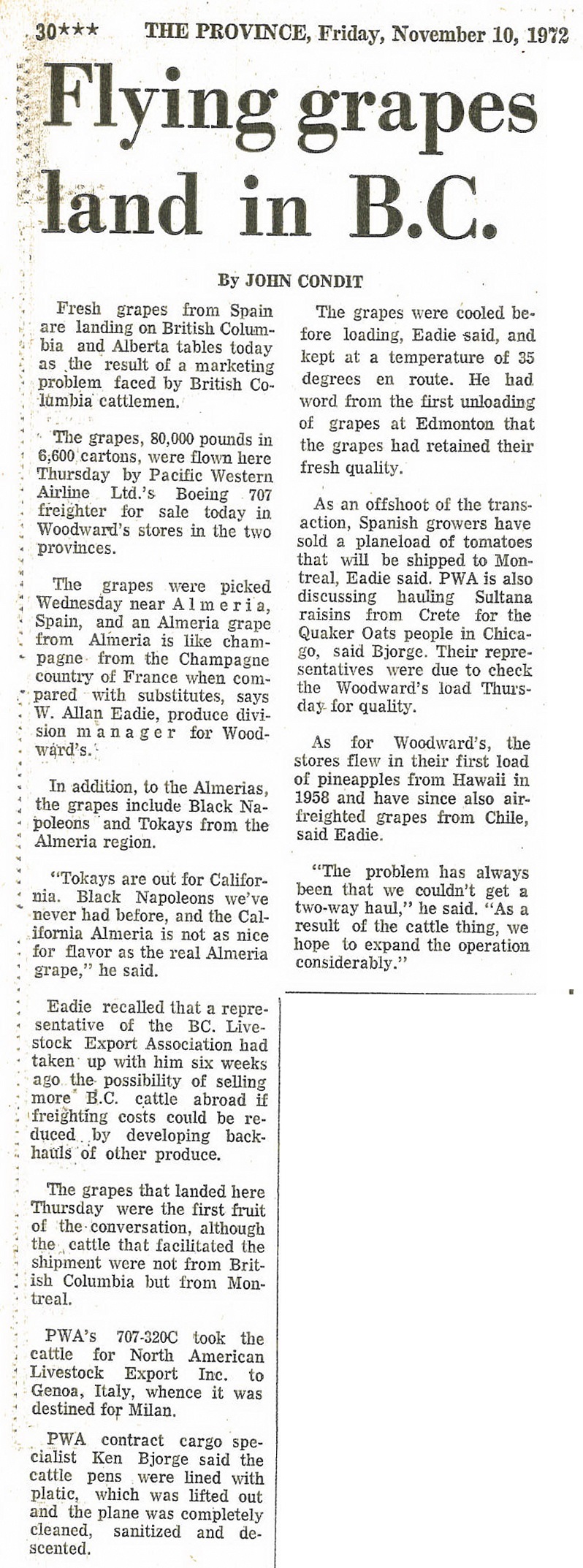
    It describes how Pacific Western Airlines was able to ship live beef to Europe, because its cargo plane could return with a cargo of grapes which were now available throughout BC and Alberta.
    The article also explains how the plane was cleaned, presumably before the grapes were loaded on to the plane.

    The Wikipedia page for PWA mentions the following:

    Boeing 707 equipment was added to the fleet in 1967…  The addition of a cargo model Boeing 707 meant that livestock and perishables could now be carried all over the world, and the name Pacific Western became synonymous with “World Air Cargo”. The company aircraft visited more than 90 countries during this period of time.
    Pacific Western operated a worldwide Boeing 707 cargo and passenger charter program until the last aircraft was sold in 1979.

    This is in the era where container shipping was beginning its world wide adoption.
    Air cargo was expanding during this time as well, when “Boeing launched the four engine 747, the first wide-body aircraft” in 1968.

    As the newspaper report explains, transportation of people and goods only makes sense if the airplane is loaded to maximum capacity at all times.

    This was the thinking behind the Triangular trading system of the 19th century.

    Moving people extended this thinking to modern day hub airports such as Toronto Pearson, London Heathrow and Dubai UAE.

    Even today with airplanes that can travel half way around the world, the take off and landing locations are the national hub airports.

    Air cargo has undergone the same thinking.
    In the 1972 news report, it only made sense to Pacific Western Airlines to undertake this one-off trip once the entire route was fully booked.

    The article goes on to describe how the airline was looking for other opportunities. They recognized the potential, but the tipping point (the development of an airport hub for cargo) had not yet arrived.

    To see what kind of completion PWA would face today simply go to an airplane tracking app and filter for FedEx planes, or track the Memphis airport.

    UPS has a similar hub in Louisville. Here is an example of one airplane in the UPS fleet that revisits the hub city regularly. This particular plane left Louisville on 28 May 2017 and travelled around the world via Honolulu, Hong Kong, Dubai, Cologne, and Philadelphia, before returning to Louisville three days later.
    When you read this article, there will probably be more recent examples of round the world trips or forays to Asia or Europe before returning to it’s home base.

    The article does not quote anyone from the BC Livestock Export Association, however Europe is again front of mind for the Cattlemen’s Association.

    Mr. W. Allan Eadie produce manager for Woodward’s, and PWA cargo specialist Ken Bjorge would be impressed!

    As Mister Eadie says in the report, he hoped that this operation would expand because of “this cattle thing.”
    He and Mister Bjorge may have failed to realize that the problem was not to solve the “cattle thing.”  They needed to solve the “hub thing.”

    On a side note, The Imax movie “Living in the Age of Airplanes”  has an excellent section on the transportation of flowers that is well worth the price of admission.

    PWA purchased CP Air to form Canadian Airlines International in 1987.

    Canadian Airlines has the distinction of being the first airline in the world to have a website on the Internet (http://www.cdnair.ca/).

    It merged with Air Canada in 2001.


    Expo 86 opened its doors to the world on 02 May, 1986.

    Leading up to the World Fair, several large infrastructure projects were proposed and planned for, so that they would be open and useable by the public by the time the fair opened.

    These projects included

    These projects were discussed on the Webster Show.

    Of course politics was involved, as the mayor defended his vision of what Vancouver would look like, as it celebrated the hundredth anniversary of its founding.

    Redevelopment of False Creek was a major issue – BC Architect Arthur Erickson and the director of planning for BC Place, David Padmore discuss the Expo 86 site plans.

    Here is the interview of a member of the BC Place planning committee.

    Sky train was a region wide issue.

    This episode shows the proposed route of the LRT as Steve Wyatt drives the streets of Vancouver, trying to get as close to the proposed route as possible.

    Bear in mind that the route used existing railway rights of way for the majority (if not all) of the line.

    There are several versions of this. The final one was slowed down somewhat so you can see the surrounding city a little more easily.

    For the unedited show see this Link.

    Canada Place – the cruise ship terminal. Webster goes on a fly about/ walk about

    BCTV was a major sponsor and broadcast daily from the Expo grounds.

    Here is part of the hype, when some of the pieces  get lost.

    Counting Down to opening day

    And after the exhibition

    The auction

    And distributing the wealth

    Inspired by the Landscape

    W1

    Figure 1. Viewfield Farm at Macaulay Point, in1854. The farm extended along the southern water front from Saxe Point in Esquimalt, to Lime Bay in Victoria West and across the peninsula to Selkirk Waters.

    As Donald Macaulay with his Tsimshian wife Margaret and the first four of their six daughters Mary, Flora, Catherine and Sarah, gazed out at the beautiful ocean view and the fields draped with blue camas, he must have been reminded of his native home on the Scottish Isle of Lewis. It was 1850, and Macaulay was bailiff of the new 600-acre Viewfield Farm owned by the Puget Sound Agricultural Company.

    Macaulay could hardly have known that this landscape would one day be named after him. Or that it would become a popular military camp in the late 1890’s, where Victoria’s citizens flocked to witness regimental demonstrations.

    Macaulay Point was first named Sailor Point in 1847, but the Hudson’s Bay men called it Macaulay Point in 1851 and this was made official by the surveys of Captain Richards in 1859.

    With the building of the military base and houses, the Macaulay Plains disappeared.  But a visit to Macaulay Point reveals the large defensive structures that were still being used in the Second World War.  Less visible are the three ancient archaeological sites in Fleming Bay.

    W2

    Figure 2. In 1878, based on the belief of a threat from Russia, an Earthwork Battery was built at Fort Macaulay. Later, in 1887, the old earthworks were dismantled and new six-inch disappearing guns were installed. These were used during both world wars. (Robert Kidd photograph, 1959; RBCM, Archaeology Collection.).

    W3

    Figure 3. Crowds of people witnessed the performances of the British Columbia Provincial Regiment of Garrison Artillery on Macaulay Plains, about 1885. (RBCM A-03131).

    First Nations cultural features

    Macaulay Point was known as Mukwuks by the Lekwungen First Nations on whose traditional territory it was located.  Today the Lekwungen are represented by the Esquimalt and Songees Nations. In 1952, Songhees elder Jimmy Fraser indicated that Mukwuks was once the location of a salmon reef net fishing station. The stone seen here in figure 4 is a net weight or anchor stone found by divers on Macaulay reef.

    Divers also found piles of larger, unmodified rocks used as anchors on the reef net. Every year the kelp rope holding these anchors would be cut, and they would be left behind. This shaped rock would have been one that was retrieved after use, but in this case was probably accidentally lost.

    W4

    Figure 4. This shaped rock was used as a net sinker to hold a reef net down between two canoes. It weighs about 4 kg or 9 lbs (RBCM. DcRu-Y:96).

    W5

    Figure 5. On reefs where the salmon came close to shore, this type of net was placed in a pathway cut into the kelp beds. When the fish were above the mesh net, it was pulled up by crews in boats on each side. (Re-drawn after Hilary Stewart 1977:94).

    The oldest archaeological site in Esquimalt

    Between about 5000 and 11,000 years ago, all of the many archaeological sites in bays around Esquimalt, were dry land. As the sea level rose to near its present height about 4,200 years ago, we find evidence of First Nations living at Fleming Bay.

    A large shellmidden stretches across the back of the bay, containing shellfish remains, bones, artifacts and other evidence of past human behaviour. It is one of two equally old Archaeological sites in the municipality of Esquimalt. It dates to the same age as a shellmidden under the Tillicum Road Bridge. Much of the site has now been destroyed, but there are still portions intact.

    The location was a camp, used at least on a seasonally basis, at various times starting 4200 years ago. On both ends of this large site were two later period shellmiddens identified as aboriginal defensive locations – used in times of warfare.

    Defensive sites are often located on a raised peninsula with an intentionally dug trench across the back of the peninsula. The dirt was mounded up on the inside of the trench and wooden palisades placed in the inner rim of the trench.

    This peninsula, extending out from the main shellmidden site was occupied at a later time period than the older deposits of the main site. This was a defensive location where about 800 to 1000 years ago a trench was dug across the back end of the peninsula.

    A second defensive site was located on the south side of Fleming Beach. Shellmidden deposits once occurred from the tip of the small peninsula that once formed the south side of Fleming Bay and extended eastward along the Bay to the ”Climbing Wall”.

    W6

    Figure 6. The ancient shellmidden at Fleming Beach once extended west from the high rocks on the east side of the Esquimalt Anglers Association boat ramp. Much of it has been destroyed by the boat ramp and housing development. The “Climbing Wall” is on the far right (Grant Keddie, 2006).

    W7

    Figure 7. The beach is named after the family of photographers’ Harold and Edgar Fleming, who built their house, Viewfield, here in the 1880s. This 1896 painting shows the house above what is now the boat launch, before three metres of soil and shellmidden were removed. The rocks on the right are now a popular climbing wall. (RBCM; PDP4171).

    Fleming Beach shellmidden

    The archaeological sites at Fleming Bay were known since the 1890s, but officially recorded by Robert Kidd for the Provincial Museum in 1959. He took a series of photographs at that time which allow us to see the recent changes that have occurred.

    W8

    Figure 8. Archaeological site DcRu-20. Looking down over the boat ramp at Fleming Beach, toward Kinver Road in the background. (Robert Kidd photograph taken in 1959. RBCM, Archaeology Collection).

    W9

    Figure 9. The raised shellmidden bank can be seen across the back of Fleming Beach. Kinver Road is on the far left and what is now the climbing wall on the far right ( Robert Kidd photograph. 1959. RBCM, Archaeology Collection).

    W10

    Figure 10. The cultural debris that made up the shellmidden at Fleming Beach was once up to two metres deep. (Robert Kidd photograph 1959. RBCM, Archaeology collection).

    The western defensive site

    W11

    Figure 11. Looking across the aboriginal defensive site on the west side of the back of Fleming Beach, in 1901. The present day Esquimalt Angler’s Association ramp is on the distant right next to the exposed climbing Rock. (Charles Newcombe photograph; RBCM, Ethnology Collection, PN139).

    W12

    Figure 12. Remnants of a defensive trench that once cut across the back of the peninsula of the site, in 1928. The climbing wall can be seen at the centre of the photograph in the far background. (William Newcombe photograph; RBCM, Ethnology Collection, PN169).

    W13

    Figure 13. Looking across the south end of the defensive site seen in figures 11 and 12. Shellmidden can be seen eroding down the slope. (Robert Kidd photograph; RBCM, Archaeology Collection).

    W14

    Figure 14. The Aboriginal defensive site on the west side of Fleming Bay is on the peninsula at the centre of the photograph (Robert Kidd photograph 1959; RBCM Archaeology collection).

    Figure 15. Looking across Fleming Bay to the Aboriginal defensive site at the left of the centre of the photograph, 2006. (Grant Keddie photograph).

    Figure 15. Looking across Fleming Bay to the Aboriginal defensive site at the left of the centre of the photograph, 2006. (Grant Keddie photograph).

    The southern defensive site

    W16

    Figure 16. The location of the second defensive site on the south-western side of Fleming Beach, in 1900. Part of the area in the foreground has been filled in and now forms part of Buxton Green Park. Shellmidden deposits once occurred from the far right to what is now the climbing wall on the left. The photographer is unknown, but it was likely the professional photographer Edgar Fleming who lived at the beach. (Grant Keddie Collection).

    W17

    Figure 17. The southern aboriginal defensive site (DcRu-21) is seen in 1959 in relation to the peninsula before it was artificially extended in 1965. The stone wall in the foreground is part of the first salt water swimming pool built in greater Victoria. It was built by Canadian soldiers stationed at Work Point Barracks during the Second World War. It was filled in with the creation of Buxton Green Park in 1983 (Robert Kidd photograph; RBCM, Archaeology Collection).

    Take a walk

    Fleming Bay and Macaulay Point are home to one of the oldest First Nation habitations in the region and two types of defensive sites – one from a thousand years ago and one used from 1878 until World War II.

    As you walk around the bay you will be able to observe these special features and think of the Macaulay family that walked here before you.

    Taking knowledge of the community’s heritage features, the rock underneath your feet, the birds, the plants and the fish in the water below will make your stroll along the waterfront a much more enjoyable experience. It gives the community a sense of place.

    Part 1. Introduction and Spindle Whorls in the Archaeology Collection of the Royal BC Museum

    Introduction

    In order to provide a broader understanding of the earlier history and origins of both historic and pre-contact spindle whorls used in British Columbia, I will provide a description with images of all the spindle whorls in the Archaeology and Ethnology collection of the Royal B.C. Museum.

    1

    Figure 1. Examples of small sea mammal bone spindle whorls in the Royal BC Museum ethnology collection.

    This will be presented in three Parts: (1) Introduction and Spindle Whorls in the Archaeology Collection of the Royal BC Museum. (2) Small Spindle Whorls in the Ethnology Collection of the Royal BC Museum. (3)Large Spindle whorls from speakers of the Salish language family in the Ethnology Collection of the Royal BC Museum.

    The archaeological record suggests that significant differences existed in the past. This project will look at the larger picture of all uses of spindle whorls in British Columbia, their age and distribution in earlier and more recent times.

    Most of the discussion on this topic to date involves reference to the making of woven capes and blankets of mountain goat, dog hair and other materials using large spindle whorls. However, the majority of small spindle whorls in Museum ethnological collections that derive from the coast of British Columbia are related mainly to the production of fibers, such as stinging nettle, for the production of fishing nets. An overview for understanding this broader topic is presented here.

    The Significance of Spindle Whorls in British Columbia

    The weaving technology of First Nations of British Columbia is a popular topic. Designs on historic Salish Spindle whorls have had the greatest influence on what is termed modern Salish Art. Over recent decades Salish Artists have copied designs from Spindle whorls in Museum collections and have developed from these a wonderful array of new and creative designs that are a reflection of those early patterns.

    The word Salish is, of course, a term used by linguists to refer to a number of different human populations that speak different languages that have a common origin. The common language origin indicates that these groups have interacted with each other to varying degrees at various times in the past, but each has their own history. The history of the use and expression of weaving technology will be different for some of these groups. We know, for example, in the historic period that some Salish speaking groups did not decorate their spindle whorls with designs.

    The Interests of Archaeology

    There is a desire to know the history and origins of the weaving of clothing, but the role of spindle whorls for other purposes is generally not understood. This project will put the broader role of spindle whorls in the public domain.

    For Archaeologists, artifact typologies and where they fit into defined cultural phases play an important role in developing hypothesis about cultural development on the northwest coast.

    What artifacts to include and exclude from trait lists defining cultural phases can be a very subjective exercise. Interpreting what the artifact represents in terms of cultural behavior can also be a subjective exercise.

    Determining which spindle whorls were used for the production of different products and determining when this behavior began in the past would be crucial in making time specific statements about past human behavior.

    Did the spinning of nettle for making nets precede the spinning of materials for clothing or were they both produced at the time of the introduction of spindle whorls?

    Spindle whorls are a type of artifact that is not likely to have been independently developed, but rather introduced into the region. This seems to be the more typical pattern in other parts of the world. Knowing the function and timing of the introduction and/or local development of specific types of spindle whorls may help us better understanding the process by which it was introduced into this region and the source of its introduction.

    Both internal and external cultural catalysts may underlie the explanation for the introduction of this new form of behavior. Does the introduction of the spindle whorl reflect a change in economy or a new technology for an existing economy? Is it a result of new trade and exchange with, or a borrowed idea from some outside culture?

    In comparing the ethnographic record with the archaeological it is important to understand the nature of both. Archaeologists and ethnologists can make incorrect assumptions about the others data when they are not familiar with it. Knowing the specifics of when and where both the ethnographic and archaeological examples of spindles whorls were collected is important in making comparisons between them.

    When comparing ethnographic spindle whorls with archaeological examples we need to ask if the ethnographic examples were actually used – or ones made for sale or made as models for collectors or museums. Are the whorls made in the early 20th century the same as those made in the early 19th century?

    The biggest factor in the comparison of modern and ancient whorls will be in the nature of the raw materials. Wooden examples will be lost from the archaeological record except in the case of those found in extremely wet or dry conditions.

    However, since almost all of the ethnographic examples of small whorls are made of sea mammal bone and stone, these should be found in archaeological sites.

    Spindle Whorls in the Archaeology Collection of the Royal BC Museum

    figure2

    Figure 2. Examples of the size range of archaeological stone spindle whorls in the Royal BC Museum collection.

    3

    Figure 3. Example of size differences in sea mammal bone spindle whorls in the Archaeology collection of the Royal BC Museum.

    Identifying archaeological spindle whorls is not something that can always be done with certainty. Some archaeological examples are similar enough to known ethnographic examples. They are often finely made with a lenticular or flat cross-section. The hole for inserting the whorl on the spindle is usually well defined and in proportion to the size of the diameter of the whorl. The hole is usually well centered.

    There are other bone and stone objects that seem to be more likely to be spindles whorls than anything else. These come in a variety of sizes. Spindle whorls in other parts of the world show considerable variation in size depending of what kind of material is being spun. A few of the 27 specimens described here deviate from the known historic examples, but are being considered as possible whorls until further research can substantiate or reject them as whorls. There may be some elements of the spinning and weaving industry that are found in earlier times that do not have an historic equivalent. For example, the presence of spinning bowls (Keddie 2003).

    Description Notes

    In some cases sea mammal bone whorls have a smoother side that is the outer portion of the original bone and a rougher side with a more porous surface. Where this is clear, the smoother side will be considered the upper portion or top against which the fibre being spun accumulates.

    The whorls will be described here in regional clusters of my own invention for comparative purposes. This is based on general geographic areas and in part reflects the current state of the collection.

    South East End Vancouver Island. Pedder Bay to Nanaimo. (Total 11)

    DcRt-Y:41 Cadboro Bay. Flat, rounded, but slightly rectangular, whale vertebrae epiphysis. The smoother top is nearly flat, while the bottom is convex only along a thicker middle portion. 155mm – 123 mm dia. Hole dia. 17mm. It varies in thickness from 12mm near the center to 5-6mm around the outer rim. Records show that this is from the Cadboro Bay archaeological site DcRt-15 [old accession 1932-1]. The porous bottom surface has an incised face on one half composed of two eyes and a mouth. On the top surface is a star-like pattern composed of two rings encircling the center hole with four triangular extensions that have long thin triangles in them, and two thinner arm-

    like extensions between the larger triangles extending to each side. Weight: 102 grams (portion missing – estimated original weight 120 grams). Surface collected by T.W.S. Parsons, 1932.

    4-combined

    Figure 4. The only large bone whorl with a design. DcRu-25:1555.

    DcRt-15:1289. Cadboro Bay, Victoria. Bone whorl blank. Whale vertebrae epiphysis. This was shaped by chopping around the circumference with an adze. Flat with original smooth bone top surface and porous bottom surface. Maximum dia 15.5cm; Max. th. 1.5cm. Weight: 179 grams. (Old number 12650].

    5-combined

    Figure 5. Unfinished whalebone whorl.

    DcRu-25:1555. Victoria Harbour. Old Songhees Reserve. Portion (about 40%) of round to slightly rectangular whale vertebrae epiphysis. Flat smooth ground top surface and porous, ground, slightly convex bottom surface. Only slight remnant of center hole exists. The outer rim is flat sided with rounded edges. Maximum diameter present (144mm). Estimated original diameter based on continuance of outer rim is about 160mm. The radius from the hole remnant edge is 68mm. If the hole was the same size as the similar DcRt16:158 specimen, the diameter across this portion would be a minimum of 154mm. This whorl is larger from the hole to the edge than DcRt-16:158, and seems to have been slightly rectangular – suggesting that an original diameter of about 160mm is accurate. Thickness ranges from 9.5mm at hole to 6-7mm on the outer edge. Weight:(32.8 grams). Estimate of original weight is about 135 grams. Excavated form disturbed historic debris. This site was occupied from 1844-1911. It is likely that this whorl dates to the earlier period of the mid-19th century.

    6

    Figure 6. DcRu-25:1555.

    DcRt-16:158. McNeil Bay, Victoria. Whale vertebrae epiphysis. Nearly flat on the ground top – which is the original bone surface. The ground porous bottom is slightly convex. Diameter: 144mm by 132mm. Thickness varies from 4mm-5mm around the edges to 7mm near the centre. Hole diameter: 18mm. No raised area near the spindle hole. Outer bone cortex side more polished with wear patterns. Weight: 123.5 grams. This site has two bottom dates of around 500 years. The oldest (WAT1627, RH86-10; 560-+65) dates the base of the midden to the period around 1390 A.D. to 1455 A.D. A second date covers the period from A.D. 1445 – A.D. 1680.

    Oral history refers to this site being occupied by the Chikawich people. It may have been last used in the early 1800s as a more permanent village, but used on a more temporary basis after this. The spindle whorl, therefore dates to a maximum of 500 years, but may be closer to a date of 200 years ago.

    7-combined

    Figure 7. Large spindle whorl, Both sides. DcRt-16:158.

    DcRt-16:335. McNeil Bay, Victoria. Whale vertebrae epiphysis bone. This small fragment is flat on the original ground bone top surface and convex on the bottom ground porous surface.  There is no central whole present but the ground contours are the same as the outer edge of the whorl DcRu-12:1555. Diameter: (51mm). Width: (28mm). Thickness: 6mm on edge to (11mm) inward. Weight: (6.9 grams).

    8-combined

    Figure 8. Fragment of large spindle whorl, DcRt-16:335. Obverse and reverse sides.

    DcRv-1:733 Pedder Bay. Oval shaped, sea mammal bone vertebral epiphysis. Flat on both surfaces and flattened sides. Diameter: 73mm – 64mm; Thickness varies from 3mm to 5mm; Hole diameter is 7.5mm. Weight: 12 grams.

    9-combined

    Figure 9. Obverse and reverse of spindle whorl, DcRv-1:733

    DcRu-Y:63. Esquimalt Lagoon area. Small grey siltstone whorl fragment (about 22% present). One side is flat and the other slightly convex. It tappers from a thickness of 4.8mm at the hole to 3mm at the rim. Maximum diameter present (67mm). Original estimated diameter is about (78mm). Original hole diameter about 7mm. Old accession 75-57. Written on artifact: “Seashore Belmont, A. N. Marrion”. Marrion was known to have collected other material from site DcRu2. This is likely the site that it came from. A series of radio-carbon dates places most of this site after 1000 B.P. Weight: 13.9 grams.

    10

    Figure 10. Small Siltstone spindle whorl, DcRu-Y:63

    DcRu-Y:266. (DcRu-23). Finlayson Point, Victoria. Ground sea mammal bone. Nearly flat on both surfaces. Fragment only. Includes portion of central hole and portion that includes a section of original outer rim. Distance from hole edge to outer rim 55mm. Hole diameter 16mm. Thickness varies from 3.8mm on the outer rim to 5.5mm near the central hole. Original diameter estimated at 126mm. Collected by William A. Newcombe at a shell mound in Beacon Hill Park in 1902. The only site this description would fit at that time is the Finlayson Point site, DcRu-23. Weight: [23.4] grams. Original weight would be about (70 grams). This site dates within the last 1000 years and was likely last occupied in the mid-1700s.

    11-combined

    Figure 11. Portion of whalebone spindle whorl, DcRu-23. Obverse and reverse sides.

    DeRu-1:2611. Sidney area. Whalebone whorl fragment (about 7/12 present). Flat on more porous bottom surface and slightly convex on top surface. Tapers from 9mm thick at hole to 4mm at rounded outer rim. Original hole dia. c.8mm. 50–52mm from hole edge to outer rim. Original diameter c. 114-118mm. Slightly rectangular. (Old accession 5489; From collection of A. and Francis J. Barrow – #358, from Barrow property). Weight: [52] grams. Original weight about 120 grams.

    12-combined

    Figure 12. Fragment of large spindle whorl, DeRu-1:2611.

    DeRv-Y:56. Cowichan region. Possible whorl? Oval shaped siltstone. Slightly bi-conical in cross-section. Bi-conically drilled central hole. Edges ground flat with portions slightly rounded. Diameter ranges from 76mm – 89mm. Outer hole diameter 15mm; Inner hole 9mm. Thickness: 10mm – 13.5mm toward centre. Weight: 148.1 grams. Old accession # 275, donated by E.M. Skinner) On label “Cowichan. Mrs. Skinner, May 1890”. Smooth surface. This may also be a small net weight, but there are no other net weights like it in the region.

    13-combined

    Figure 13. Small Stone Spindle whorl, DeRv-Y:56.

    DgRx-Y:14. Nanaimo District. Large disc shaped stone with slight 2mm collar (raised rim around the hole edge). Bi-convex cross-section. Diameter: 144mm-164mm. Thickness varies from 25mm at the inner hole to 6mm on the outer edge. Hole diameter: 33mm. Raw material: Andesite. Weight: 623.3 grams. (Originally from the D. Steveson Collection, that became part of the Charles Newcombe Collection. Old accession #10946).

    14-combined

    Figure 14. Large Stone spindle Whorl, DgRx-Y:14

    Gulf Islands (Total 4)

    DfRu-24:749. Galiano Island. Active Pass. Georgeson Bay. Whorl fragment of whale vertebrae centrum epiphysis. Nearly flat top surface and slightly convex bottom surface. Weight :(30.8) grams. This has the characteristics of a whorl but is missing the portion where the central hole would be. Minimum diameter estimated at about 160mm-180mm.

    15-combined

    Figure 15. Fragment of large spindle whorl, DfRu-24:749.

    DfRu-24:1287. Galiano Island. Possible whorl? Very small round, flat stone with central hole. Edges ground flat. This is much smaller than any known ethnographic examples or any information provided in ethnological accounts in British Columbia, but does fit the size range of whorls in other parts of the world. It could be a decorative button or some other object? Diameter: 25.5mm; Thickness: 3mm; Hole size: 4mm. Weight: 2 grams. Accession 68-19.

    16-combined

    Figure 16. Possible small stone spindle whorl?. DfRu-24:1287.

    DgRw-4:2740. Gabriola Island. Flat slate whorl. Diameter: 56.8mm to 59mm. Thickness: Varies from 2.5mm to 3.0mm. Hole diameter: 6.5mm. Bi-conically drilled. Weight: 16 grams. Accession 1967.27. Excavation. David Burley 1988. False Narrows III component. Gulf of Georgia Cultural type (“with an approximate age between A.D. 1200 and the historic period”).

    17-combined

    Figure 17. Small siltstone spindle whorl, DgRw-4:2740.

    DeRt-1:103. Pender Island. Small flat sandstone whorl. Diameter 38-42mm. Even thickness of 7mm with well defined, steep edges. Hole diameter: Inner 6mm; outer cut area 10-12mm. (#94 of Herbert A. Spalding collection). Weight:16.1 grams.

    18-combined

    Figure 18. Small stone whorl. DeRt-1:103

    Lower Fraser River.  (Total 3)

    DjRi-Y:134. Yale area. Small disc shaped siltstone whorl. Bi-convex in cross-section. Weight: 31 grams. Diameter: 5.4cm. Thickness: 9.4mm at center and tapering to edges. Hole diameter: 9mm. [old #3134; Accession 1917.27].

    19-combined

    Figure 19. Both sides of stone spindle whorl DjRi-Y:134.

    DjR1-3:14. North of Yale. Unfinished round whorl. Flat on bottom and nearly flat on top surface. Schist-like material. Unfinished 4mm deep hole drilled at center on one side. Diameter: 45mm by 43mm. Thickness: 4.8mm at center tapering to an average of 4.5mm at outer edges. Weight: 15.9 grams. [Old accession # 12625; 65-48].

    20-combined

    Figure 20. Both sides of stone spindle whorl DjR1-3:14

    DhRlm-Y:1832. Agassiz-Dewdney general area. (67-4). Flat nearly round siltstone whorl with rounded edges. Bi-conically drilled hole. Diameter: 69-73mm. Thickness 8mm. Hole diameter: Inner 8mm, outer cut 13-14mm. Weight: 64.6 grams.

    21-combined

    Figure 21. Small stone spindle whorl, DhRlm-Y:1832

    North end Vancouver Island/Mainland region (Total 2)

    EdSo-Y:1. Lagoon Cove, Cracroft Island. Flat sea mammal vertebral epiphysis bone. Flat ground edges. Diameter: 72.5mm Thickness: 5.5cm. Hole diameter: 11mm; [old #5556; 425]. Surface collected by M. Miles. Became part of collection of A. and F.W. Barrow – #425. Weight: 22 grams.

    22-combined

    Figure 22. Obverse and reverse sides of bone spindle whorl EdSo-Y:1.

    EaSe-Y:23. Prideaux Haven. Siltstone whorl. Near flat to slightly bi-convex in cross-section. Ground around edges and high area on surfaces. Rough, unground portions on both sides. Diameter: 49mm to 49.9mm. Thickness: 4.7mm near centre and tapering to 3mm at edges. (old accession “5625”; Found by Phil Lavigne in 1938 and given to Francis Barrow. Part (#494) of A. and F.W. Barrow collection donation in 1944). Weight:16.1 grams.

    23-combined

    Figure 23. West Coast Vancouver Island. (Total 1)

    EdSv-6:20 Quatsino Sound. Sea mammal bone whorl. Bi-convex in cross-section. Diameter: 61.5–64.1mm. Hole diameter: 10.5mm. Thickness varies from 4mm at edge to 10.8mm at hole. Transferred from Ethnology. John Stephenson Collection. A-1985-10. Weight: 37 grams.

    24-combined

    Figure 24. Both sides of bone spindle whorl EdSv-6:20

    Interior  (Total 2)

    EbRj-Y:39 Lytton area. Flat circular siltstone. Flattened to rounded edge. Bi-conically drilled hole. Diameter: 100–102mm. Thickness: 8cm. Hole diameter: 9mm [13mm hole depression area].[old catalogue #455, lists this as from “S.Thompson” [South Thompson River] 1892.3, from the collection of F.M. Stevenson of Lytton]. Weight: 147 grams.

    25-combined

    Figure 25. Both sides of stone spindle whorl EbRj-Y:39

    ER-Y:836. Southern Interior. Flat schist whorl fragment. Radius of piece from edge of hole to rim 41mm. Estimated diameter based on hole at center 90mm. Thickness: 9.3mm; Hole diameter estimate c. 9mm. Design pattern – A groove 3mm in from and around the edge separates a slightly lower area extending to the edge. Inside the grooved circle there is a star-like pattern formed by three 13mm high triangle patterns on the inside of the circular groove. Fire burn marks on one portion. “Interior Salish”. [old acc.66-6] Surface collected by H. Cowden. Weight: [47] grams (original estimated weight – c.120 grams)

    26-combined

    Figure 26. Obverse and reverse sides of stone spindle whorl ER-Y:836.

    Central Coast (Total 3)

    FcTe-4:458. Price Island. Sea mammal vertebrae epiphysis bone whorl fragment. Diameter: 77mm. Oval shape; only half present; Thickness: 4mm; Diameter of hole: 6mm. [accession #72-362] Weight: 11.2 grams.

    27-combined

    Figure 27.Obverse and reverse side of bone spindle whorl FcTe-4:458.

    EkSp-13:5293. Owikeno. Sea Mammal bone whorl. Flat. Diameter: 61mm by 60mm. Thickness 6mm. 5.5mm on edges. Hole diameter: 11mm. Weight: 25.8. Excavations 24.7.75. N.E. Quadrant. Likely date 18th to early 19th century.

    EkSp-13:5542. Owikeno. Sea Mammal bone whorl. Flat. Diameter: 52mm by 50.5mm. Thickness 8mm. 7.5mm on edges. Hole diameter: 11mm. Weight: 24.8. Excavations 24.7.75. S.W. Quadrant. Likely date 18th to early 19th century.

    28-combined

    Figure 28. Obverse and reverse views of bone spindle whorls EkSp-13:5293 and EkSp-13:5542.

    B.C. Unknown Location (Total 1)

    Y:1879. Stone. Flat surfaces, but with 7mm wide angled facetting around edges on both sides. Edges ground flat. Weight: 67 grams. 6.4-6.5cm dia.; .5-.6cm flat edge; 1cm max. th.; hole .9cm (1.9cm hole depression area).

    29-combined

    Figure 29. Both sides of stone spindle whorl from unknown B.C. location.

    Possible whorl?

    DhSb-11:31. There is no evidence of a central hole, but other dimensions suggest that this is a whorl.

    30-combined

    Figure 30. DhSb-11:31. Possible bone whorl

    DdRu-5:85a&b. Unidentified object. This item was originally described as a possible whorl but I matched another piece, DdRu-5:159, which showed that the placing of the ground edges meant this could not be a whorl.

    31

    Figure 31. Ground whale bone that is not a whorl.

    Dating and context of spindles from other collections

    Haida Gwai. A spindle whorl was found on the floor of a habitation rock shelter, FaTt-36:2. The site is located on the south shore of Djitkan Ankun near Cape Freeman, S.W. Coast of Moresby Island (Acheson 1998:188&202). (Dia. 78.2mm; Th. 6.9mm; hole dia. 12mm. Weight not given). Date unknown.

    Queen Charlotte Strait. Two sea mammal bone spindle whorls were found at Davies Island Fort site, EeSp-95a, off Fife Sound (Mitchell, 1981:118; Fig. 37p&q) (Dia. abt. 37mm & abt. 63mm (Mitchell, 1981:118 and Mitchell 1988:251, fig.4).

    These are only associated with the deposits of a general time period containing what is called the Queen Charlotte Strait Culture Type assemblage which dates from after AD 300 to near the historic period. (Mitchell 1988:251; figure 4i). (Dia. 32mm; Dia. of hole 5.5mm).

    A “bone spindle whorl” was found in a shell midden at the head of Echo Bay, site EeSo-1, on the northwest shore of Gilford Island. Known as an historic period Kwicksutaineuk village (Mitchell, 1981:109; fig. 33m).

    South-eastern Vancouver Island

    DcRw-14:303. 135mm by 125mm; thick 18mm. Private collection of Gordon Crowe. Lower Fraser River

    Lower Fraser River

    Charles Borden describes a fragment of a spindle whorl from the old Musqueam village of Stselax, site DhRt-2, as a: “Marginal fragment of an elaborately and bifacially engraved spindle whorl fashioned from the epiphysis of a whale vertebra”. This site dates from 1250 AD to late contact times, but Borden suggests that the spindle whorl fragment was among artifacts that were “probably carved and engraved with steel cutting tools during the Historic Period” (Borden 1983:165;Figure 8:34c).

    Fraser River Canyon

    Charles Borden excavated a small “brown steatite” spindle whorl (DjRi-3L11.142) from the Milliken site in the Fraser River canyon (Diameter: 11.45cm). It has Snake motifs engraving on one side and multiple snake eyes on the other. Borden placed it in the Esilao Phase dating to after 1380 A.D., but then suggested that it is “more likely” to date to the “Historic Period”. He stated that: “On the available evidence it is perhaps best to consider this steatite whorl more of less contemporary with the carefully designed compositions on some of the elaborately carved spindle whorls of the nineteenth century, bearing in mind, however, that future data and deeper insight may eventually justify placing this remarkable artifact into an earlier period” (Borden 1983:161).

    Interior

    Sanger reports two stone spindle whorls from the Texas Creek site. “Steatite spindle whorls are known from the Mile 28 Ranch Site, but to date they have not been found around Kamloops. The proximity of these site (the Texas Creek and the Mile 28 Ranch) to the Coast, where the spinning of mountain goat hair was practiced, may offer a partial explanation for the presence of these artifacts in the western periphery of the Interior plateau” (Sanger 1968:13).

    References

    Acheson, Steven. 1998. In the Wake of the ya’aats’xaatgaay [‘Iron People’]: A study of changing settlement strategies among the Kungit Haida. BAR International Series 711.
    Barber, Elizabeth J.W. 1991. Prehistoric Textiles. The Development of Cloth in the Neolithic and Bronze Ages with Special References to the Aegean. Princeton University Press.
    Borden, Charles. 1983. Prehistoric Art of the Lower Fraser River Region. Pages 131-165. In: Indian Art Traditions of the Northwest Coast. Edited by Roy Carlson.
    Keddie, Grant. 2003. A New Look at Northwest Coast Stone Bowls. In: Archaeology of Coastal British Columbia. Essays in Honour of Professor Phillip M. Hobler, pp. 165-174. Edited by Roy L. Carlson. Publication Number 30, Archaeology Press, Simon Fraser University.
    Mitchell, Donald. 1988. Changing Patterns of Resource Use in the Prehistory of Queen Charlotte Strait, British Columbia, Pages 245-290. In: Research in Economic Anthropology. Edited by Barry L. Isaac, Supplement 3. Prehistoric Economies of The Pacific Northwest Coast.
    Loughran-Delahunt, Isa. 1996. A Functional Analysis of Northwest Coast Spindle Whorls. Master of Arts. Western Washington University.
    Mitchell, Donald. 1981. Test Excavations at Randomly Selected Sites in Eastern Queen Charlotte Strait. Pp. 103-123. In: B.C. Studies. Fragments of the Past: British Columbia Archaeology in the 1970s. No. 48, Winter, 1980-81.
    Sanger, David. 1968. The Texas Creek Burial Site Assemblage, British Columbia. Anthropological Papers National Museum of Canada, Number 17, Ottawa.


    I ran across an interesting video of describing how a Museum is using its food offerings to integrate them with the rest of the museum experience.

    The item appeared as part of “CBS Sunday Morning” food edition on 20 Nov 2016.

    Here is the link.

    The menu recreates historically famous items from around the world as taught to the staff by the chefs who created them.

    This is the link to the menu.

    The menu includes the name of the chef, the restaurant, city, and year of creation.

    Be sure to click through the Lounge, Dining Room and Beverage tabs!

    One of the dishes created there is Oops! I dropped the lemon tart.

    Three-Michelin-star chef Massimo Bottura’s describes how the dish was created here.

    Feel free to research the chefs, restaurants and recipes listed on the menu. Time well spent!

    A Unique photograph in the Collection of the Royal B.C. Museum

    19th century photographic images in the Victoria region that show Lekwungen (Esquimalt and Songhees First Nations) undertaking traditional food gathering practices are rare. The only example of fishing is a photograph, taken in 1868, by Frederick Dally in Esquimalt harbour at the south entrance to Lang Cove (RBCM PN905). Lang Cove is located south of Skinner’s Cove, both of which are within the larger Constance Cove. This is the location of an ancient shellmidden as demonstrated by the scattered white clam shells seen in the image and later observed by the author at this location.

    figure1

    Figure 1. Herring Fishing Station at Wood’s Landing in Esquimalt Harbour. RBCM PN905.

    This image (fig. 1 and close-up fig.2) of a man and woman at a herring fishing site is listed in Frederick Dally’s Miscellaneous Papers, (File 17), as #5 “Indian at Esquimalt, canoes, fish etc.”. A copy of the photograph in the RBCM Archives Dally Album #5 has information along the bottom of the image noting what is in the photograph “herrings drying – rush mat- fish spears – Indian woman cooking – Chinook canoes – Esquimalt Harbour V. Island”.

    A copy of this photograph was also in the original photo album of Lieutenant J.C. Eastcott, the surgeon on the ship H.M.S. Reindeer that was on duty at the Esquimalt Royal Naval Dockyard station from 1868-75 (now the Canadian Forces Base Esquimalt).

    figure2

    Figure 2. Close-up of Herring fishing camp (RBCM PN905).

    Dating and Location of the Photograph

    The album, in the possession of A.R. Eastcott, was temporarily loaned to the City of Vancouver Archives in 1958 where the information written on it was recorded by archivist Major James Mattews. This album was also loaned to the Provincial Archives in 1978, and the information copied down by Dan Savard of the RBCM ethnology division on November 23, 1978. They recorded the caption on this image as “Woods Landing, Constance Cove, Esquimalt 1868”. The reference to “Woods Landing” likely refers to the place that Sir Charles Wood, the First Lord of the Admiralty came ashore in 1856. It could also refer to a landing place used by Lieutenant James Wood who surveyed Esquimalt Harbour in 1846 under the supervision of Captain Henry Kellet, but James Wood’s name was not officially given to this location.

    Dates placed on photographs long after the image was taken, and by someone other than the photographer, are often subject to error. In this case the date of 1868, is likely correct, and it would have been taken in late February to April of that year during the herring runs. Dally was away from Victoria in the Interior from June of that year and did not return to Victoria until to February 25, 1869.

    I was able to identify the location where this photograph was taken by observing the same fishing site location in another photograph of Dally’s (RBCM F-08522), that was undated, but one that must have been taken in 1867 (figure 3). There are five ships in this image.  The times they were on duty at the Esquimalt naval station allows us to be specific about the time the image was taken.  The ships include the Egmont, Sparrowhawk, Alexandra, Malacca, Shearwater and Grappler. As the Shearwater was only on duty in 1867 the photo must date to that year. The vegetation in this image shows similar growth to that in photograph PN905, suggesting the time separation of a year or less is most probable.

    figure3

    Figure 3. This photograph taken in 1867, by Frederick Dally shows the herring fishing camp in left foreground (RBCM F-08522).

    figure4

    Figure 4. Close-up of photograph (RBCM F-08522) showing the same fishing camp area as seen in figures 1 and 2.

    In figure 4, the remnants of many fish drying racks can be seen. Note the large number of upright short posts to the left of the photo and the large framework poles just to the right of centre of the photo at the edge of the bank. The fence-like rails in the background are related to Wood’s Landing and the historic naval wooden buildings to the far left of the photo.

    Wooden planks that are held by pegs can be seen at the centre. The planks hold back the midden and create a flat platform for a mat lodge location. Barrels can be seen on both sides of this platform. The large pole framework can be seen in the middle against the back in the same location in image PN905 to the right of the tuli mat shelter.

    Note the tiny little Island just on the other side of this point.  This is part of what was called “Village Rocks” – as seen in figures 5 and 6.

    By knowing what naval construction features were in the adjacent areas and by observing the angle of the two above images and what is in their background, the location can be identified as a small hooked piece of land extending into Lang Cove at its southern entrance.

    Image PN905 is looking north-east to the North entrance to Lang Cove. Figure 3 (RBCM F-08522) is looking north, with the Officers Club House on Munroe Head visible on the far right and Ashe Head beyond it. Another image, RBCM F-08538, taken in 1866-67 (based on dates of the presence of the boats) and from higher up shows more of the Bay between Munroe Head and Ashe Head.

    The small rock Islet (part of “Village rocks”) off the herring fishing site seen in Figure 3 (RBCM F-08522) can be seen on the far left in RBCM Archives image E-01844 – which also shows the rock formation on the north side of the entrance to Lang Cove as seen in the herring fishing camp image.

    Adjacent to Wood’s Landing (on the west side of the hooked piece of land in photograph PN905) is a group of rocks in the harbour called “Village Rocks”. This hooked piece of land with the small bay of the campsite photograph can be seen in the detailed map of Esquimalt Harbour produced by Captain Richards in 1859 (see close-up figure 5). Over the years this area has been drastically altered and is no longer visible. The fact that it was named village Rocks suggests that the survey crew mapping Esquimalt harbour may have observe a group of First Nations camped there – even if it was just a seasonal camp site at the time and not what might be called a more permanent winter village site.

    figure5

    Figure 5. Map showing the small hook of land at Wood’s Landing and Village Rocks. H.M.S. Plumper survey of 1859. Note the larger area called Constance Cove.

    The Origin of the name “Village Bay” and “Village Rocks”.

    The names of some of the bays and coves changed over time. Several maps produced from 1851 to 1855 show “Village Bay” in Lang Cove or where later maps show Constance Cove.

    figure6

    Figure 6. Small Portion of 1854 “District of Victoria and Esquimalt, Vancouver Island” showing Village Bay at the same location later referred to as Constance Cove. Village Rocks is noted and remains on later maps (Canadian national Archives g.3/96 (N9301).

    figure7

    Figure 7. The name Village Bay is shown here in what later became Lang Cove. Small Portion of Hudson’s Bay Company Archives map T16019 entitled: Peninsula Occupied by the Puget Sound Company. The red marks are naval storage buildings on Thetis Island.

    Observations on Photograph Content

    Photograph PN905 shows herring fish on wooden drying racks to the left side of the image. A First Nations man, in European style clothes, is standing in front of a tuli (bulrush) mat summer lodge which is located on a built-in flat platform area faced with a board in front. This is the left of the two board faced platforms that can be seen in photograph F-08522. This is an interesting example of the human modification of a shellmidden.

    Note the pathway near the right centre that can be seen in both photos. On the right of the mat lodge are poles for fish drying racks. Some of the long ones may be herring rakes (see figures 1 & 2), but the image is not clear enough to identify these. If Dally observed these, his reference to “spears” in his photograph description may have resulted from him seeing the long herring rakes at the site?

    Of the three canoes seen in figure 1, the closest one is of a west coast Vancouver Island style, while the outer two canoes with the long pointed bows and sterns are made of the style most common among Salish speaking peoples of the southern Coast of B.C. and northern Washington State. The term “Chinook canoe” used in one caption is now referred to as the “West Coast” style.

    figure8

    Figure 8. Tuli mat temporary lodges. An early 1900, Black and white photograph (private collection) of a Paul Kane painting that was produced during Kane’s visit to the Victoria region between April 8th and June 9th, 1847. The original colour painting is now in the Stark Museum of Art, Orange Texas (cat. 31.78.4).

    The Rediscovery of the Shellmidden

    In the 1980s, Ernie Colwood of CFB Esquimalt took me to the Wood’s Landing location during construction activities. Here I observed tons of historic debri from previous projects on top of and mixed in with shellmidden.

    Figure 9. Buried dense concentrations of Shellmidden. Grant Keddie Photograph.

    Figure 9. Buried dense concentrations of Shellmidden. Grant Keddie Photograph.

    figure10

    Figure 10. Ernie Colwood with construction foreman at location of mostly destroyed Herring Fishing camp. Looking N.N.E.

    figure11

    Figure 11. Area of buried shellmidden. Looking North.

    A Second herring fishing site in Lang Cove.

    In 1851, naval surgeon John Palmer Linton, while visiting on board the HMS Portland, drew a view from the back of Lang Cove (Driver 2013; Driver and Jones 2009). In this image (Figure 12) we can observe, on the far right, a tuli mat shelter with fish drying racks like that in figure 1. This fits the general descriptions of the time about temporary shelters around the edges of Esquimalt Harbour, but no specific mention of this location is in Linton’s writings. We cannot be certain that this imagery was not simply added to enhance the drawing as was a common practice at the time. The added-in drawing of First Nations in canoes near European ships was a common practice among artists.

    figure12

    Figure 12. Drawing by John Palmer Linton in 1851. Constance Cove. Esquimalt Harbour, Vancouver Island. Royal Geographical Society.

    Herring and Anchovy Fishing 1843-1878.

    In the 19th century, there were both spring and fall runs of herring and anchovy in the Gorge waterway and Esquimalt Harbour. Anchovy bones are common in archaeological sites but overfishing caused their extirpation from this region around the First World War.

    In 1865, Frederick Dally described the spring herring fishery in Esquimalt Harbour. During the fishing season: “lodges spring up like mushrooms along the edges of the bays and harbours …When thoroughly dried the fish are packed in bales made of rush mats, each bale weighing about fifty pounds, the bales being tightly lashed with bark-ropes” and carried by horses back to the “winter quarters”. Some of the fish were used “as lamps for lighting their lodges”. The 6 to 8-foot herring rakes had barbs “usually” of bone but “preferably” of nails. They sometimes catch two to three herring on each tooth. (Dally 1865).

    figure13

    Figure 13. This drawing shows the use of the herring rake by Tlingit people near the mouth of the Stikine River in the 1880s (From Elliott 1886:57).


    figure14

    Figure 14. Model of a herring rake in the Ethnology collection of the Royal B.C. Museum.

    The first written observation of the Pacific herring in this region was by James Douglas in 1843. He notes that they arrive in April and are “taken in great abundance” in Victoria harbour. In April of 1847, the visiting artist Paul Kane observed:

    “The Indians are extremely fond of herring-roe, …Cedar branches are sunk to the bottom of the river in shallow places by placing upon them a few heavy stones, taking care not to cover the green foliage, as the fish prefer spawning on everything green. The branches are all covered by the next morning with the spawn, which is washed off into their waterproof baskets, to the bottom of which it sinks; it is then squeezed by the hand into small balls and dried, and is very palatable.” (Kane 1925:148). A similar description is given by Bayley in 1878. He notes the “immense amount” of herring eggs preserved for winter use. The spawn is deposited on Cedar boughs placed “at low water”, then gathered and taken to camp and “stripped after being dried and put into boxes”.

    In 1848, James Wood notes that the most common fish taken in the general area of the Strait of Juan de Fuca were “halibut, flounders, skate, rockcod, sardine [anchovy], salmon, trout, and several varieties of the herring.” Sole and flounder were plentiful in the Royal Roads area off Esquimalt Lagoon where the Songhees “would expose flounders on spits to the sun in order to roast them.” Halibut were once very plentiful on the shallow offshore banks from Victoria harbour to Discovery Island.

    The Lekwungen increasingly began gathering resources for others. James Bell described the situation in 1858:

    “we are indebted to the Indians for a supply of everything in season …at very reasonable rates; They collect great quantities of Berries,…For a back load of Potatoes they charge one shilling; these they cultivate by simply burying the seed under the green turf; A fine salmon can also be purchased for one shilling; …Cod, Herrings, Flounders &c are always to be had cheap; A large Basket of Oysters one shilling; The market is also supplied with plenty of venison, Deer are quite plentiful, until the arrival of the American Hunters”.

    A second seasonal herring run was observed by Captain Wilson in 1858-1859. He noted that during October, and November, “herrings and a species of anchovy appear in great numbers”.  In 1867, Edward Bogg describes the fishing technique with the “Herrings and whiting [anchovy]”. A pole (14′ X 3″ X 3/4″) has one edge with “very sharp spikes, made of hard wood, and about two inches long”. The fisherman paddles quickly into a shoal of fish “drops his paddle, picks up his rake”, and “makes a sweep through the shoal” impaling 5 or 6 fish which are dropped into the canoe “by striking the rake forcibly on the gunwale”.

    Rev. Owens, after mentioning on September 30, 1869 that the Reserve had been nearly deserted over the past three months, due to the Songhees being away fishing, noted: “The abundance of salmon & anchovies (the latter generally but incorrectly named Sardines) has been extraordinary & unless actually seen would appear incredible”.

    The B.C. Guide for 1877-78 says that during the autumn the anchovy “abounds in the harbours and inlets” and is easily taken. Recent studies indicate that the Anchovy may have only been in this area for the last two thousand years. Deep sea drilling in Saanich inlet revealed yearly layers with herring remains over the last 10,000 years, but anchovies only appear in the last 2000 years. Weather this is a pattern that pertains to the larger region, will require further research.

    Paul Kane, in 1847, observed many of the temporary tuli mat shelters seen if figure 8. He referred to this image as “Clallum travelling lodges”. Although there were Klallam people from the Port Angeles area visiting the Victoria region during Kane’s stay, he sometimes referred to the local Songhees people in the new village across from Fort Victoria as “Clallum”. Kane may have drawn these tuli reed shelters in Esquimalt harbour, but we cannot be certain if he drew this image at that time of his stay here or later during his stay in what became Washington State. Kane noted in his Landscape log # 74, that “These are only used when they go fishing for a short time” (Harper 1971:314; also see Lister 2010:284-285).It is unfortunate that both Harper (1971) and Lister (2010) miss-identify images of the Village on the Old Songhees Reserve in Victoria Harbour as being in Esquimalt harbour. This was a result of Kane ans others referring to the Victoria West area of Victoria’s inner harbour as being “on the Esquimalt” which was in reference to the Esquimalt Peninsula and not Esquimalt harbour.

    References:

    Bayley, Charles 1878.  Early Life on Vancouver Island. Manuscript prepared for H.H. Bancroft, pp. 28-31. BCARS, E/B/B34.2.

    Ireland, Willard (ed).  1948. A Letter from James Bell. In: British Columbia Historical Quarterly, Vol. XII, No.3, July.

    Bogg, Edward B.   The Fishing Indians of Vancouver’s Island. Memoirs of the Anthropological Society of London, Vol. 3, 1867-8-9, pp. 260-265. Paper Read April 30, 1867.

    Dally, Frederick. 1865.BCARS, Add. Mss.2443. Misc paper, Box 1, File 14, E/B/D16m.

    Douglas, James. 1843. Diary of  a Trip to Victoria, March 1 – 2, 1843. RBCM Archives, Ms A/B/40/D75.4.

    Driver, Felix 2013, ‘Hidden histories made visible? Reflections on a geographical exhibition’, Transactions, Institute of British Geographers 38: 420–435.

    Driver, Felix and Lowri Jones. 2009. Hidden Histories of Exploration: Researching Geographical Collections, Royal Holloway, University of London, and Royal Geographical Society (with IBG), London.

    Elliott, Henry W. 1886. An Artic Province. Alaska and the Seal Islands. London. Sampson Low, Marston, Searle & Riverington.

    Harper, J. Russell. 1971. Paul Kane’s Frontier. Including Wanderings of an Artist among the Indians of North America by Paul Kane. Edited with a Bibliographical Introduction and a Catalogue Raisonne by J. Russel Harper. Published for the Amon Carter Museum, Fort Worth, and the National Gallery of Canada, Ottawa, by the University of Toronto Press, Toronto.

    Kane, Paul 1925. Wanderings of An Artist Amoung the Indians of North America. From Canada to Vancouver’s Island and Oregon Throught the Hudson’s Bay Company’s Territory and Back Again. The Radisson society of Canada Limited.

    Lewis, Adolphus Lee.  1842.  Ground Plan of Portion of Vancouvers Island  Selected For New Establishment. Taken by James Douglas Esqr. Drawn by A. Lee Lewes L.S. Hudson’s Bay Company archives, Provincial Archives of Manitoba G.2/25 (8359).

    Lister, Kenneth R. 2010. Paul Kane/The Artist/Wilderness to Studio. Royal Ontario Press.

    Owen, H. B.  1868-69. Reports of Rev. H. B. Owen, Missionary at the Indian Reserve, Victoria, to the United Society for the Propagation of the Gospel. Nov. 1 to Dec. 31, 1868 and April 1 to June 30th, 1869, Vol. E26a, pp.833-849 and pp. 851 – 859, Rhodes House Library, Oxford.

    Wilson, Captain. 1866. Report on the Indian Tribes Inhabiting the Country in the Vicinity of the Forty-Ninth Parallel of North Latitude. Transactions of the Ethnological Society of London, New Series 4:275-332, London.

    Wood, James. 1851. Description of Juan de Fuca Strait. The Nautical Magazine and Naval Chronicle. A Journal of Papers on Subjects Connected with Maritime Affairs, January, London.

    A Modern Linkage to Francis Drake

    figure1

    Figure 1. Approximate location of traditional territories of Nuu-chah-nulth tribes to the south of Brooks Peninsula.

    Information about First Nation practices on the West Coast of Vancouver Island have been interpreted as possible evidence of a visit by Francis Drake – rather than the well documented voyages of Juan Perez in 1774 or James Cook in 1788. Part of this is based on a tradition among the  Che:k’tles7et’h’ (Chicklisaht) people of the west coast of Vancouver Island who had a ceremony which involved providing food to a “traveling chief” from the sea – a tradition different than all the other Nuu-chah-nulth tribes related to the Chicklisaht (sometimes spelt “Chickleset” and “Checleset”). Juan Perez did not land on Vancouver Island but did trade briefly off shore with a few Hesquiaht people in a canoe. James Cook anchored much further south of the Chicklisaht at Resolution Cove, in the territory of the Muchalaht, and interacted mostly with the Ka:’yu:’k’t’h’ (Kyuquot) people of Yuquot.

    The Ka:’yu:’k’t’h’/ Che:k’tles7et’h’ are today part of the Maa-nulth Treaty group along with the Toquaht, Uchucklesaht and Ucluelet First Nations who completed a final treaty agreement with Canada and British Columbia under the B.C. treaty process that came into effect April 1, 2011 (see figure 1 and 2).

    Figure 2. The combined Ka:’yu:’k’t’h’/ Che:k’tles7et’h’ territory recognized in the 2011, treaty settlement. The old village of Upsowis is in the red area at the left entrance to Malksope Inlet above the name Checleset Bay.

    The first Europeans to anchor in Chicklisaht territory to the south of the Brooks Peninsula were James Colnett in the ship Prince of Wales and Charles Duncan in the Princess Royal in 1787 (see Galois 2000:69-91 for details). The information of interest here is that reported on June 24, 1791, by John Hoskins, the ship’s clerk on the Columbia Rediviva, which visited the village of “Opswis” [Upsowis] in Chickleset Bay to the south of the Brooks Peninsula. Upsowis is located at the east entrance to Malksope Inlet to the north of the Bunsby Islands. Hoskins describes

    how they were seated and fed and: “after this entertainment, we were greeted with two songs; in which was frequently repeated the words “Wakush Tiyee awinna’, or “welcome travelling Chief.” These were sung by a great concourse of natives, who came from all parts of the village to see us, for it is very probable we are the first white people that ever was at their village, and the first many of them saw”
    (Howay 1990:191-192).

    Anthropologist Susan Kenyon noted: “The fact that the first White people in the area went to Chickleset territory (Ououkinish Inlet) is well accepted in the Kyuquot area. The Chickleset people still claim details of these stories as their private property and celebrate them in potlatches and song. Without knowing much of the recorded background history, however, people today claim that this meeting took place “before Captain Cook came” and was with a Spaniard. It is not unlikely that one of the Spanish exploratory voyages from California in the 17th or 18th centuries did get blown off course and met the Chickliset people; the meeting was not repeated (“They promised to come back, but never did,” I was told) and unless details of it are unearthed from a search of the Spanish records, it must remain a mystery.” (Kenyon 1980:42).

    In the early 1980s, Peter Webster, an Ahousaht Elder, talked to the author (Grant Keddie) about Sir Francis Drake. Peter went to a lecture on Francis Drake when he was in San Francisco in the 1960s. He told me about the Chicklisaht practice of feeding “the visitor from the sea” during a feast, and thought that tradition might be referring to the visit of Francis Drake.  This unique practice of putting food into the sea was also told to the author by Ahousaht Band member, the late Dr. George Louie (February 19, 1912 to July 7, 1995) in 1994. George Louie worked at the Royal B.C. Museum as an affiliate in anthropology in the late 1980s and early 1990s. He worked on transcribing, into English, a backlog of tape recordings of Nuu-chah-nulth elders speaking in their native language.  Dr. Louie was also working with linguist Thomas Hess of the University of Victoria in the creation of an Ahousat dictionary. George Louie knew about the story of the Chicklisaht feeding ceremony from stories he heard from elders that had died, and he was aware of the beliefs of other Nuu-chah-nulth, that is Peter Webster and Noah Smith, who were connecting the ceremony with Francis Drake.

    Noah Smith was interviewed for an article written by journalist Arthur Mayse in 1982. Mayse notes that: “When I was a boy in Nanaimo, the occasional youthful expedition still shoved off by cabbage-crate boat to dig for ‘Drake’s Treasure’, which was reputed to lie hidden somewhere near the Malaspina Galleries, a series of sea-sculptured indentations in the Gabriola Island bluffs”.  Mayse goes on to say: Noah Smith, whose wife, Martha, is a weaver of note, dropped in at out Campbell River museum a while ago. My wife, a museum volunteer, got to talking with Noah. The subject of the old navigators came up. Noah mentioned Drake’s voyages, and even sought help from the British Museum in an attempt to fill in the 68-day gap in Drake’s record of his West Coast cruise” …”Noah Smith’s good friends’ the Chikliset of Queen’s Cove near Zeballos, may hold the key. Quite simply, they believe that for at least some portion of that period, Francis Drake was their honored guest. Like every other Indian band, the Chikliset have a wealth of tales and legends handed down from one generation to the next. One of the oldest of these stories has to do with big, hairy men (the words are Noah Smith’s) who arrived in their cove on an enormous floating house, led by a great chief from beyond the horizon. This countless moons before the arrival of Captain Cook.

    Nor is it only in legend that the visit by these bearded men in their floating house is celebrated. The band also has its traditional songs and dances. One of the Chikliset’s oldest songs has to do with the arrival of the visitors and their welcome. There is also a most peculiar potlatch custom, which Noah Smith believes to be unique among this band. It is a tradition of all potlatches up and down the coast that the first gift is given to the most honoured guest. But in the case of the Chikliset, no present guest is awarded their ‘gift of honour’. The gift is carried down with great ceremony to the water’s edge. There it is dedicated to ‘The great chief beyond the horizon’ … a chief whom Noah Smith is utterly convinced was none other than the intrepid sailor who returned to England to become Sir Francis Drake. As I said at the start, the winds of romance blow along this wild and wonderful coast. And who’s to say that matters didn’t fall out in the long ago precisely as Noah Smith and the Chikliset people believe they did?”.

    When examining First Nations oral histories, I tend to put more trust in information placed in written form by 19th and early 20th century authors who have at least some understanding of the traditional culture they are recording or preferably by an author who is writing the information down (from a First Nation consultant) in a known linguistic script that is then interpreted in a European language. In the older documented stories it is difficult to tell if a tradition pertains to events that are 200 or 500 years old unless there is some indication in the story as to how many generations back the story goes or if it pertains to known events that are independently documented. More recently written 20th century First Nations stories that have no previous archival history can easily be re-interpreted in light of more recent influences found in reports, books or on television. I am presenting this fragmented information here, so that future readers can incorporate it into their assessment of the stories of early visitors.

    References

    Galois, R.M. 2000. Nuu-chah-nulth Encounters: James Colnett’s Expedition of 1787-88. In: Nuu-chah-nulth Voices, Histories, Objects & Journeys, pp. 69-91. Edited by Alan L. Hoover. Royal B.C. Museum, Victoria, B.C. Canada.

    Howay, Frederic W. 1990. Voyages of the “Columbia” to the Northwest Coast. 1787-1790 and 1790-1793. Oregon Historical Society Press in cooperation with The Massachusetts Historical Society. (Originally published in 1941 as volume 79 of the Massachusetts Historical Society Collections).

    Kenyon, Susan M. 1980. The Kyuquot Way: A Study of a West Coast (Nootkan) Community. National Museum of Man Mercury Series. Canadian Ethnology Service. Paper No. 61. A Diamond Jenness Memorial Volume. National Museums of Canada. Ottawa.

    Mayse, Arthur. 1982. Campbell River Upper Islander, February 17, 1982.

    Webster, Peter. 1983. As Far As I know: Reminiscences of an Ahousat Elder. Campbell River Museum and Archives, Campbell River, B.C.

    Piecing together Outsiders Views

    Figure 1. Chief David Latasse photographed on the Tsartlip Reserve in 1922, at age 61-64 (RBCM PN6165).

    Figure 1. Chief David Latasse photographed on the Tsartlip Reserve in 1922, at age 61-64 (RBCM PN6165).

    David Latasse was a Tsartlip (W?JO?E?P) First Nation. They are part of the Saanich (W?SÁNE?) peoples whose territory is centered on the Saanich Peninsula and southern Gulf Islands. Latasse gained notoriety from 1927-1936 as a speaker in his native language at ceremonies, the subject of an early movie maker and as a source of information via translators for newspaper reporters and at least one anthropologist. He was born about 1858-1863 and died May 2, 1936.

    For most of his life he lived near his mother’s relatives on the Tartlip Reserve located on the Saanich Peninsula north of Victoria. We are fortunate to have a letter that was dictated by Latasse himself and addressed to the Department of Indian Affairs on June 25, 1903:

    “I now live at Saanich on the Sartlip Reserve and have lived here for the last 25 or 30 years. My father was a Songhees Indian and my Mother was a Saanich women. I was born on the Songhees Reserve and lived there until I was about 15 years old and then came to live at Sartlip Reserve. My Grandfather and two brothers are buried on the Songhees Reserve. My grandfather’s name was Skull pult. I don’t remember the names of my brothers I know where all their graves are.”

    David Latasse would, by his own statement, be 40-45 years old at the writing of this letter, which means he was born around 1858-1863 or 15 to 20 years after the building of Fort Victoria. His age later became a subject of controversy but was play-up by newspaper reporters perpetuating the stereotype of Latasse as an “ancient” man with a fountain of all knowledge.

    Figure 2. Home of Chief David Latasse on the Tsartlip Reserve in 1922. First house on the waterfront at the left of the photo. (RBCM PN11740).

    Figure 2. Home of Chief David Latasse on the Tsartlip Reserve in 1922. First house on the waterfront at the left of the photo. (RBCM PN11740).

    In his old age Latasse appeared to change the stories of his earlier life to make it seem that he was much older than his true age and the stories he told of his father’s generation were part of his own experience. But, it is uncertain how much of this was a result of his interpreters and the stereotyping of newspaper reporters. Some newspaper reporters seem to have preferred to exaggerate his age as he got older.

    The first published newspaper commentary on Latasse appeared in association with the visit of the governor-general of Canada in 1927. Latasse spoke at a special ceremony held at what is now Kosampson Park on the upper Gorge Waterway. The event was to initiate the governor-general as honourary Chief Rainbow (Keddie 1992).

    Figure 3. Canoes of First Nations and government officials in Victoria Harbour heading up the Gorge Waterway on March 30, 1927. David Latasse is in the canoe at centre in the poka-dotted white cape with Chief Alex of the Malahat and Chief Cooper of the Songhees in front of him and the Viscount and Lady Willington behind them (Keddie postcard collection).

    Figure 3. Canoes of First Nations and government officials in Victoria Harbour heading up the Gorge Waterway on March 30, 1927. David Latasse is in the canoe at centre in the poka-dotted white cape with Chief Alex of the Malahat and Chief Cooper of the Songhees in front of him and the Viscount and Lady Willington behind them (Keddie postcard collection).

    More information about Latasse appeared on March 15, 1931, as part of a sequence of articles titled: Soliloquies in Victoria’s Suburbia by Nancy de Bertrand Lugrin – the wife of the editor of the Victoria Colonist. In speaking about the Tsartlip Reserve Lugrin mentions:

    “The present chief is David, a very ancient man, who claims to be more than one hundred and speaks only Chinook. If one goes to see him his wife will do all the talking. His present wife does not look more than forty. Occasionally she will translate a question for him to answer. But he says little, though he is pleased to have visitors. His lodge is a fairly modern house, and the living-room a large one.

    The chief will tell you, through his young wife, something of his early days. Particularly he likes to dwell upon the part the Indians used to take in the regatta on May 24 in the years gone by. They would practice for this event during the whole year, going out every night in their racing war canoes, for the rivalry between the various tribes for the honor of winning in these events was very keen. They got good money, too, from eight to ten dollars a paddle. One could have a rather fine celebration on eight or ten dollar, he says. But the present-day members of this reserve take little or no interest in the regattas nowadays. ‘It’s too much work’, says old David, ‘for the amount of money there’s in it, and they won’t pay, as they used to do, whether the boats crew win or not.’”.

    On July 12, 1931, Lugrin writes about the burial sites among the Saanich and mentions that:
    “Just now Chief David is away ‘in the States, for berry picking.’ He is about eighty years old, but that does not deter him from traveling and working. He goes every year at this time. When he returns we are to learn from him some of the old legends of the Saanich Indians with their place names. Tunen, which is the lovely slope of land which faces the southern side of Mount Newton; Omysuk, which is Mackenzie Bay; and the story of Tlespace, the great bare rock in this vicinity which we are told every fisherman knows; Oluktuts, which is Goldstream, and many another. Only old David has the history of Saanich Indians in his head, and he knows no English. But his Indian is very graphic and complete’”.

    This is, of course, a stereotype built around Latasse as the fountain of all traditional knowledge. There were certainly other Saanich elders who were knowledgeable about the past and had personal family histories not known by Latasse. To this day, many Saanich families have contributed to providing traditional place names (see Hudson 1970 and Elliott 1990).

    On August 23, 1931, another article appears in which Lugrin talks to Latasse after his return from berry picking:

    It is wonderful and a precious thing the saga he sings, for with him it will die, and no one will ever hear its cadences again. Therefore we had with us as interpreters Frank Verdier, who speaks Chinook as well as anyone versed in that coast jargon, and Paul, who might have been chief but he was too young. Then there was Mrs. David to help now and then. Paul knows well the musical Indian language of the Saanich tribes, and it is that medium which Chief David mostly employs, though he is fluent in Chinook and knows a little English as well.”

    After talking on about Latasse’s mannerisms of speaking, Lugrin notes: All sorts of stories have been told about the chief’s age. When he was received by His Excellency Lord Willington, the Governor-General of Canada, a few years ago, it was said that he was a centenarian. We believe that is wrong. He thinks he is well over a hundred. But Frank Verdier says he cannot be much more than ninety. He doesn’t look over seventy.” Lugrin then chooses to ignore what she just said and focus on the stories that Latasse was a young man at the time of the founding of Fort Victoria in 1842, which would imply that he was in his late 90s.

    Lugrin mentions that they “were anxious to learn what the chief could remember of the stories his own father used to tell him”. Latasse is quoted as saying: “Many stories my father has told me of how every summer the Indians from Cape Mudge, the Yucultas, would come down and fight the Songhees, the Saanich tribes and the Cowichans. They would come in their huge canoes, many warriors, and steal upon the villages by night. ‘Always they came for the same reason, to kill the men and to steal the women and young girls, so they might sell them for slaves and become rich. For blankets they would sell them over across the water on the United States side, for blankets and canoes or any other thing the Indians valued’”. Even today you may see throughout the woods in Saanich great pits which have been dug long ago, and which are not yet filled in, so deep they are. That is where the Indian men would hide their wives and children when the wars were on. There they must always sleep at night, so that no enemy Indian stealing through the tree in the dark could find them”.

    On August 8, 1931, Latasse’s story is told about the great battle of Maple Bay, where many local First Nation warriors joined the Cowichan to defeat the northern invaders from the Cape Mudge region. On October 18th, Lugrin provides more information about Saanich place names. When trying find out the name for Saltspring Island she says:

    “Chief David’s memory is remarkably good, but he does disappoint one occasionally and may have forgotten this. Here are a few names as near as we could get to the spelling. Tod Inlet was known to the Tsautups [Tsartlips] as ‘Snitqualt,’ but the meaning of this euphonious cognomen he could not tell us. Butchart’s Bay was ‘Humsawhut.’ Meaning Sunshine Bay. The bay at the foot of Verdier Avenue [north end of Brentwood Bay] ‘was named for a man who died. We call him ‘Skahasin’.

    Another source for Latasse’s stories appears in the Saanich Peninsula and Gulf Islands Review on March 14, 1932 (p.2), entitled: “Aged Chief Tells of Olden Times”.

    “The editor of the Review, through an interpreter, recently interviewed the oldest Indian Chief Latess of the Brentwood Reserve, who claims to be 120 years old”. On the topic of extreme weather Latasse indicated that: “some 130 or 140 years ago, according to the information given by the chief’s father, there was an unusual winter when snow fell to a depth of 14 feet on the level and remained for a considerable length of time. Many Indians starved to death as a result, the snow being too deep to procure wild vegetables from the fields and wild game soon being depleted.”

    Maclean’s Magazine and the Creation of a Costume

    The notoriety of David Latasse had caught the attention of Maclean’s Magazine. On December 15, 1932 (p22&38) they wrote “Indian Saga” which included Latasse’s story of the “Last Great Battle”. “David La Tasse is the oldest living chief on the North pacific Coast. He claims to be more than 100 years of age, and he can remember ‘Jim” Douglas very well – Sir James Douglas, first governor of British Columbia – also the building of the Hudson’s Bay Company’s fort, where Victoria stands today”.

    It would appear that Maclean’s arranged for Victoria’s Ernest Crocker of Trio Photography to take photographs of Latasse in what was to be a traditional costume. One of, at least three, images that he took appears in the Maclean’s article (Figure 4, RBCM PN117781). Another, (RBCM PN11778, Figure 6), appeared later in the Victoria Daily times on July 14, 1934 and the other (RBCM PN11743, Figure 5) was not used.

    Latasse was holding the same spear, but wearing a different outfit than in the 1927 images. The outfits worn are very much like the large woven blankets made in 1927 for a Tipi constructed for the visit of the Governor-General of Canada (see Keddie 1992).

    Figure 4

    Figure 4. David Latasse in 1932. (RBCM PN11781).

    Figure 4. David Latasse in 1932. (RBCM PN11781).

    Latasse was interviewed by the well-known Canadian ethnologist, Diamond Jenness between 1934 and 1936. Using less flowery language than the reporters that proceeded him, Jenness recorded that:

    “David LaTesse received his 1st name when he was a little child. There was no potlatch and he does not remember what the name was. He received his second name at a potlatch when he was 12 years old. The new name was qalek waltan (no meaning); it was given him by his grandfather and had belonged to some grand uncle. He received his 3rd name when he was 14. His father conferred it on him. It was the name sxa wal
    ‘whirlwind’ of his great grandfather who had lived at Sooke. This name goes to the oldest son in the family. The name haiel wat (thunder) goes to the eldest daughter. The name talsit (lightning) to the 2nd son. Sxwa wal remained his name till he was about 50. Then, at a potlatch, he gave himself the name steel um (no meaning), after his mother’s father. This name he still bears” (Jenness 1934-36). Jenness gave David’s age as 85, which would place his birth c. 1849-51.

    Figure 5. David Latasse in the middle, with Tommy Paul of the Tsartlip Nation on the left and Chief Edward Jim of the Tseycum Nation on the right, in 1922. (PN11743).

    Figure 5. David Latasse in the middle, with Tommy Paul of the Tsartlip Nation on the left and Chief Edward Jim of the Tseycum Nation on the right, in 1922. (PN11743).

    Reporter Frank Pagett, writing in The Victoria Daily Times on July 14, 1934, made Latasse considerably older with an article entitled: “105 years in Victoria and Saanich. Chief David Recalls White Mans’ Coming”. By Latasse’s original accounts he would be about age 72-77 at this time.

    There was often confusion by reporters about whether Latasse was recalling stories from his own observations or from those of his father’s experience. Latesse provided stories for the newspaper about known historic activities that were clearly out of sequence, mixed up versions of events, such as the observation of the first European ships and the first bringing of cattle to Victoria – which did not occur until several years later – or his suggestion that there was a central camp on Mud Bay where the Empress Hotel and the Union club were located – no evidence of an archaeological site has been found in the historic excavations in this area. Pagett noted that Latasse was “mentally keen, although extremely fragile”. He “was looked after by a well-educated wife, half his age, who aided in interpreting the ancients vigorous statements. The principal interpreter of Chief David’s reminiscences was his grand-nephew, Baptiste Paul, professionally known as Baptiste Thomas, a boxer and wrestler, whose prowess has won fame throughout the Pacific Coast”.

    Latasse gave the reporter a political statement about being present during the 1852 meeting regarding the Saanich treaties and interprets the treaties not as a purchase of land but of agreements to use parts of the land for annual payments of rent:

    “More than eighty years ago I saw James Douglas, at the place now called Beacon Hill, stand before the assembled chiefs of the Saanich Indians with uplifted hand … I heard him give his personal word that, if we agreed to let the white man use parts of our land to grow food, all would be to the satisfaction of the Indian peoples. Blankets and trade were to be paid. We knowing a crop grows each year, looked for gifts each year. What we now call rent. Our chiefs then sold no part of Saanich”.

    Figure 6. Chief David Latasse in 1932. (RBCM PN11778).

    Figure 6. Chief David Latasse in 1932. (RBCM PN11778).

    The above statement is one that parallels the statement given by Latasse in a letter of April 4, 1932 to Commissioner William Ditchburn with a letter of support from five Chiefs identified as Saanich and witnessed by Simon C. Pierre from the Stolo Nation who was referred to as an “Indian Lawyer” (Latasse 1932). On the same Times article page the relevant sections of the Douglas Treaties referred to by Latasse were published under the title: “Saanich Title Deeds Denounced by Chief”. Latasse was successful in getting across his interpretation of the Douglas Treaties.

    Here, Latasse tells a different story about his coming to Brentwood Bay than in his earlier letter version:
    “When I was seven years of age I went to Brentwood Bay to live, joining aunts who had become wives of members of the Saanich tribe”. He is quoted as saying that he was 14 years old when the First Europeans came to Victoria Harbour, but this is similar to the age he gave in 1903, for when he moved from the old Songhees reserve to the Tsartlip reserve. This statement may have been misinterpreted in the translation to English. One of the photographs taken by Trio Crocker two years earlier appears with this story (RBCM PN11778).

    The Colonist newspaper reports on September 4th, 1935 (p.2): “Centenarian Chief of Saanich Tribe Dances for Movies”. Chief David “being 109…donned his ancient tribal garments and did the Sun Dance before a motion picture camera of Hugh A. Matier, public relations representative for the Union Oil Co. of California …in color …Mr. Matier took 2000 feet of film on Vancouver Island, featuring Indians. … Mr. Matier left yesterday afternoon for Seattle. He expects to return to Vancouver Island next April in search of further interesting material for his lectures.”

    The Reporting of His Death

    David Latasse died the next year on May 2. The Times Newspaper (p.1-2) provides further miss-information on Latasse’s age, social status and the events of his personal experience: “Chief David Dies at 109″ – “Head of Songhees Indians Remembered Founding of Fort Victoria” … died at his home on the west Saanich reserve this morning”.

    The Times mentions the events of the previous summer when Latasse “put on his ceremonial dress to dance before the movie camera.” This is a reference to the American producers mentioned above that made a movie of Latasse dancing.

    The next day on May 3 (p.1) the Colonist, with the headline: “Centenarian Chief Passes” repeats the statement of the Times that Latasse died “at the age of 109 years”. The romanticized article by reporter and amateur historian Bruce McKelvie is accompanied by a photograph of Chief David with a woven blanket and spear. “He is pictured above, as he appeared not long ago, when he donned his old-time regalia as a warrior chief.” – “Death Takes Chief David” – “On the Indian Reserve at Brentwood Yesterday morning. … Chief David was a fine type of man. His influence for good among his people was extensive, and his example was an inspiration. He was highly respected by whites as well as by his own people. He recalled the attack by Cowichan and Songhees Indians on Fort Victoria, and was present at the great conclave at Beacon Hill when Governor Douglas extinguished the Indian land title by purchase. … and only last Summer donned his picturesque costume and executed some of the ancient dances before the lens of a motion picture camera. …his name will become a legend and his memory an inspiration to his people – Peace to his ashes”.

    On May 8 (p.5) the Saanich Peninsula and Gulf Islands Review under the title “Link with Saanich is Severed by Chief’s death”. The editor notes that: “despite his age, which according to different sources is stated to be anywhere from 110 to 122, was surprisingly energetic to the end”.

    Not long after, on May 17 (p.6), the Colonist published another article by Nancy de Bertrand Lugrin about the famous battle of Maple Bay entitled: “Chief David’s Saga”. Here he is telling his father’s experiences when referring to the battle of Maple Bay. The story also appears in Maclean’s Magazine on December 15, 1932, (p.38)

    The Latasse version of the lead-up to the Maple Bay battle is recorded as follows:

    “For many years, all in the bright summer weather, they have come down upon us, those Ukultahs [Lewiltok] of the north. They have killed our men and taken away our women to slavery. Every year they come and nobody knows whose house shall be left desolate with the ending of summer. They are many and strong and their canoes upon the sea are as the salmon in the spawning season at the river’s mouth. We cannot stand against them. We are too few. We are not united as they are. Year after year we wail the loss of our champions, the loss of our wives and children.”

    Latasse provided information on some basic economic activities of “long ago”:

    “In July the deer are very fat, we dig our pits for them. In August we hunt the elk with bow and arrow in the swamp lands. The clams too, are fat in August. Always in these days the women are very busy, roasting the meat and drying it for winter; roasting and drying the clams. In August also is the big fishing for tyee salmon, which we dry. All these things we store in cedar bark boxes and hang in our houses. …We gather plenty of bark from the fir trees, big pieces of bark and store it under the wide seat which runs all-round the house. There is plenty of wood for all the cold weather. Only bark we burn, nothing else. When winter come, for four months there is good time. Dancing and feasting and making happy. Nobody sad at all. Everybody laughing like children. Everybody giving parties. You come to my house. I give you present. I go to your house you give me present. All the time like that. Very good”.

    Sixteen years later in 1952, Lugrin published a series of articles based on early interviews with Latasse. These included: “Memories. Stories Chief David Told Me” in the Sunday Victoria Times Magazine on April 5 (p.5), where Lugrin notes that: “With the late Frank Verdier and Chris Paul to act as interpreters, we went several times to call”. An article on April 12, was titled:
    “Chief David’s Stories – No. 2. Indian Tribes Win Vicious. The Battle at Maple Bay”. Lugrin points out here that the battle “happened when David’s father was a young man”. The story was continued with an article on April 19 (p.5): “Chief David’s Stories – No.3. Triumphant Indians Sing Victory Paean”.

    David Latasse was respected by his own people. From the time of the visit of Governor General Willington in 1927, to his death in 1936, Latasse was seen by non-First Nation reporters as an icon representing the romanticized version of the history of local First Nations. David Latasse, however, took the opportunity of playing this role in order to tell his version of history as he remembered it.

    References not fully cited in text

    Elliott, John Sr. 1990. Saltwater People as told by Dave Elliott Sr. Native Education. School District 63 (Saanich). Edited by Janet Poth. Revised edition.

    Hudson, Douglas (compiler) 1970. Some Geographical Terms of the Saanich Indians of British Columbia with information from: Mr. Richard Harry, East Saanich; Mr. Ernie Olsen, Brentwood Bay; Mr. Christopher Paul, Brentwood Bay; Mr. Louis Pelke, East Saanich. Manuscript. McMaster University, Hamilton, Ontario.

    Jenness, Diamond. 1934-36.Diamond Jenness, Coast Salish Field Notes. Manuscript #1103.6, Ethnology Archives, Canadian Museum of Civilization).

    Keddie, Grant. 1992. Installation of a Songhees chief. Discovery. Friends of the Royal British Columbia Quarterly Review. 20:1:1-3.

    Latasse, David. 1903. Letter in Department of Indian Affairs Records. RBCM Archives. RG 10, Vol. 1343, Reel B1874, Cowichan Agency.

    Latasse, David. 1932. Letter of April 4, 1932 to William E. Ditchburn, Indian Commissioner for British Columbia. RBCM Archives. RG 10, Vol. 11, 303. File 974/1-9.

    Jack Webster was an icon of Vancouver and British Columbia News reporting.

    His legacy includes video recordings of his entire Webster! show which aired on BCTV (CHAN – Channel 8) for nine seasons from 02 Oct 1978 through 03 Apr 1987.

    Shortly after the last show aired, Jack Webster and BCTV* donated the videos for all his shows to the BC Archives.

    The show originally aired from 9AM through 10:30AM on BCTV. For a period of years a half hour excerpt was rebroadcast on Victoria’s CHEK Channel Six at midnight.

    The final regularly scheduled 90 minute show was broadcast on 27 Mar 1986. The last season of Webster! was reduced to one hour and moved to the 5PM broadcast slot.

    Long before then the iconic phrase that Jack Webster used to announce upcoming shows was embedded into the cultural memory of BC’s news junkies.

    The 1982 opening sequence emphasizes this by opening with an image of the Vancouver Block clock at 736 Granville Street set at “9AM precisely”.

    Putting on the show.

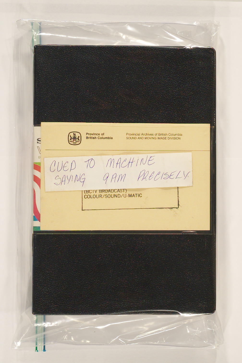
    Prior to each show a one hour U-matic tape began recording for the entire hour. It was swapped out at 10AM for a 30 minute tape. At the end of the show, they were labeled by the date and recording order. If special guests or events occurred during the show they were identified for possible future use.

    One such note even used Webster’s famous phrase to identify the cue .

    V1988_25_0670_large

    The Royal BC Museum is in the process of digitizing a large portion of these shows. Part of the process involves editing the original one hour and thirty minute videos and combining them into a cohesive whole.

    No-one tended to the original recordings while the show was on the air. Because of this, the recording included the off air time as the commercials were airing. In most cases, sound engineers turned off the stage microphones. On occasion they were turned on for a brief time to check sound levels and the like. In other cases, upcoming video segments or title cards were cued up for use in future segments of the show.

    The Royal BC Museum maintains digital master copies of the entire recordings as part of the Archiving process. Making these shows available to the public involves an editing process which removes the dead air time (where nothing is recorded on the original video) while ensuring that the on air portion, as well as the material recorded during the commercial breaks, is captured in its entirety.

    One example that shows how helpful this can be is in the episode that ended the 1981-1982 broadcast season. The 02 Apr 1982 show begins with an hour long interview with Premier Bill Bennett. The final segment of the interview begins with Jack Webster smiling at something before he takes a telephone call for the premier. The off air recording shows what the cause of the smile was.

    This was in preparation for the final part of the show which can be seen here.

    Another example where knowing what happened off air is useful occurred during the lead up to Expo 86. As a corporate Sponsor, BCTV was closing each Webster! Show with a “Number of days to go” countdown. It appears the recording of the announcer used for this particular day’s segment was unavailable. This clip shows the preparation and result.

    You can now watch an “ever expanding list” of Webster! episodes which includes “never before seen or heard” “behind the scenes” parts of the show. Simply visit the Royal BC Museum YouTube channel and click on the Webster! Playlist.

    *Officially donated by Jack Webster Productions Ltd. and British Columbia Television Broadcasting System Ltd. – acquisition notes.

    This paper deals with the definition, categorization and distribution of labrets, or lip plugs, and gives a regional synthesis of their history as known from both archaeological and ethnological studies on the Pacific Rim, from the Gulf of Georgia region in Canada to northern Japan.

    Small fragments of woven material were found along with other items in a burial cave site on Gabriola Island in 1971. The Burial remains and associated artifacts were brought to the (then) Provincial Museum to protect the material that was being removed by unknown persons.

    keddie1

    Cloth made from the woven seed plume of the Fireweed plant (DhRx-28:13; accession 71-233). (Grant Keddie photo).

    Artifacts found in the cave included bracelets of copper and brass, shell pendants, a stone bead, a green glass wire wound Chinese made bead, a woven rattle head and bark matting, in addition to the small fragments of unidentified woven material. This assemblage of material suggested that the woven material likely dated to around the late 18th to early 19th century.

    In 2001, the Snuneymuxw First Nations and the Royal B.C. Museum held discussions for the repatriation of their ancestral remains from a number of archaeological sites, as well as 460 boxes of soil samples and faunal material – mostly from the Departure Bay and Duke Point sites. A ceremony was held at the Royal BC Museum and at the final re-burial ceremony at Nanaimo on October 20, 2001.

    During the repatriation process, C-tasi:a – Geraldine Manson, of the Snuneymuxw First Nation, brought a group of elders to the Royal BC Museum, to examine the artifacts to be reburied. The elders held discussions among themselves and agreed that they would allow for small fragments of woven material to be kept for future examination to determine what they were made of.

    Microscopic view of seed and plume fibres found in the piece of woven cloth (100X). (Grant Keddie photo).

    Microscopic view of seed and plume fibres found in the piece of woven cloth
    (100X). (Grant Keddie photo).

    I examined this cloth fragment under a 200X power microscope with the intent of trying to find hair samples that could be identified as either from dog or mountain goat. The latter are well known to have been used in making several types of blankets. But there were no examples of hair to be found.

    What I did find was a mass of tiny plant-like fibres and many tiny seeds. Using our Museums comparative plant and seed collection, I was able to identify the seeds as those of the common fireweed plant, Epilobium angustifolium.

    Epilobium angustifolium seeds and plume from RBCM herbarium collection (400X). (Grant Keddie photo).

    Epilobium angustifolium seeds and plume from RBCM herbarium collection (400X). (Grant Keddie photo).

    I surmised that the fibres must be from the plume (the fluff) of the fireweed plant. This proved to be the case even though they were of different thicknesses. It turns out that the fibre thickness varies with the amount of water that the plant has during it active growing stage.

    Microscopic View of masses of seed plume fibres in the piece of woven cloth (200X). (Grant Keddie photo).

    Microscopic View of masses of seed plume fibres in the piece of woven cloth (200X). (Grant Keddie photo).

    What is significant about this find is that this cloth fragment is the first and only example of clothing made entirely out of the plume of the fireweed and not just a mixture with other raw material in the clothing construction.

    Fireweed plants (Grant Keddie photo) The Early

    Fireweed plants (Grant Keddie photo)
    The Early

    The Early Ethnographic Accounts

    In the ethnographic literature it is important to see if statements about plant use are coming from First Nation advisors who have personal experience with the use of fireweed and not just statements by writers repeating the information that previous ethnographers had received.

    Myron Eells collected information in the 1870s and 1880s from First Nation advisors who would be knowledgeable about traditional practices, based on their personal observations, from the early 1800s. In speaking about Puget Sound in general and specifically including the Squaxin, Klallam, Skokomish and Twana, Eells notes that: “Fireweed (Epilobium). The cotton-like down from the seed was formerly used in making blankets” (Eells 1985:52). Eells indicates that there are three kinds of blankets: “One was made of dog’s hair, geese or duck down, and the cotton from the fireweed. These were twisted into strings and woven together” (Eells 1985:122).

    Edward Curtis, recorded from his First Nation advisors (some of whom were born as early as the 1832 to 1850 period) that the Klallam on the Olympic Peninsula and North Strait Salish speakers on the south end of Vancouver Island “used on special occasions a robe woven from a mixture of down with the hair of goats and dogs and with certain vegetal products. The down of ducks, geese, and gulls, the hair of dogs and mountain goats, and sometimes the cottony fibre of dead fireweed blooms and cattail spikes, were taken in varying proportions and thoroughly mixed by beating and stirring vigorously with a paddle. The resultant fibre was then twisted into loose, fluffy strands, ready for the weaving” (Curtis 1913:44).

    Curtis’s statements are confirmed by Erna Gunther’s Quileute and Cowlitz First Nation advisors, in 1924-25, who had never seen a woman weaving a mountain goat blanket, but: “Much more common were blankets made of the fireweed cotton mixed with feathers of seagulls or ducks”. These were pounded together and spun using a spindle whorl (Gunther 1927:221).

    Conclusion

    It is fascinating to see the ingenuity of the Snuneymuxw First Nations in producing a quality cloth with the very fine seed plume of the fireweed by itself. It is likely that this practice was more wide-spread than previously believed.

    References
    Curtis, Edward S. 1913. Salish Tribes of the Coast. The North American Indian. Vol. 9, pp.175, Norwood, Mass.

    Eells, Myron. 1985. The Indians of Puget Sound. The Notebook of Myron Eells. Edited with an introduction by George Pierre Castile. Afterword by William W. Elmendorf. University of Washington Press, Seattle and London, Whitman College, Walla Walla, Washington.

    Gunther, Erna. 1927. Klallam Ethnography. University of Washington Publications in Anthropology. 1(5):171-314, University of Washington Press, Seattle, Washington.

    This was a likely scene around Victoria, British Columbia for a 300 year period between 11,700 and 10,900 years ago when an open parkland environment provided habitat for herds of bison. A subsequent cold period saw their disappearance from Vancouver Island.Grant Keddie photo.

    This was a likely scene around Victoria, British Columbia for a 300 year period between 11,700 and 10,900 years ago when an open parkland environment provided habitat for herds of bison. A subsequent cold period saw their disappearance from Vancouver Island.Grant Keddie photo.

    Large animals, such as mammoths, mastodons, horses and camels that roamed North America near the end of the ice age are referred to as mega-fauna. Why these large animals went extinct has been widely debated but answers are beginning to emerge.

    New information is showing the answer is more complex than previously thought. Both climate change and human hunting play a role at different times in different places.

    This was a likely scene around Victoria, British Columbia for a 300 year period between 11,700 and 10,900 years ago when an open parkland environment provided habitat for herds of bison. A subsequent cold period saw their disappearance from Vancouver Island.

    Expanding and Shrinking – Habitat and Genes

    Before the appearance of humans on the northern landscapes we see that ecosystem stability for animal species generally persisted over long periods of time. During repeated sudden climate changes over the last few hundred thousand years of the Pleistocene (2.6 million to 11,700 years ago) animal populations had the ability to disperse across the landscape to shrinking refugia during harsh times and expand back to increasingly more favourable habits during good times. During cold periods, when the sea level was lower by as much as 150 meters, the Beringian continent was as wide as the Canadian Prairies.

    The evidence for shrinking environments is seen in the reduction of genetic diversity in large animals such as mammoth, mastodon and bison. Grass loving animals of the far north were displaced with the expansion of boreal forests during the onset of warm periods. Boreal forest loving mastodons disappeared 70,000 years ago from large regions of the north with the advance of colder climates and the return of an open tundra environment. By the time humans appeared on the scene mastodons only lived much further to the south.

    Animal populations were often drastically reduced in numbers, before sub-populations made a comeback. This pattern of population reduction and expansion happened especially during rapid warming periods. The appearance of humans in the region may have destabilized this pattern of population regeneration by restricting the movements of animal populations.

    Human Interference

    Humans likely interrupted the ability of mega-fauna sub-groups from connecting with each other. This would be especially true if humans were concentrated on regular migration routes between or living on resource rich areas used by the animals. The concentration of large game animals in smaller regions would make them more susceptible to predation from carnivores and humans.

    Some mammal species whose ranges straddled the length of Beringia became extinct on one continent, but not the other, with the rise of sea level at the end of the Pleistocene. Examples are the horse (Equus caballus) and Saiga antelope (saiga tatarica) that survived only on what became the Old World side of the Bering Strait.

    Humans co-existed for several thousand years in eastern Beringia – the area now including Alaska and the Yukon. During this time mammoths and horses disappeared but muskox, bison and caribou survived.

    Further south large animals were faced with rapid environmental change and increasing human and carnivore predation. In the American Southwest mammoths experienced a warm and dry climate that would have made their seasonal movements more predictable and more vulnerable to predation. Large scale predation of mammoths and mastodons is often associated with a culture called Clovis that was only around for a short time period of 300 years from 13,200 to 12,900 years ago. The Clovis culture is recognized by distinct types of spear points. Other cultures before and after the Clovis culture also hunted mammoths, but our knowledge of these cultures is still developing.

    The megafauna diversity of North America and Eurasia was considerably reduced around the time of the transition from the ice age to the more recent Holocene period after 11,700 years ago. By this time the woolly mammoth (Mammuthus primigenius) became extinct in many regions in both North American and the Eurasian continent. The last mammoth survivors on Wrangle Island northwest of the Bering Strait disappeared only 3700 years ago when we see the first evidence of human occupation of the Island.

    Muskox in British Columbia

    List and Comments on Select Population References to the Lekungen (Songhees and Esquimalt Nations)

    Fortified Defensive Sites and Burial Cairns of the Songhees Indians

    Netting Needles of British Columbia

    The Importation of old Chinese Coins for the Playing of Fan Tan Gambling Games in British Columbia.

    Symbolism and Context: The World History of the Labret and Cultural Diffusion on the Pacific Rim

    The Chuchawaytha Rock Shelter Pictographs

    Installation of a Songhees Chief

    Dating Ethnographic Artifacts with Chinese Coins