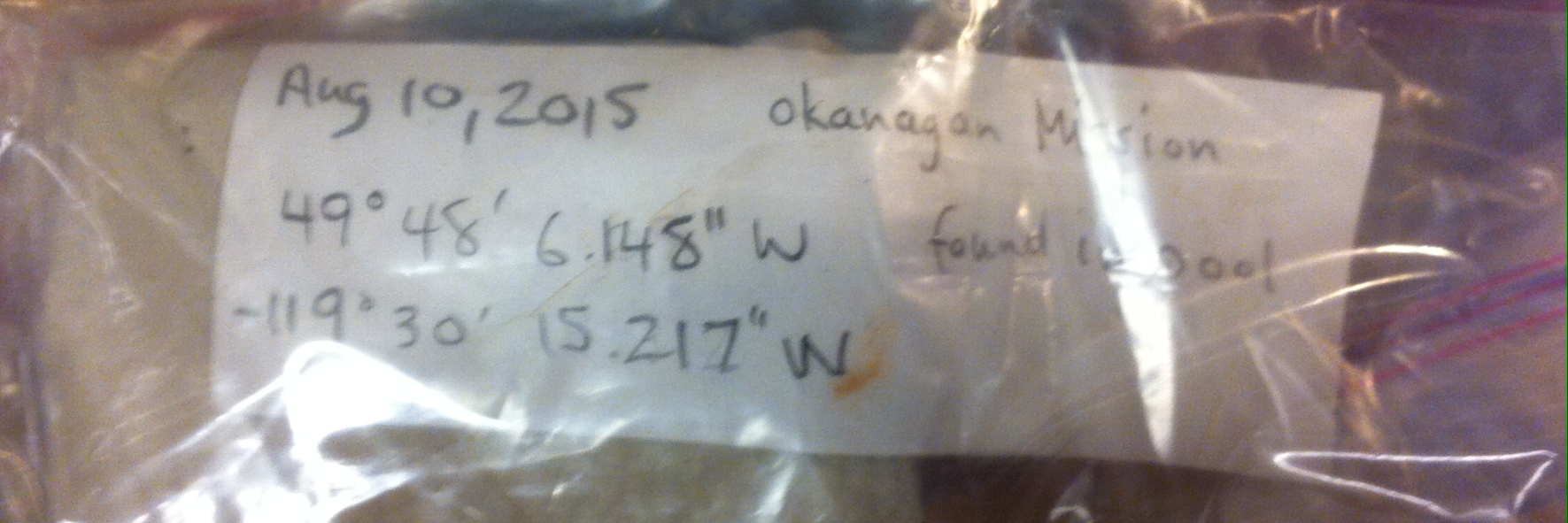
Whenever we receive new specimens at the RBCM, we hope to have enough collection data to make the specimen valuable to science. The bare minimum we need is the date collected, a description of the collection location, and if you have latitude and longitude for the collection site – GREAT. Our Mammal and Bird Preparator was sorting through some of the newer specimens in the receiving freezers – and this label stuck out:
There’s the date, a location, even a cause of death – a drowning victim.
That’s a source of mortality that someone should study – in-ground pools as a man-made source of wildlife mortality. I remember seeing a Barn Swallow trying to swoop low and drink from a pool on a still summer day. It lost track of the surface and “landed too low” (if I remember my WWII aviation slang correctly). It actually did an end-over-end into the pool when its beak dug too deep into the water’s surface – and since we were in the yard, we were able to save the bird.
But I digress.
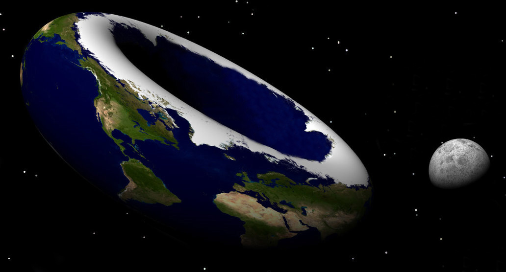
A key feature of a specimen label is clarity. I am just as guilty as anyone else in our modern day rush-rush society – and have scribbled labels much to fast. The above label is great – it looks like 49°48’06.148″W, -119°30’15.217W – or is that North? Woah – 119°N? The earth must be doughnut shaped… I remember a student giving a lecture on cod when I was a grad student and she said that Arctic Cod (Boreogadus saida) ranged to 95° North. Could it be true? Is the Earth doughnut-shaped and its coordinate system goes beyond 90 North?

Modified from: http://pre10.deviantart.net/3689/th/pre/f/2011/013/b/0/what_if_earth_were_a_donut__by_stardust4ever-d374rnr.jpg
Old museum labels also suffer from the same problem – before we printed labels, we relied on perfect handwriting to make sure that 100 year old labels would still make sense. When the pen fades, it can be a real challenge to decipher the original content on an oily bird label. Signatures are easy to figure out – they usually show each researcher’s distinctive flare. But a lazy 6 or a 9 can look like a zero, a faded 7 can look like a 4, a 1 like a 7, a Z like a 2, etc…
To all citizen scientists – please write your labels as clearly as possible or print them out on your home computer. Our collection’s scientific value is totally dependent on your data.
Yea – I know this specific label is detailing a location in Upper Mission at 49°48’06.148″N; 119°30’15.217″W – but if the N and W were obvious on this label, we’d have not had such a chuckle. It does however, highlight how handwriting can seriously change the interpretation of a label.


